• Home
  • FP
  • 4130-A
  • Generative techniques for urban place-making

Koralkar Eklavya

4130-A

Generative techniques for urban place-making

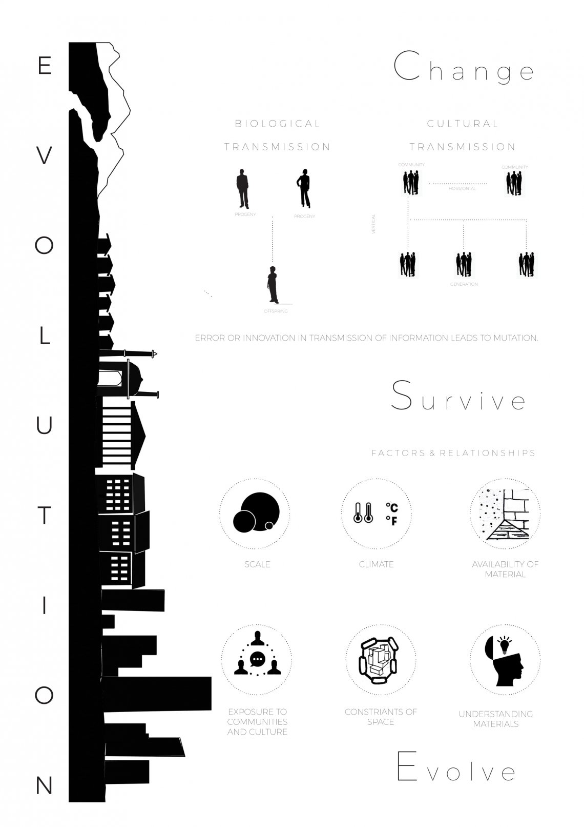
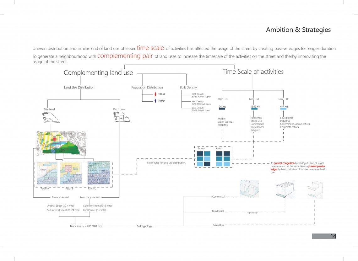
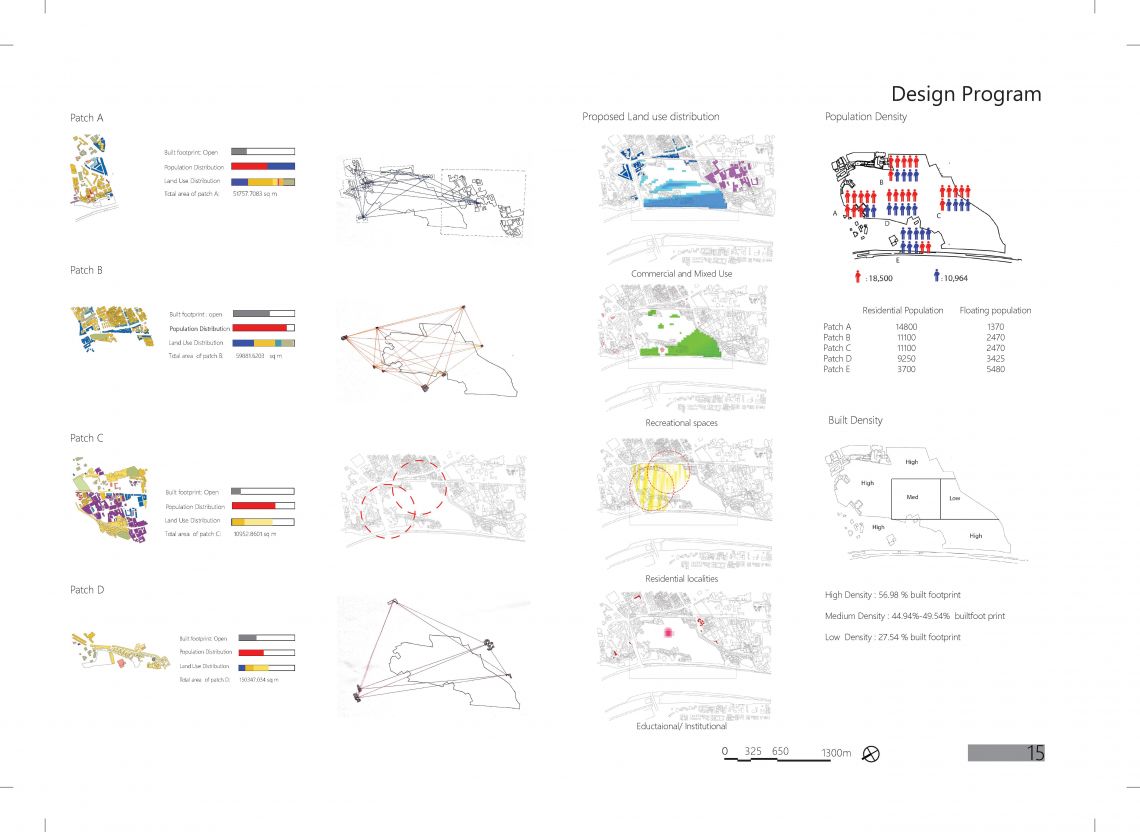
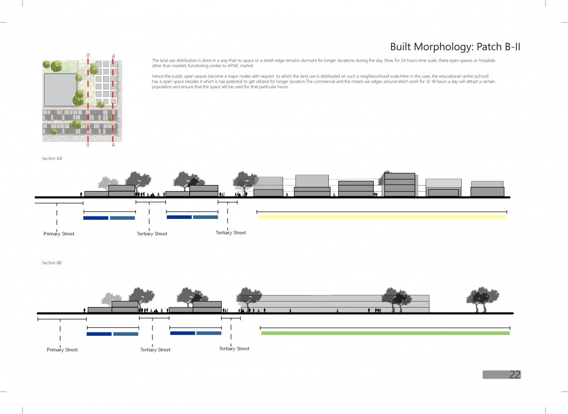
The project focuses on the land use distribution on the basis of their time scale. The proposal suggests to encourage arrangements of land uses with varied time scale instead of clustering of land uses with similar time scale. The reason behind the strategy is to prevent dead spaces on the streets( during non working hours or when the abutting buildings are shut down) and to ensure that the street usage is maximized 


Report Content

Exercise 1: Read & Infer Reading reference: Emergent technologies and design: Towards a biological paradigm in architecture

Exercise 2: Site Analysis (Calico Mills) Various aspects were taken into consideration such as the land use, street networks, inter dependency networks, population density. Under the street network,Junctions were studied on basis of physicality and various aspects which collectively affect the character of the junctions.Five different junctions were identified and studied in detail.Traffic count was carried out in order to study the pedestrian and vehicular movement.Analysis and inferences for

Exercise 3: Network Analysis and Permeability Under this exercise, street networks of various urban fabrics were studied and the distinction between connectivity and permeability was understood with the help of tests like Closeness centrality, Between ness centrality and Degree centrality. Study of the street character around the Vastrapur lake is as above. Various Analytical plugins such as Ladybug and decoding spaces were carried out on selected patches to draw inferences about the neighborho

After identifying the issues and potentials on the site.The aim of this project is to create a neighborhood with complementing land use such that it increases the time scale of the activities on the street and thereby improvising the usage of the street .The flow chart explains the strategies adopted to achieve the mentioned aim.

Exercise 4; Urban Block( Hutongs,Beijing) This exercise was a part of evolutionary computation in which a smaller unit of fabric was selected and its characteristics were examined. Right from the climatic conditions the social customs and traditions affecting the built form. A genotype was constructed on grasshopper and fitness criteria for the Evolutionary computation came from the study of characteristics of the built form.Further various phenotype were obtained after running the genotype in

Land use and Population distribution. The distribution of land use and population is context responsive and is such that it complements the context. Built density is distributed according to the street network. The higher density patches will be nearer to the primary streets and vice versa.

The street network is a resultant of the land use. Te major primary network (sub-arterial street) connects a two primary nodes.such that the commercial neighborhoods are synced with the primary network. Connecting all the access to the site with the primary network yields the secondary network around which the mixed use and the residential neighborhood develop.

A 200*200 m patch having varied land use is selected and is constructed in Grasshopper and the fitness criterias are i) Maximize volume ii) Maximize the unbuilt area iii) Minimize solar exposure.

Built density of the context is followed. Various built typologies are assigned to the patches with specific built density.These typologies include High rise to low rise buildings, squatter settlements, residential tenements etc.

Here, the 200 by 200 meters patch consists of a school, residential apartments, mixed use units and commercial units. The school with a smaller time scale is complemented by mixed use residences,the residential apartments and the public open space. Here, public open spaces which are of higher time scale are necessary to complement the timescale of activities on the street and prevent dead and passive spaces on the street.