Your browser is out-of-date!
For a richer surfing experience on our website, please update your browser. Update my browser now!
For a richer surfing experience on our website, please update your browser. Update my browser now!
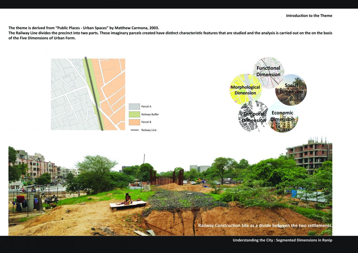
'Segmented Dimensions in Ranip' : Explains the heterogeneous nature of Ranip precinct. Ranip is a sub-urban area located in the North western fringe of Ahmedabad City and lies at a distance of 6 Km from the city center. The precinct allotted for study was 1 sq. Km. of Ranip area. Ranip started to urbanize after 1955 due to industrialization in the nearby areas like Chandkheda. The change in land use pattern from agricultural to residential is the major variable for infrastructure development in the area. People migrated from different parts of Gujarat, MP and Rajasthan due to availability and cheaper land and hence the area developed in terms of infrastructure and services. (Sengupta, 1988).The precinct has a railway line passing through it which acts as a distinct feature as it segments the area into two fragments. The two parts have varied mode of delivery, socio-economic aspect, differential built form characteristics and expenditure patterns. There is a stretch of vacant land as green belt on the SE of the precinct. In 2013, new TP Schemes for 636 ha of greenbelt land in the New West Zone was proposed which lead to the development of residential multifamily dwelling units on the prior vacant land. This area has divergent infrastructure development and hence affects the urban form in different aspects.The theme is developed with reference to “Public Places - Urban Spaces” by Matthew Carmona, 2003. The author has described distinct dimensions of an urban space and the given precinct is studied and analyzed on the basis of those dimensions. It is important to build concepts in order to study an urban area. The dimensions are used to break up the characteristics of the space and hence simplifying the complexity of urban areas as a theme. The different dimensions comprise of temporal, morphological, functional, and social dimensions of Urban form. Although economic dimension is not a part of stated dimensions by the author but here considering the attributes of the precinct, economics play a vital role in defining the living standard based attributes. These differential dimensions are studied and compared within the precinct by an overall study carried out through primary data collected from regular site visits as a Monsoon 2018, Foundation Studio over a period of 13 weeks. The study hence explains the urban form of the area along with its comparison with the city of Ahmedabad.