Your browser is out-of-date!
For a richer surfing experience on our website, please update your browser. Update my browser now!
For a richer surfing experience on our website, please update your browser. Update my browser now!
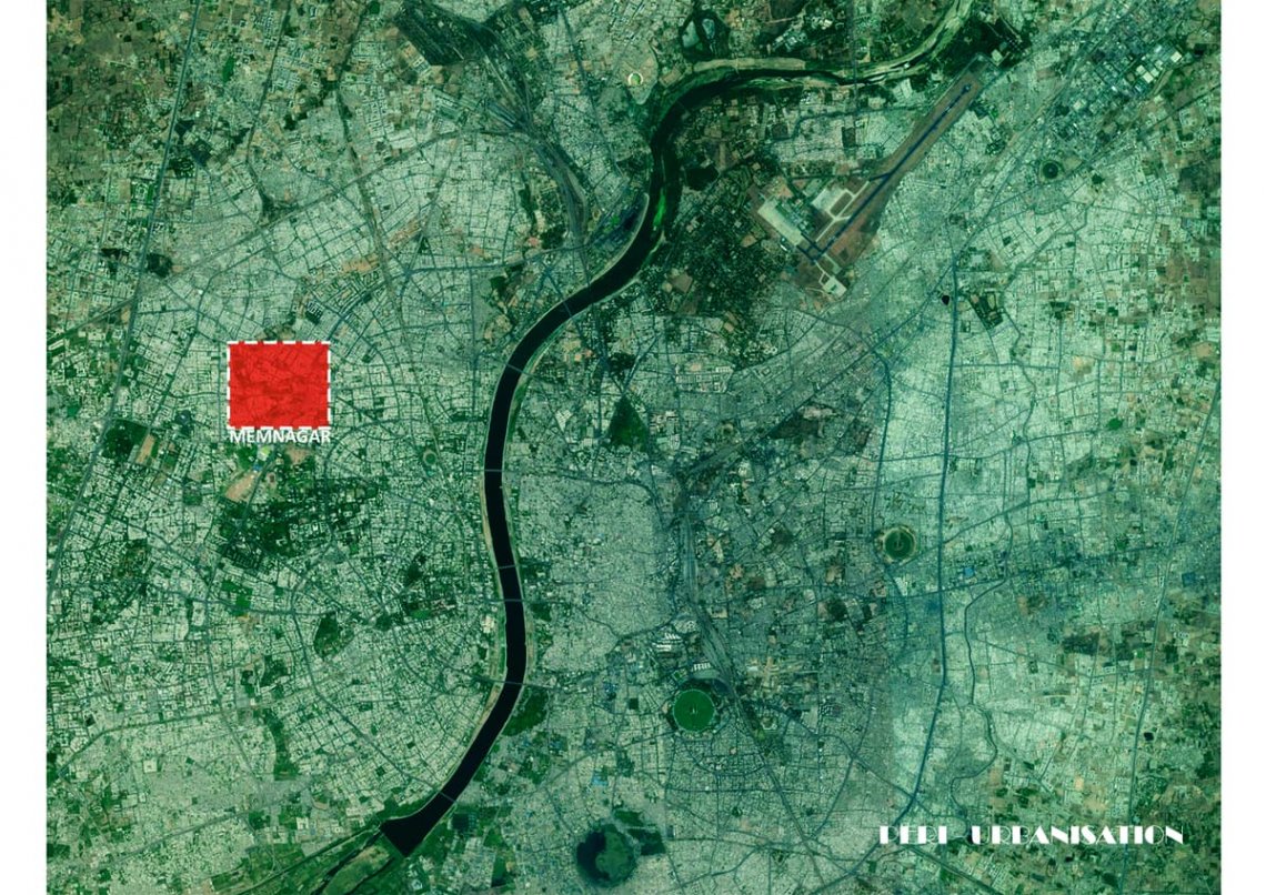
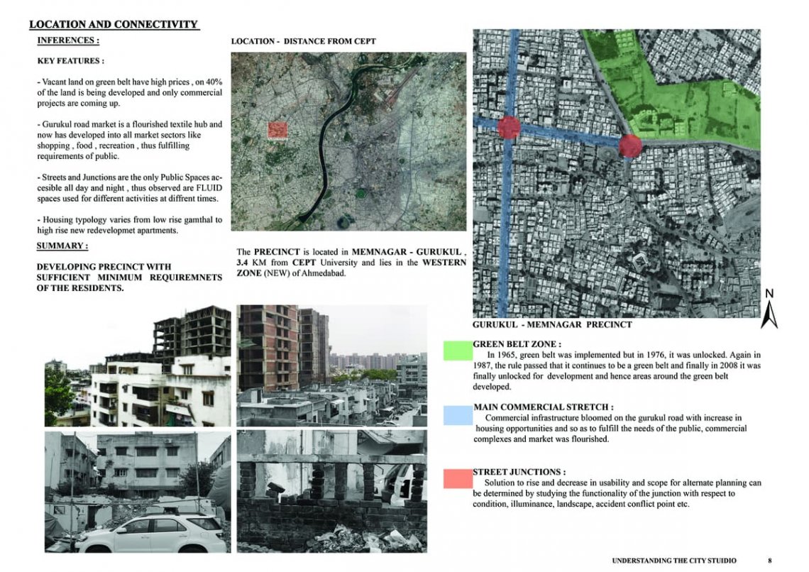
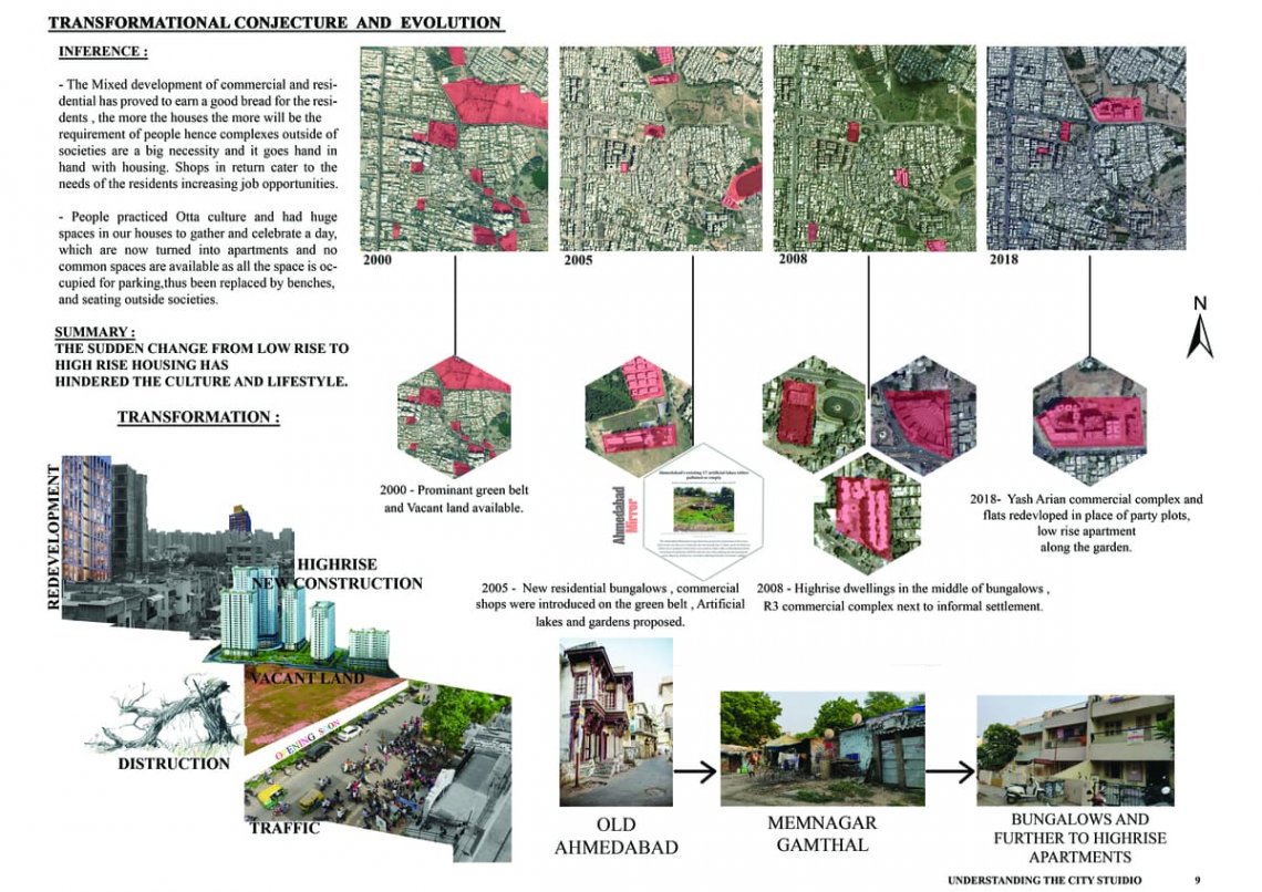
Ahmedabad began its journey as a walled city but stretched along and on the sides of the river with time.Until the implementation of green belt in 1950s, the precinct namely Bhuyangdev, Gurukul road andMemnagar were considered to be outskirt areas according to Ahmedabad Development Plan. But after its implementation in 1965, the district expanded to such outskirts like the precinct as people began looking for settlements here to avoid expensiveness of pre-set district limits of the city where the land cost was high. In 1998, Memnagar gram was included in the municipal corporation of Ahmedabad. The precinct is located in the Central-west part of Ahmedabad and also the heart of a developing textile hub. An observation of the satellite imagery inferred that the texture graduates from large-scale built commercial and institutional built forms with more open interactive spaces, wherein memnagar gamthal the built grains are densely knit. In 1978, development of housing facilities began with the population explosion and expensive city prices, until 1990 people began settling in and by 1998-2000; the area was flourished with people living in housing societies all around the precinct. To cater to the amenities of the residential citizens, commercial complexes started developing and by 1998, Gurukul road was blooming with opportunities of the market for sellers and buyers alike.