Your browser is out-of-date!
For a richer surfing experience on our website, please update your browser. Update my browser now!
For a richer surfing experience on our website, please update your browser. Update my browser now!
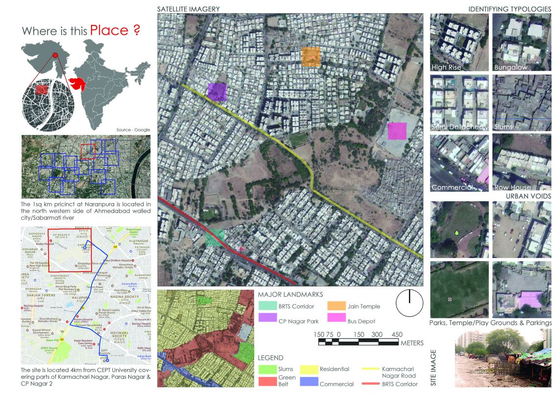
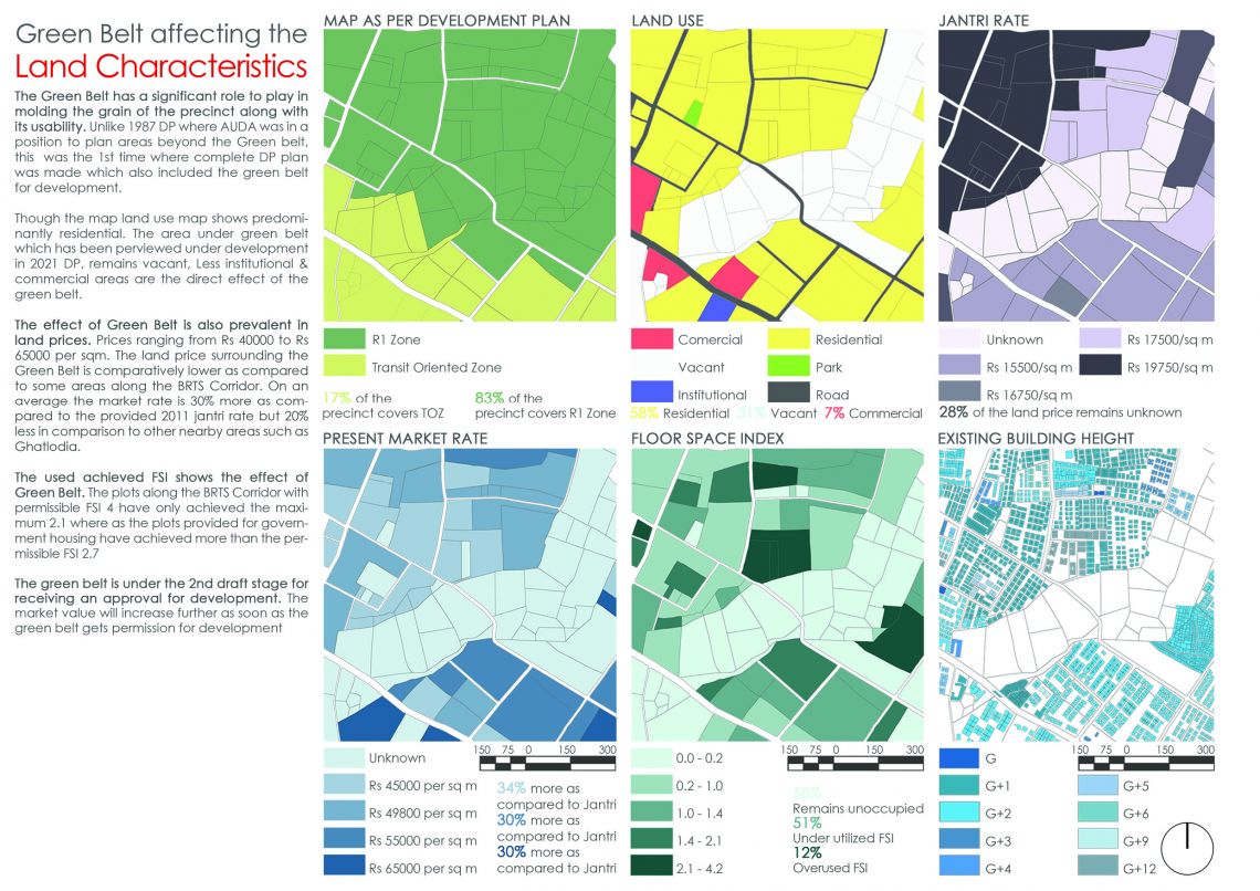
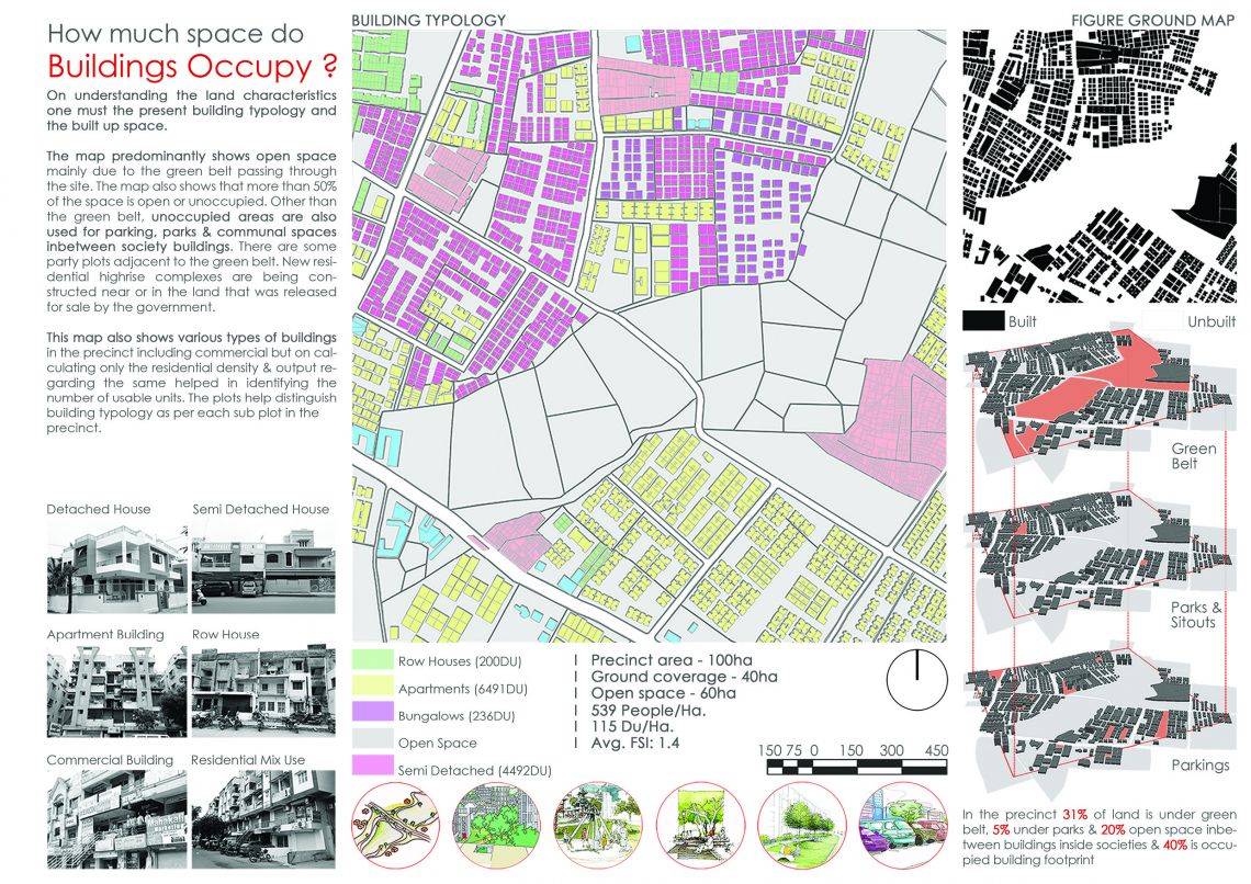
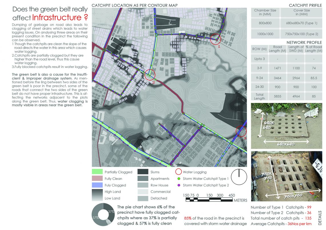
The 1st semester foundation studio titled ‘Understanding the City’ aims to develop intimate understanding of the city of Ahmedabad. The study was undertaken to gain conceptual, methodological & analytical understanding about how a city functions. Ahmedabad has been studied across 156 precincts and a one km square stretch was focused upon to gain perspective. The analysis has been done through various lenses of land characteristics, Infrastructure, Travel pattern, Network, among others. History To understand the detailed characteristic of the city one must know that Ahmedabad is the largest city in the state of Gujarat. It is located in the western India on the eastern banks of the river Sabarmati. The walled city was founded in the year 1411 & was announced as the capital by Ahmed Shah 1 of Gujarat Sultanate. Over the years the city has expanded on the western part of Sabarmati. The city municipality was given the status of Municipal Corporation when the city started growing rapidly eastwards & south words. With the coming of the railway in 1960 the development began to spill over beyond the city limits. Effects Thus, to stop the growth, the government proposed a green belt in 1965. The total area of the green belt was 3.29 sq. km. In 1967 20% of the ‘no development zone’ in the form of green belt was encroached. Thus, from this time onward the battle of releasing the land for development began. This was because the presence of the green belt was negligible. The gap between the proposal and implementation of government strategy was evident. As a result the land was left with vacant fields, wastelands & informal party plots. Result This Green Belt has affected the areas from where it has passed. Thus, the 1km sq precinct at Naranpura is also not devoid from its effect in every economical & development aspect.