Your browser is out-of-date!
For a richer surfing experience on our website, please update your browser. Update my browser now!
For a richer surfing experience on our website, please update your browser. Update my browser now!
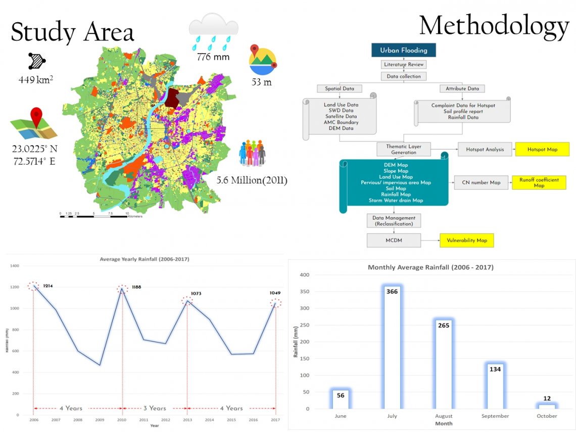
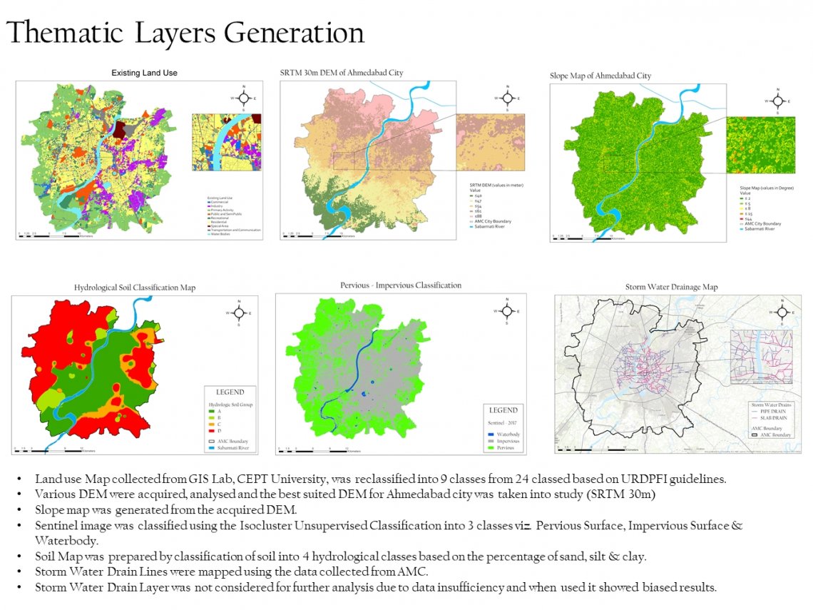
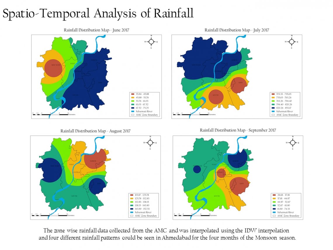
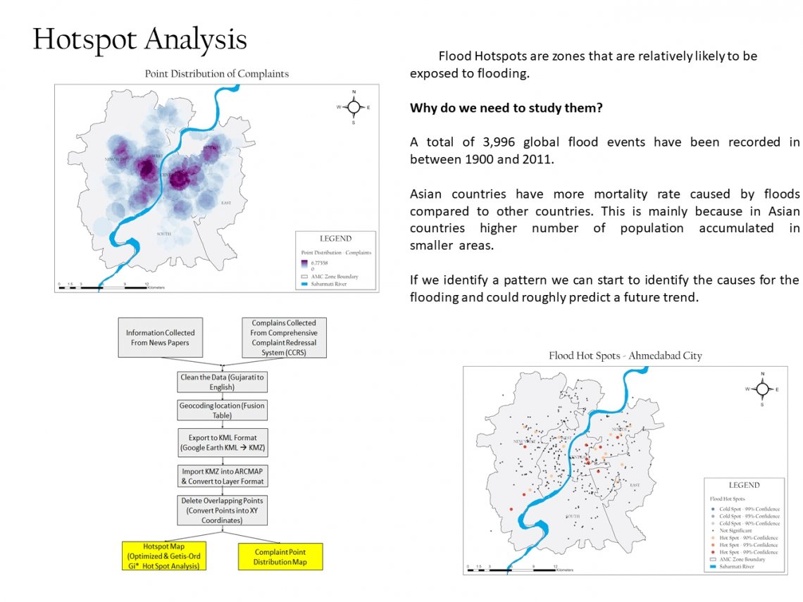
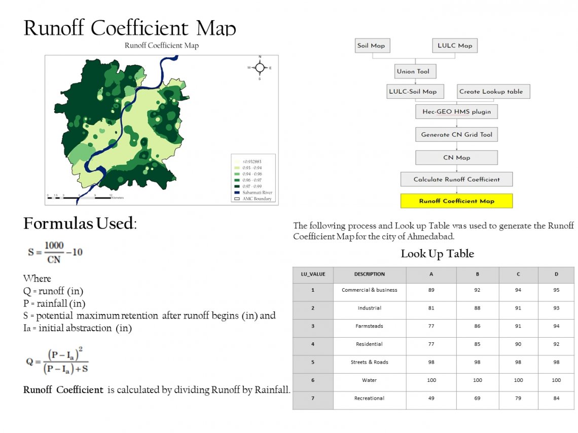
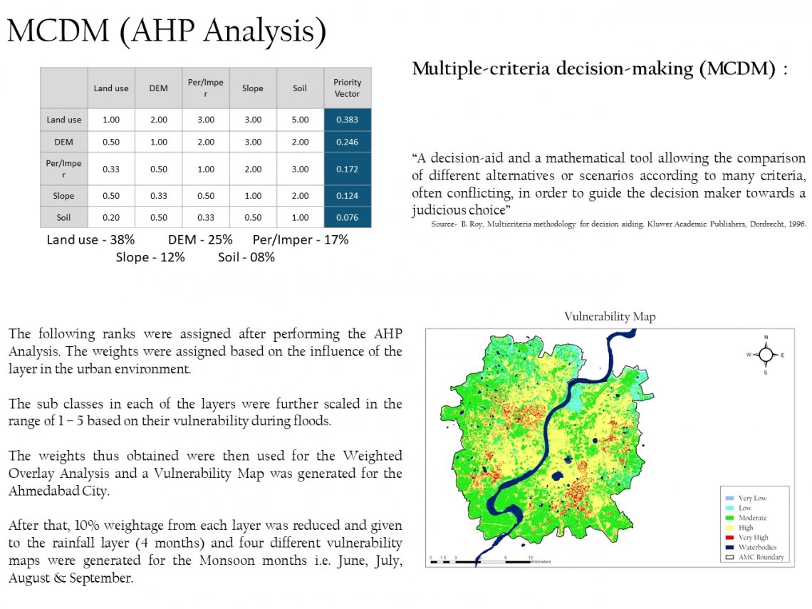
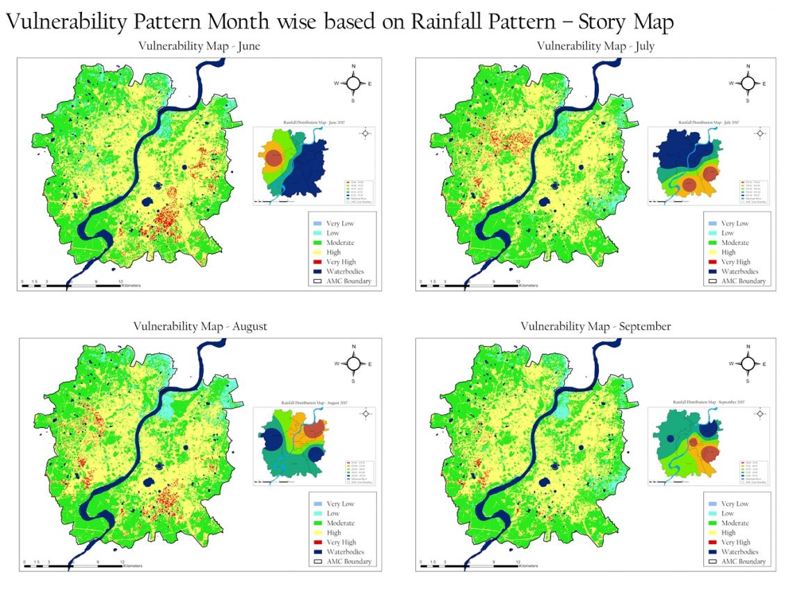
Urban flooding is a serious and growing development challenge. Against the backdrop of demographic growth, urbanization trends and climate changes, the causes of floods are shifting and their impacts are accelerating. Pockets of vulnerable areas have come into existence in the cities putting infrastructure and population residing within these areas at the fore front to bear the brunt of the imminent losses. With the help of Geospatial technology these areas can be identified and addressed so that the losses can be contained. In this studio, we have attempted to identify these vulnerable zones with the help of GIS techniques and a Multi-criteria approach.