Your browser is out-of-date!
For a richer surfing experience on our website, please update your browser. Update my browser now!
For a richer surfing experience on our website, please update your browser. Update my browser now!
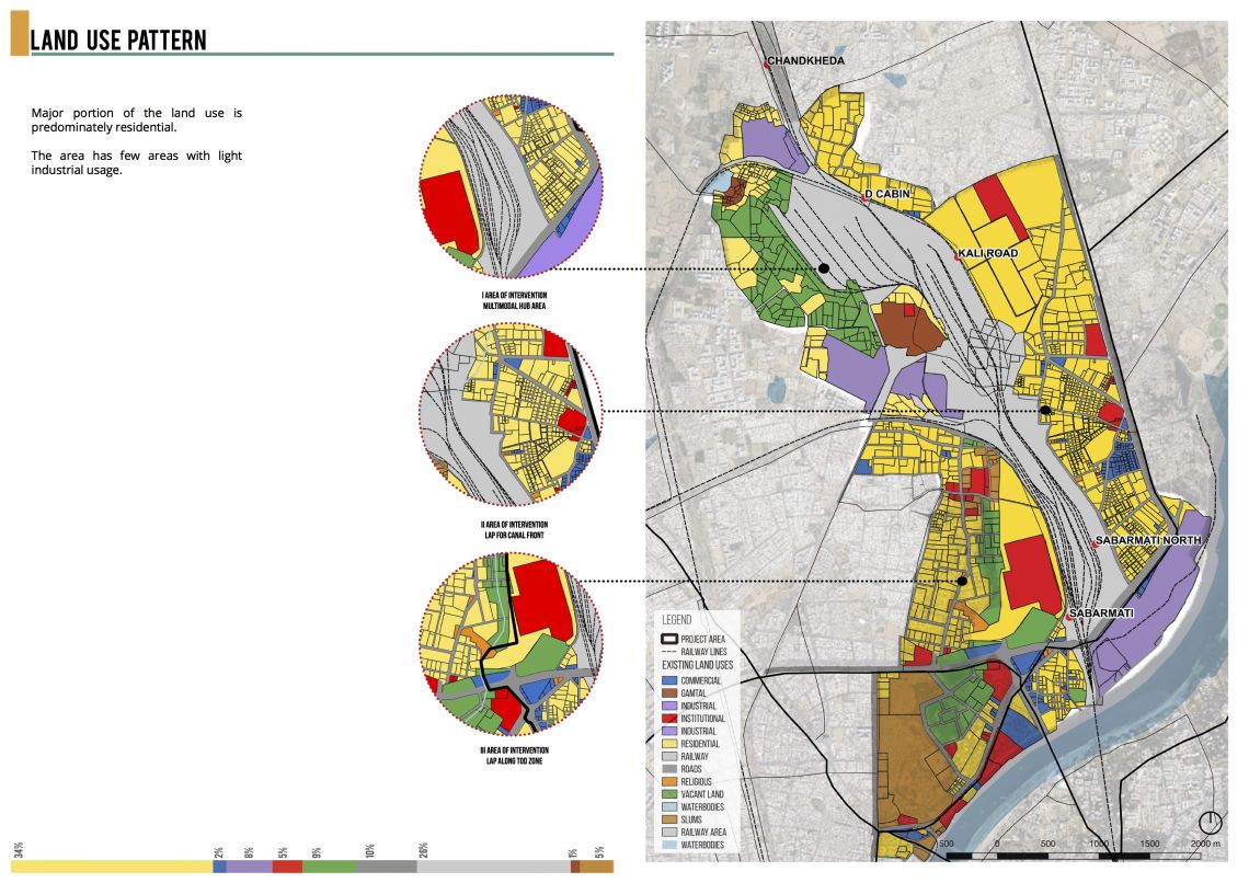
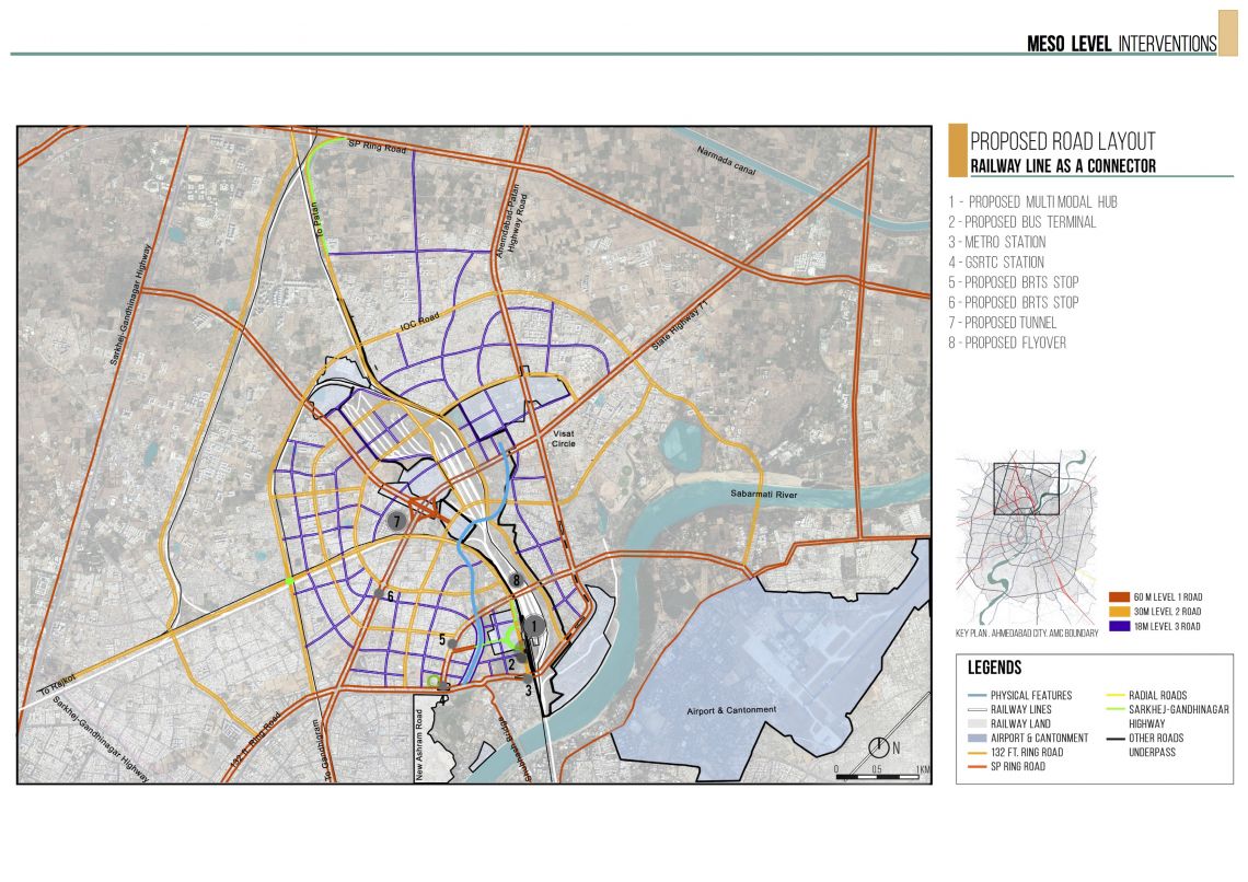
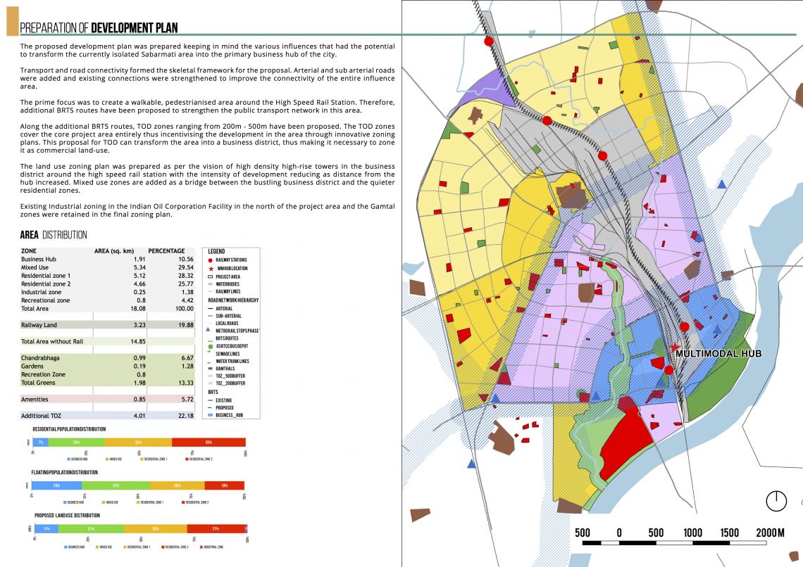
The proposed development plan was prepared keeping in mind the various influences that had the potential to transform the currently isolated Sabarmati area into the primary business hub of the city. Transport and road connectivity formed the skeletal framework for the proposal. Arterial and sub arterial roads were added and existing connections were strengthened to improve the connectivity of the entire influence area. The prime focus was to create a walkable, pedestrianised area around the High Speed Rail Station. Therefore, additional BRTS routes have been proposed to strengthen the public transport network in this area. Along the additional BRTS routes, TOD zones ranging from 200m - 500m have been proposed. The TOD zones cover the core project area entirely thus incentivising the development in the area through innovative zoning plans. This proposal for TOD can transform the area into a business district, thus making it necessary to zone it as commercial land-use. The land use zoning plan was prepared as per the vision of high density high-rise towers in the business district around the high speed rail station with the intensity of development reducing as distance from the hub increased. Mixed use zones are added as a bridge between the bustling business district and the quieter residential zones. Existing Industrial zoning in the Indian Oil Corporation Facility in the north of the project area and the Gamtal zones were retained in the final zoning plan.
