Your browser is out-of-date!
For a richer surfing experience on our website, please update your browser. Update my browser now!
For a richer surfing experience on our website, please update your browser. Update my browser now!
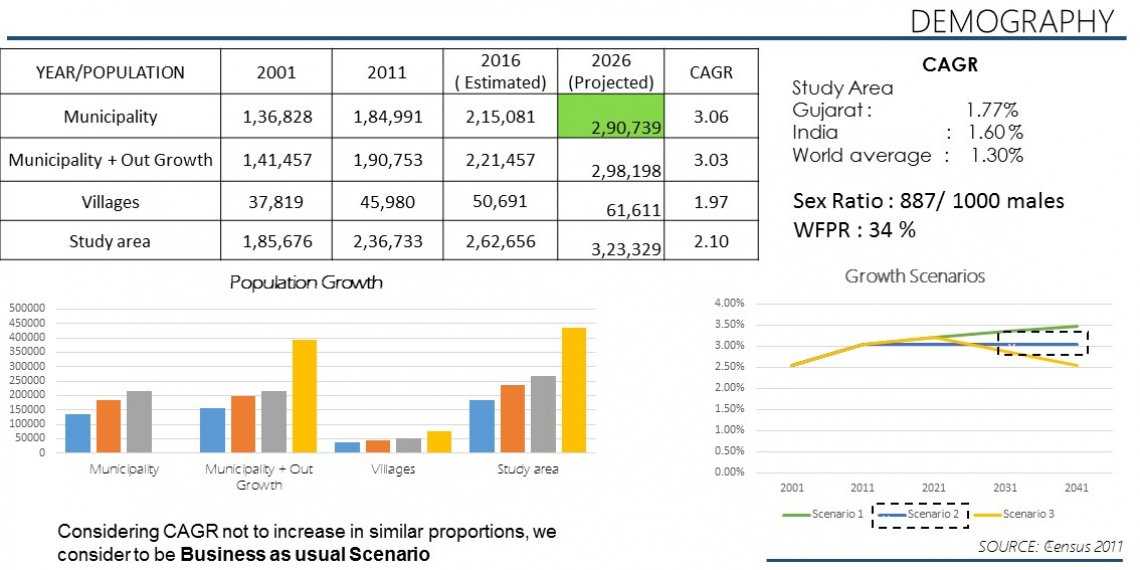
Mehsana city is strategically located on a principle North South Urban Corridor along State Highway 41 in North Gujarat. As per Census 2011 figures, Mehsana has a population of 2,36,733 and hence is a Class A municipality. The Study Area for the Studio Exercise is 118 sqkm, which is the defined planning area, delineated by the Town and Country Planning department.
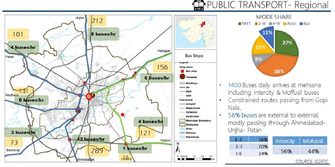
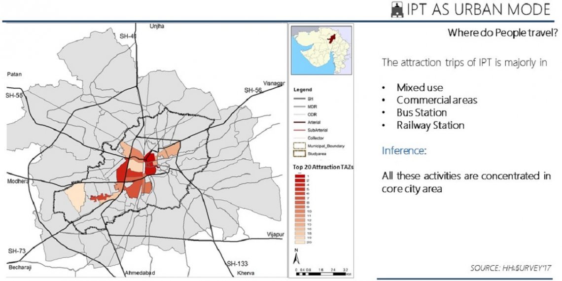
Mehsana is well connected to other regions through State Highways. The SH 41 connects Mehsana to Ahmedabad, Gandhinagar in south and Palanpur in North. Mehsana is also a prominent railway junction on Ahmedabad – Delhi Broad gauge section of Western Railway; from where Viramgam, Patan, Visnagar etc. are connected with railway lines. Mehsana is also connected with Modhera, Bechraji, Radhanpur, Unjha, Sidhpur, Patan, Visnagar, Vijapur etc. by road.
Mehsana has an economy comprising ONGC, Industrial units in GIDC estates and the Dairy in the Secondary Sector as well as APMC and other wholesale trade and Commerce activities in Tertiary Sector.
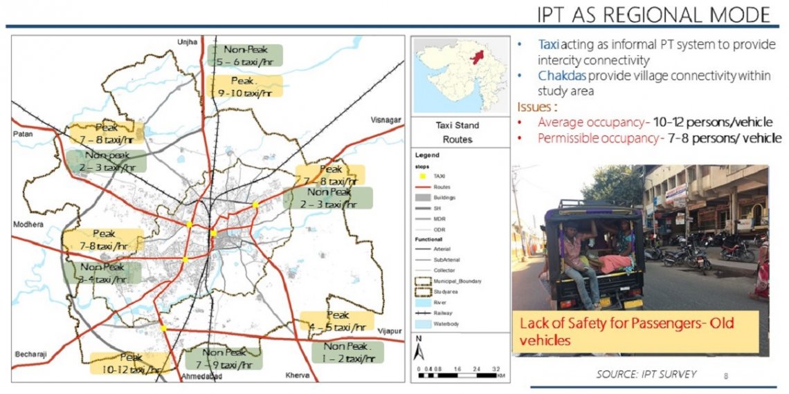
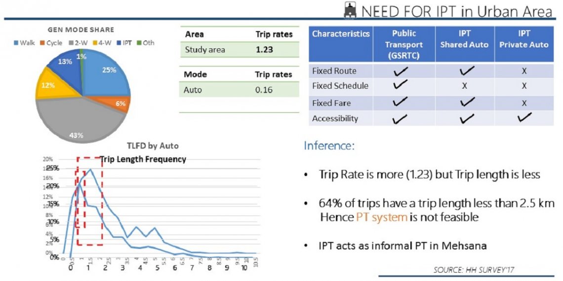
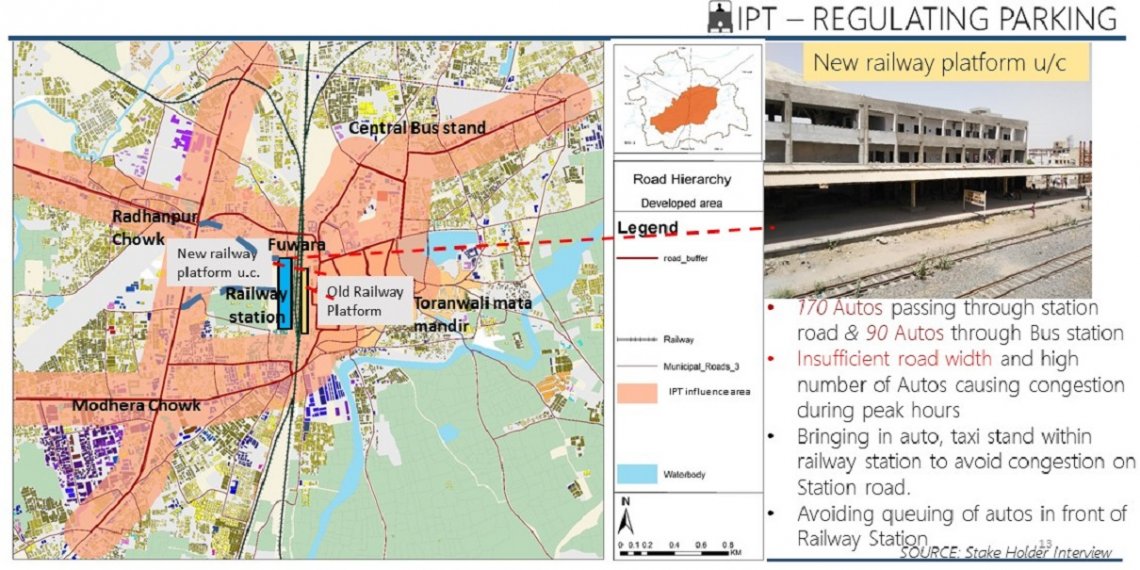
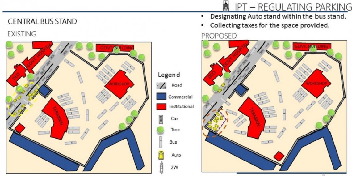
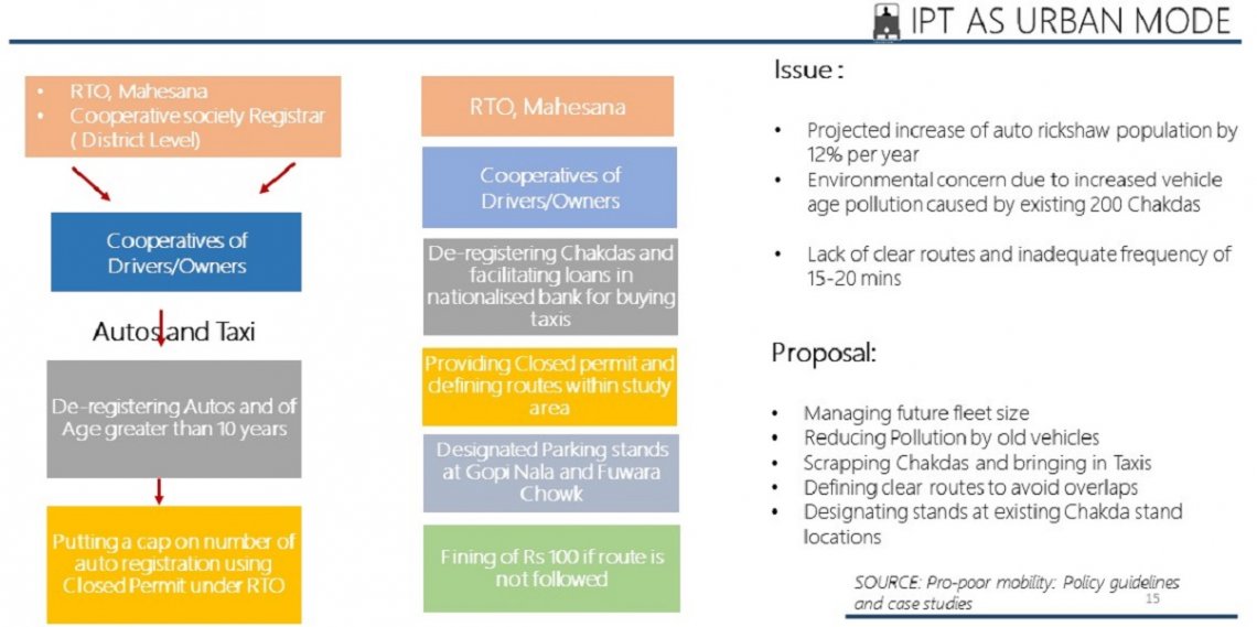
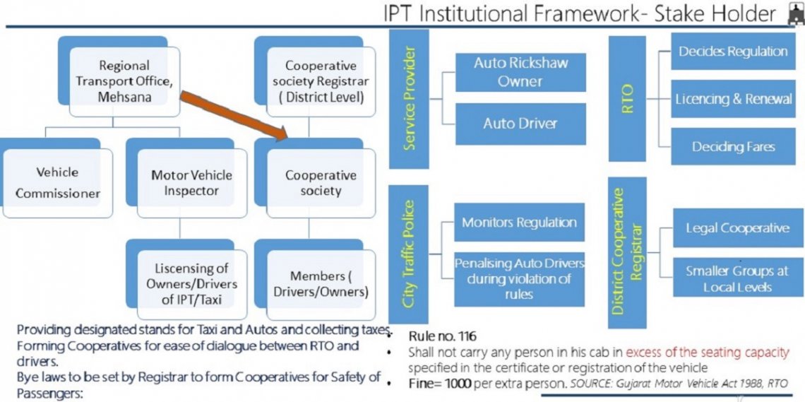
The portfolio represents the Public Transport sector in Mehsana. Different surveys were carried out like, Landuse Survey, Household Survey, Terminal Surveys, CVCs, Pedestrian Surveys, IPT surveys for better understanding of the city.
