Your browser is out-of-date!
For a richer surfing experience on our website, please update your browser. Update my browser now!
For a richer surfing experience on our website, please update your browser. Update my browser now!
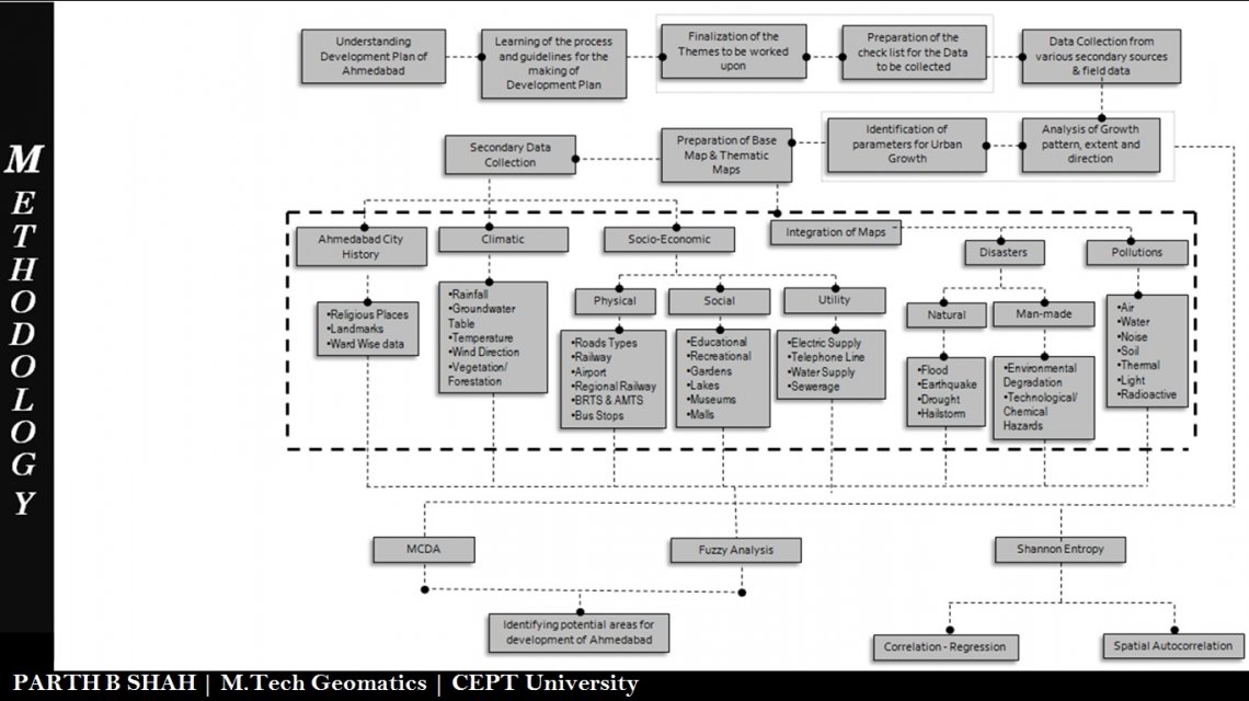
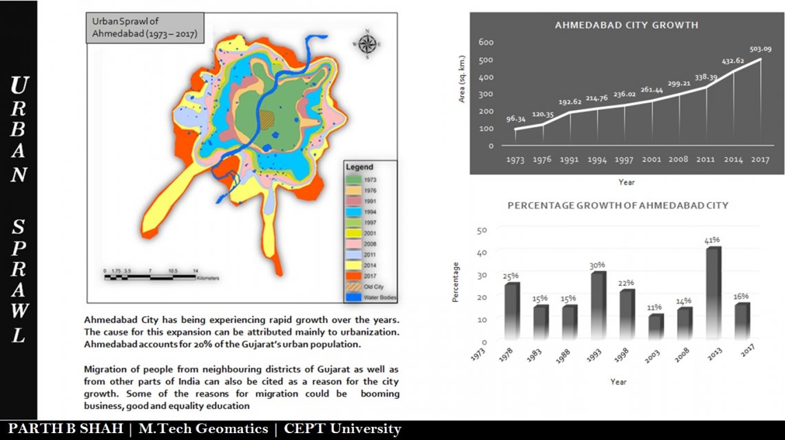
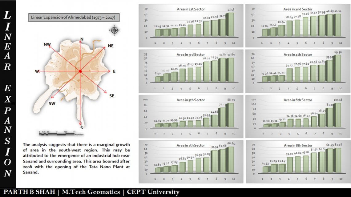
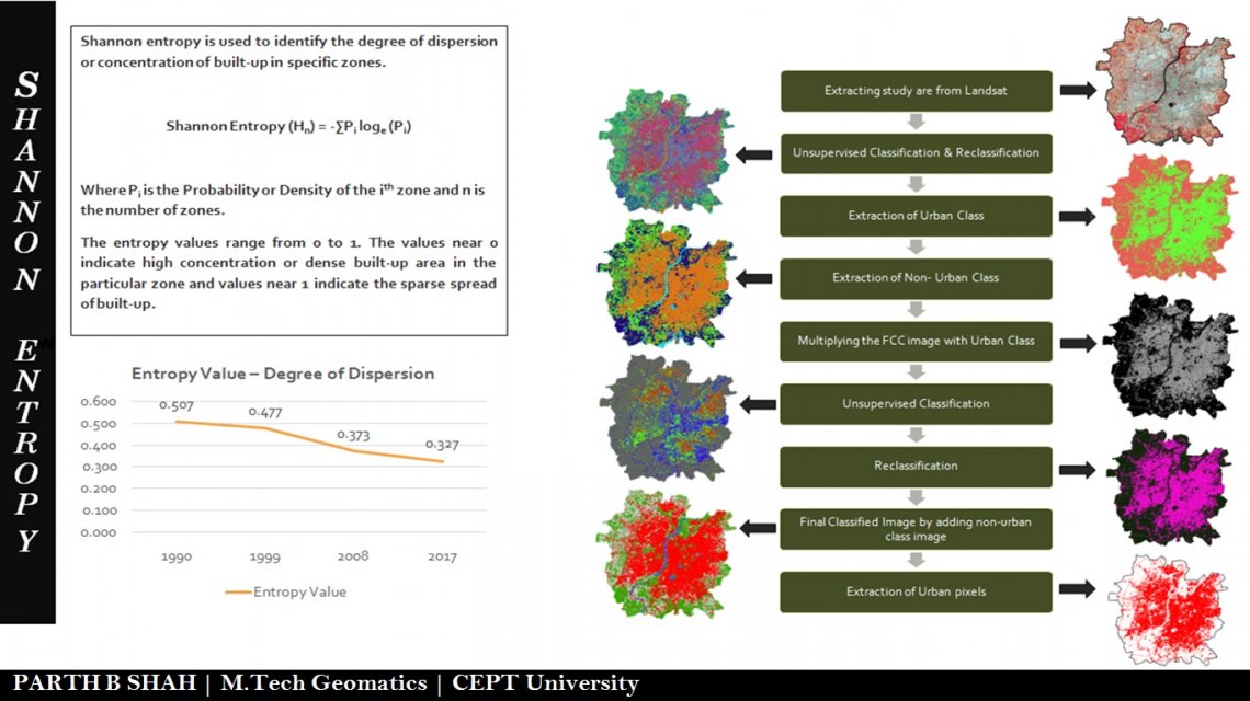
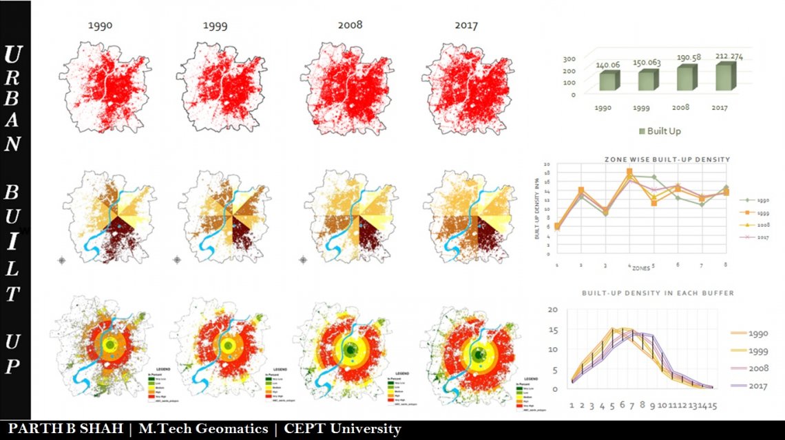
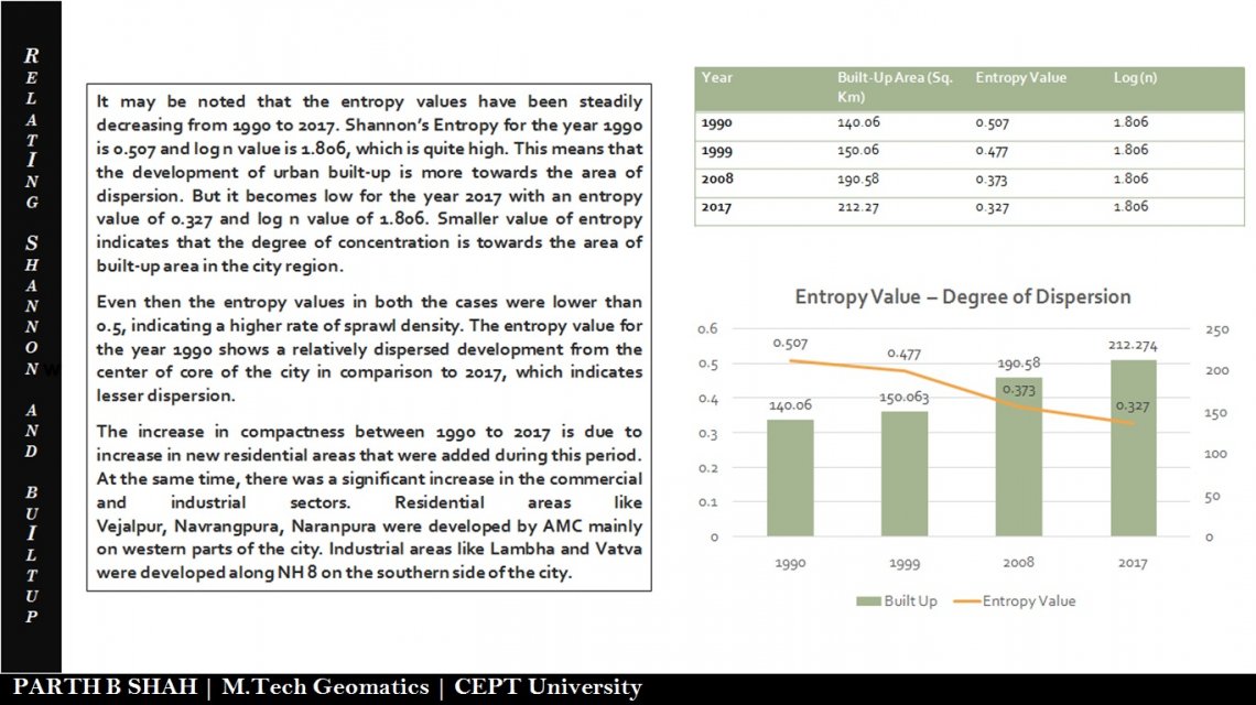
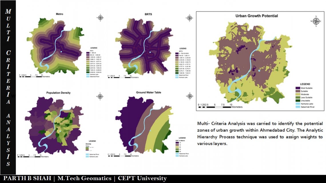
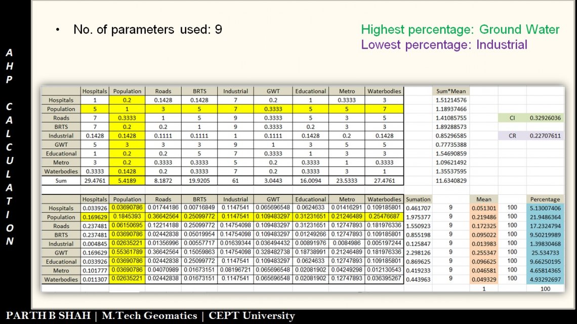
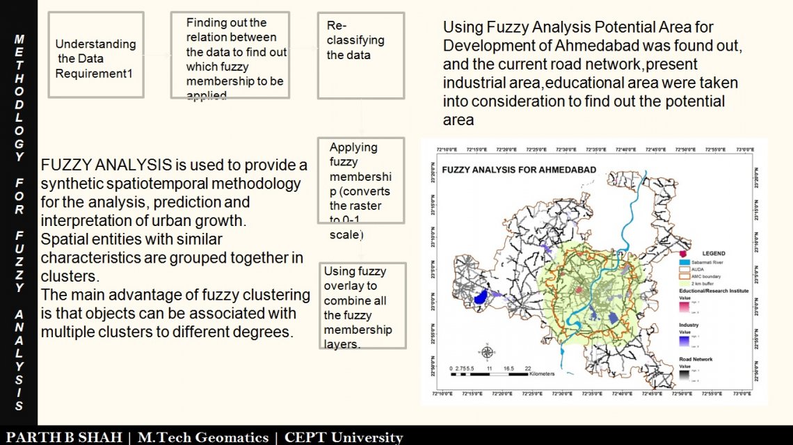
The purpose of the studio is to help us apply our knowledge of GIS and Remote Sensing to the process of planning and projecting the development of any area thus making the process simpler, faster and more efficient while reducing manual efforts through digital support. The aim of the project is to study the Urban Sprawl of Ahmedabad city, understand the built-up change and growth patterns within the city, using Shannon Entropy method and identify the potential developable areas using Multi Criteria Decision Making, keeping in mind the parameters affecting the growth of the city.
