Your browser is out-of-date!
For a richer surfing experience on our website, please update your browser. Update my browser now!
For a richer surfing experience on our website, please update your browser. Update my browser now!
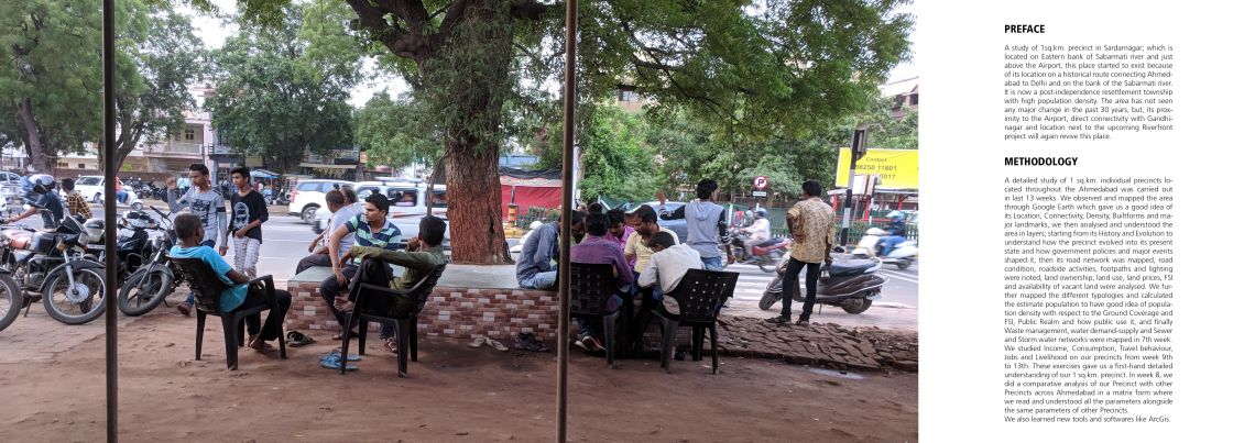
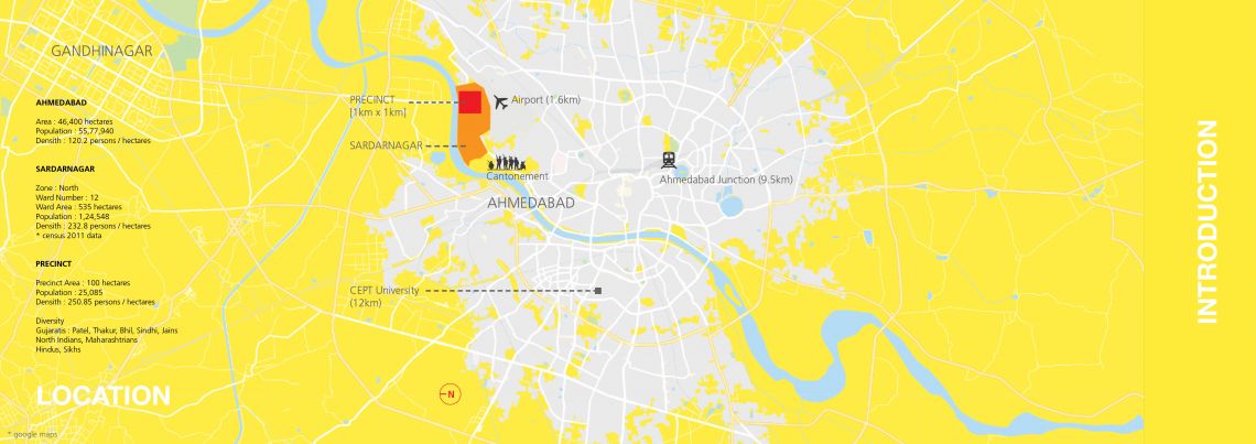
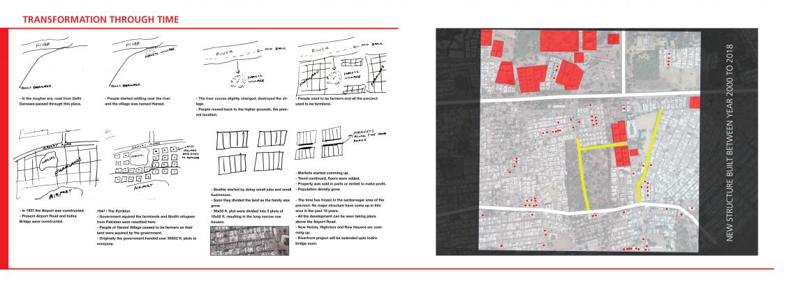
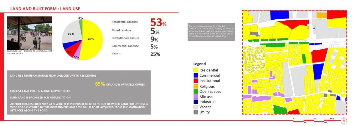
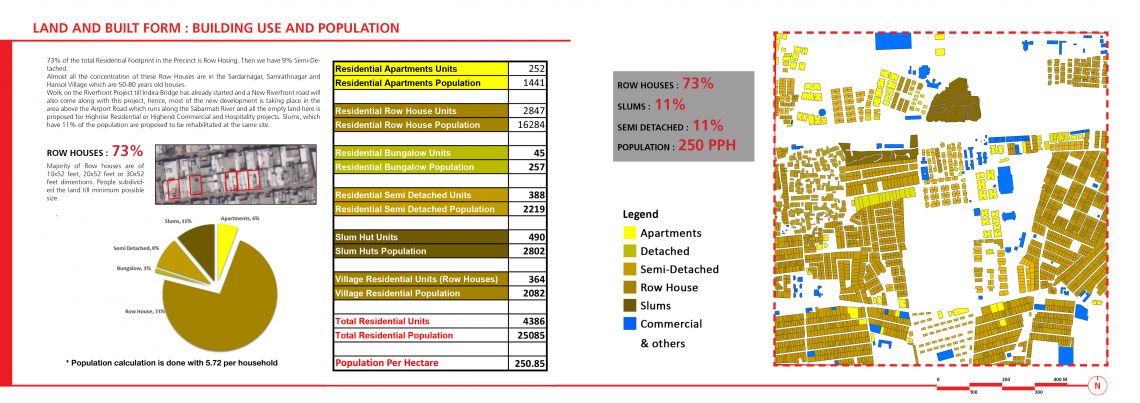
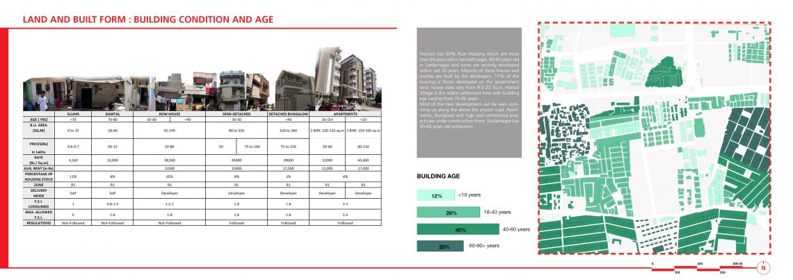
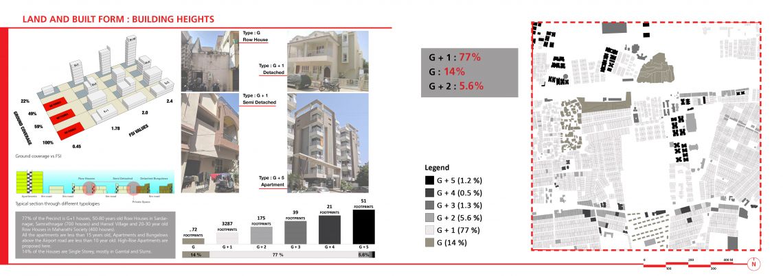
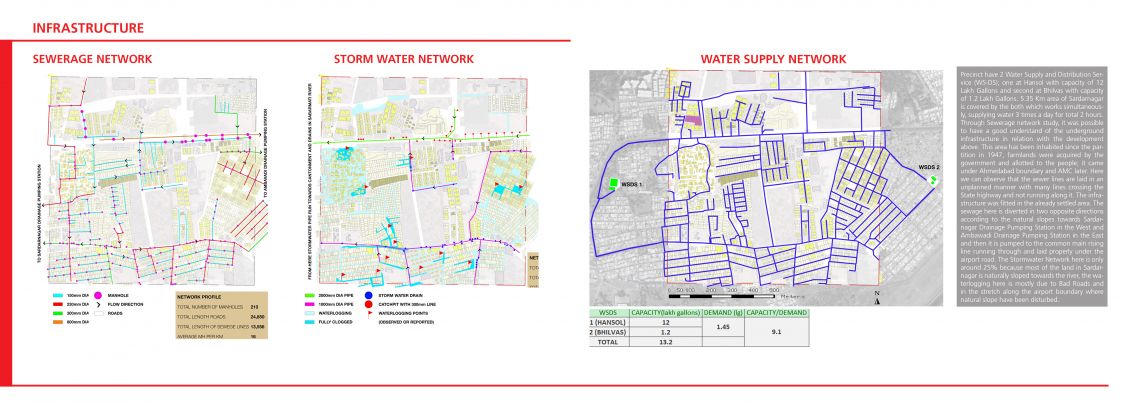
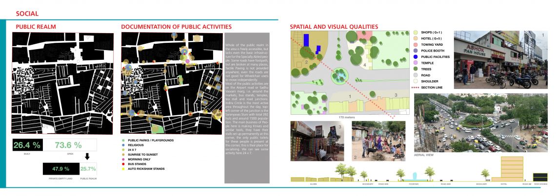
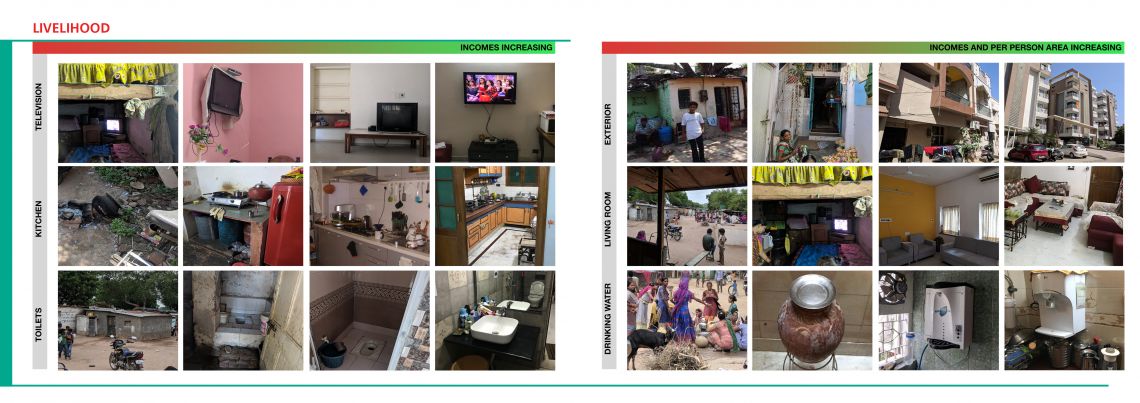
A detailed study of 1 sq.km. precinct located in the Ahmedabad was carried out in last 13 weeks. We observed and mapped the area through Google Earth which gave us a good idea of its Location, Connectivity, Density, Builtforms and major landmarks, we then analysed and understood the area in layers; starting from its History and Evolution to understand how the precinct evolved into its present state and how government policies and major events shaped it, then its road network was mapped, road condition, roadside activities, footpaths and lighting were noted, land ownership, land use, land prices, FSI and availability of vacant land were analysed. We further mapped the different typologies and calculated the estimate population to have good idea of population density with respect to the Ground Coverage and FSI, Public Realm and how public use it, and finally Waste management, water demand-supply and Sewer and Storm water networks were mapped in 7th week.We studied Income, Consumption, Travel behaviour, Jobs and Livelihood on our precincts from week 9th to 13th. These exercises gave us a first-hand detailed understanding of our 1 sq.km. precinct. Throughout the study, it has been observed that it is History, what makes every place Unique.
