Your browser is out-of-date!
For a richer surfing experience on our website, please update your browser. Update my browser now!
For a richer surfing experience on our website, please update your browser. Update my browser now!
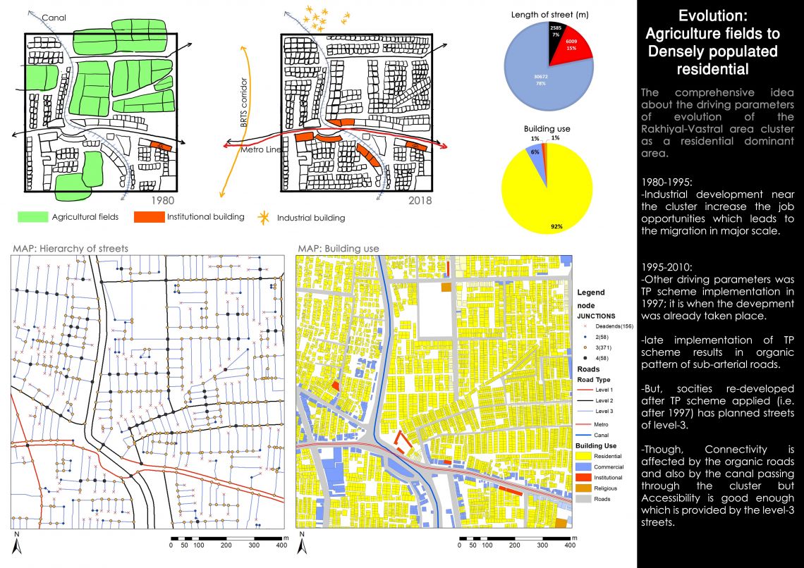
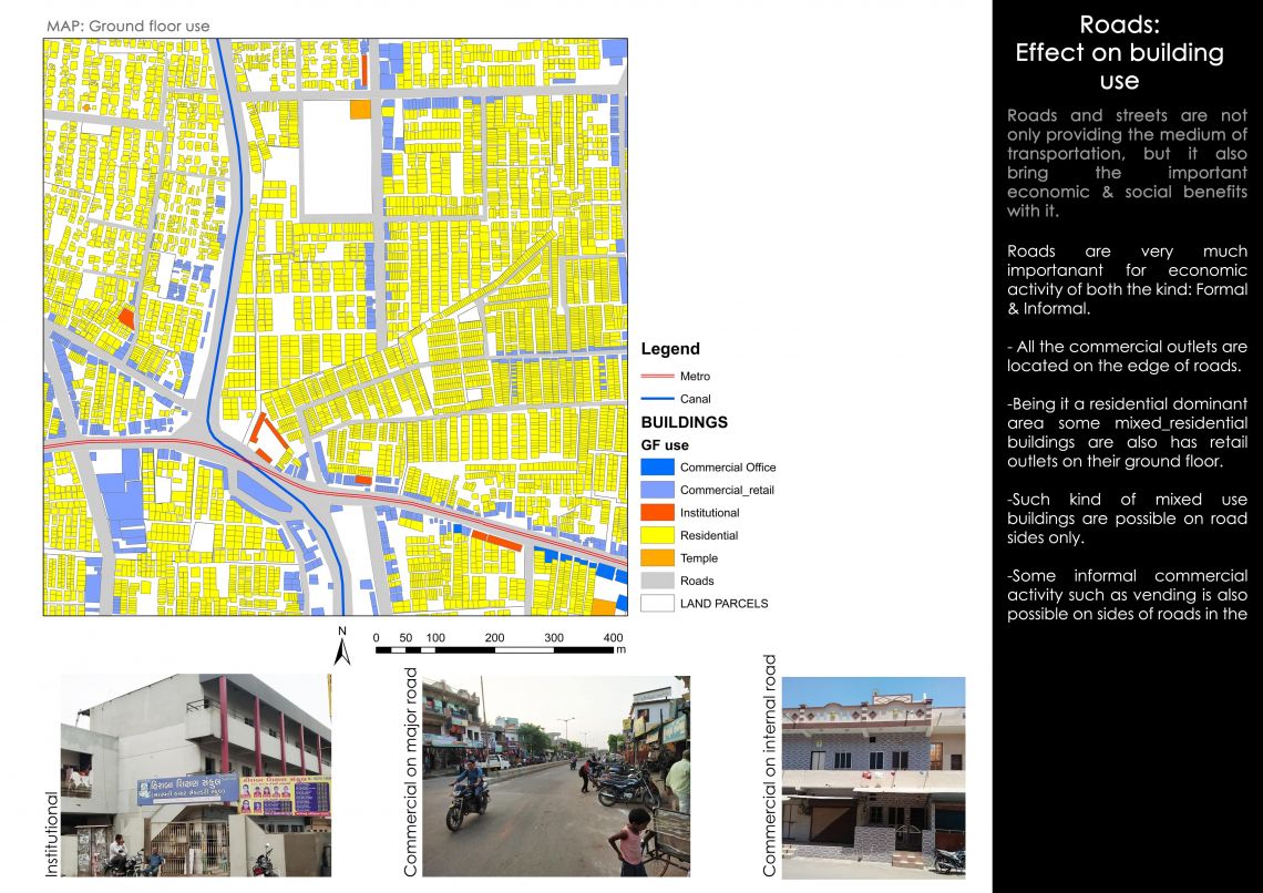
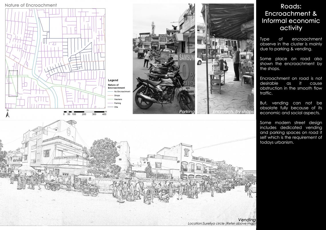
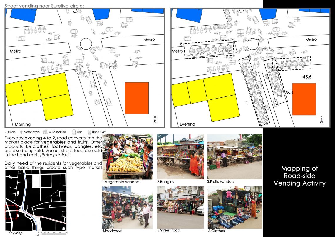
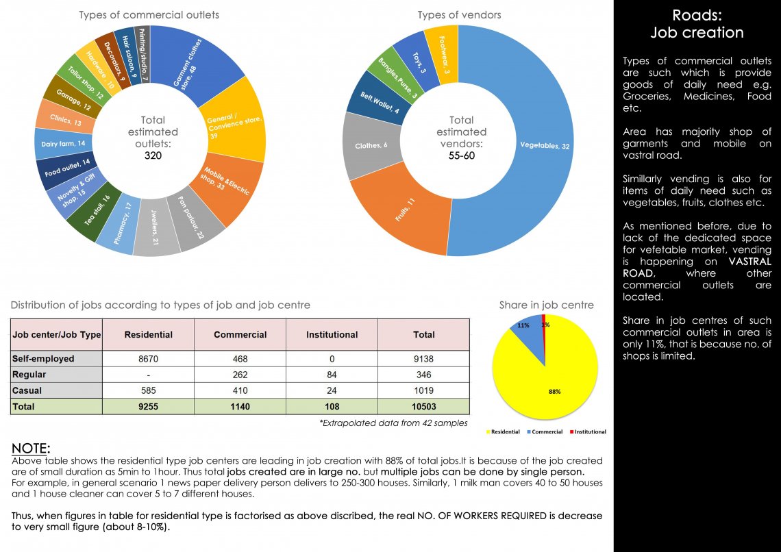
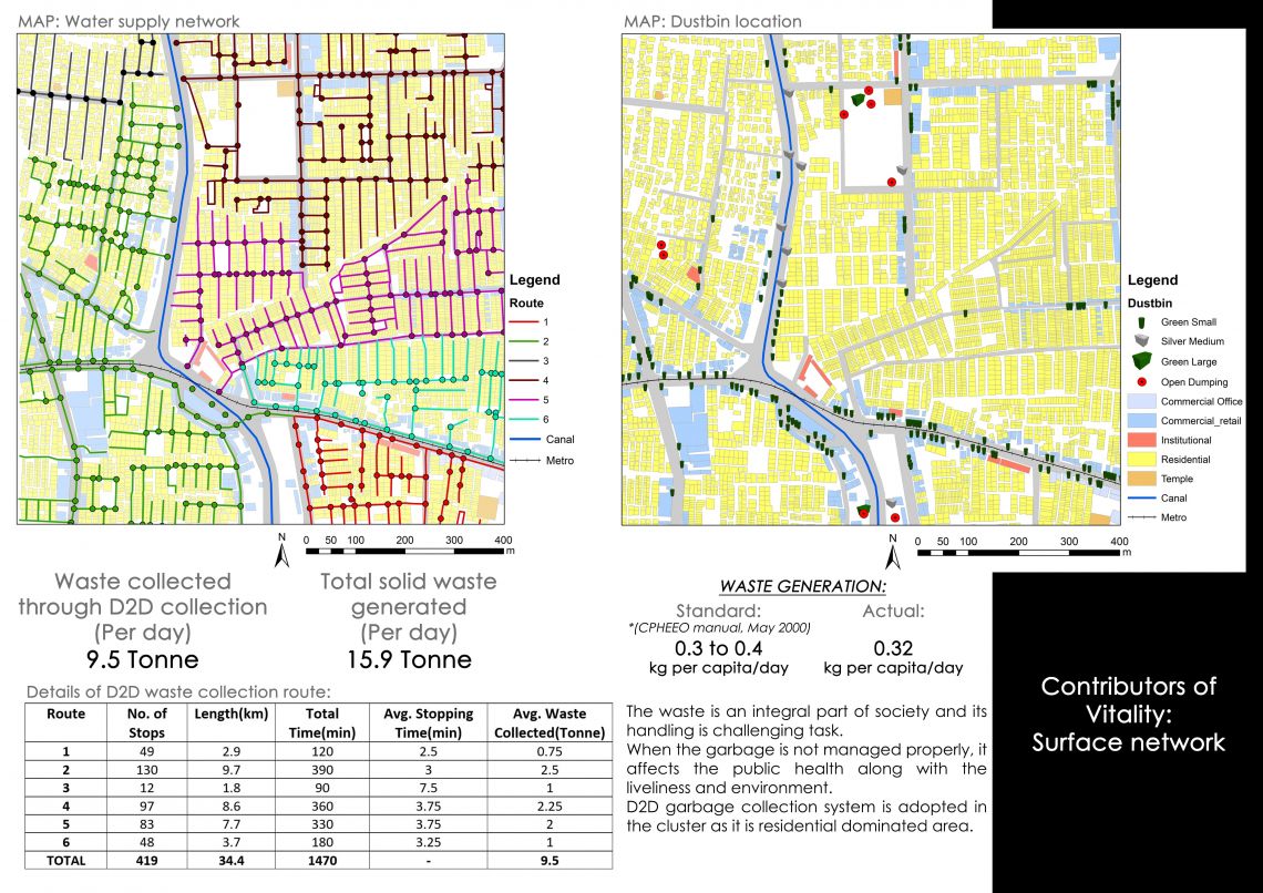
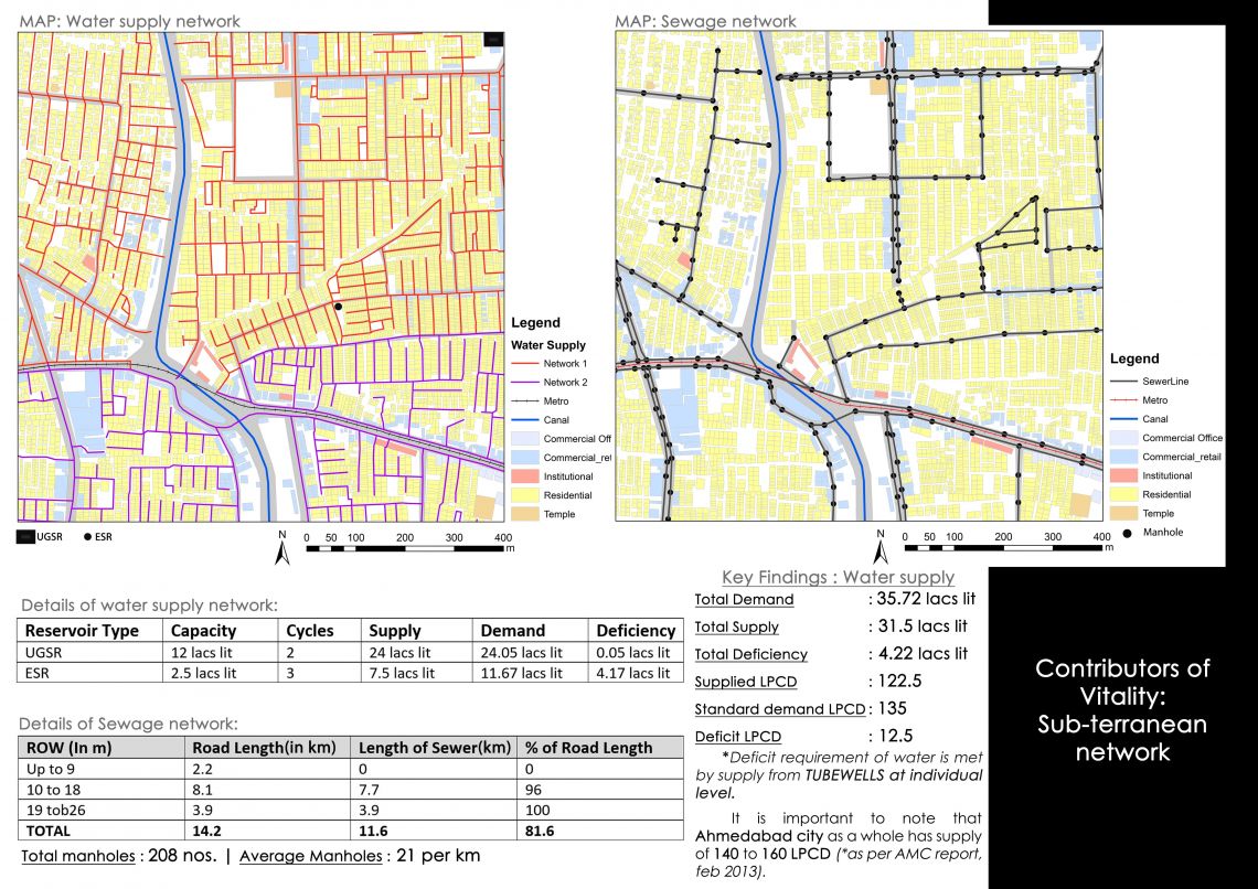
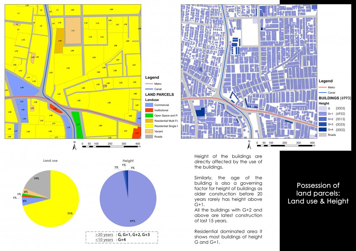
Cluster covers the Rakhiyal-Vastral area in the eastern outskirt of the Ahmedabad city. It is located in 2.5km north of the National Express way no.1 and 2km east of the S.P. ring road. Area has mostly residential buildings along with the commercial and institutional buildings. It is densely populated area since it is started developing due to migration because of the industrial development in nearby areas Mahadevnagar, Odhav and Naroda in 1980's. Before that area is mostly covered with agricultural fields and some no. of houses. Major roads of the cluster are in organic pattern and narrow compare to the western areas and therefore, permissible FSI and Land rates are quite lower in comparison with the other western part of the city. Majority of houses are construction of 1995 to 2000 and of attached type. Others are of semi-detached type houses which is newly built in 2005 to 2010. The area is of Lower to Higher-Medium class in terms of the HH income. Area has well developed infrastructure for sewage and water supply. Also it has excellent solid waste management handling through the D2D waste collection system. Area has only one dedicated public space in the form of Garden. Public activity such as vending, playing, social gathering is happening on road, vacant space, benches outside of temple respectively.
-min.jpg)