Your browser is out-of-date!
For a richer surfing experience on our website, please update your browser. Update my browser now!
For a richer surfing experience on our website, please update your browser. Update my browser now!
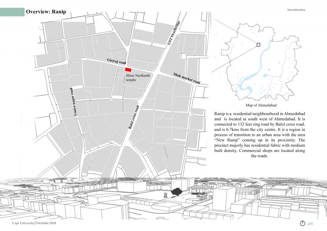
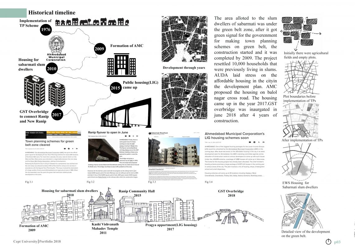
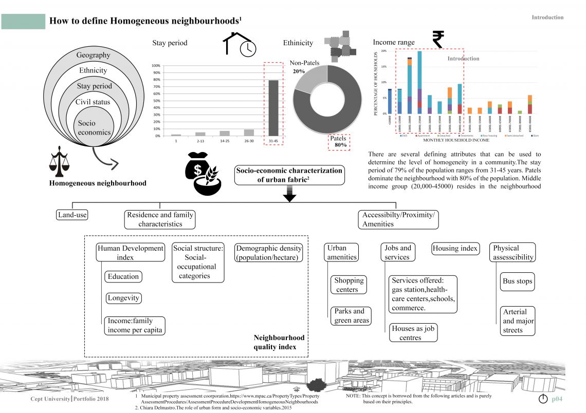
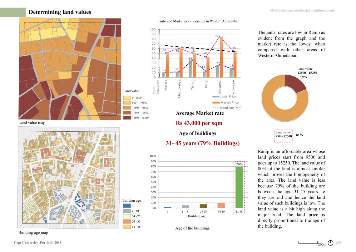
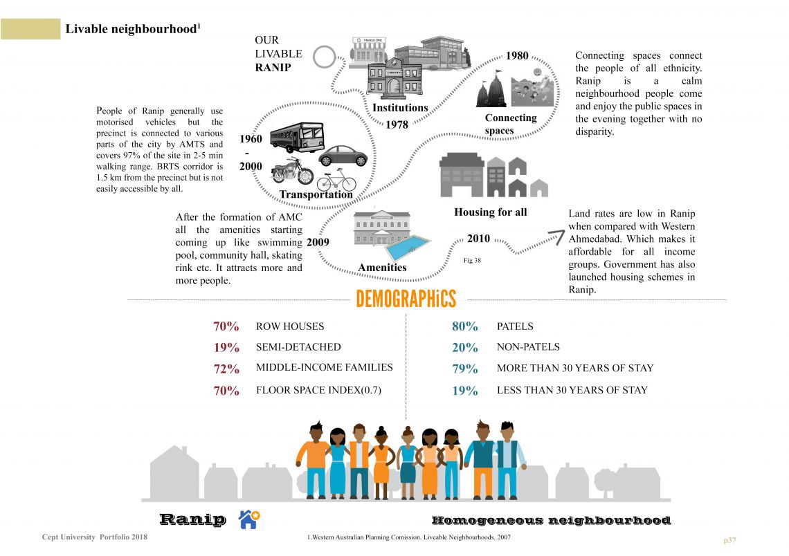
Understanding the city portfolio is a compilation of thirteen exercises which were carried out in three months. For the urban cell of 1 sq.km in the western part of Ahmedabad was studied. Ranip is a residential neighbourhood which is connected to 132 feet ring road by Balol crossroad. The city acts as a complex system. If looked closer consists of islands within an island. Defined by borders made by infrastructure. The first studio of the Urbanism master focused on understanding the form and structure of cities. The objective was to analyse the condition of the city: diagnosis, mapping, measuring, and engaging with communities through surveys. The study included the study of grain, its history, settlement pattern, employment, infrastructure and services. The present study evaluated survey data collected from 50 residents in Ranip. The characters of neighbourhoods are very different. Because of the Homogeneous nature of Ranip the road network at the neighbourhood level of the city also maintains a homogeneous character. Homogeneity is also observed among residents in ethnicity, education, wealth and other characteristics that fuel social cohesion. The Homogeneous neighbourhood also tends to erode perceived neighbourhood social cohesion. It was observed that neighbourhood homogenization can have salutary effects when it fosters social cohesion and facilitates the benefits thereof. Inferences were drawn when compared to the city as a whole, to understand a larger image of the city and the distinct characteristics. The aim was to analyse the open spaces and street patterns of the city to gain a better understanding of scales and layers it possesses.
