Your browser is out-of-date!
For a richer surfing experience on our website, please update your browser. Update my browser now!
For a richer surfing experience on our website, please update your browser. Update my browser now!
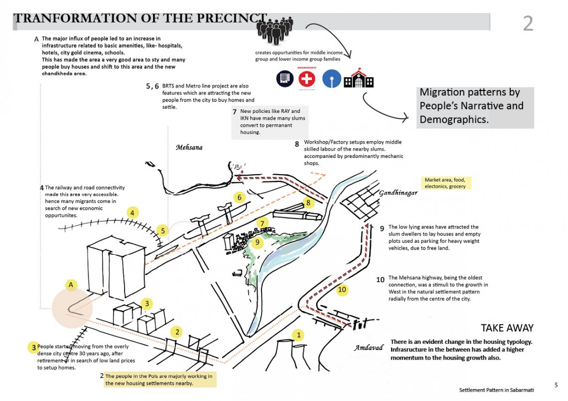
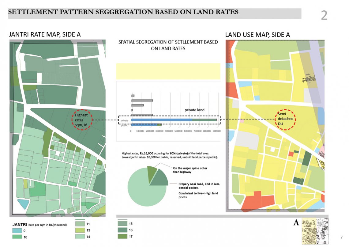
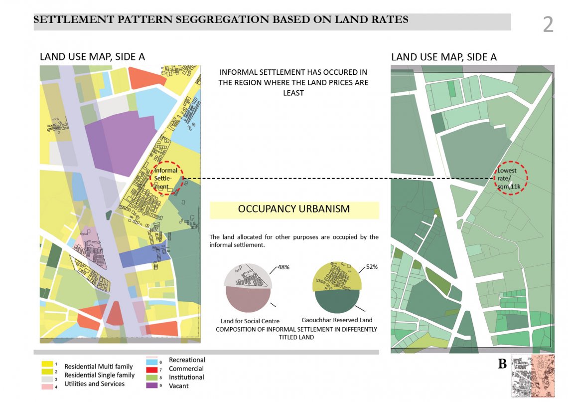
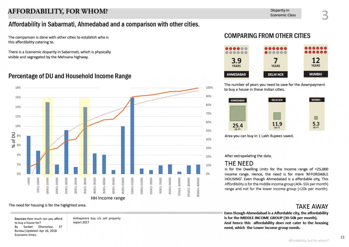
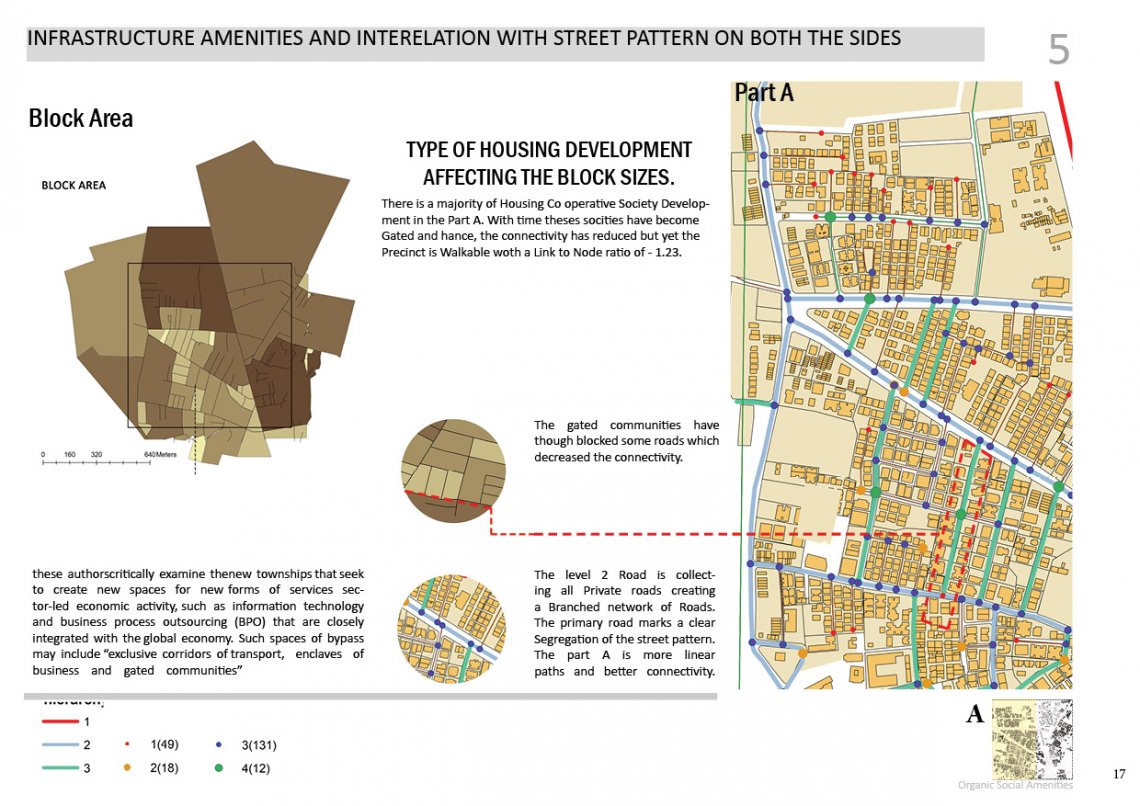
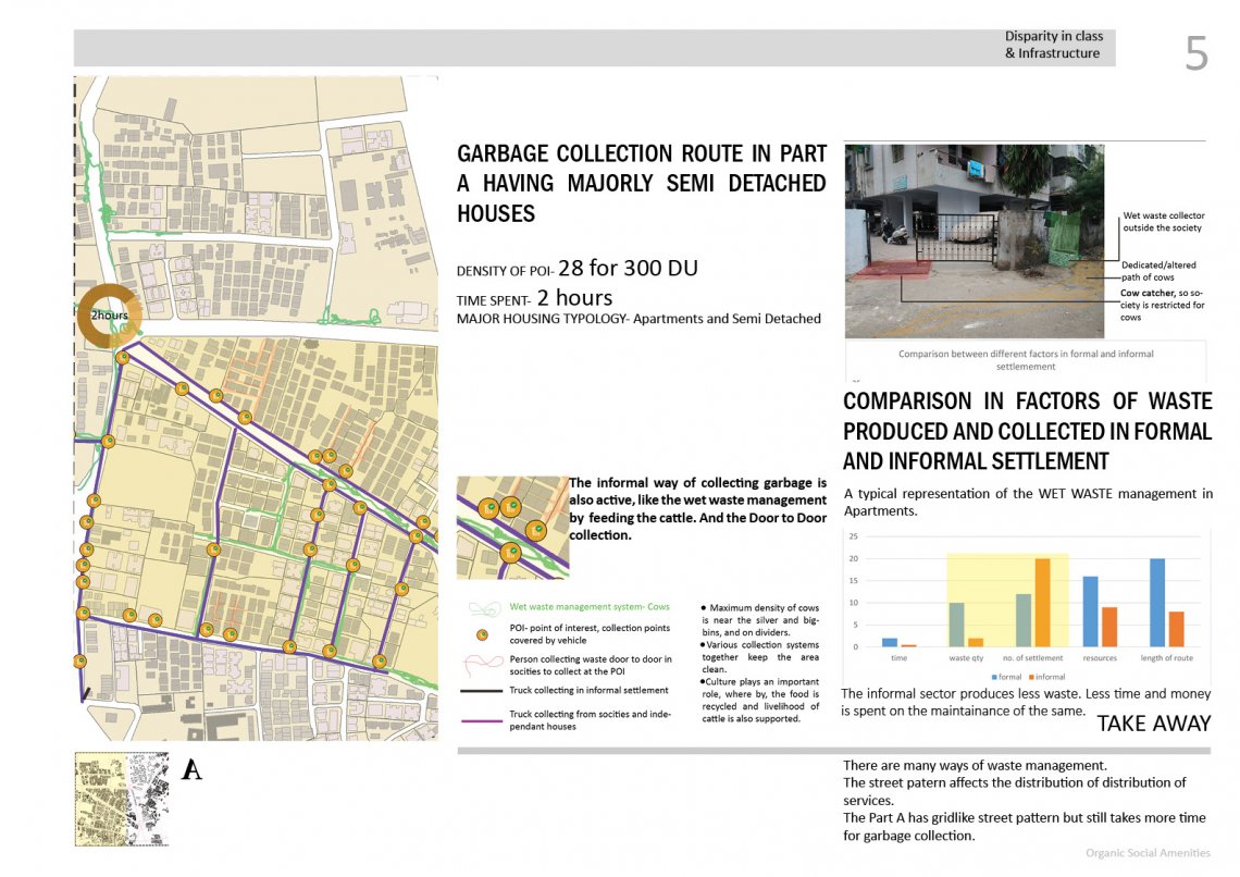
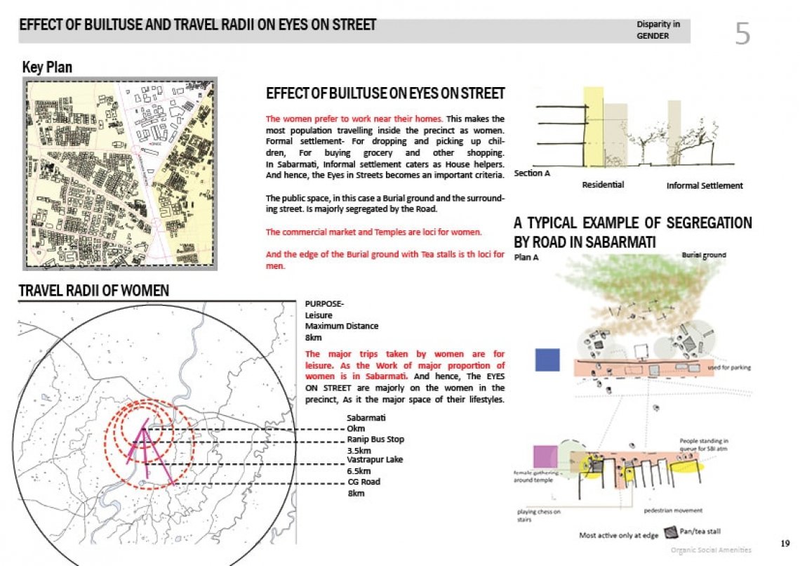
The division of spaces in cities has occurred through out history. For example, the citadel was for kings and the low lying plains for the workers of Citadel. Thus it can be said the income groups and the type of work they do rule the segregation policies seen in the cities. The higher income group has had better living spaces and the comparatively lower income groups “settle” at spaces which are lesser livable or are disputed lands. After the study, it is realised that this spatial difference in the living settlement occurs in Sabarmati too. Spatial Segregation through the lens of Topography, Origin of people, ie. Birth places (migrant, non migrant), Caste, Gender and type of work is a phenomenon governing many Indian cities. These are visible in every city and most parts of them . Ahmedabad with its glorifying textile and pharmaceutical growth, it has also witnessed Urban informality. The part of Ahmadabad Sabarmati shines bright with the division and the prevailing interdependencies of these differences in the Indian typical city context. The portfolio is an attempt to look at the Precinct of Sabarmati through the lens of spatial segregation and Urban informality prevailing. Which highlights the difference between economic classes and the structure of precinct, city affected by it.
