Your browser is out-of-date!
For a richer surfing experience on our website, please update your browser. Update my browser now!
For a richer surfing experience on our website, please update your browser. Update my browser now!
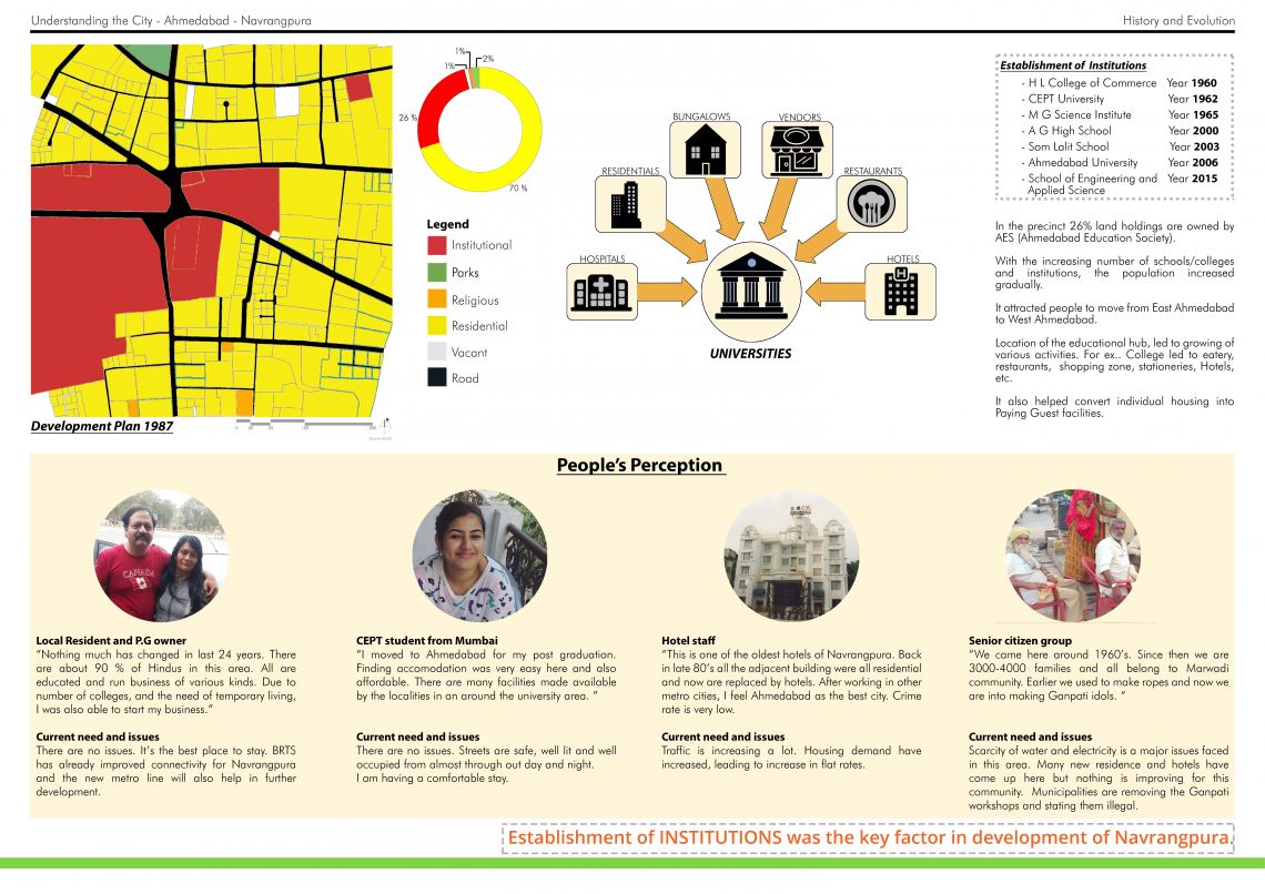
Ahmedabad which is the seventh largest metropolis in India and the largest city of Gujarat State was known as the Manchester of the east until the 1980s. But the textile industries declined in the late 1980s. During the 1960s, west Ahmedabad was developing slowly due to the establishment of institutions like ISRO Space Application Centre and Ahmedabad University. Few natural and social calamities like earthquake and riots also led to the relocation of residents within the city. Thus, West Ahmedabad started expanding as a new city and soon became a prime location for business, residence and education.
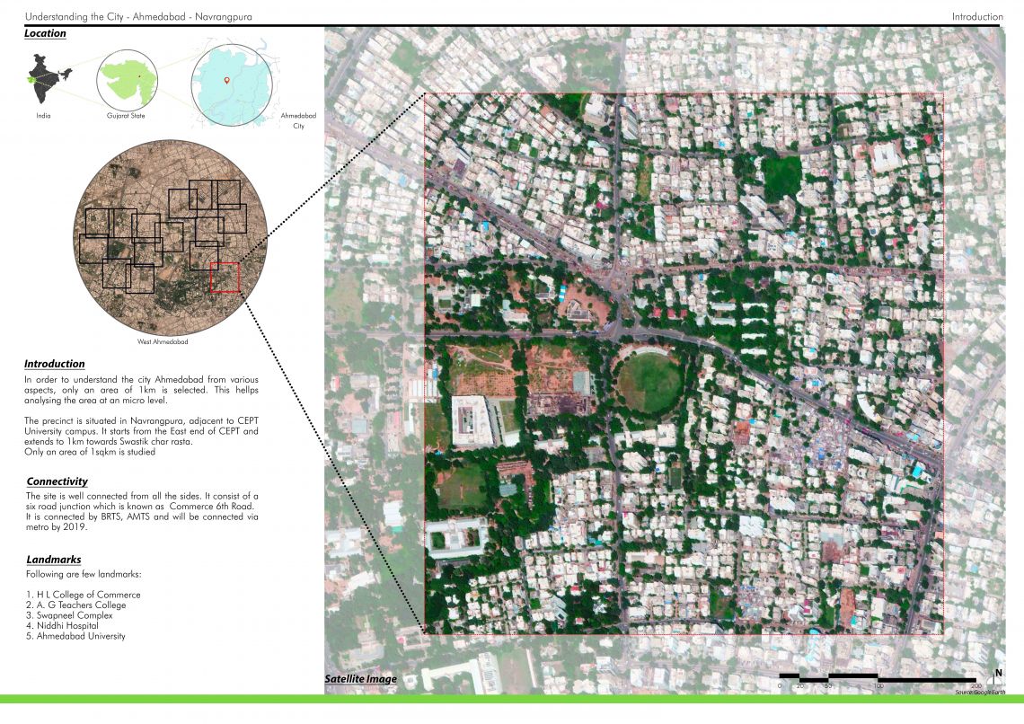
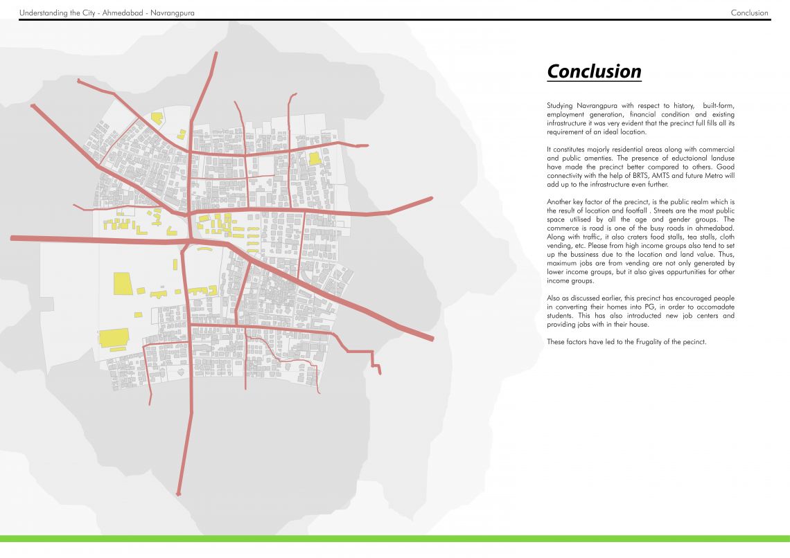
This portfolio analysis the evolution of West Ahmedabad by observing 1sqkm area through different lenses and understanding in detail the process of development. Located in Navrangpura and is adjected to CEPT University, the area can be marked from ‘The Ahmedabad University’ in the West to the Swastik Society in the East. Similarly, Girivar Society in the north and Vasant Vihar Society in the south mark the boundary of the precinct.
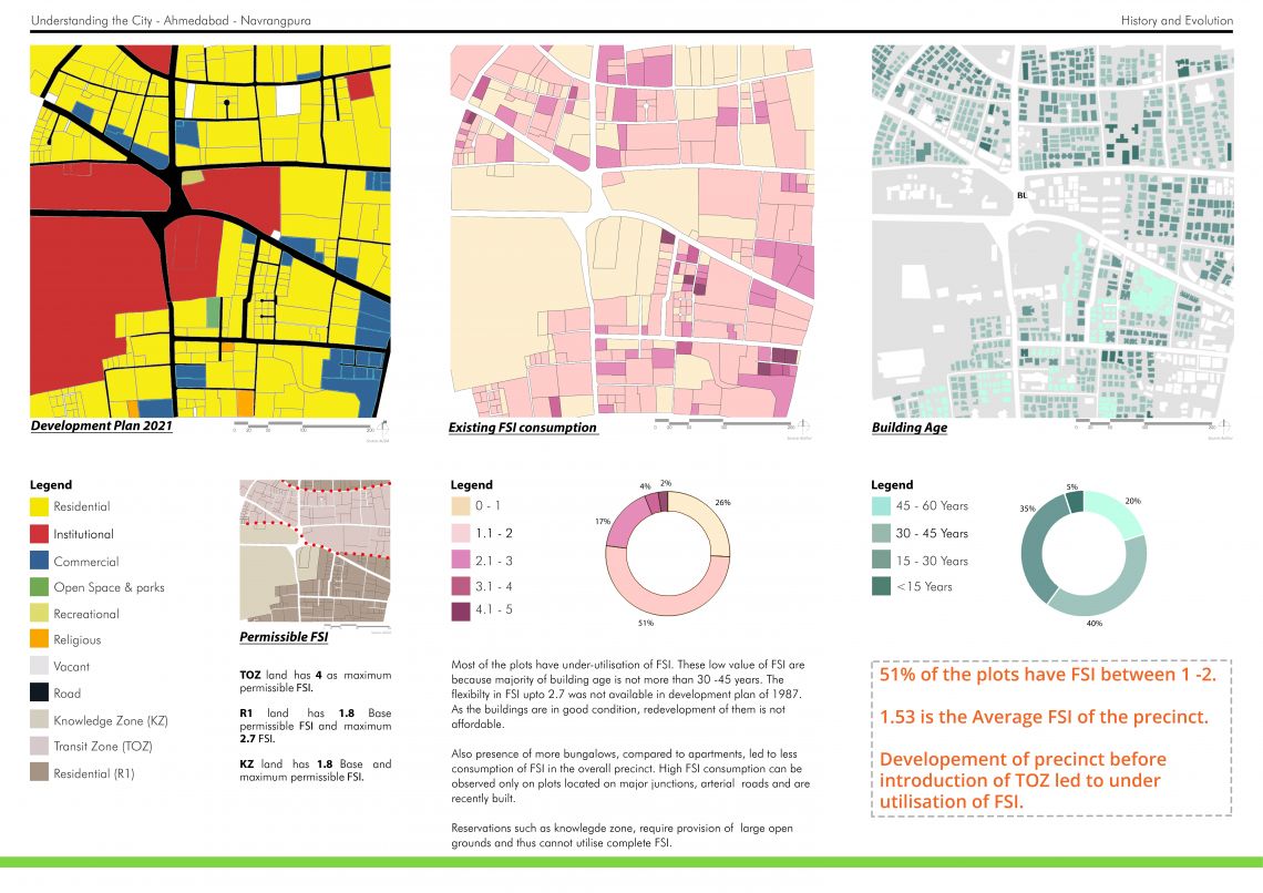
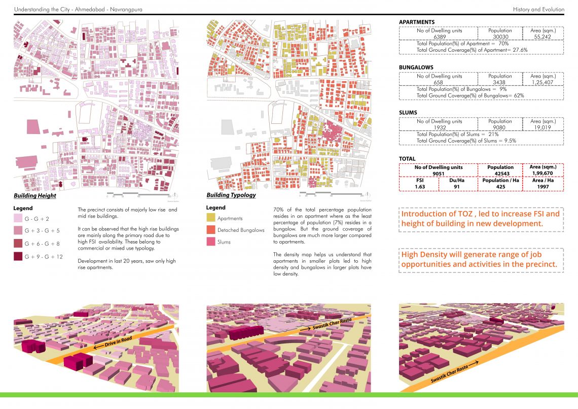
Starting from satellite imagery of the precinct and going through the built form, land use, TP allows one to understand the influence of one on the other. The study also focuses on the housing typology, characteristic, income, travel choices and job opportunity which city as a whole is able to provide the residence. Other factors like infrastructure which also forms an important part for the working of the city have been taken into consideration.
