Your browser is out-of-date!
For a richer surfing experience on our website, please update your browser. Update my browser now!
For a richer surfing experience on our website, please update your browser. Update my browser now!
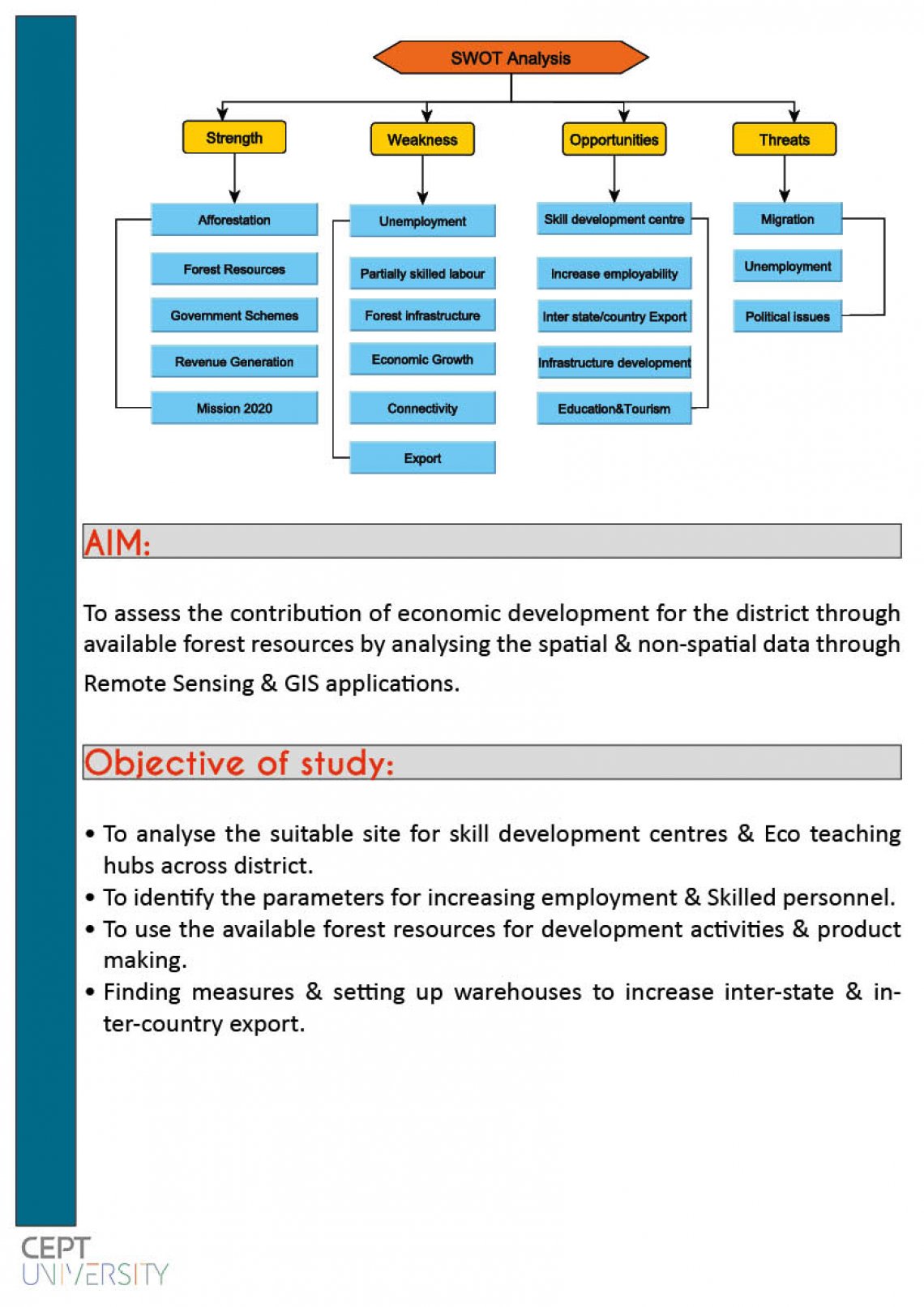
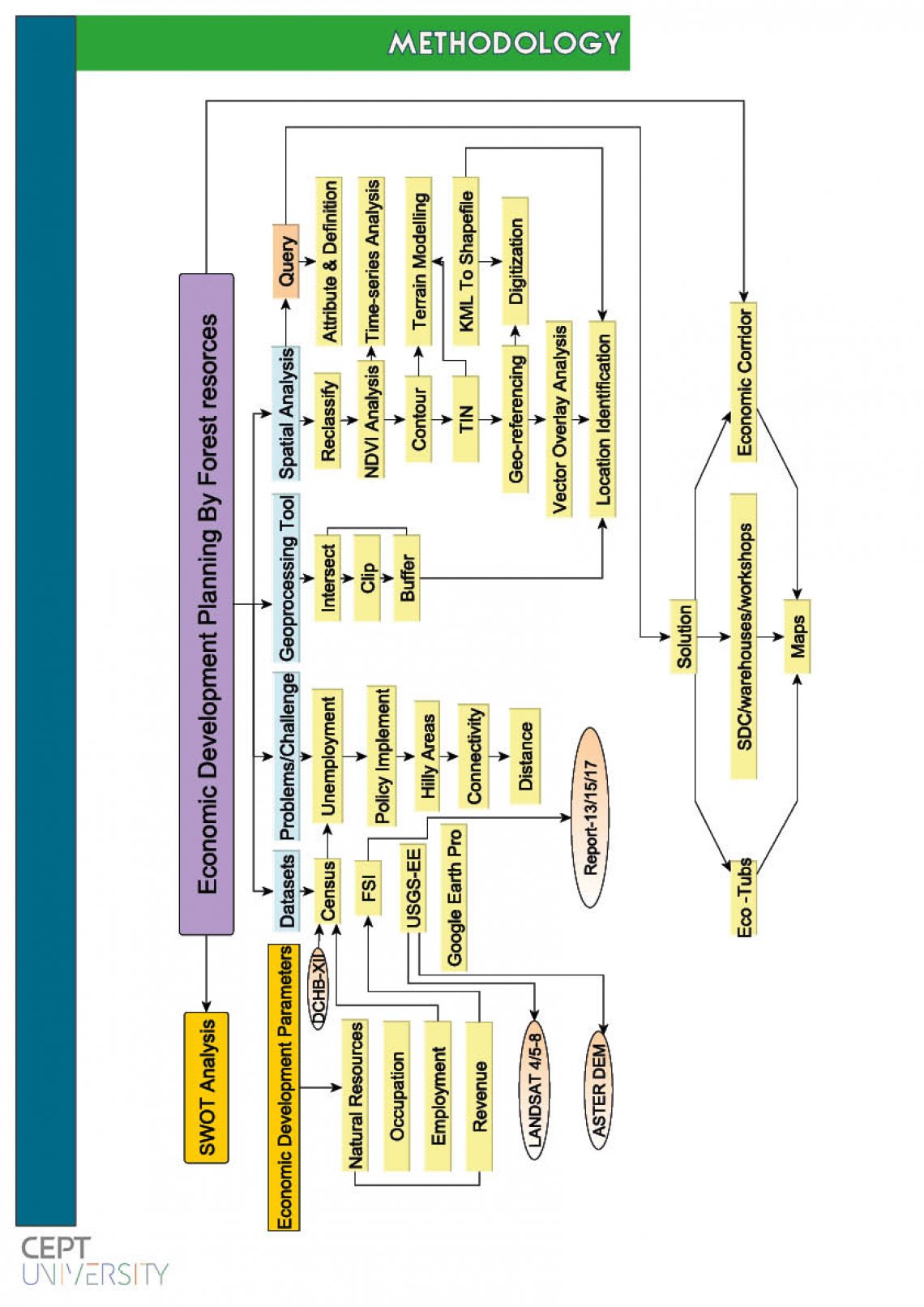
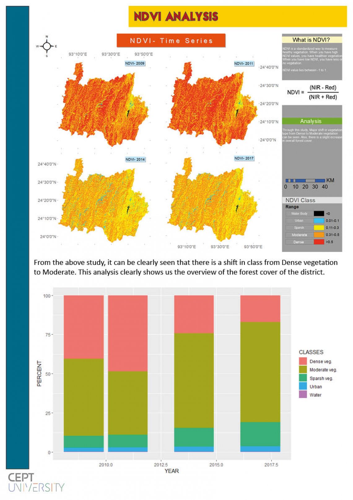
Our main aim is to assess the contribution of economic development for the district through available forest resources by analysing the spatial & non-spatial data through Remote Sensing & GIS applications.
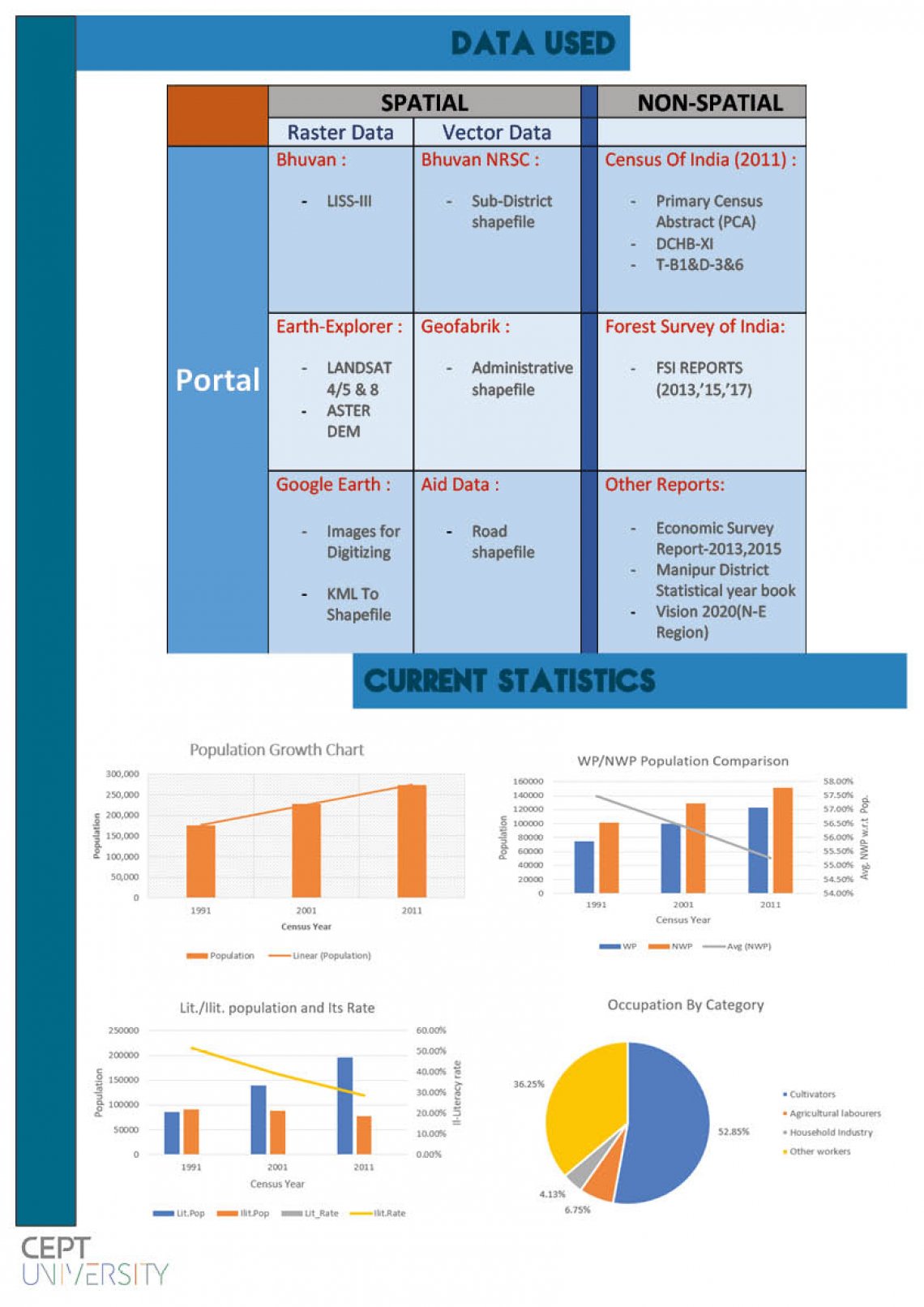
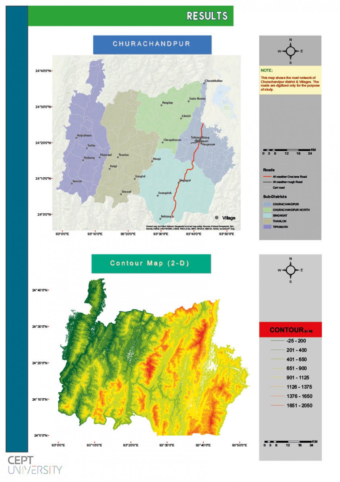
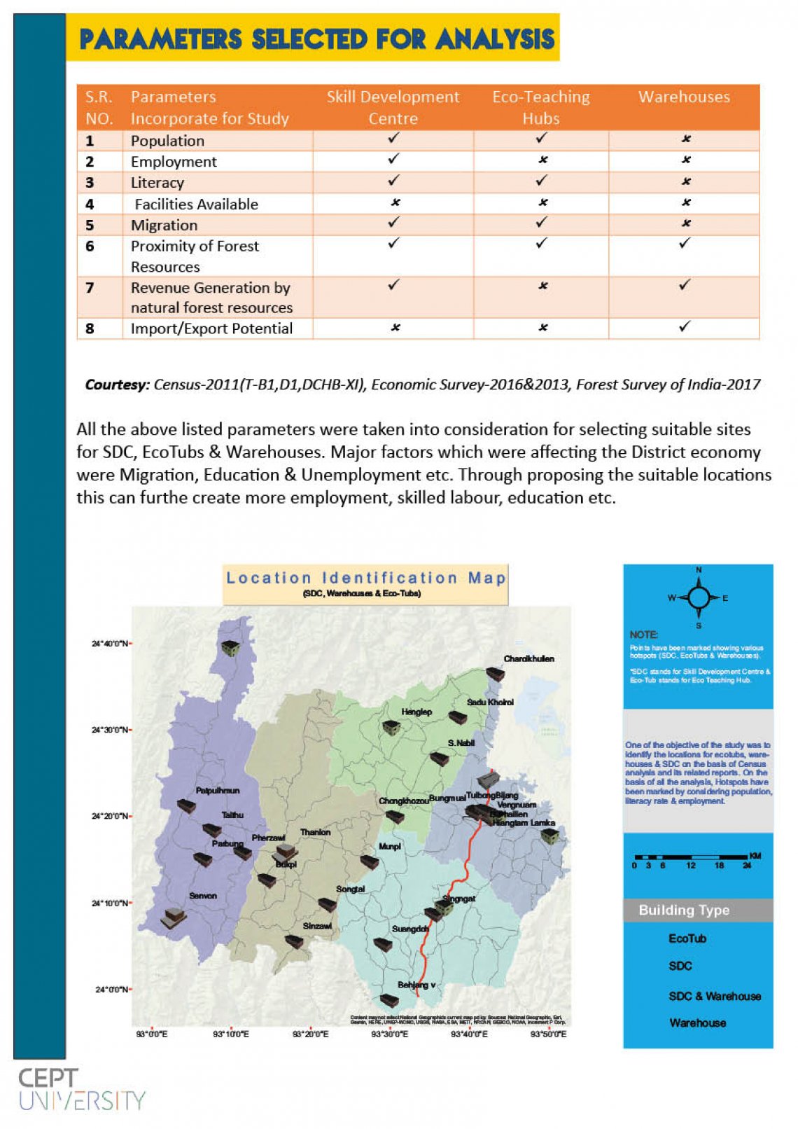
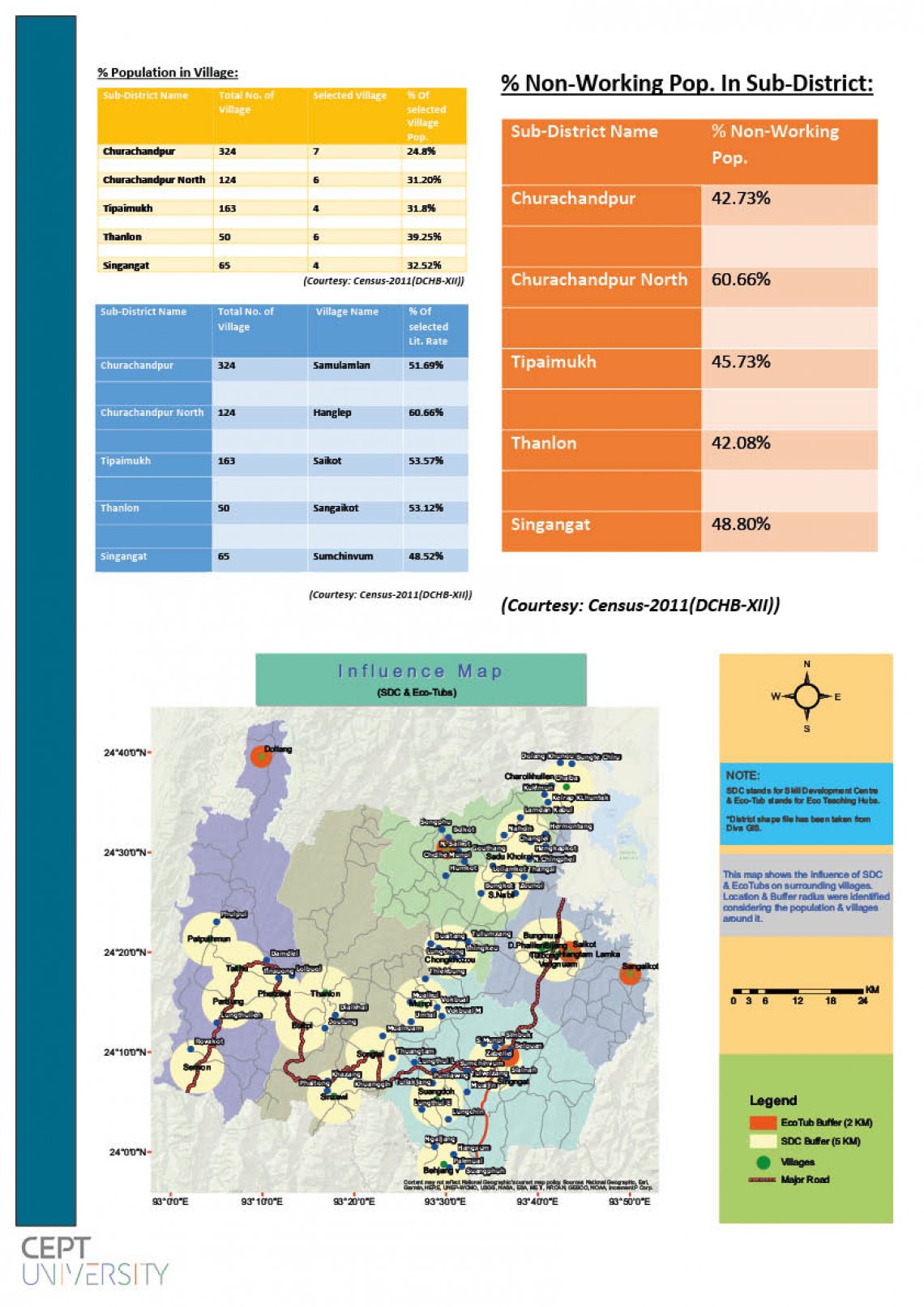
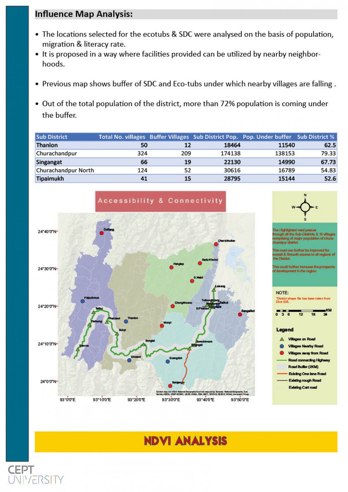
Through this study, we have analysed various parameters based on the information available with census of India & selected suitable locations where ecotubs & SDC can be built.