Your browser is out-of-date!
For a richer surfing experience on our website, please update your browser. Update my browser now!
For a richer surfing experience on our website, please update your browser. Update my browser now!
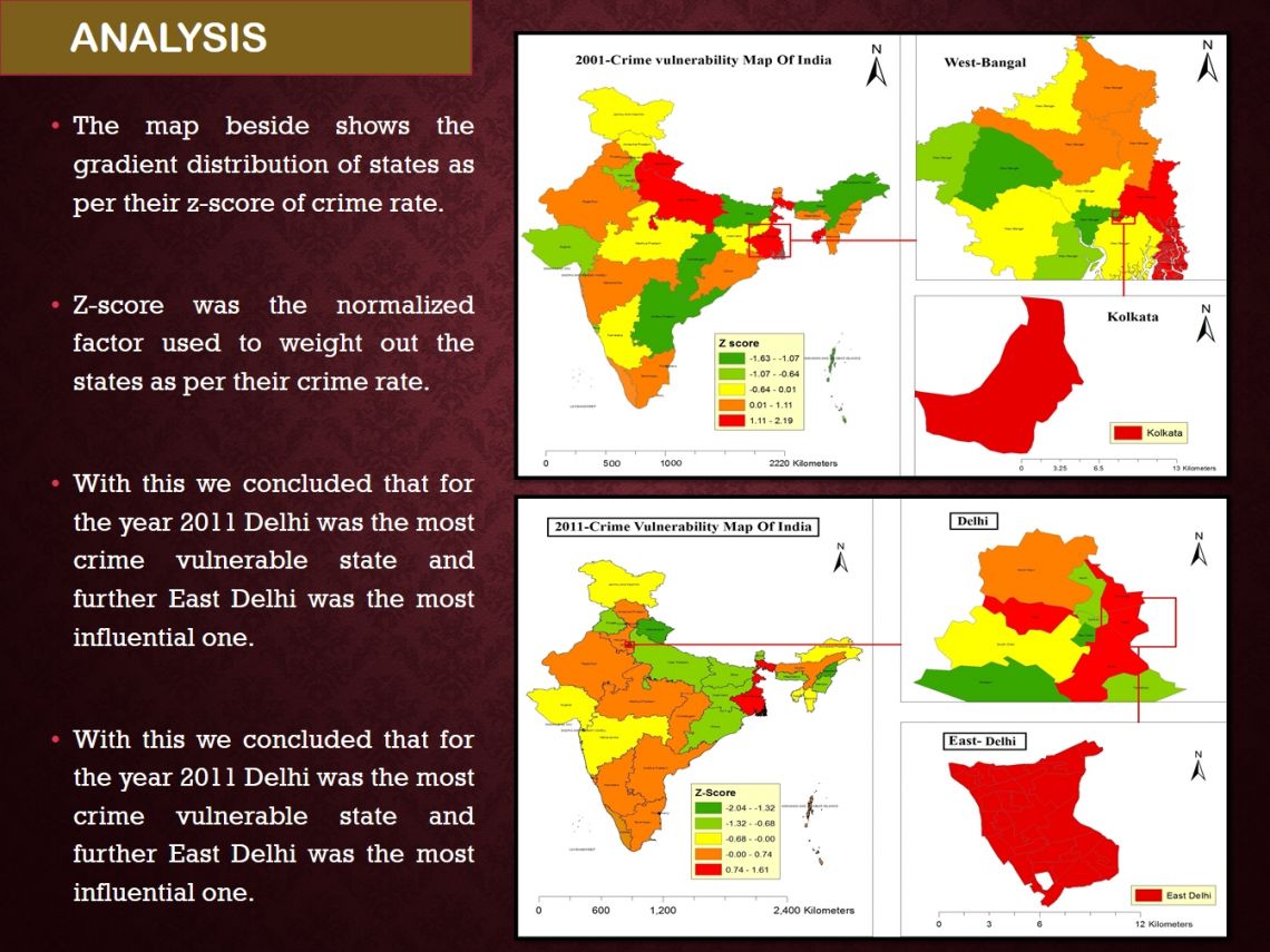
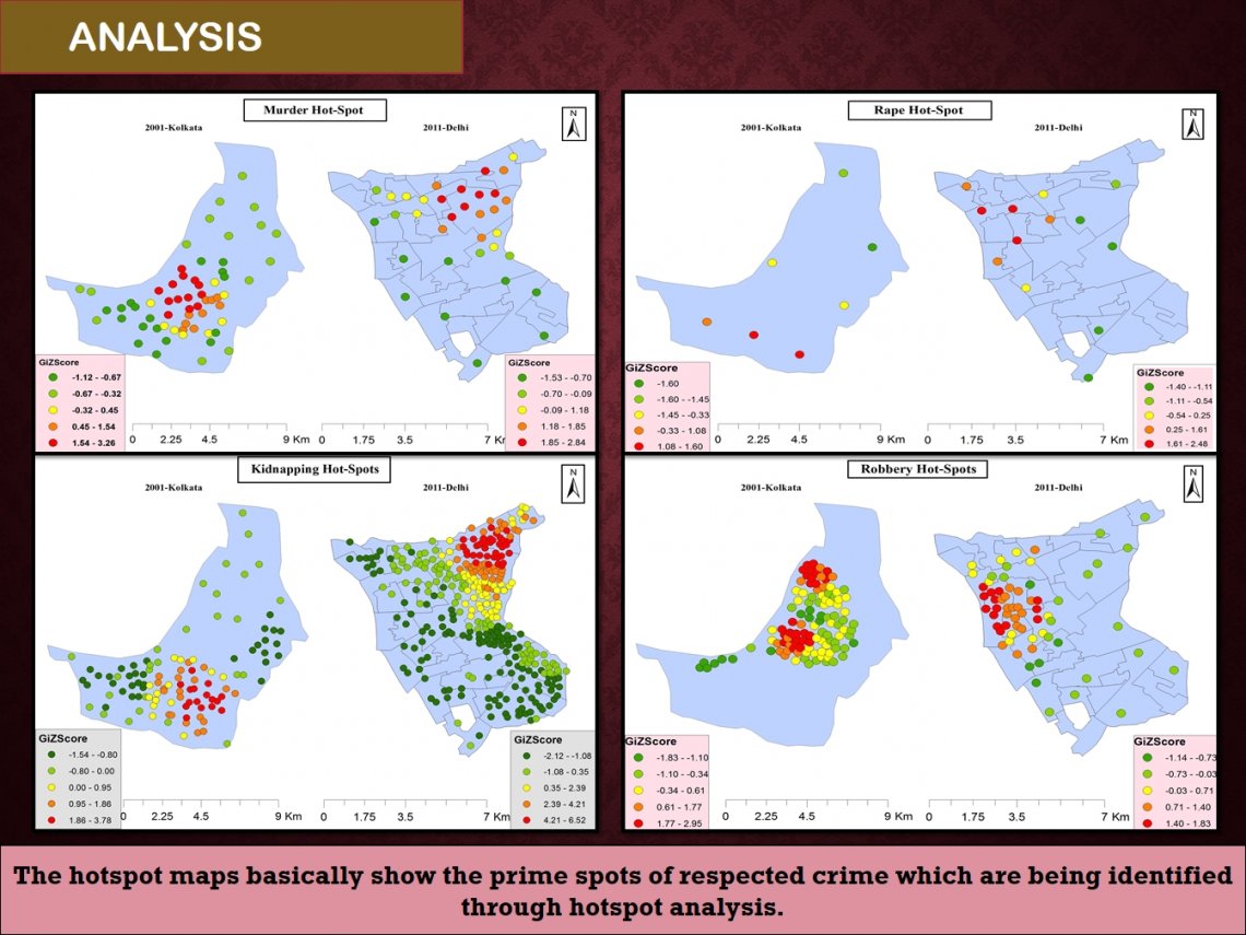
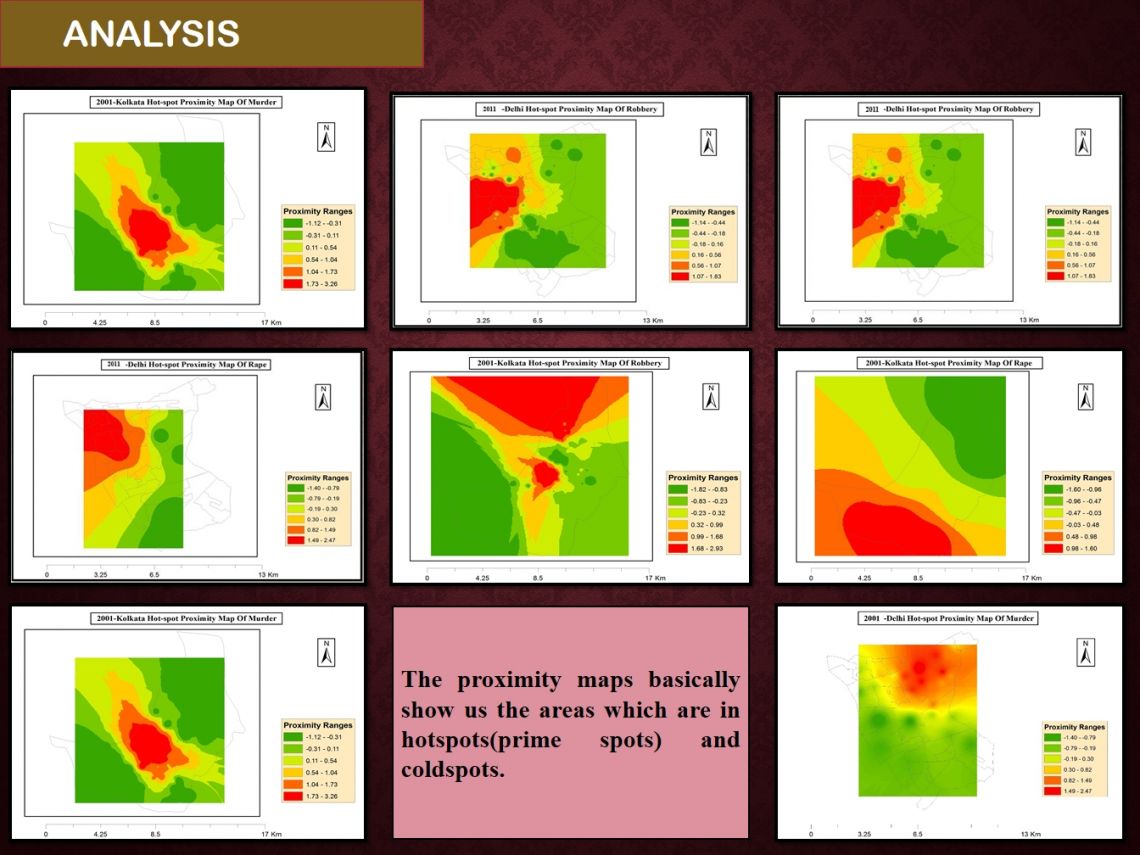
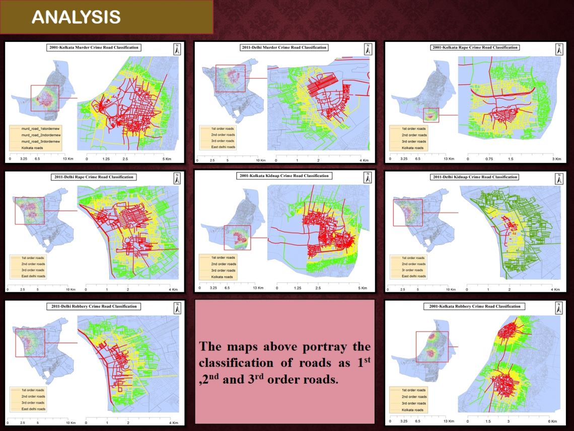
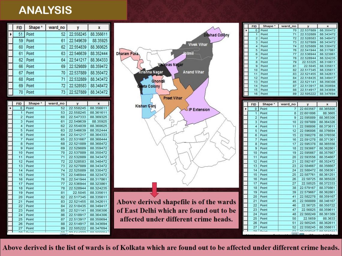
We created vulnerability maps for the year 2001 and 2011. With the vulnerability maps we concluded that WEST BENGAL and DELHI states were having the most severe crime vulnerability in the year 2001 and 2011. With crime rate of all states of India, we tried to find out it’s correlation with the socio-economic parameters. At district level of the mentioned states, we found out KOLKATA and EAST DELHI to be the most crime affected ones. The crime instances were plotted and hotspots were generated under different crime heads. With the help of hotspots we also found out the wards which were severely affected by the occurrence of particular crime. Then finally we classified roads as under 1st order, 2nd order and 3rd order roads under different crime heads for 2001 and 2011 of the concerned district.