Your browser is out-of-date!
For a richer surfing experience on our website, please update your browser. Update my browser now!
Severity: Notice
Message: Undefined offset: 0
Filename: models/Project_model.php
Line Number: 80
Backtrace:
File: /home/portfolio/public_html/application/models/Project_model.php
Line: 80
Function: _error_handler
File: /home/portfolio/public_html/application/models/Project_model.php
Line: 709
Function: get_sem_info
File: /home/portfolio/public_html/application/controllers/Project.php
Line: 112
Function: get_project_detail
File: /home/portfolio/public_html/index.php
Line: 321
Function: require_once
Severity: Notice
Message: Undefined offset: 0
Filename: models/Project_model.php
Line Number: 80
Backtrace:
File: /home/portfolio/public_html/application/models/Project_model.php
Line: 80
Function: _error_handler
File: /home/portfolio/public_html/application/models/Project_model.php
Line: 800
Function: get_sem_info
File: /home/portfolio/public_html/application/controllers/Project.php
Line: 127
Function: increase_project_view
File: /home/portfolio/public_html/index.php
Line: 321
Function: require_once
Severity: Notice
Message: Undefined offset: 0
Filename: models/Project_model.php
Line Number: 80
Backtrace:
File: /home/portfolio/public_html/application/models/Project_model.php
Line: 80
Function: _error_handler
File: /home/portfolio/public_html/application/helpers/utility_helper.php
Line: 131
Function: get_sem_info
File: /home/portfolio/public_html/application/views/includes/header.php
Line: 9
Function: semester_info
File: /home/portfolio/public_html/application/controllers/Project.php
Line: 148
Function: view
File: /home/portfolio/public_html/index.php
Line: 321
Function: require_once
For a richer surfing experience on our website, please update your browser. Update my browser now!
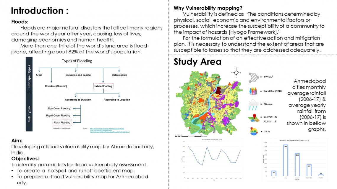
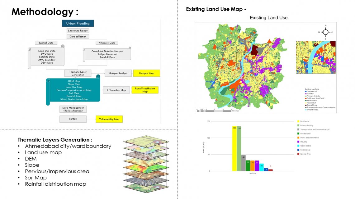
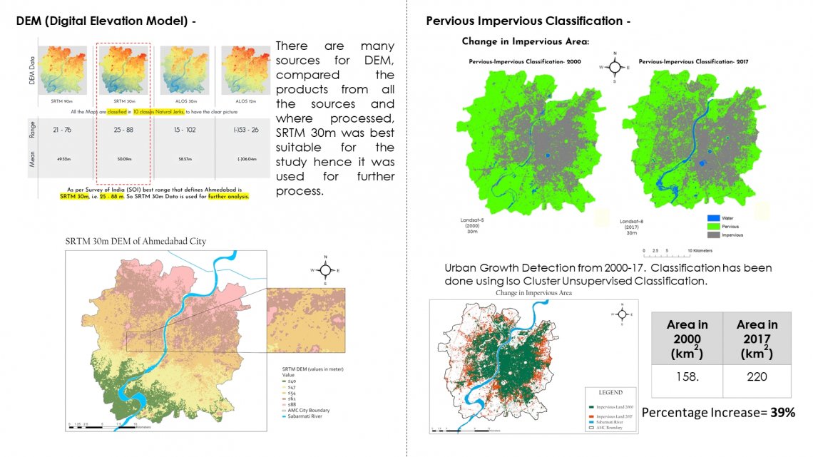
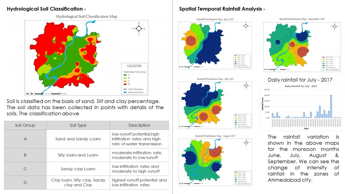
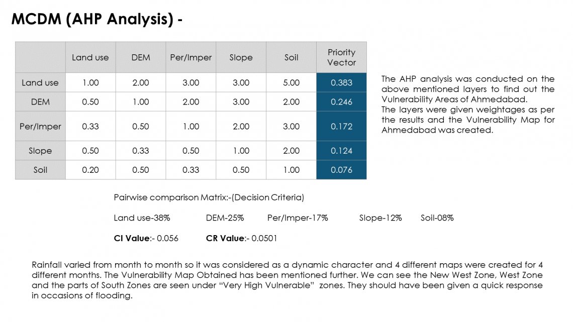
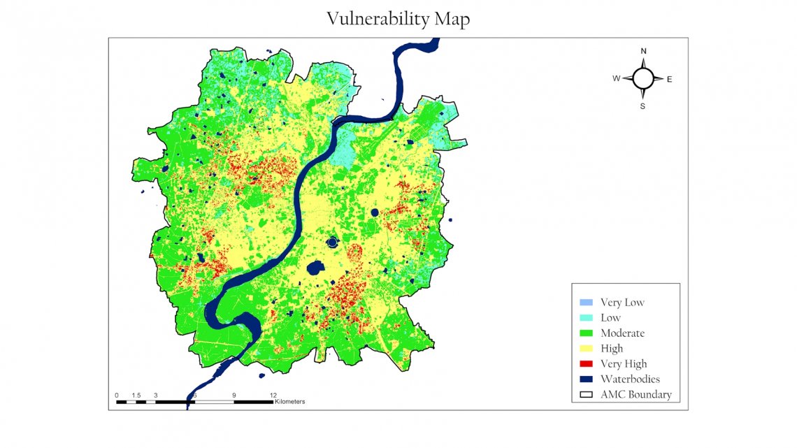
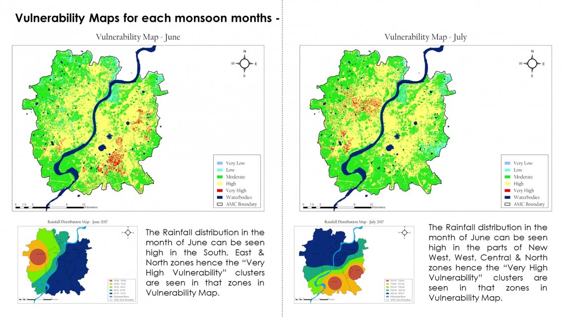
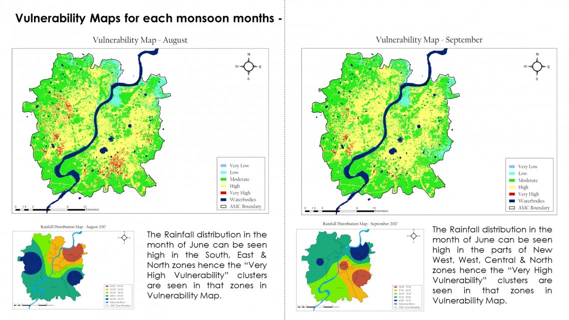
The aim of the study was to understand the for urban flooding and prepare a vulnerability map for Ahmedabad city. Different Thematic Layers were considered and Multiple-criteria decision-making was considered to provide the weights for the analysis. The study helped to understand the part of each thematic layer in the vulnerability map. Saw the change in vulnerability map with the change in the rainfall on an area.