Your browser is out-of-date!
For a richer surfing experience on our website, please update your browser. Update my browser now!
For a richer surfing experience on our website, please update your browser. Update my browser now!
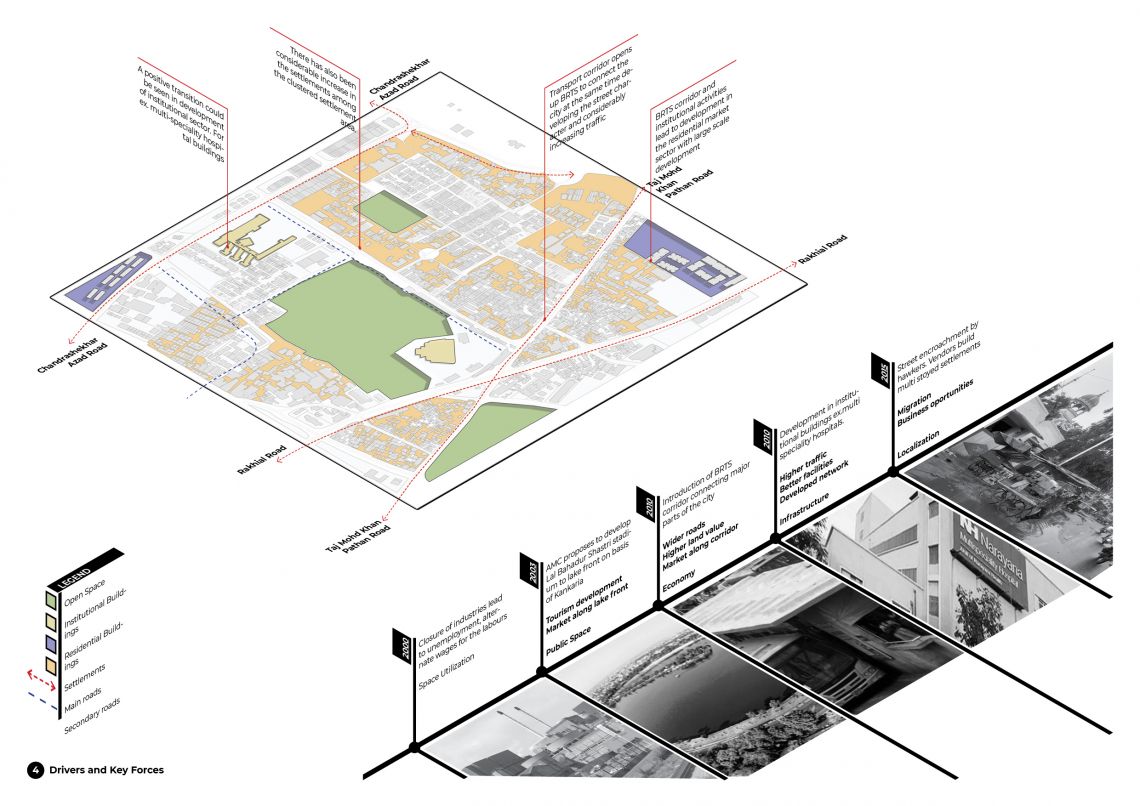
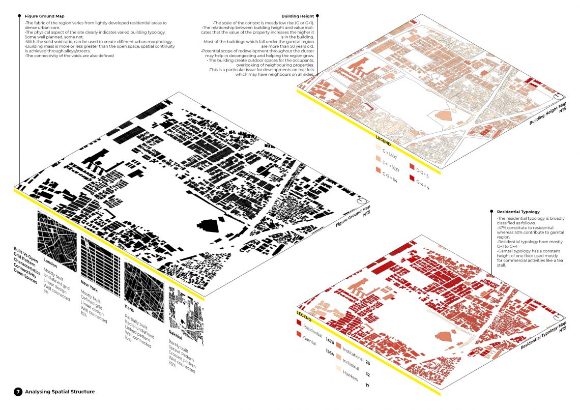
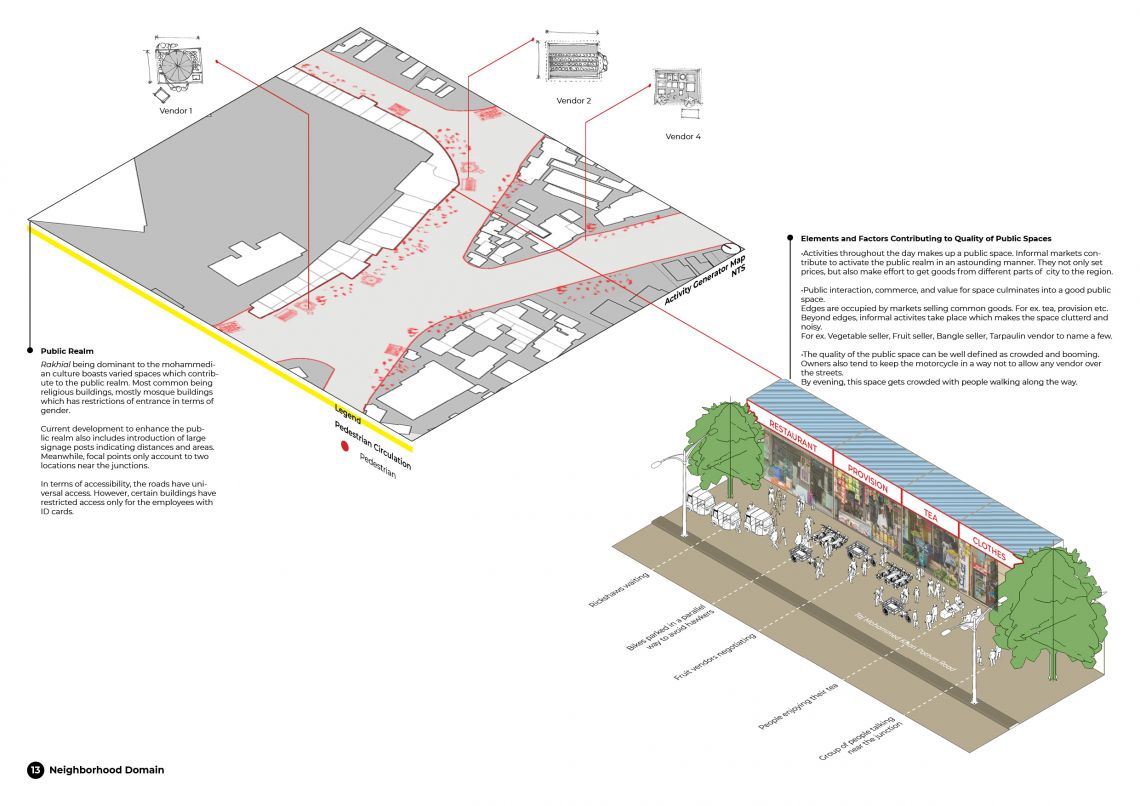
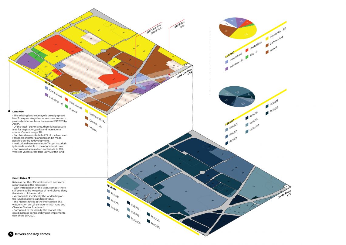
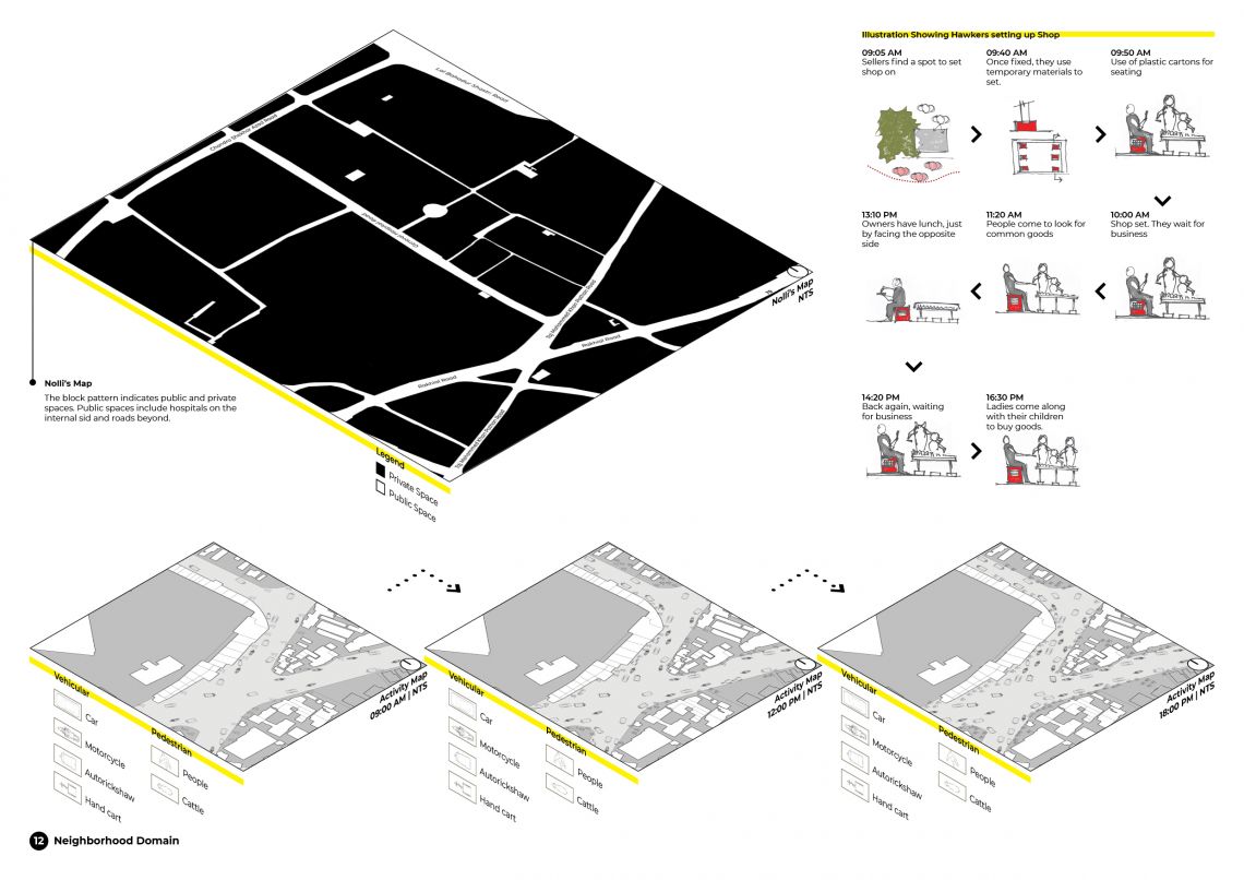
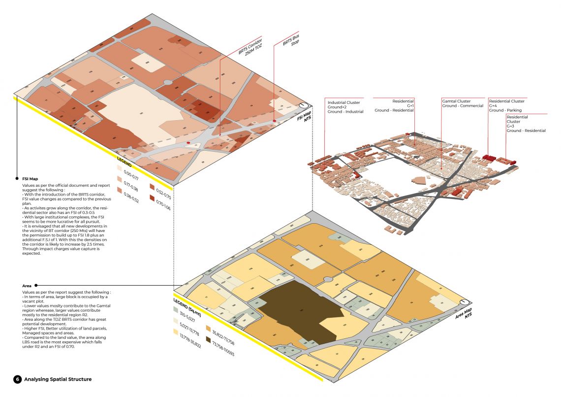
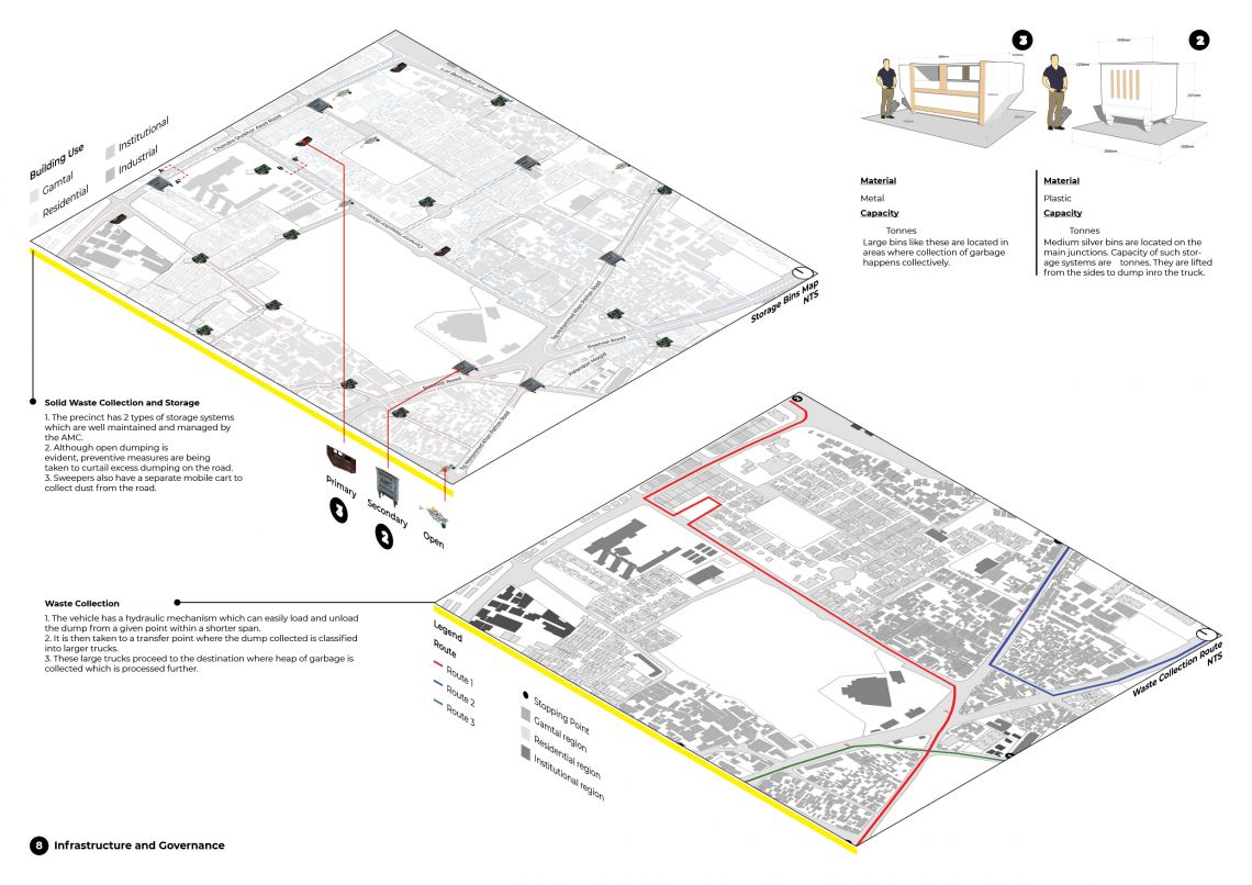
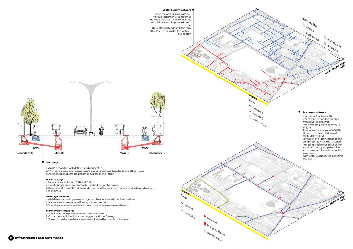
The studio started off with a formidable lecture which outlined the expanse of the subject. We were all given a parcel of the city. The ultimate objective was to dissect and understand the tiniest detail of how the city works and what are the possible problems. Use of advance software were made to analyse and generate technical maps. Excel was broadly used to generate graphs, identify deviations and compare data. Site visits were carried out to map data. Juries were mostly in the form of pin up or table top discussions. Feedback provided were quite effective. The first part of the course ended with an exhibition which showcased the quantum of work carried by 156 students. The exhibition was open to public and was well received.