Your browser is out-of-date!
For a richer surfing experience on our website, please update your browser. Update my browser now!
For a richer surfing experience on our website, please update your browser. Update my browser now!
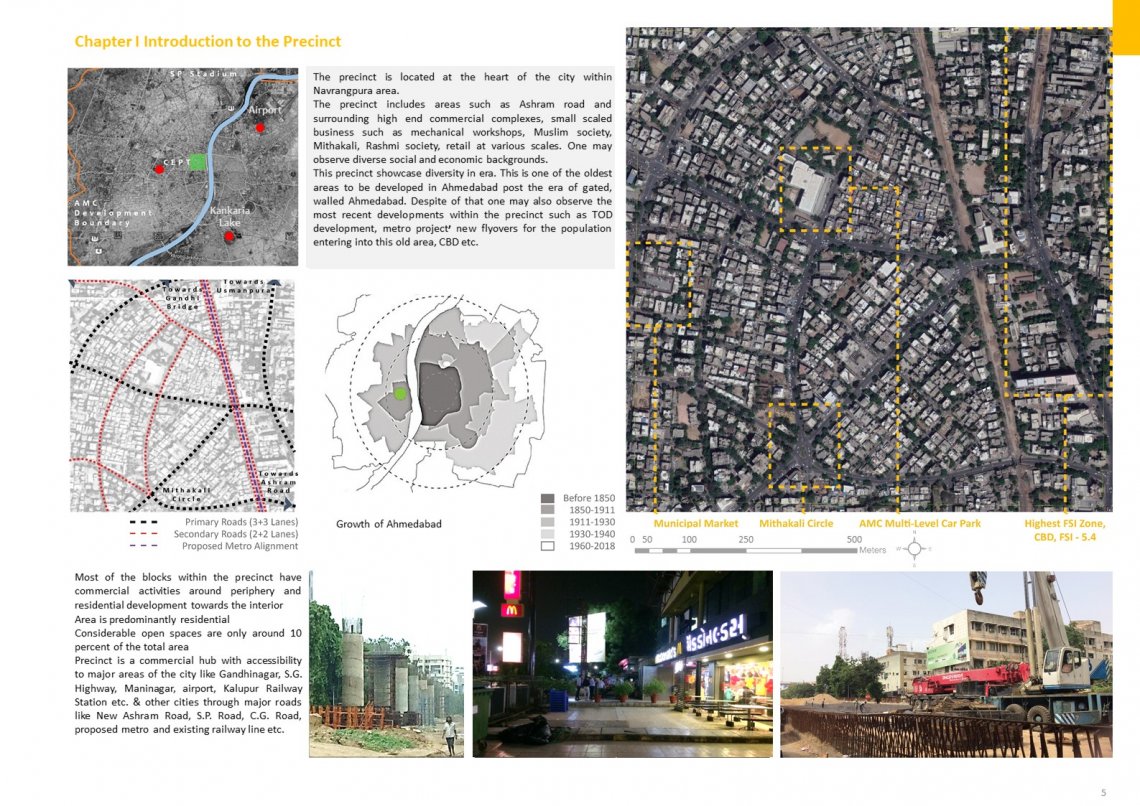
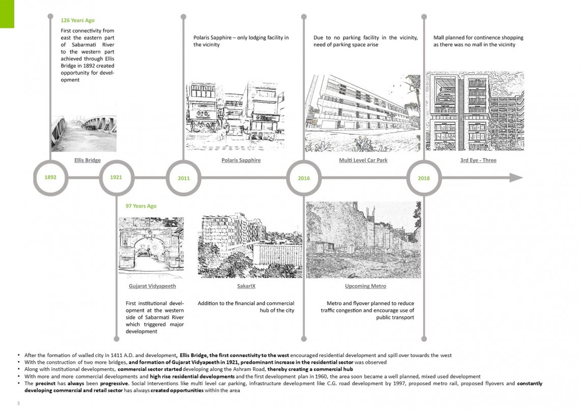
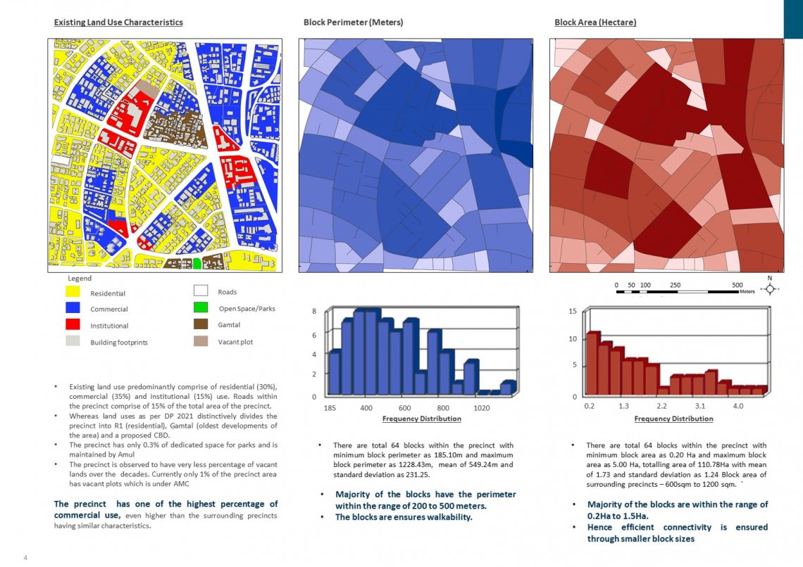
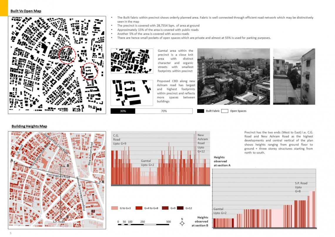
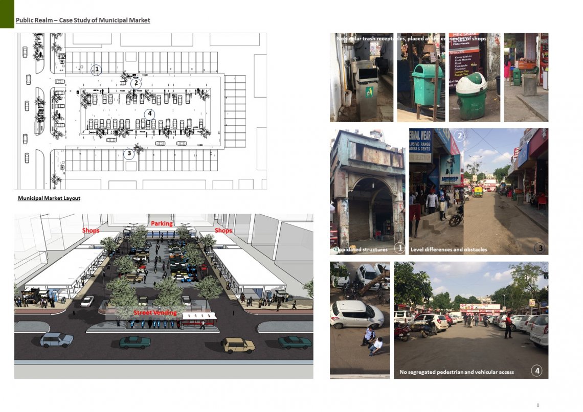
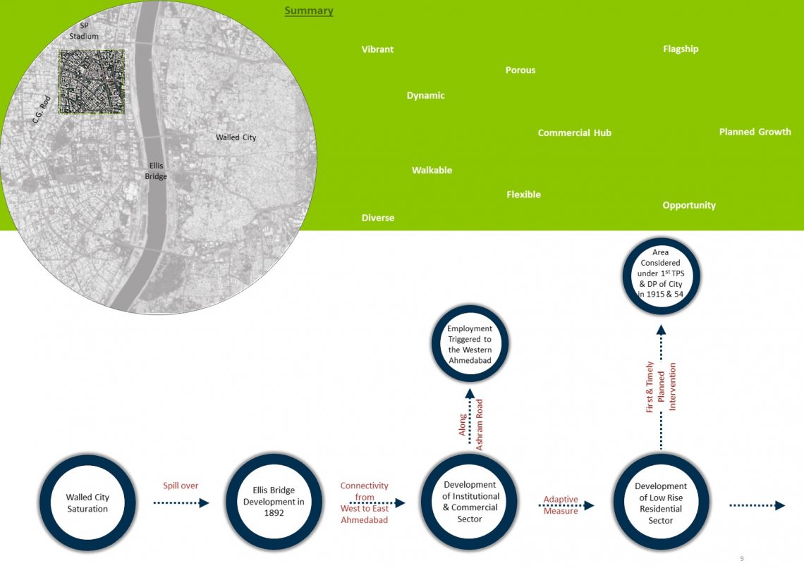
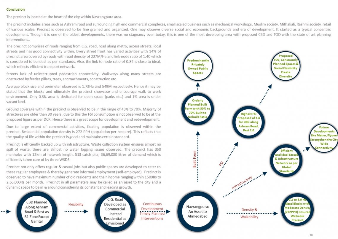
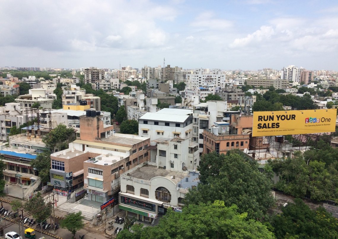
Navrangpura may be considered as an inception of development towards the western part of Ahmedabad after building up the first connectivity from East to the West of the city through Ellis Bridge in 1892. Development may be considered as a response to the saturation of activities and population within the walled city. Development of western Ahmedabad hence began as an adaptive measures, with Navrangpura Gam being one of the first village settlements. Development of institutions like Gujarat Vidyapeeth in 1921, induced development of low rise residential typology. As an adaptive measure to the outgrown commercial activities towards Eastern side, commercial development along Ashram road and eventually along C.G. road was triggered. As a response to increasing need to live around the centre of the city and this emerging city centre, high rise residential developments began to develop. The emerging character of the area was identified in the initial stages of development and planning measures taken in accordance may be referred through the first DP of Ahmedabad prepared in 1954. The same is evident from TPS scheme of 1915. DP reflected base division within the precinct as zone R1 in maximum of the area and CBD along Ashram road. This lead to configured land use characteristics and a strong connectivity planned to adapt to not only existing situations but also to consider future. This is evident from the events such as road redevelopment projects, projects like metro and construction of flyovers, happy street events etc. The connectivity planned then is accommodating the required & desired modifications through planning measures proposed periodically. This ensured intra and inter precinct connectivity and also established efficient connectivity from east to the west of the city. The flexibility of the area is evident from diverse economic groups, typologies, activities and opportunities adapted and has rendered a vibrant picture of the area. Continuous adaptation, strong planning interventions and modularity of the precinct has ensured moderately dense, orderly planned built fabric and is creating opportunities to develop it to the next level by creating provisions like highest FSI of 5.4 to the CBD along New Ashram Road, making amendments to the FSI of other areas etc. This is further backed up with a strong infrastructure network. To adapt to the diverse and vibrant character of the precinct, public spaces like Municipal Market were planned to cater to varied groups of users thereby creating informal employment along with and to cater to the regular employment. The precinct is hence may be looked at as diverse, vibrant and extremely flexible part of the city governed by controlled growth through extremely conscious planning/ design efforts.