Your browser is out-of-date!
For a richer surfing experience on our website, please update your browser. Update my browser now!
For a richer surfing experience on our website, please update your browser. Update my browser now!
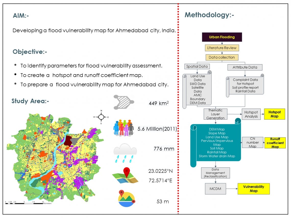
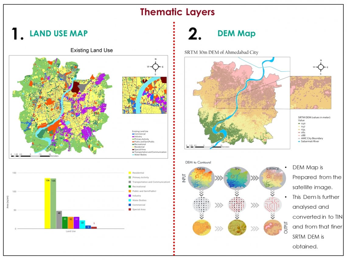
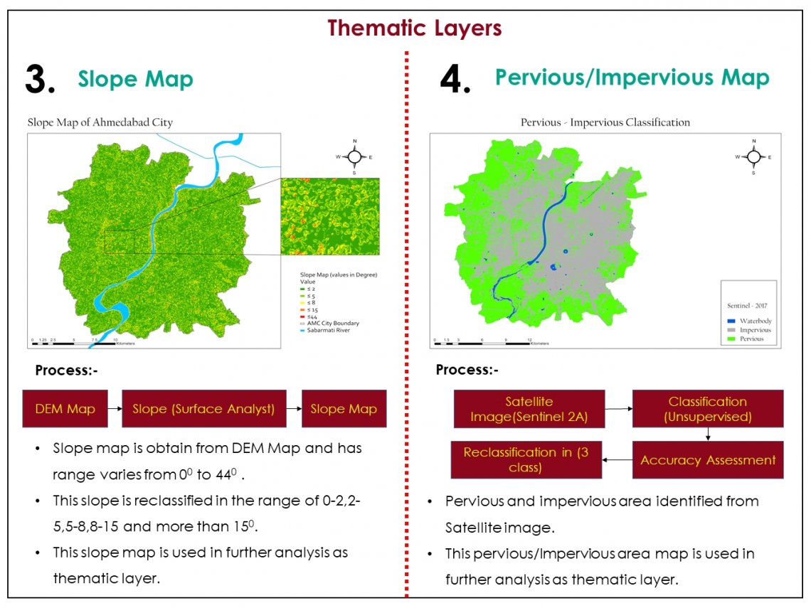
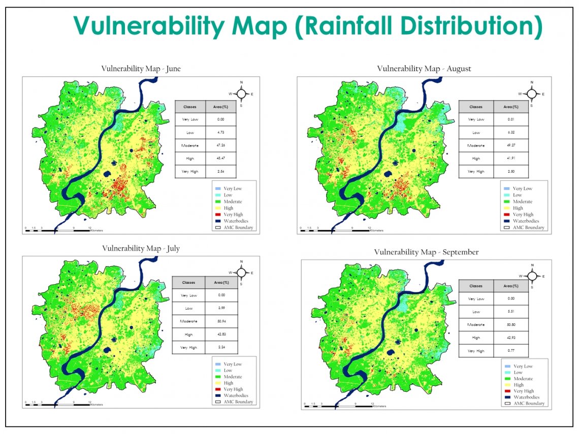
The Studio Project is carried out to identify vulnerable areas in Ahmedabad city.With the help of Geospatial technology, these areas can be identified and addressed so that the losses can be contained. In this studio, To identify these vulnerable zones with the help of GIS techniques and a Multi-criteria approach is taken. Multiple layers such as DEM, Slope, Landuse Map, Soil map, Impervious Areas Map, SWD Network Map and Spatio – Temporal Rainfall Intensity Map were prepared during the course of this studio. This leads to the Vulnerability map of Ahmedabad city.