Your browser is out-of-date!
For a richer surfing experience on our website, please update your browser. Update my browser now!
For a richer surfing experience on our website, please update your browser. Update my browser now!
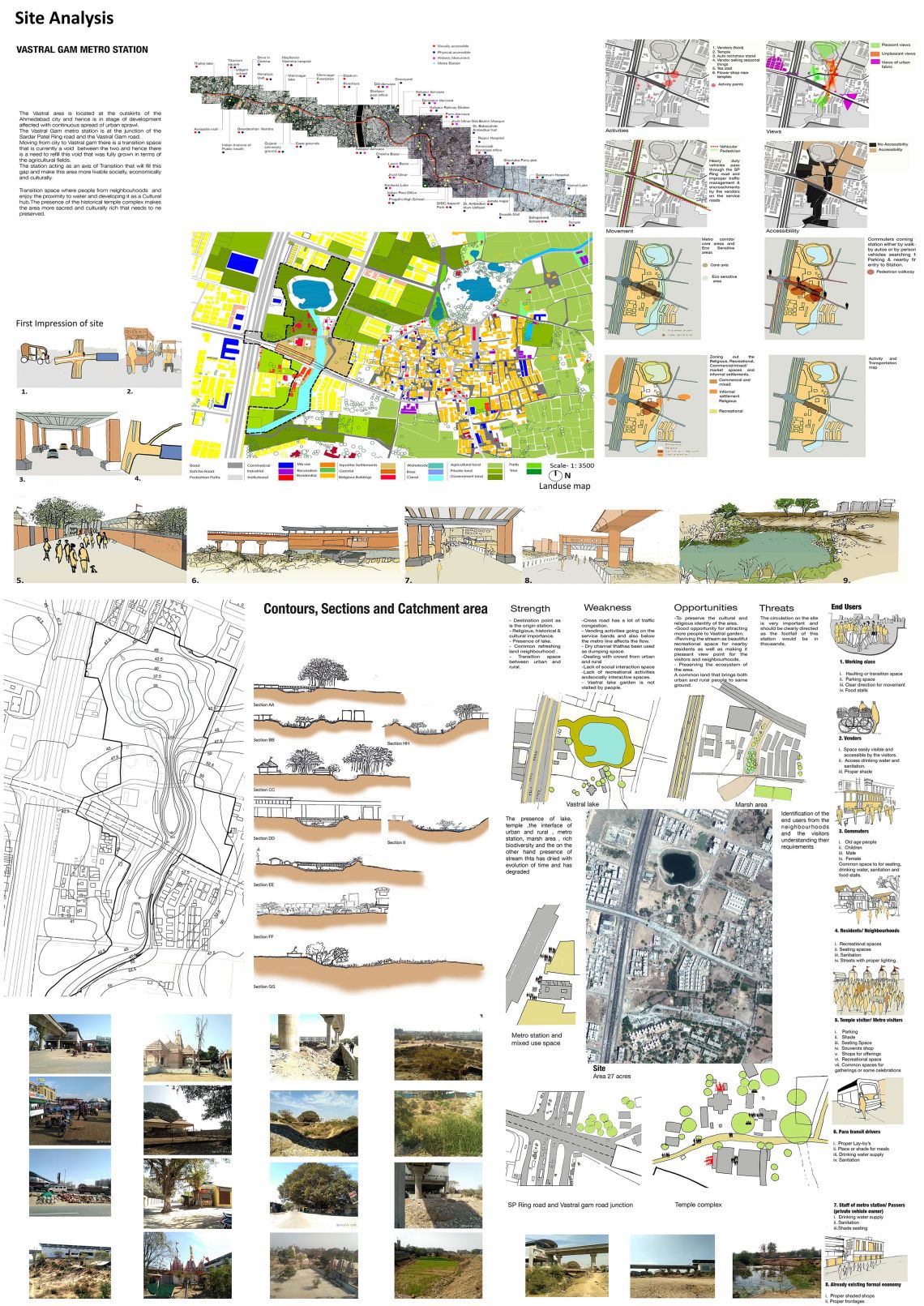
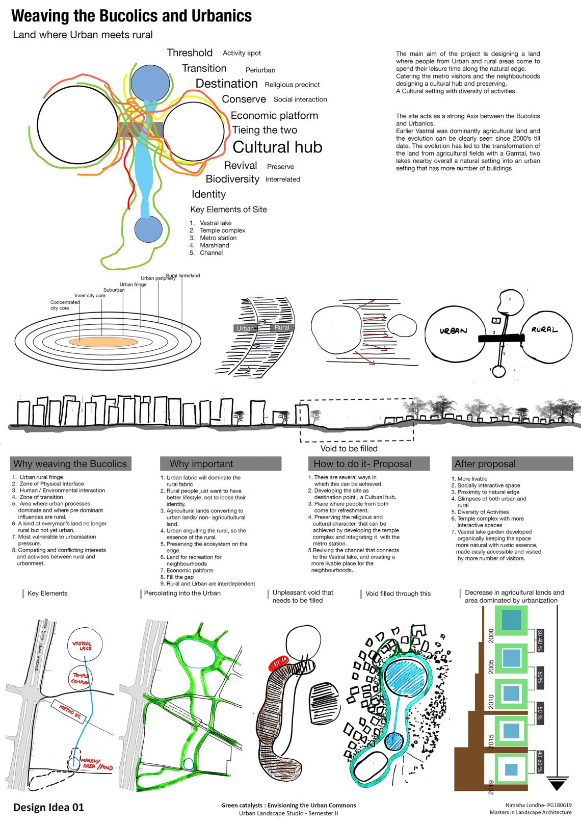
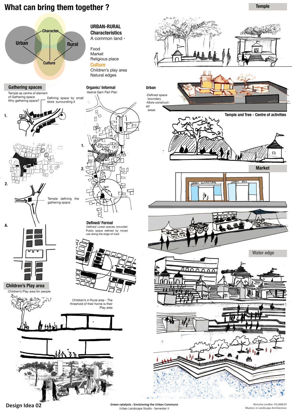
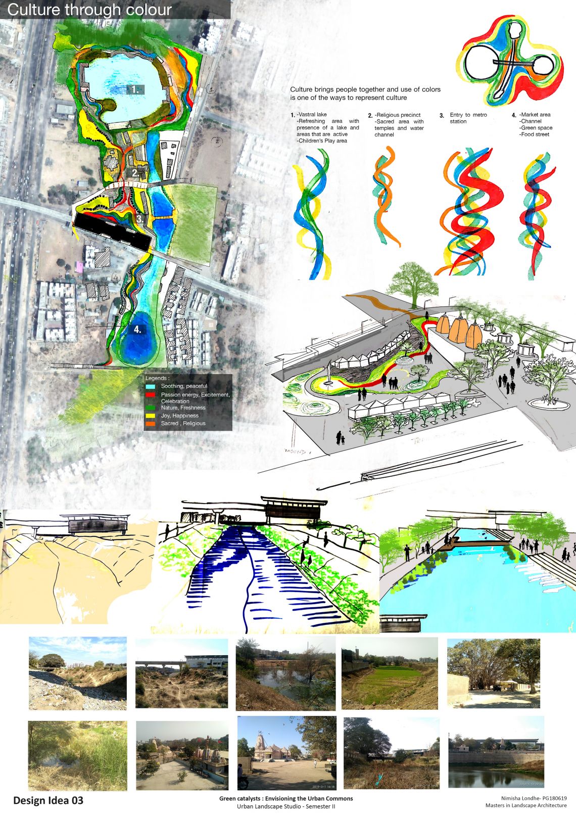
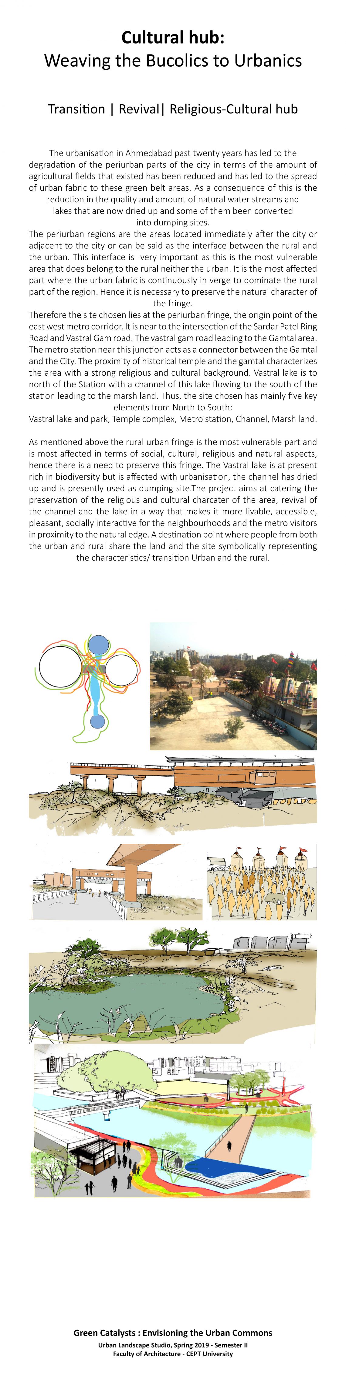
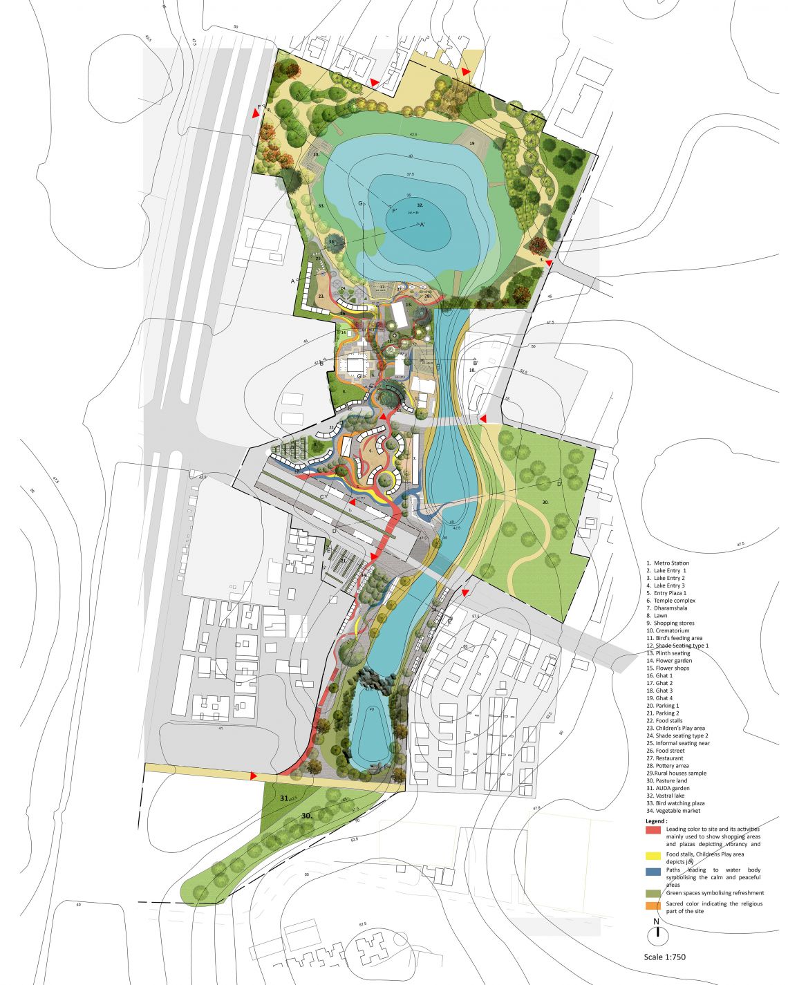
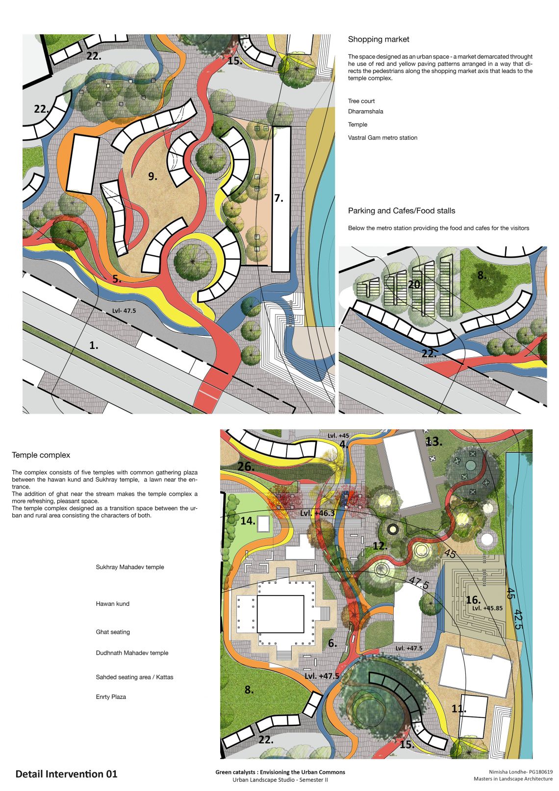
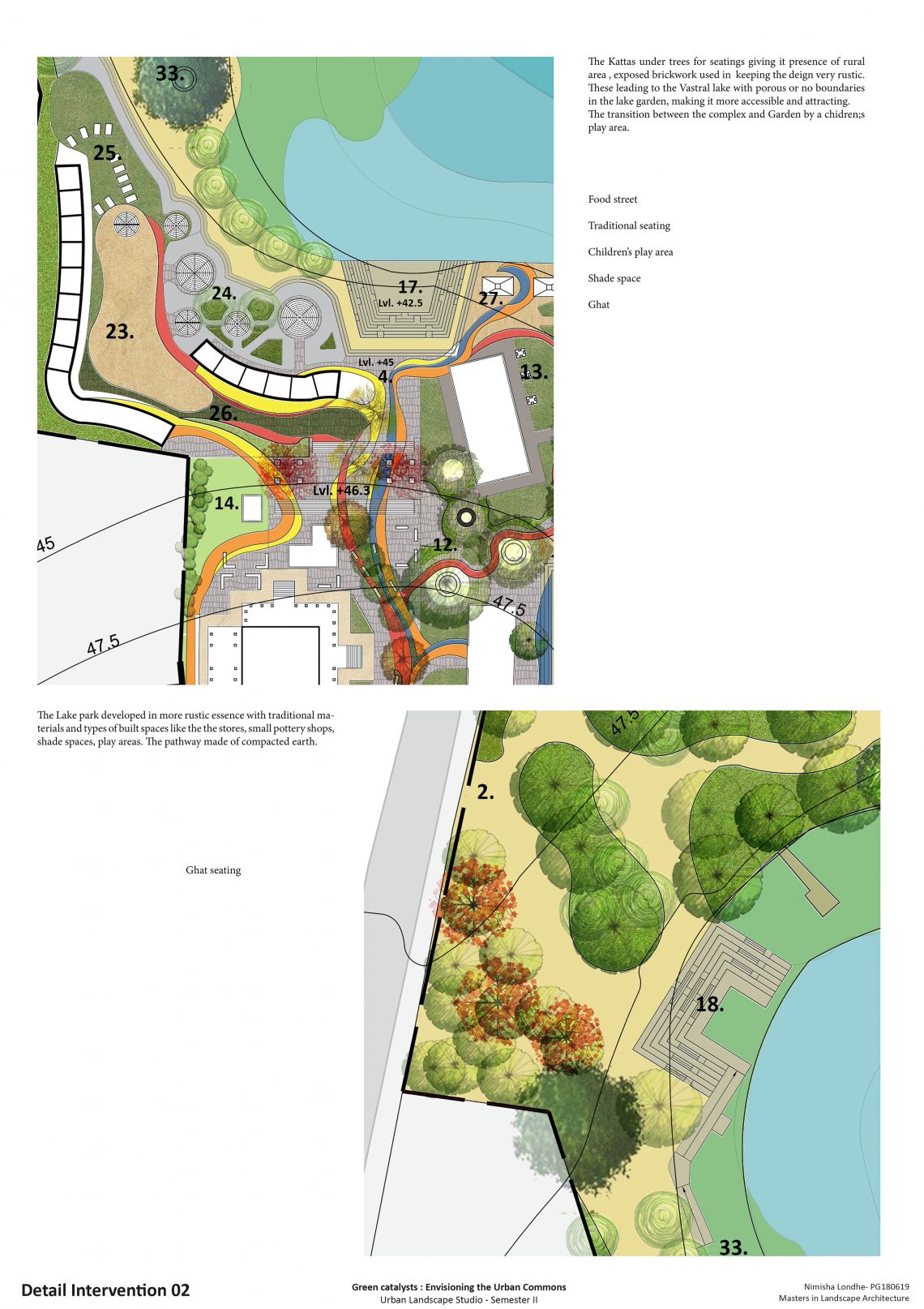
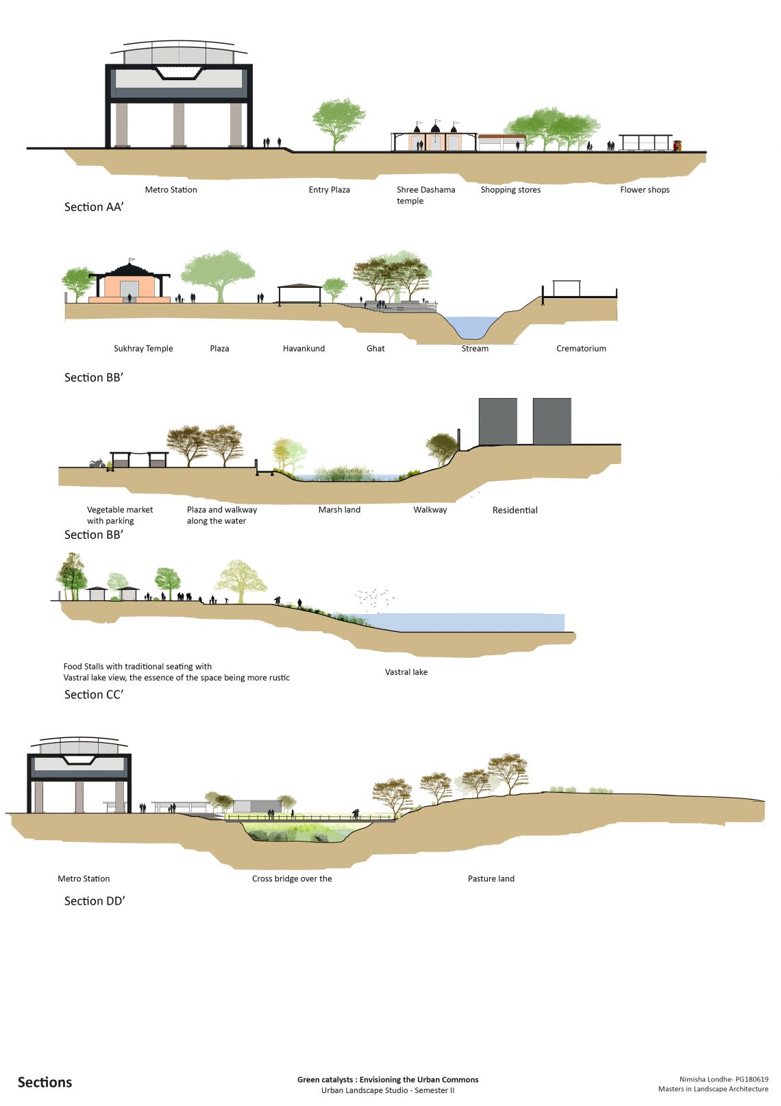
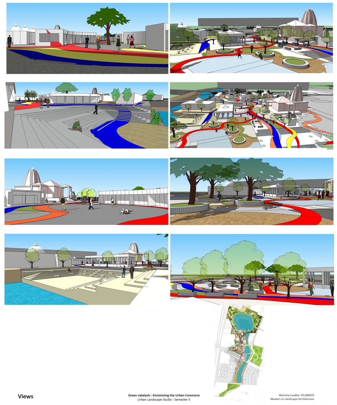
East West Metro corridor- Vastral Gam Metro StationThe urbanisation in Ahmedabad past twenty years has led to the degradation of the periurban parts of the city in terms of the amount of agricultural fields that existed has been reduced and has led to the spread of urban fabric to these green belt areas. As a consequence of this is the reduction in the quality and amount of natural water streams and lakes that are now dried up and some of them been converted into dumping sites. The periurban regions are the areas located immediately after the city or adjacent to the city or can be said as the interface between the rural and the urban. This interface is very important as this is the most vulnerable area that does belong to the rural neither the urban. It is the most affected part where the urban fabric is continuously in verge to dominate the rural part of the region. Hence it is necessary to preserve the natural character of the fringe. Therefore the site chosen lies at the periurban fringe, the origin point of the east west metro corridor. It is near to the intersection of the Sardar Patel Ring Road and Vastral Gam road. The vastral gam road leading to the Gamtal area. The metro station near this junction acts as a connector between the Gamtal and the City. The proximity of historical temple and the gamtal characterizes the area with a strong religious and cultural background. Vastral lake is to north of the Station with a channel of this lake flowing to the south of the station leading to the marsh land. Thus, the site chosen has mainly five key elements from North to South: Vastral lake and park, Temple complex, Metro station, Channel, Marsh land. As mentioned above the rural urban fringe is the most vulnerable part and is most affected in terms of social, cultural, religious and natural aspects, hence there is a need to preserve this fringe. The Vastral lake is at present rich in biodiversity but is affected with urbanisation, the channel has dried up and is presently used as dumping site.The project aims at catering the preservation of the religious and cultural charcater of the area, revival of the channel and the lake in a way that makes it more livable, accessible, pleasant, socially interactive for the neighbourhoods and the metro visitors in proximity to the natural edge. A destination point where people from both the urban and rural share the land and the site symbolically representing the characteristics/ transition Urban and the rural.