Your browser is out-of-date!
For a richer surfing experience on our website, please update your browser. Update my browser now!
For a richer surfing experience on our website, please update your browser. Update my browser now!
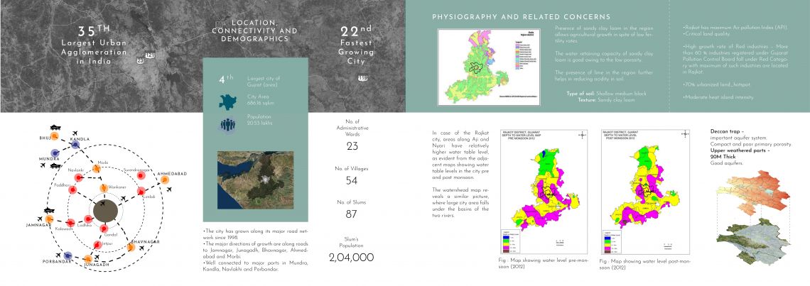
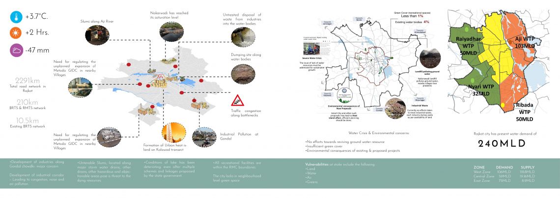
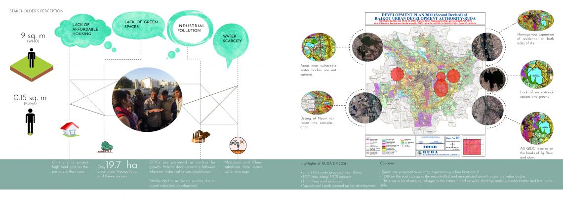
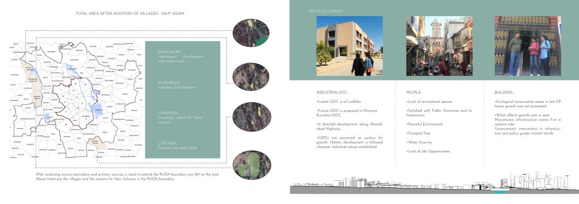
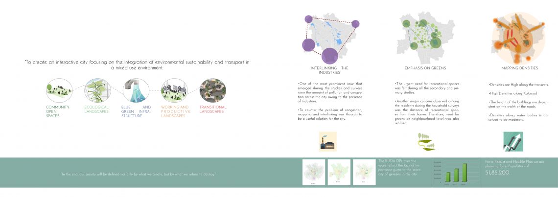
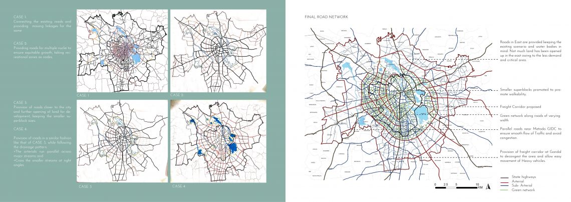
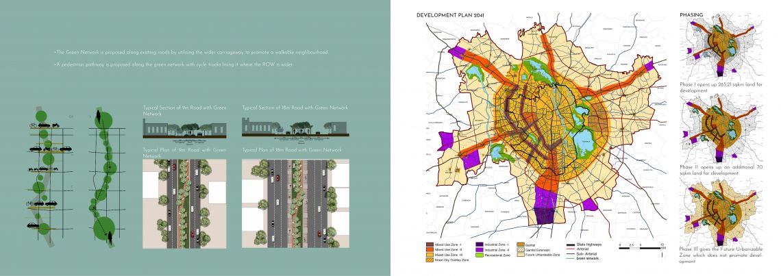
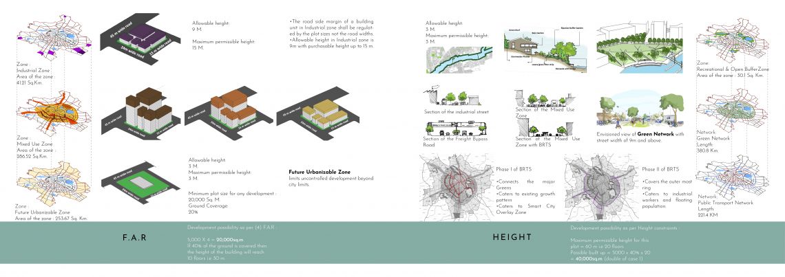
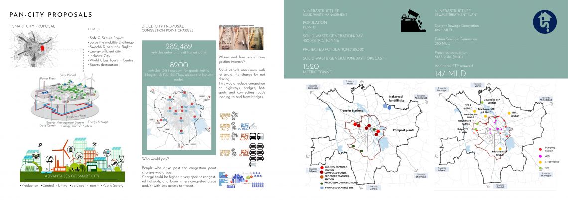
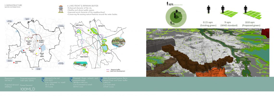
Rajkot, the fourth largest city in the state of Gujart, lies in the Saurashtra region. It is the 35th Largest urban agglomeration in India, with population more than 1.8 million as of 2018. It is also seventh fastest growing city of India. The city contains the administrative headquaters of the Rajkot district and is located on the banks of Aji and Nyari rivers. It was the state capital of Saurashtra. The city is divided into 3 zones and consists of 23 wards under RMC. The Rajkot Urban Development Authority is a civilian government body, responsible for overseeing and sanctioning construction and infrastructure development across the suburbs of the city of Rajkot. The Development Plan Studio focused on the study and analysis of the various urban components that make up the city and helps in the formation of the statutory plan. The expected outcome of the studio was the formation of a development plan for Rajkot with a vision at hand. The following chapters unfold the different iterations that lead to the final Development Plan, envisioned for the year 2041. The introductory chapters deals with the overall understanding of urban planning in general and Rajkot City in specific. The following chapters unfold the process of arriving at an environmentally oriented Development Plan for Rajkot, and concluding with the different layers, associated development control regulations and few proposals and related costing.