Your browser is out-of-date!
For a richer surfing experience on our website, please update your browser. Update my browser now!
For a richer surfing experience on our website, please update your browser. Update my browser now!
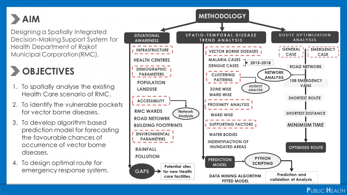
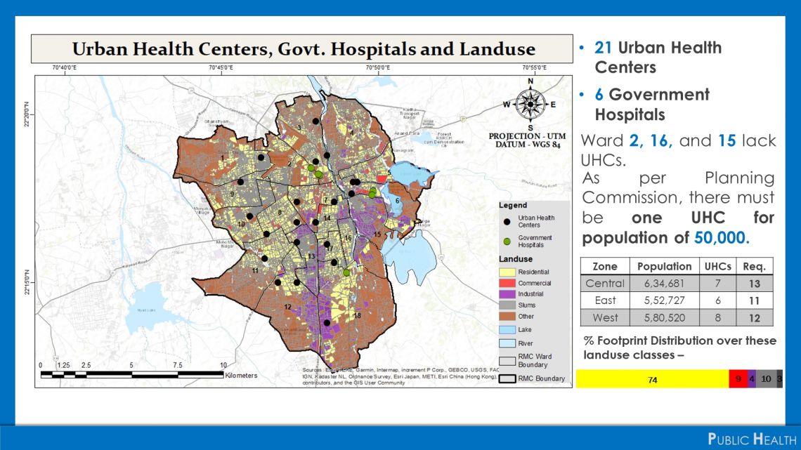
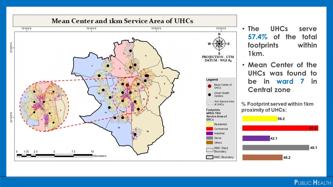
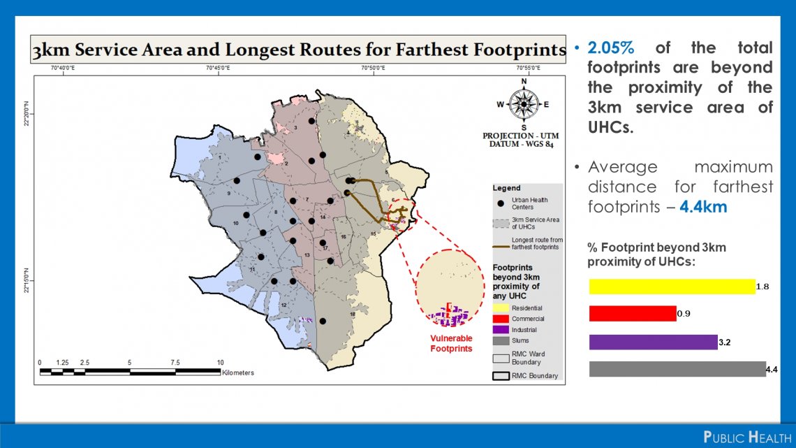
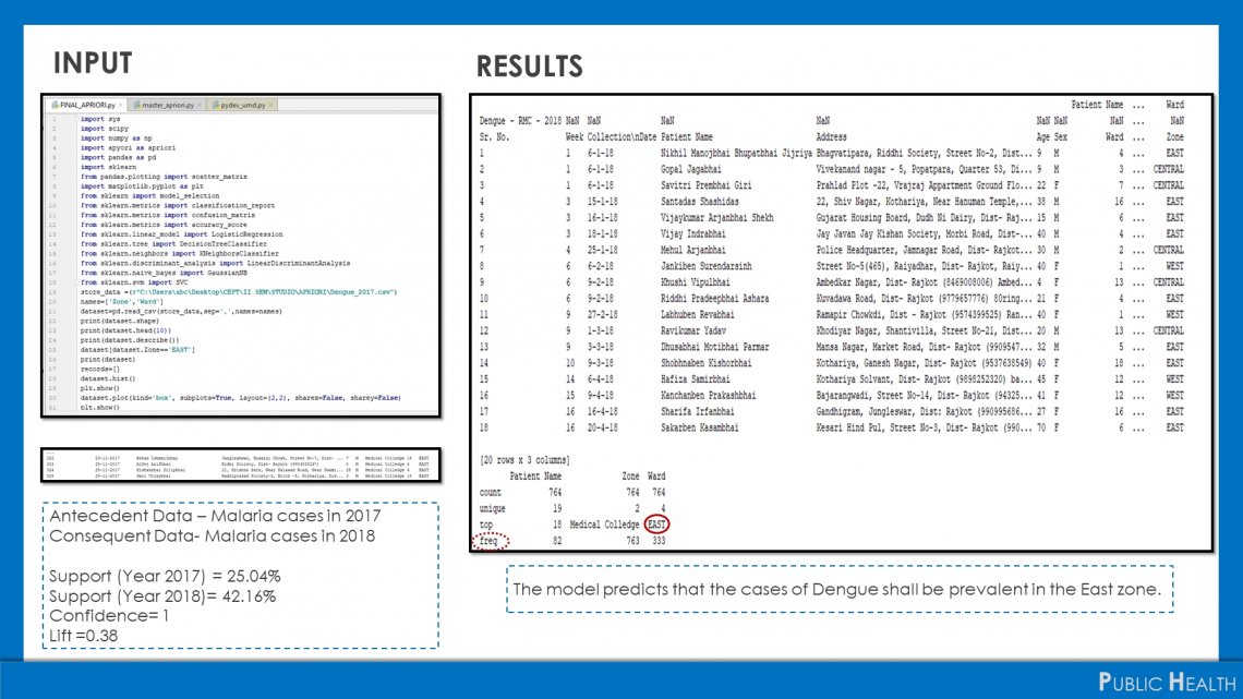
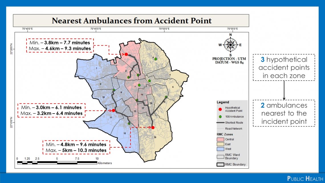
Designing a Spatially Integrated Decision-Making Support System for Health Department of Rajkot Municipal Corporation (RMC).Health Services predominantly covers two broad aspects of 'accessibility' and 'vulnerability'. Through this project, attempts have been made to achieve the same for RMC through spatial analysis and modelling.