Aditi Singh Thakur

UR3005

eCOrridors

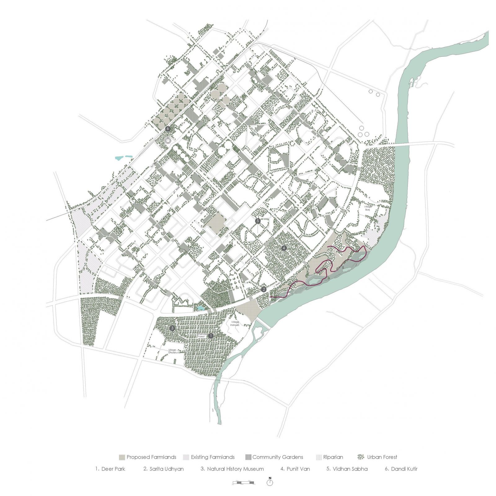
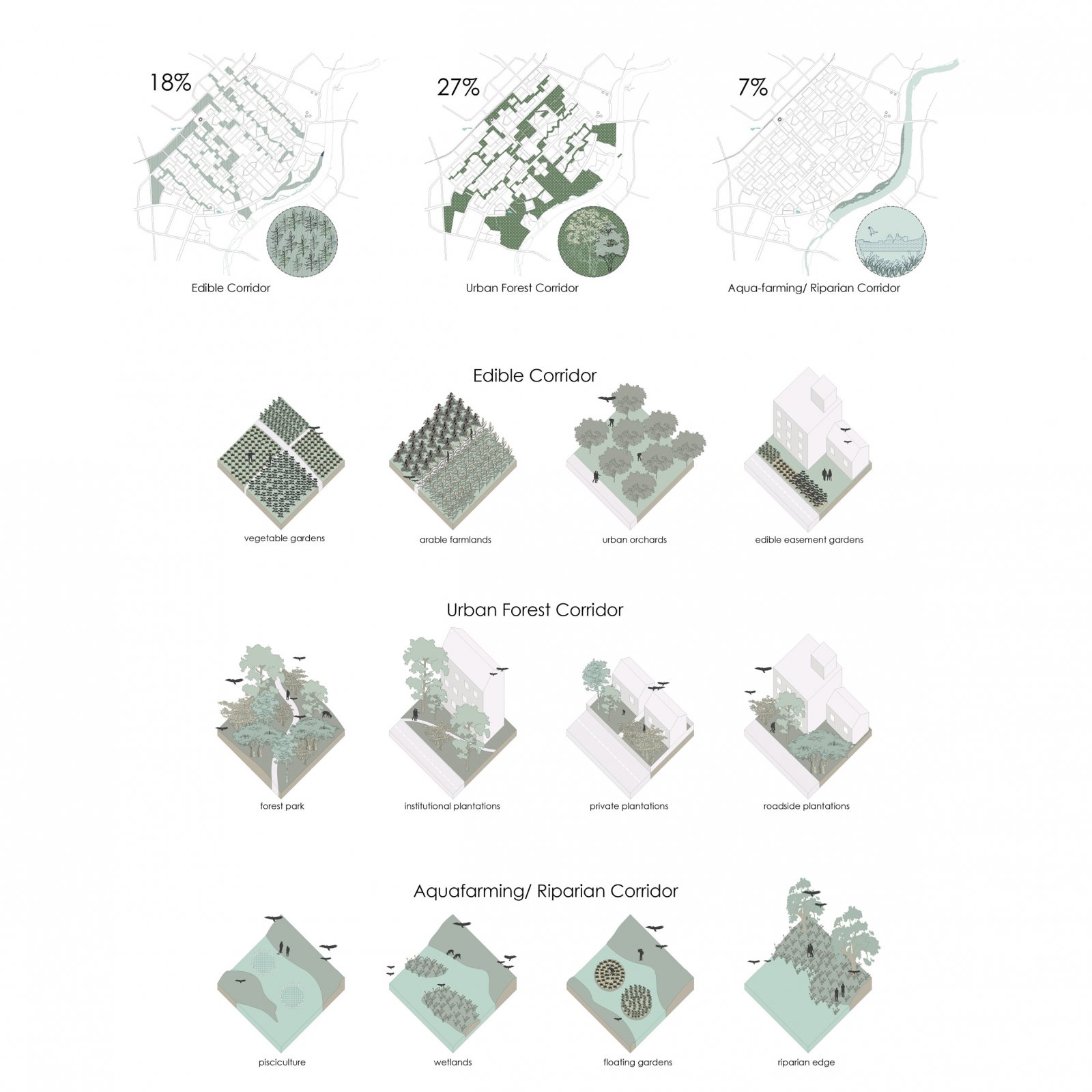
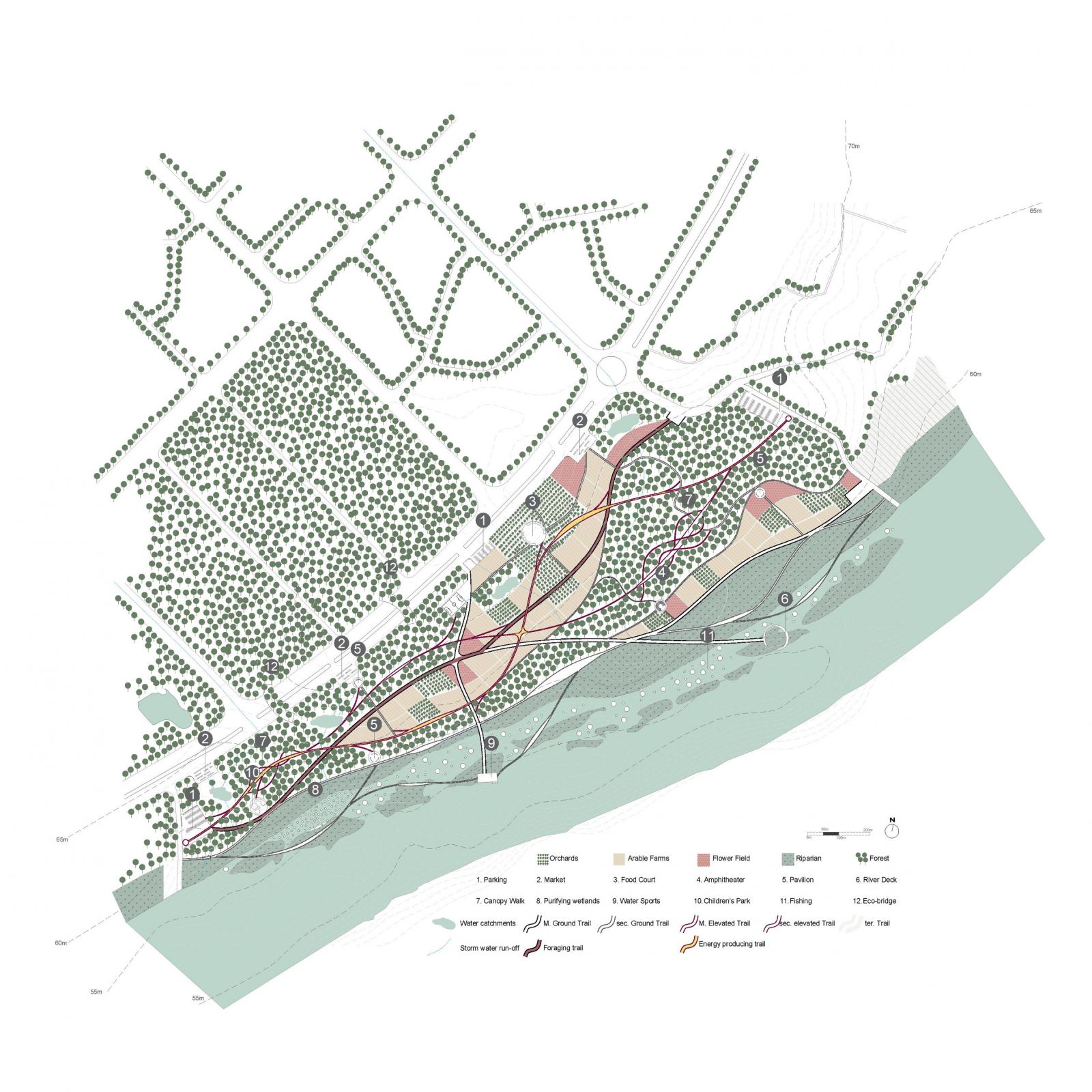
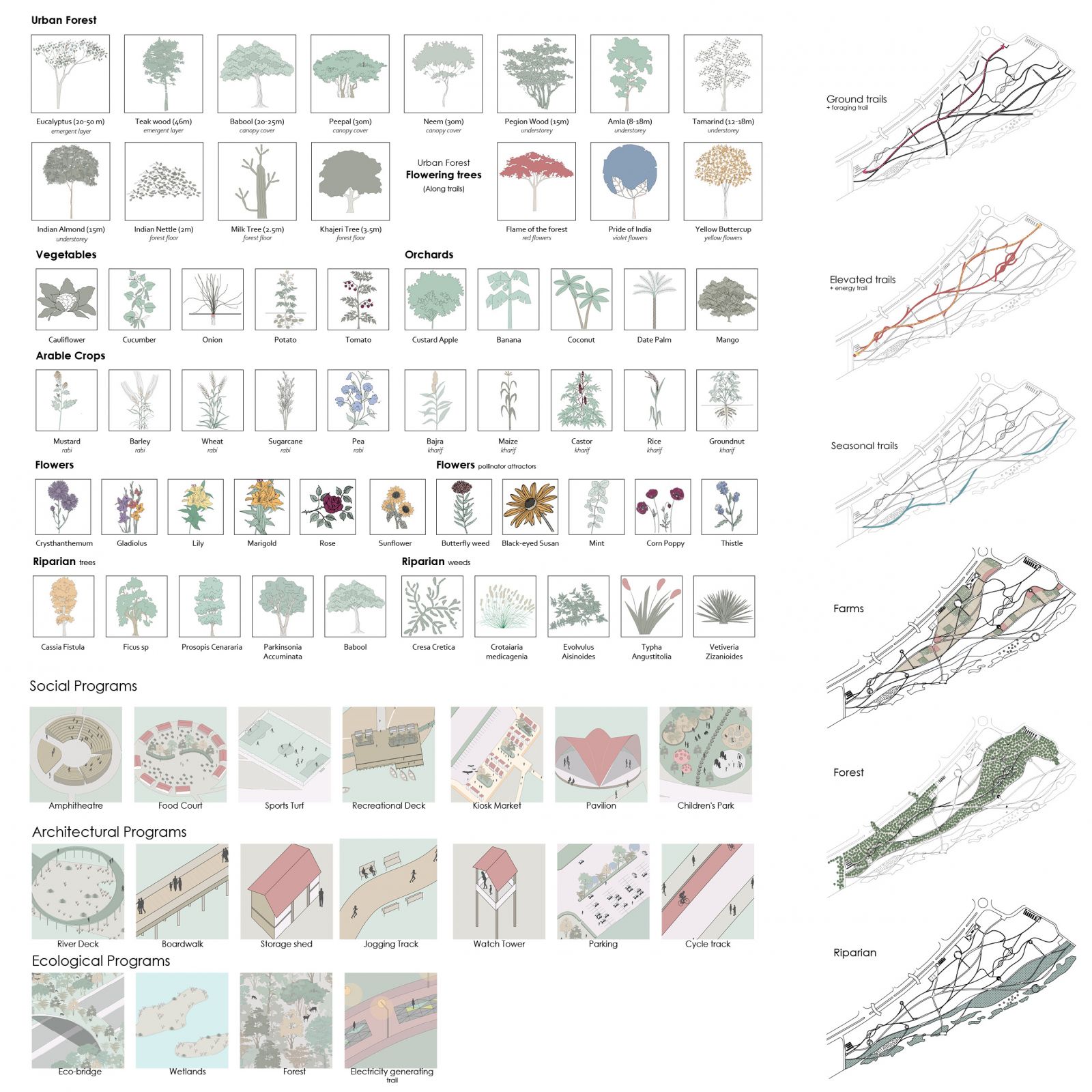
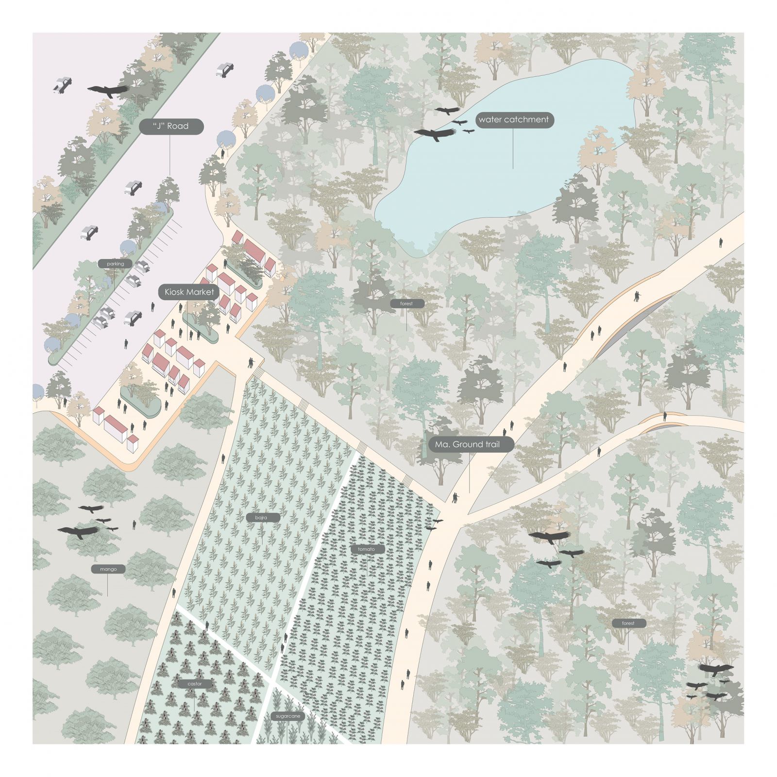
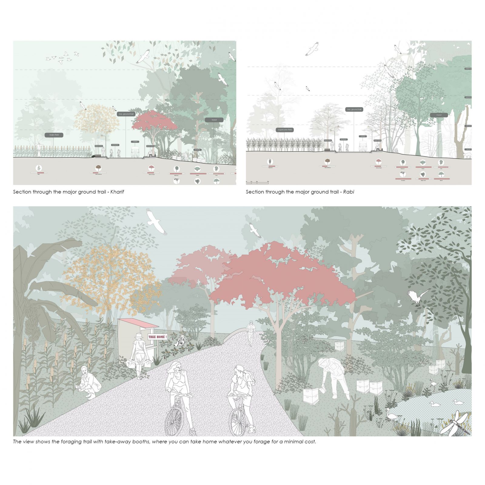
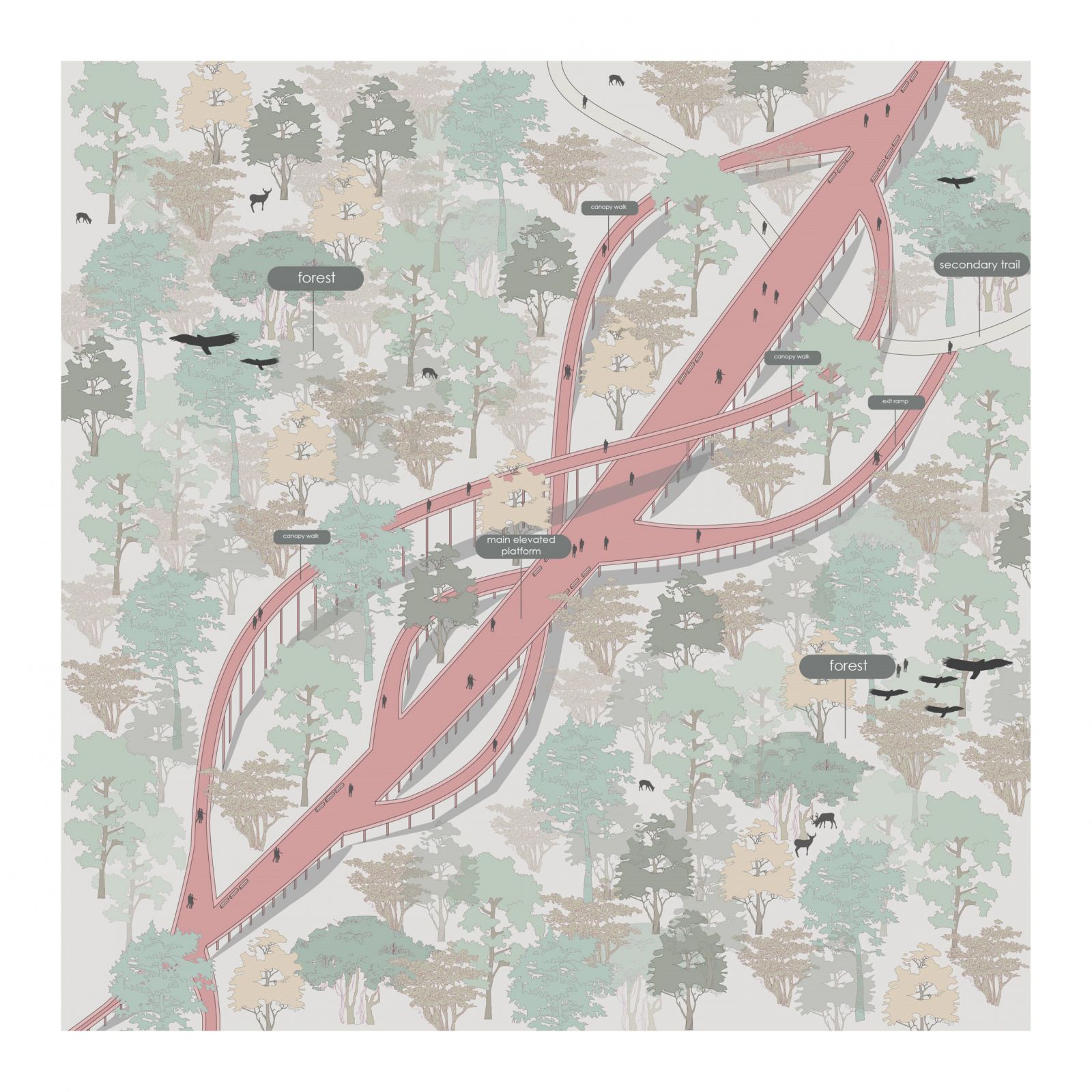
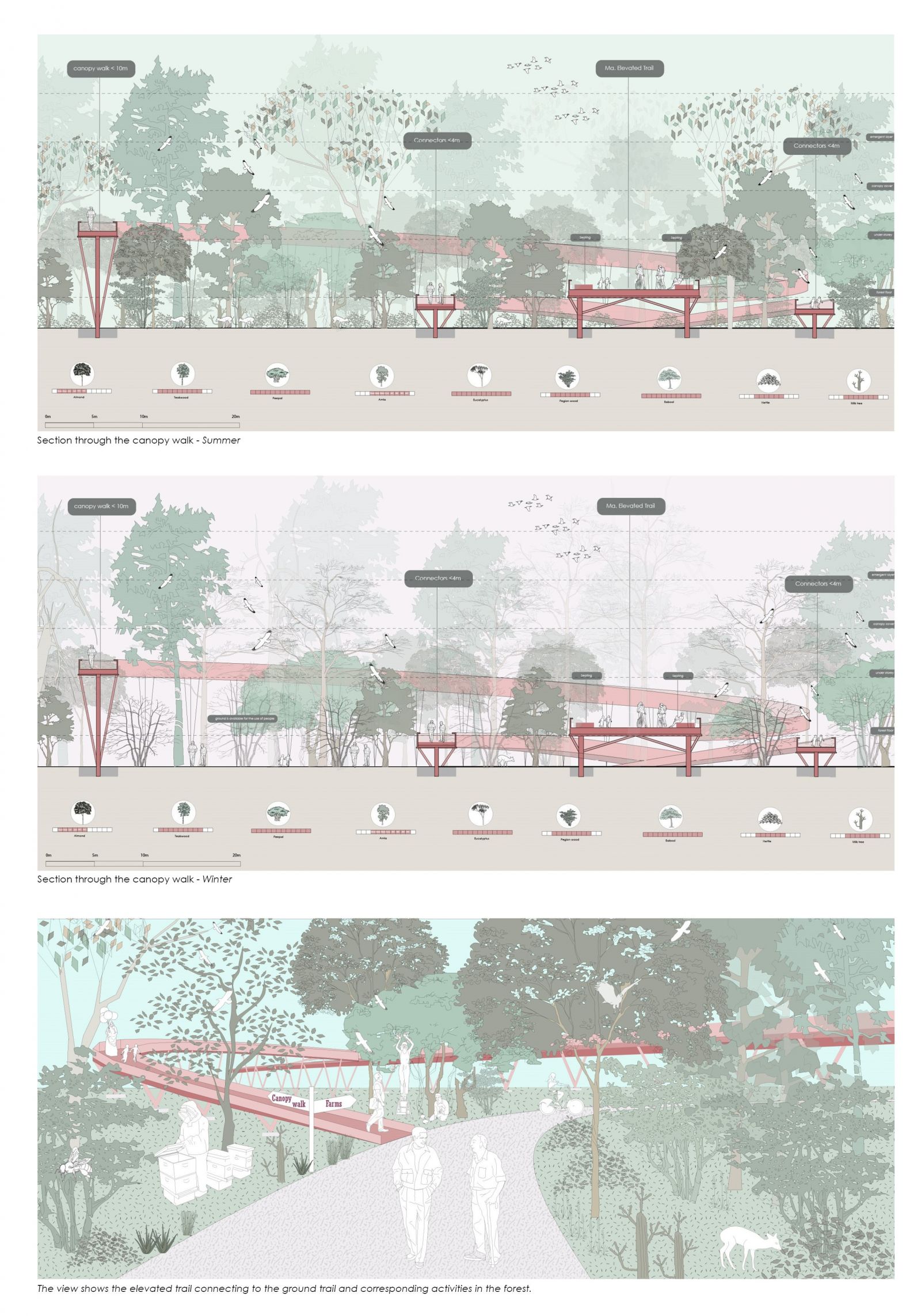
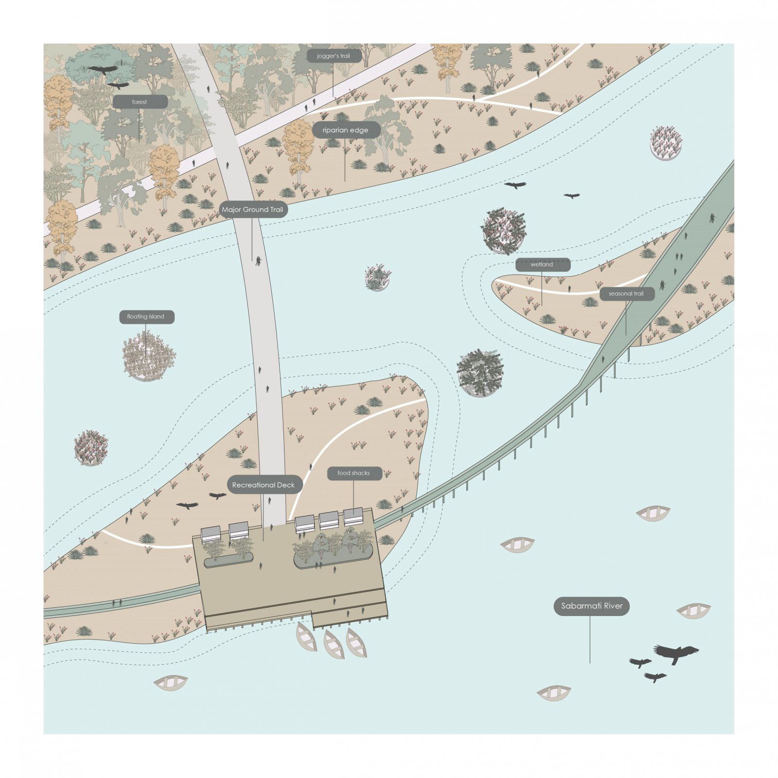
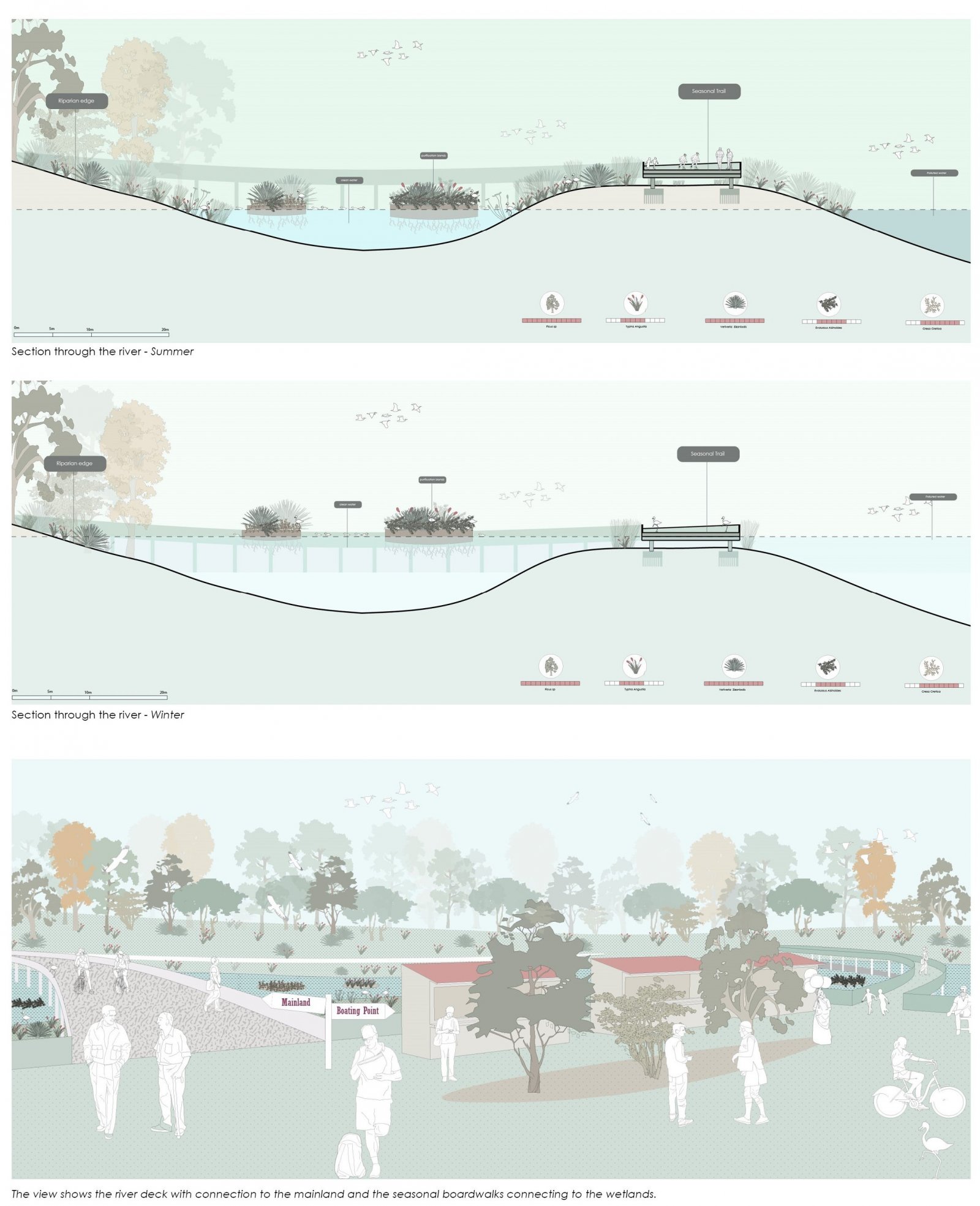
The project begins with the identification of open spaces within the city of Gandhinagar that can be put to various productive uses like urban farms, vegetable gardens, urban orchard, urban forests, etc. The aim is to introduce connections between these productive patches through a network of green corridors. This will help to connect the fragmented patches of diversity for increased interaction and unobstructed movement of urban fauna. The project essentially looks at 3 types of productive landscapes namely edible, urban forest, and aqua-farming. The edible corridor will support plant-based farming activities, the urban forest will support ecological functions such as influence micro-climate, improve air quality, regulate hydrologic cycles and provide habitat for wildlife whereas the aqua-farming corridor will support the rearing of fish along with water-based plant production. The aim is to connect the three types of corridors as a part of a continuous productive landscape in the city of Gandhinagar. Three of these productive landscapes meet at the riverside, which is envisioned as a park that supports different kinds of recreational activities coupled with productivity. The riverside is given the program of public space by the introduction of a network of trails that run along with the different landscapes within the site providing a series of experiences for the visitors while walking through these landscapes. This public corridor consists of different pause points and offers a range of activities that transform with seasons.

View Additional Work

Report Content

Vision for Gandhinagar

3 Corridors and their constituent landscapes

The 3 corridors converge at the river side. The site is envisioned as an urban park, with a range of productive activities.

The program palette for the site is chosen keeping in mind the activation required for making the park a lively place. The planting palette is chosen keeping in mind the experiential quality of the trails and the landscapes that people will walk through. The colors, height variation and the diversity of the species chosen will ensure the diversity in experiences while exploring the site.

The kiosk markets help to activate the J road along with opening up a part of the site to the city. The market sits at the edge of the edible corridors and provides the users with a diversity of experiences with changes in the seasons. The water catchments present throughout the site help in storage of storm water from the city and rain water for irrigation of the farms.

The ground trails provide connectivity and ease of mobility across site. The foraging trail is a part of the ground trail network, where people can forage and take the produce home with them.

The Elevated trails act as connectors to different programs on the site and form a network of paths at level above the ground, through which people can explore different landscapes on the site. This forms a network of trails that take you through different parts of the urban forest corridor and right up into the tree canopies.

The forest also shows a dynamic character when transitions in the seasons, during monsoons the forest floor becomes inacccessible due to wild growth of species like Indian nettle and during the winter season the forest becomes less dense and the ground can then be accessed by the people.

The riparian corridor consists of riparian edge and wetlands, and they are connected to each other and the mainland through a network of board walks which maybe submerged during the monsoon season.

The wetlands help in flood management and prevention and boardwalks connect the wetlands to the mainland bringing people closer to the river with certain activator present at the nodes.