• Home
  • FT
  • 5592
  • URBAN TRANSPORT INFRASTRUCTURE DESIGN STUDIO

Dhavalkumar Dharamendrakumar Patel

5592

URBAN TRANSPORT INFRASTRUCTURE DESIGN STUDIO

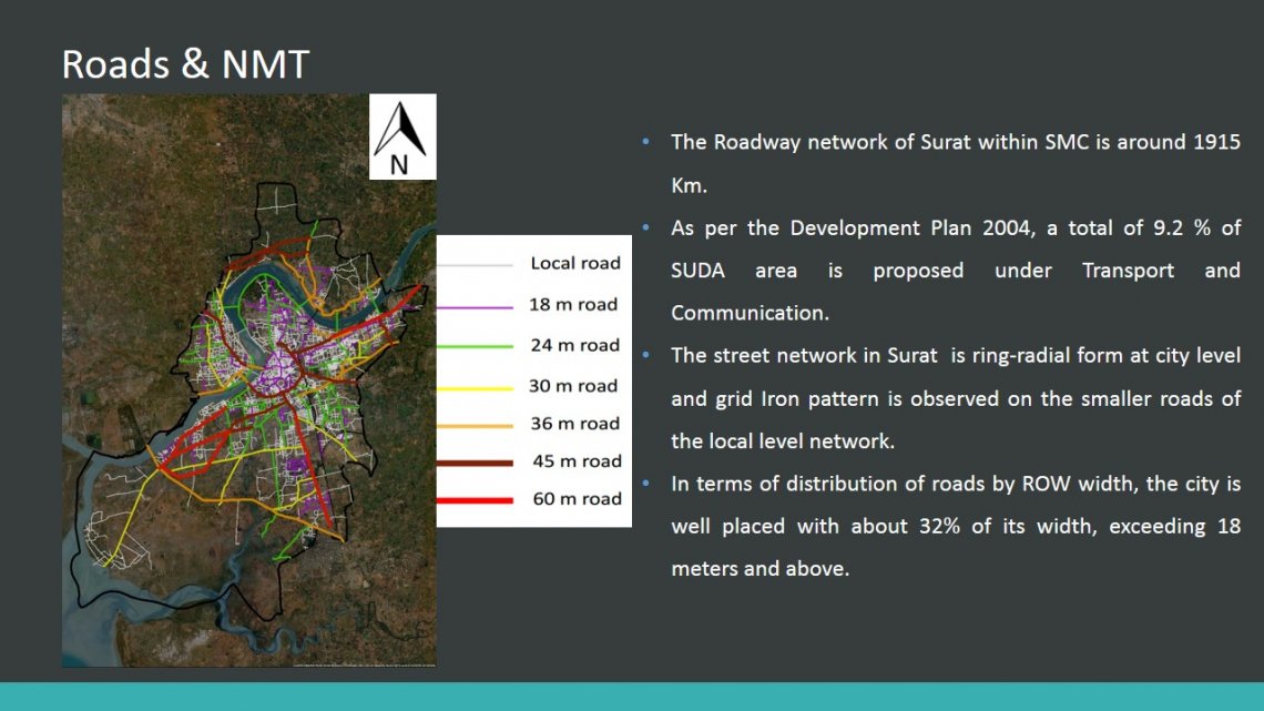
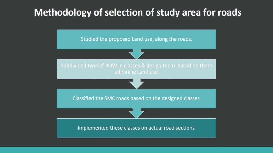
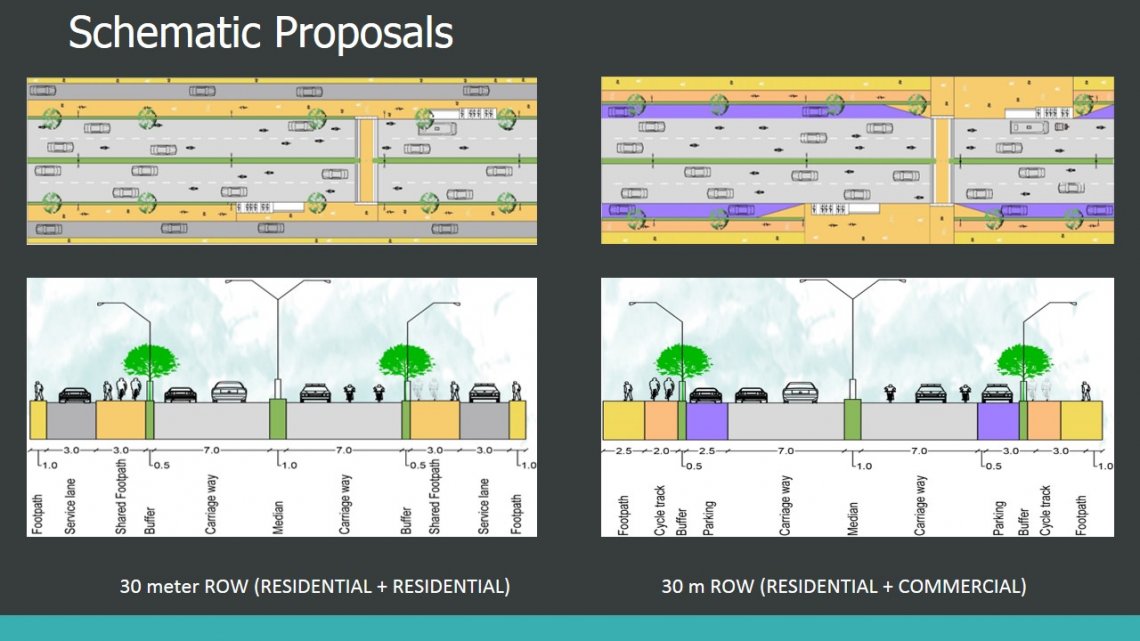
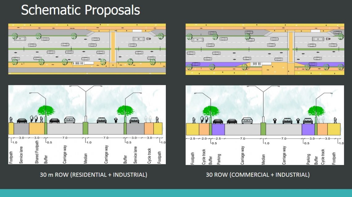
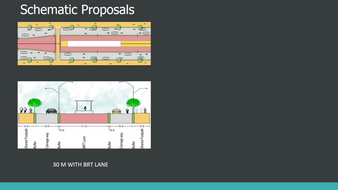
This studio focuses on the preparation of a detailed project report for the urban transport infrastructure of a  Surat city. It entails elements like detailed design, schematic design, costing, financing, and implementation mechanism.


Report Content

The Roadway network of Surat within SMC is around 1915 Km. As per the Development Plan 2004, atotal of 9.2 % of SUDA area is proposed under Transport and Communication. The street network inSurat is ring-radial form at city level and grid Iron pattern is observed on the smaller roads of the locallevel network. In terms of distribution of roads by ROW width, the city is well placed with about 32%of its width, exceeding 18 meters and above.

After deciding designapproach, the purposedland use along the road ofSuart city is noticed. Thetype of Rows is classified,depending upon theiradjoining land use.The adjoining land useaffects the types of users ofthe given road and thenrequirement from thestreet infrastructurekeeping this in mind, wedesigned the classes forvarious land use.The designed class section werethen applied to the SMC roads according to adjoining land use.

(1)This section has residential land use on both sides. Considering this service lane is providedon either side of road.A carriage way of 7m of both sides is provided.(2)This section has residential land use and industrial land use on each sides. Considering thisservice lane is provided on either side of road. A carriage way of 7m of both sides is provided.

This section has commercial land use and industrial land use on each sides. Considering thisservice lane is provided on industrial side and on street parking on commercial side of road.A carriage way of 7m of both sides is provided.

This section has BRT lane at middle of the road. A carriage way of 7m of both sides is provided and5.5m of both side where the bus stop is there.A NMT zone of 3m wide shared footpath is elevated at level of 150 mm from the street level. High risepedestrian crossing (HRPC) is provided near BRT bus stop. The HRPC can also be used by cyclists tocross the road. Cycle stands are provided in proximity to the bus stops to access the PT conveniently.

There is a gap which is used by hundreds of vehicle to access citylight area by going wrong direction.This is extremely risky as the length of this stretch is around 200m and plants on the median block the visibility.

Proposed to open up a new junction near the start of the road which leads to the citylight area and redesign the stretch and junction accordingly.

View of New junction.