Your browser is out-of-date!
For a richer surfing experience on our website, please update your browser. Update my browser now!
For a richer surfing experience on our website, please update your browser. Update my browser now!
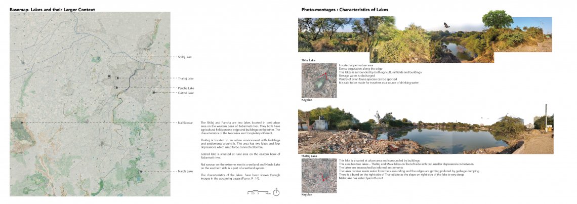
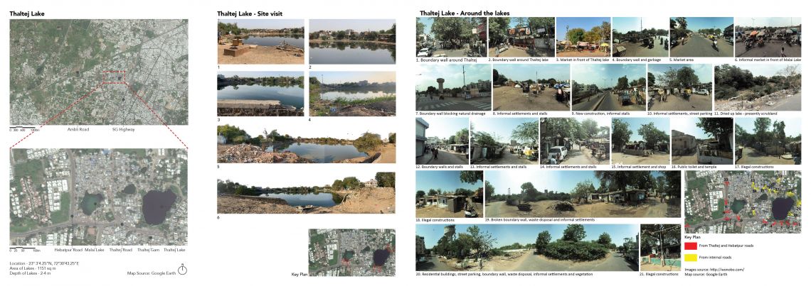
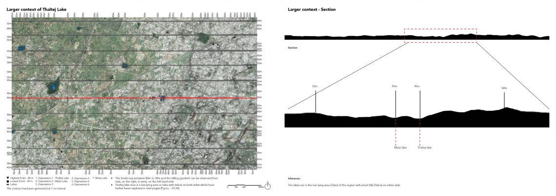
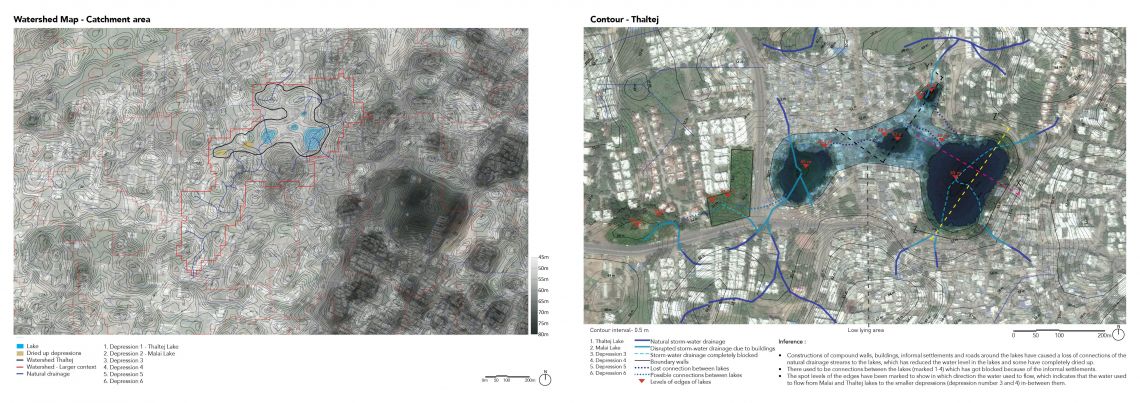
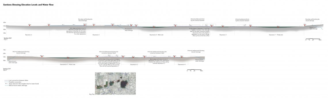
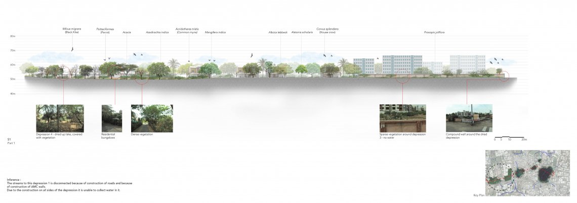
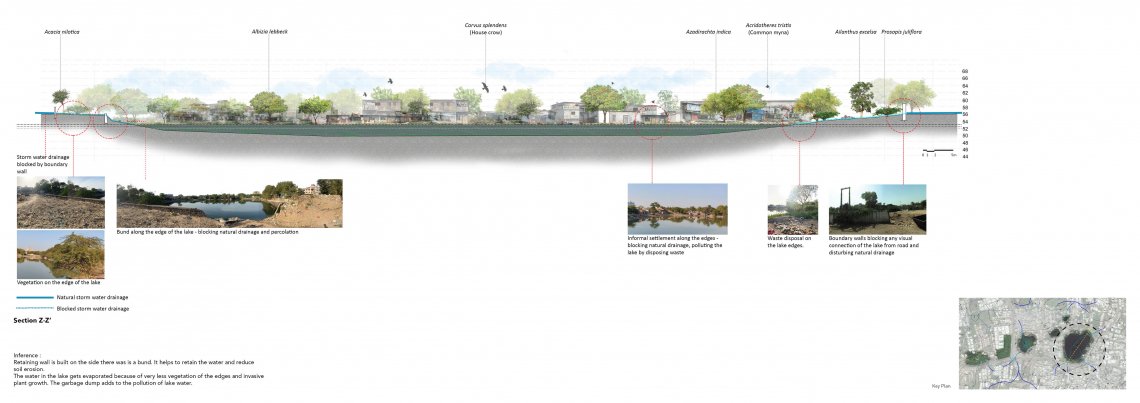
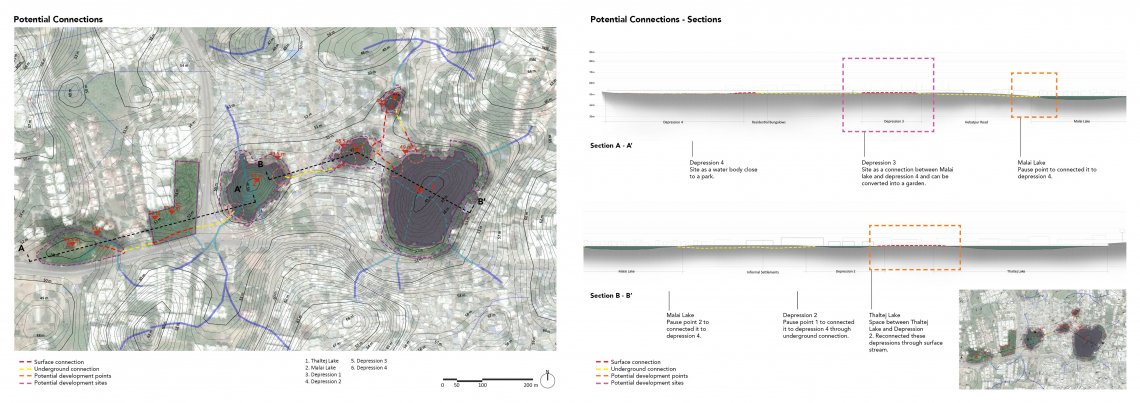
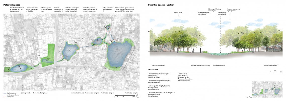
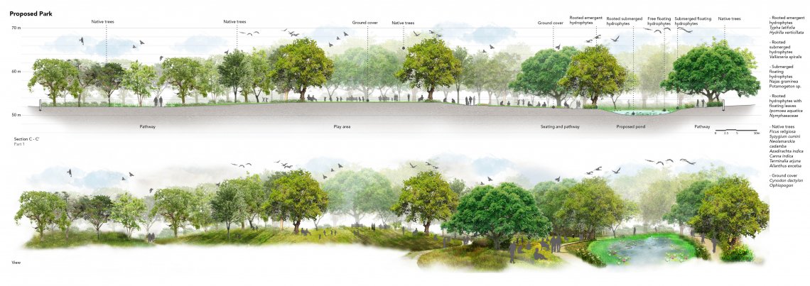
Lakes being an integral part of our environment benefit the humans as well as the environment in many ways. A few environmental benefits of lakes are – it helps in ground water recharge, it can reduce the impacts of floods and droughts by storing water, it plays an important role in water cycle by collecting storm water through streams from a specific watershed area, the lakes can be migration stops and breeding grounds for many birds, it helps in preserving biodiversity and providing habitat to a diversity of organisms, many aquatic plants and animals. Apart from the environmental benefits lakes have social and economic benefits - people use water from lakes for irrigation, it works as a primary water source for households in many rural areas, lakes can become recreational destinations, many lakes help in tourism also.The idea of studying the lakes took shape by visiting different sites and observing the large number of lakes located in and around the city. Bearing witness to the large number of water bodies present in and around Ahmedabad significantly altered our perception of the city as that of a relatively barren land located in a semi-arid region.Ahmedabad being one of the fastest growing cities in Gujarat, has undergone rapid urbanization in the past few years with significant environmental impact. The rapid expansion of the city has led to considerable changes in its environment along with a marked change in both the quality and quantity of water bodies in the city. The number of lakes in Ahmedabad have plummeted from a figure of more than 204 in 1960 to a paltry 137 in the year 2000 with many still getting dried up or polluted. It was observed during the site visits that many of the lakes in the rural areas and some in the urban ones used to be connected earlier but have on account of rapid urbanization become fragmented.In order to better understand the reason behind the lakes losing their inter-connectedness and drying, Thatlej was chosen as the area of our study. The area has four natural lakes and one dried up lake, with the former being connected in the past.The study was done through a series of drawings coupled with photographs to better understand the natural settings of the area along with the impacts of human activities. The study of the topography of the area helped us understand the general slope of the terrain and the direction of flow of storm water streams in addition to shedding light on the location of Thatlej as a low-lying area with small hillocks on either side. A study of the history and evolution of the area revealed the significant fall in the size of the lakes over the years coupled with reduced water levels and the drying up of one of the lakes in the region. In order to further explore the reason behind the mentioned phenomenon, the streams flowing into the lakes from the surrounding were studied using watershed maps. When this study was combined with that of man-made layers of boundary walls, informal settlements and buildings a picture emerged explaining the reason behind the loss and disruption of connection between the lakes and the phenomenon of them drying up. The impacts of human activities on the lakes were also studied, which show how the edges of the lakes and the water were getting polluted.This study has finally led to a possible design solution to revive the lakes and the connections among them thereby precluding the process of drying up. The design also focuses on how humans can connect and interact with the lakes which may prevent them from polluting the area.The studio has helped in understanding the process of studying landscape in a different way through recording the character, understanding factors responsible for shaping the nature of it, analyzing it and finally forming a design proposal which can respond to the issues of a specific site. It has taught how to form a design idea based on what already exists and how the idea can be shaped through studying the area.