Your browser is out-of-date!
For a richer surfing experience on our website, please update your browser. Update my browser now!
For a richer surfing experience on our website, please update your browser. Update my browser now!
"Politicians are the same all over. They promise to build bridges even when there are no
rivers”
- Nikita Khrushvchev
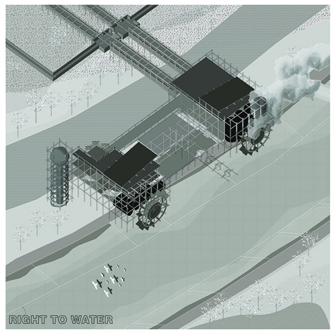
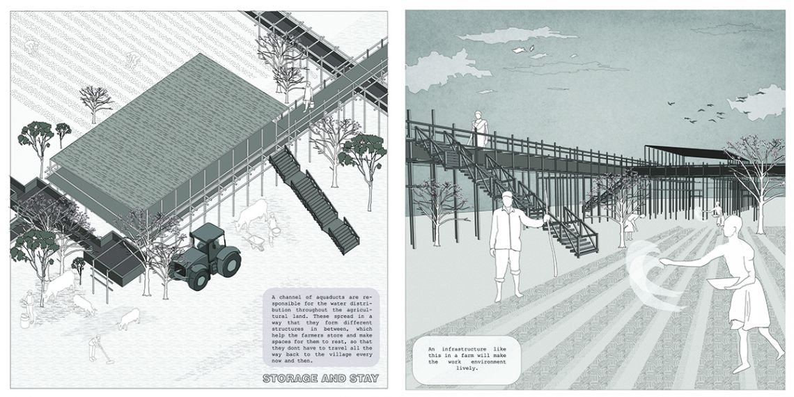
My speculative intervention includes a water infrastructure in such areas which undergo
the lack of facilities promised by the Government. It aims to eliminate the extra expenses
that the farmers spend for their needs. I am trying to engage with the politics behind
the Sardar Sarovar project which aimed at prospering the industries more, irrespective
of the suffering of the native farmers. The idea is to construct advanced water infrastructure
which would help in making the claims by the government actually come into an
effect and some extra advantages which would make their lives easier. This intervention
is much more visible with respect to the existing system of water distribution which
helps in addressing these issues out in the open and to give a reality check about the
existing condition to the people.
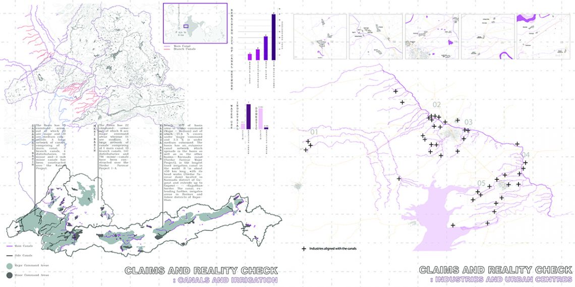
The plan for harnessing the river for irrigation and power generation in the Narmada
basin was initiated in 1946 by the Indian government.The length of the irrigation distribution
network was stated to be 75,000 km during the early nineties, and recently, the
Gujarat Chief Minister quoted a figure of 90,000 km. It has been 74 years since the government
had claimed that all of this money spent by them was for the betterment of its
local citizens. However, much of the irrigation benefits have not been realized because
of delays in the creation of distribution networks.
Dam-based irrigation is highly dependent on the development of the command areas through
a network of minor and sub-minor canals. In the SSP, the command area development work
is lagging behind. In the first phase region in Gujarat — about 41% work on branch canals
and 76% work on sub-branch canals remains to be completed. The work on minor and field
channels has been inadequate to take irrigation water to farmlands even in the first
phase of the command area.
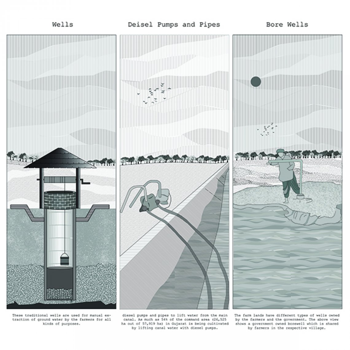
As a result, the use of the Narmada waters is dependent on the ownership of diesel pumps
and pipes and is, thus, influenced by local power relations. Farmers are investing in
diesel pumps and pipes to lift water from the main canal. As much as 45% of the command
area in Gujarat is being cultivated by lifting canal water with diesel pumps. So basically,
instead of the poor farmers of the villages, it is actually the industries which
are getting prospered. This practice was later announced as illegal.
Now, if this practice is also announced illegal, then how are the farmers supposed to
get their water?
“Who gave them the authority to tell me not to take water (from the canal). I will continue
taking my water, I have my right on it!” an angry farmer says, sitting in an abandoned
thatched hut, surrounded by fields of castor and cotton.