Your browser is out-of-date!
For a richer surfing experience on our website, please update your browser. Update my browser now!
For a richer surfing experience on our website, please update your browser. Update my browser now!
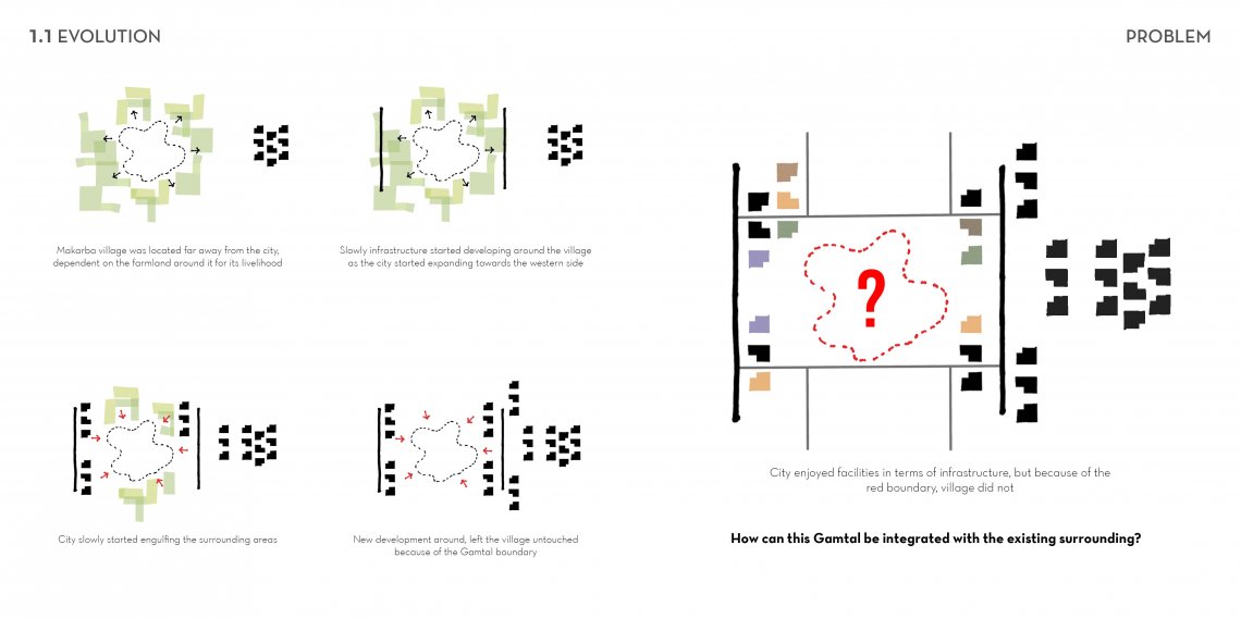
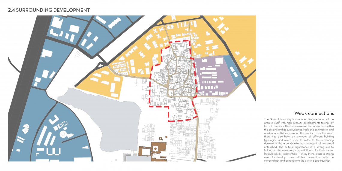
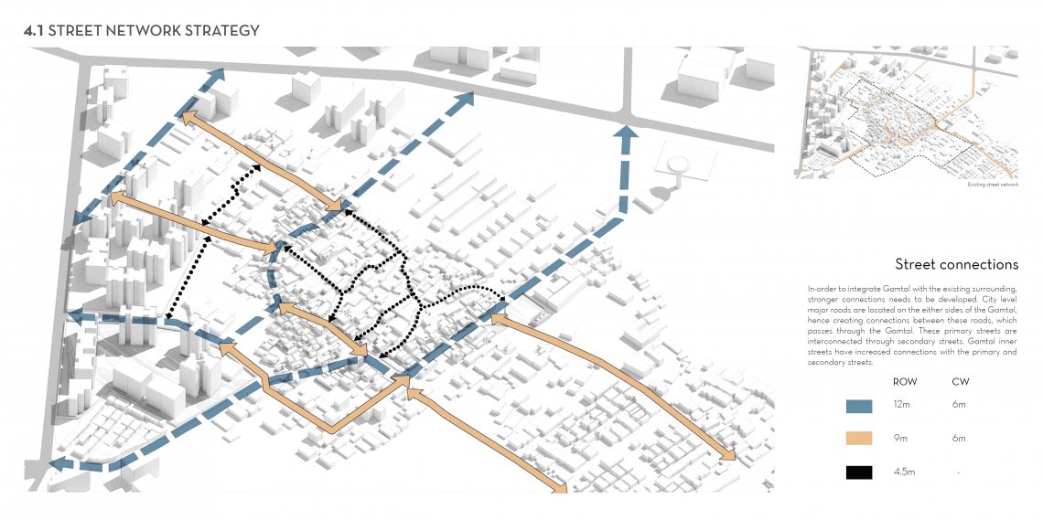
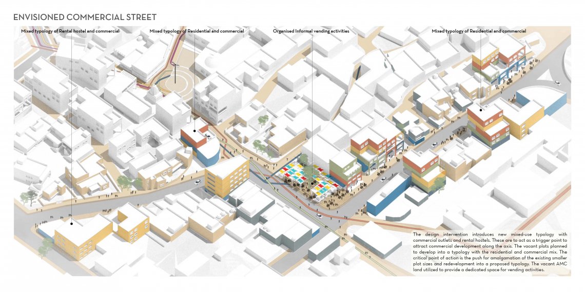
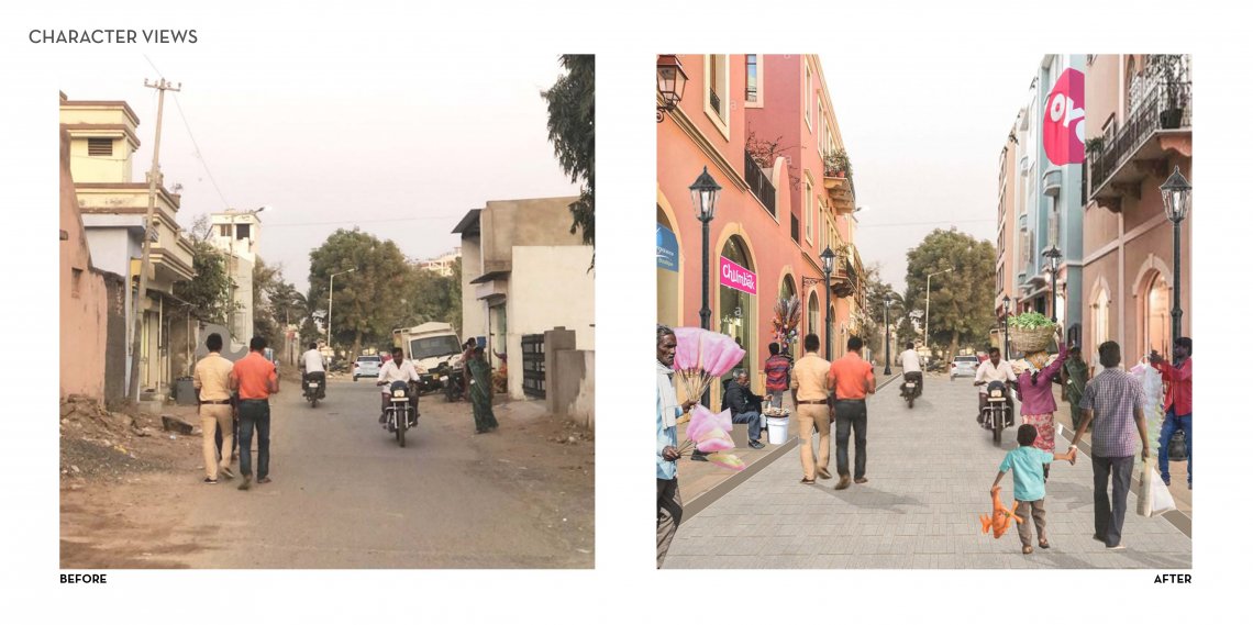
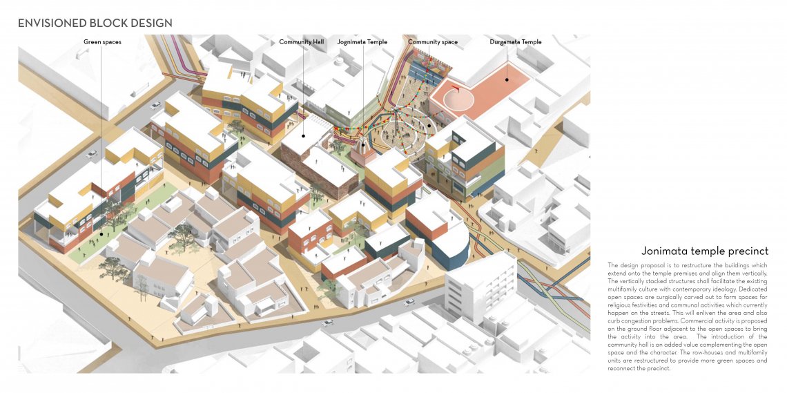
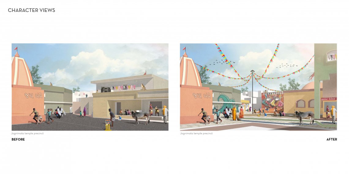
Before urbanization, cities had small village clusters surrounding them predominantly dependent on agriculture for the livelihood. One such village is “Makarba” located in the south-western part of Ahmedabad. With the fast-paced urbanization of the city, large scale expansion and infrastructural development, extended over this agriculturally rich village, the urban fabric soon engulfed the surrounding areas of Makarba leaving the village untouched and to its true nature owing to the boundary etched on the Development Plan, the Gamtal. The city around, enjoyed facilities in terms of infrastructural development, however because of the formally existing village boundary, the precinct seldom did. The primary goal of the project, therefore, lies in exploring the possibility of meaning integration of the village with the existing surrounding.