Your browser is out-of-date!
For a richer surfing experience on our website, please update your browser. Update my browser now!
For a richer surfing experience on our website, please update your browser. Update my browser now!
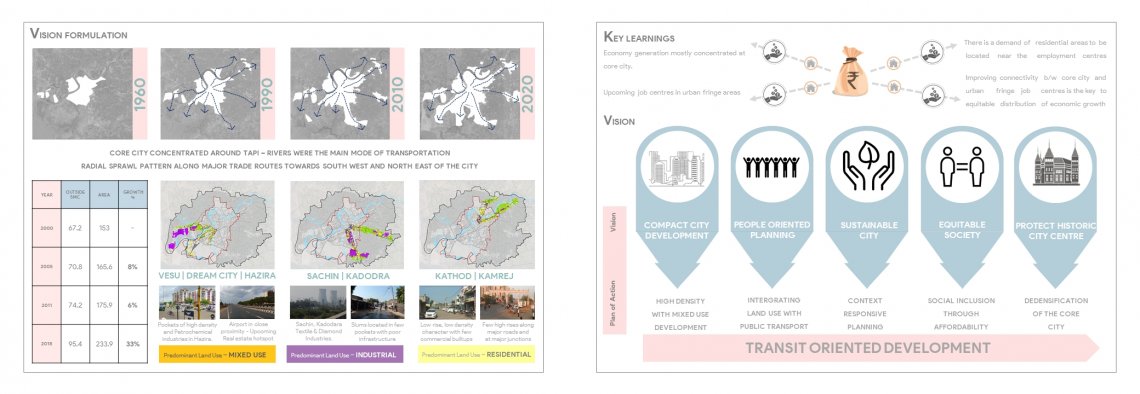
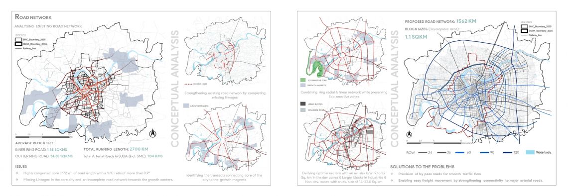
Surat is a compact city and has been expanding along its major transit corridors in last four decades. As the population of increased, the area of the city has evolved from an agricultural land to an urban built form in the same manner its user demanded. The evolution and growth of the city to an industrial driven economy having population more than 66 lacks is segregated into various districts, nagar pallikas etc. which hold the charge of their development as per the requirement. A moat divides the older parts of the city, with their narrow streets and historical houses, from the newer suburbs. The growth trends indicate sprawl pattern towards the South and North-East, with growth extending towards the northern side across the river. The residential development in the city covers about 57% of the total developed land in the city. Peri-urban growth is also a feature of the city, especially along the Surat-Hazira corridor, which has led to associated growth in the periphery. The city within SMC limit has reached to its saturation level and needs expansion towards the potential growing regions.