Hetvee Panchal

UR3001

Hidden Connections

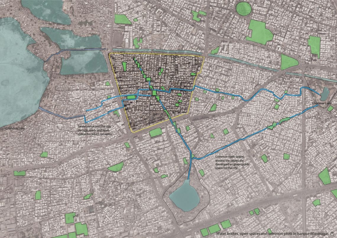
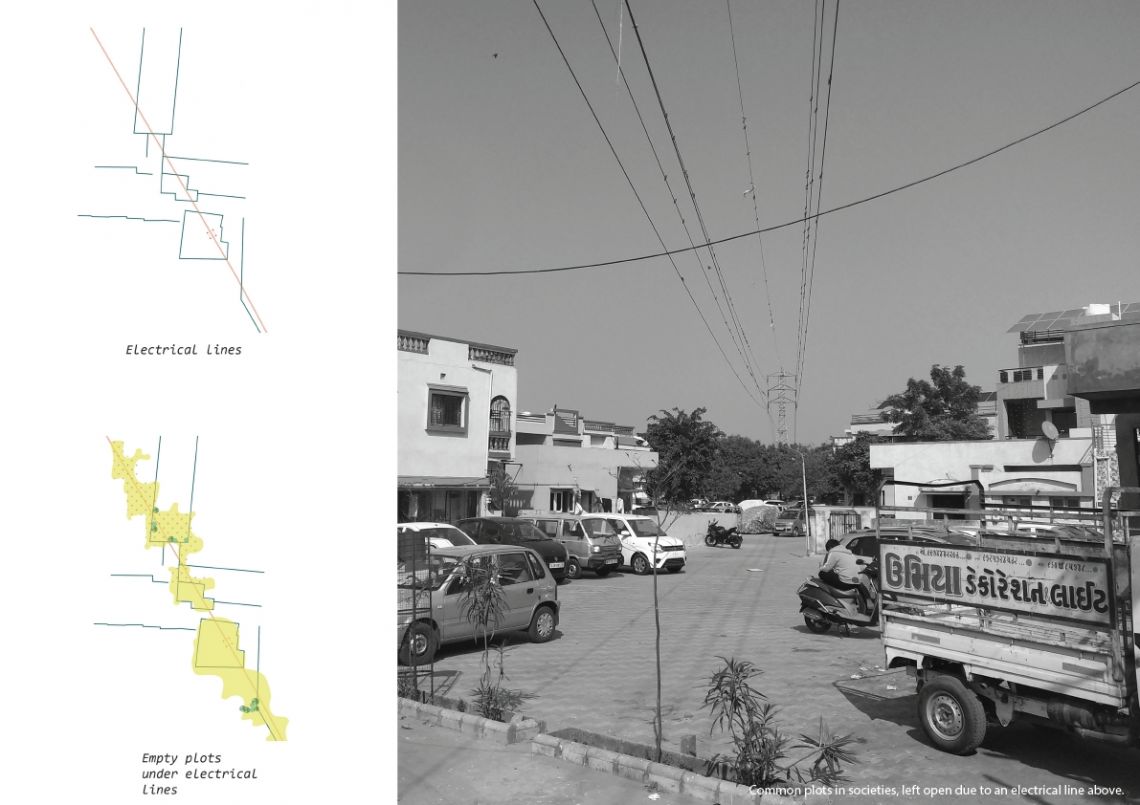
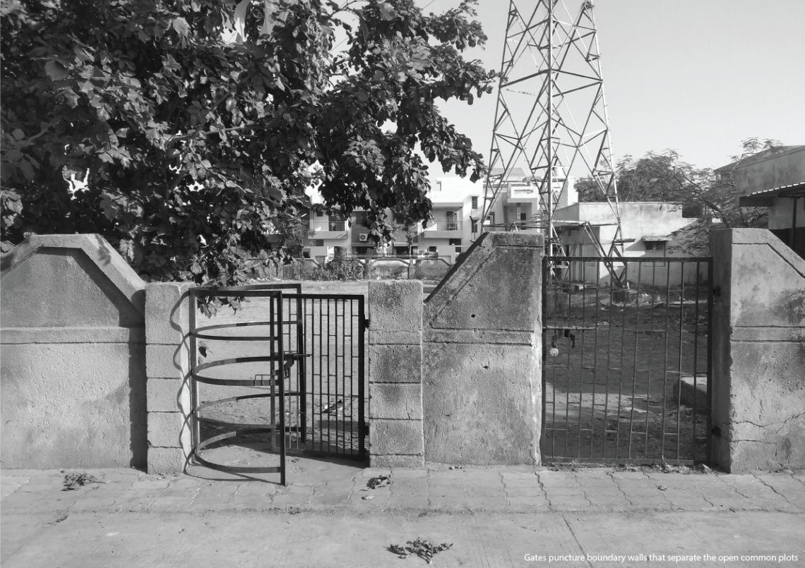
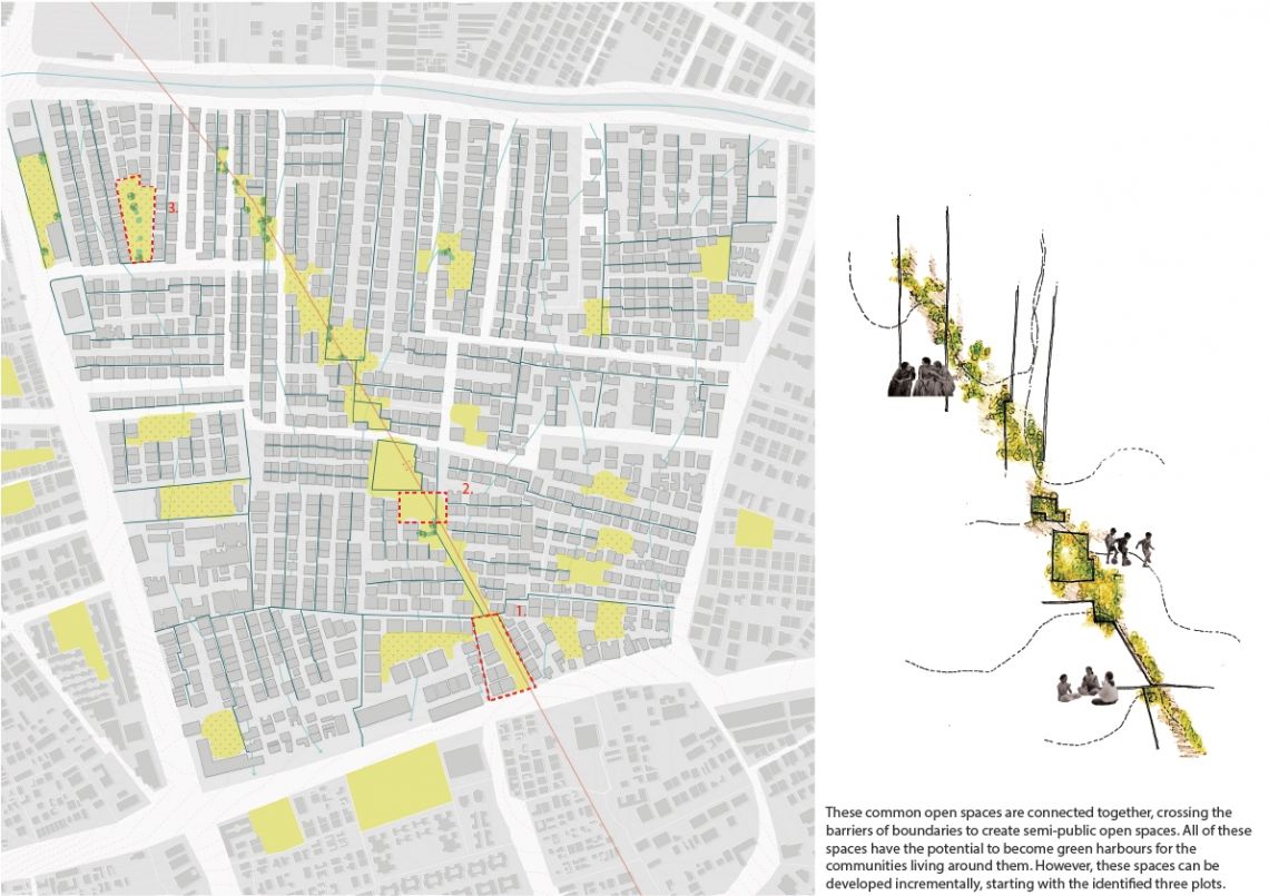
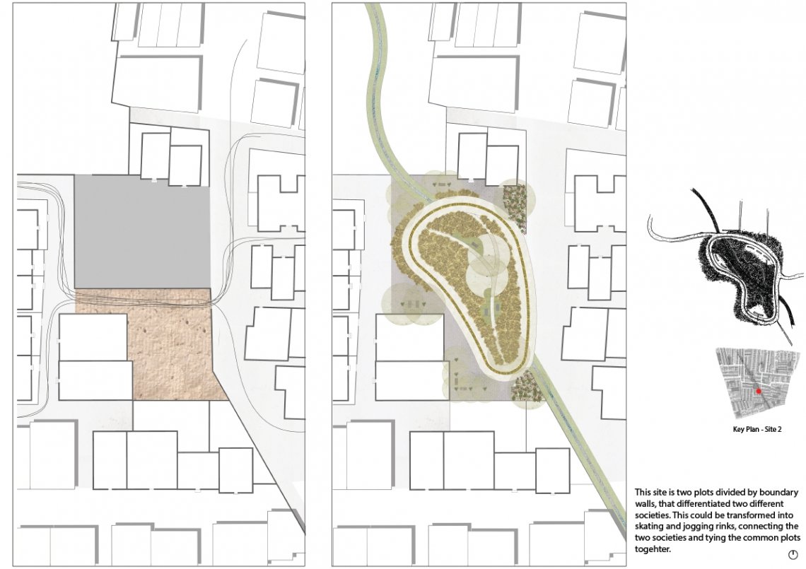
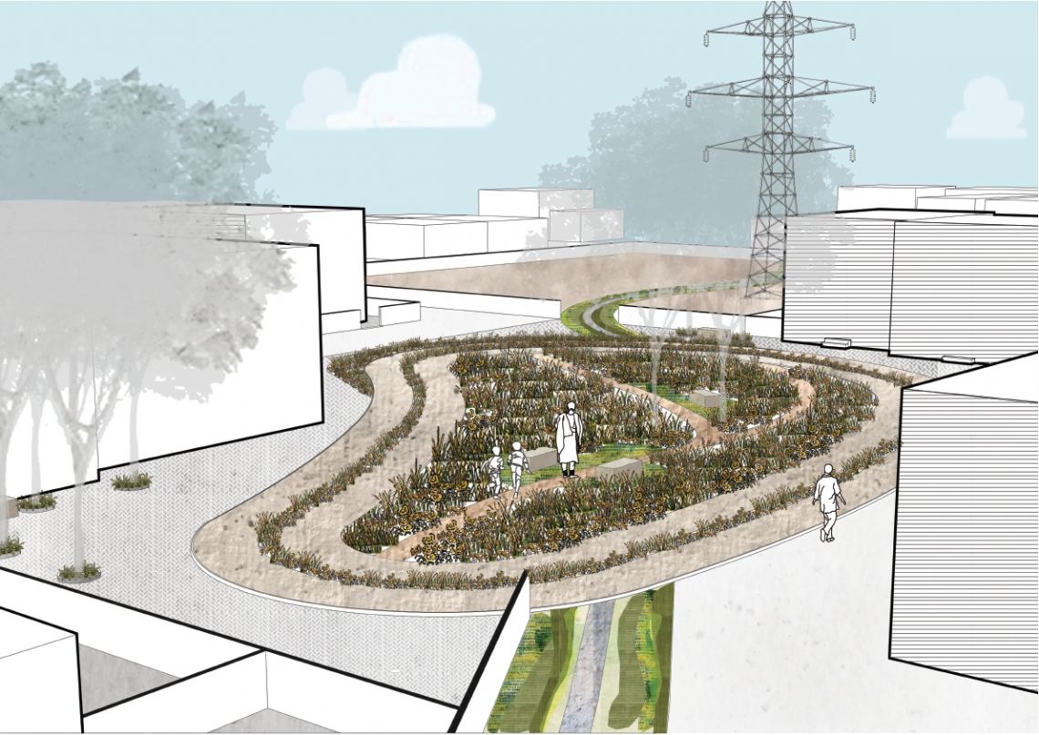
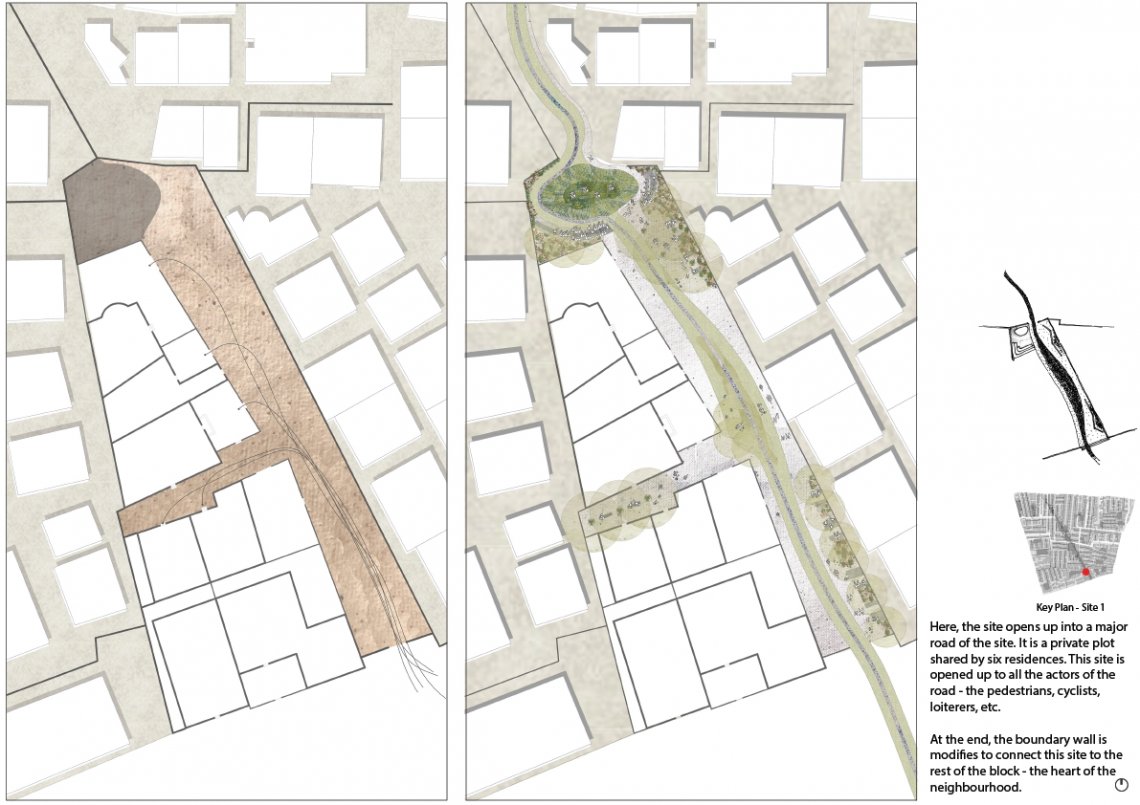
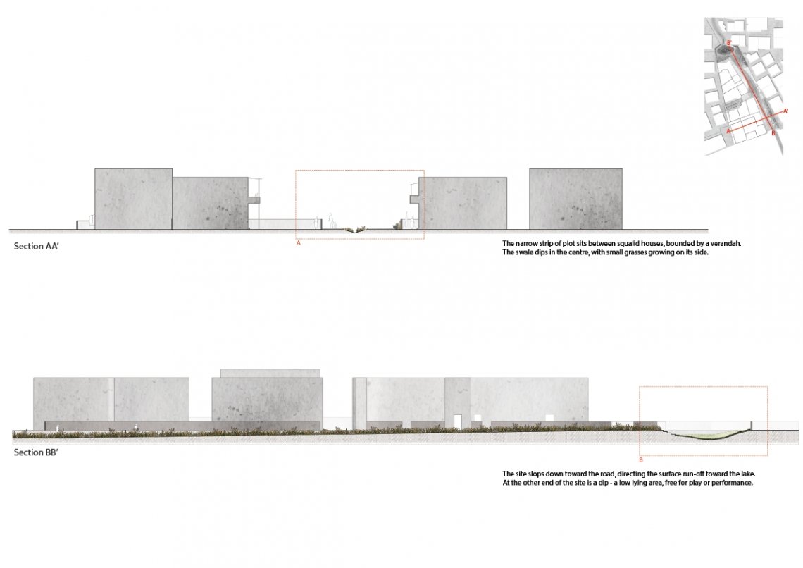
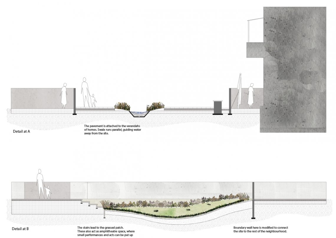
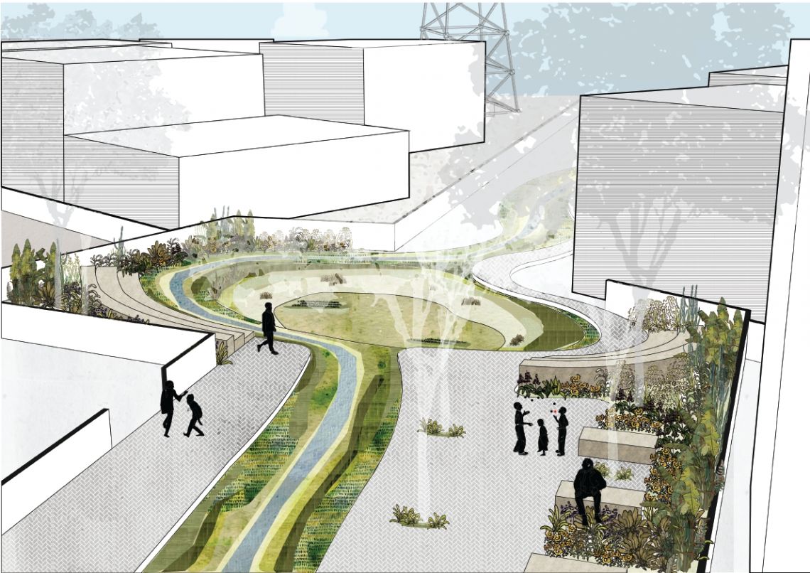
The project is based in a typical neighbourhood, one of the first suburbs of the city. The idea stems from a pre-existing condition on site, where open spaces are aligned but disconnected by boundary walls. They are deep set within societies and act as common plots, for parking. A string of open spaces, where you can see them in a line, but can’t walk across. What must it be like crossing the boundary, into another open space, where dust covered cars stand under sparse neem trees? The manifesto begins by imagining routes rising above these boundary walls, as elevated structures. 


Report Content

The site fabric is defined by small, single storey independent homes, that were developed by multiple developers over the years. These are co-operative societies that are dotted with common plots typically used for parking. Overhead runs an electrical line. These plots are divided by boundary walls, separating one society from another and solidifying plot lines set on paper. The open spaces are imagined to be connected through a system of swales, collecting and guiding surface run-off into one o

These plots have an interesting geometry, wherein because of the electrical line, the spaces under remained empty - all connected but divided by politics of the wall. While most of them are paved, some are open grounds. They are mainly used for parking and occasionally for social functions. They are also open grazing grounds for cows and are typically devoid of trees, with only a few existing trees dotting the site.

However, gates break through the boundary walls into these open spaces. They create shortcuts through the site that are predominantly used by the residents and house help in the site. Sometimes the gates are designed to leave out vendors and animals from entering.

The open spaces that sprinkle the site are imagined to be connected through a system of green spaces, connecting the communities living around them, by virtue of looking after these spaces and caring for them. Eventually, it becomes an inter-connected system and the common plots are developed as open spaces for the community.

This particular site is located in the heart of the neighbourhood. The common plots for two different societies meet here. One of them is paved, whereas the other is unpaved mud and sand. On the boundary wall between these two sites is a small gate that is used by residents and household help as an alleyway to cut across the site.

This site breaks through the boundary walls dividing two adjacent vacant plots. A cycling, jogging, skating track creates a loop and sits between plantations of wild grasses. Smaller clearings sit and trails run through the grasses. The rest of the site is paved and planted. Here, residents come early in the morning for a walk, and in the evenings to freshen up - to meet with others, sitting on the benches as they watch the children run around.

A narrow dirt track and a small clearing at the back forms this particular patch of open space. It is an access route for the seven individual homes present there. Moreover, this patch of land is bounded by boundary walls on three sides, separating it from the rest of the community.

The cross section of the site shows the relationship between the swale and its neighboring buildings. The long section highlights the condition of the ground and the garden in the site.

These are detailed sections as pointed out in the previous drawings.

It is imagined as an inlet into the rest of the community. A long narrow swale runs the length of the site. Benches are placed at the entrance, and fill up the space between the homes. At the end of the site, a sunken court is surrounded by small steps - forming something like an amphitheatre. The boundary walls at the end break up, connecting this site to the rest of the neighbourhood.