Your browser is out-of-date!
For a richer surfing experience on our website, please update your browser. Update my browser now!
For a richer surfing experience on our website, please update your browser. Update my browser now!
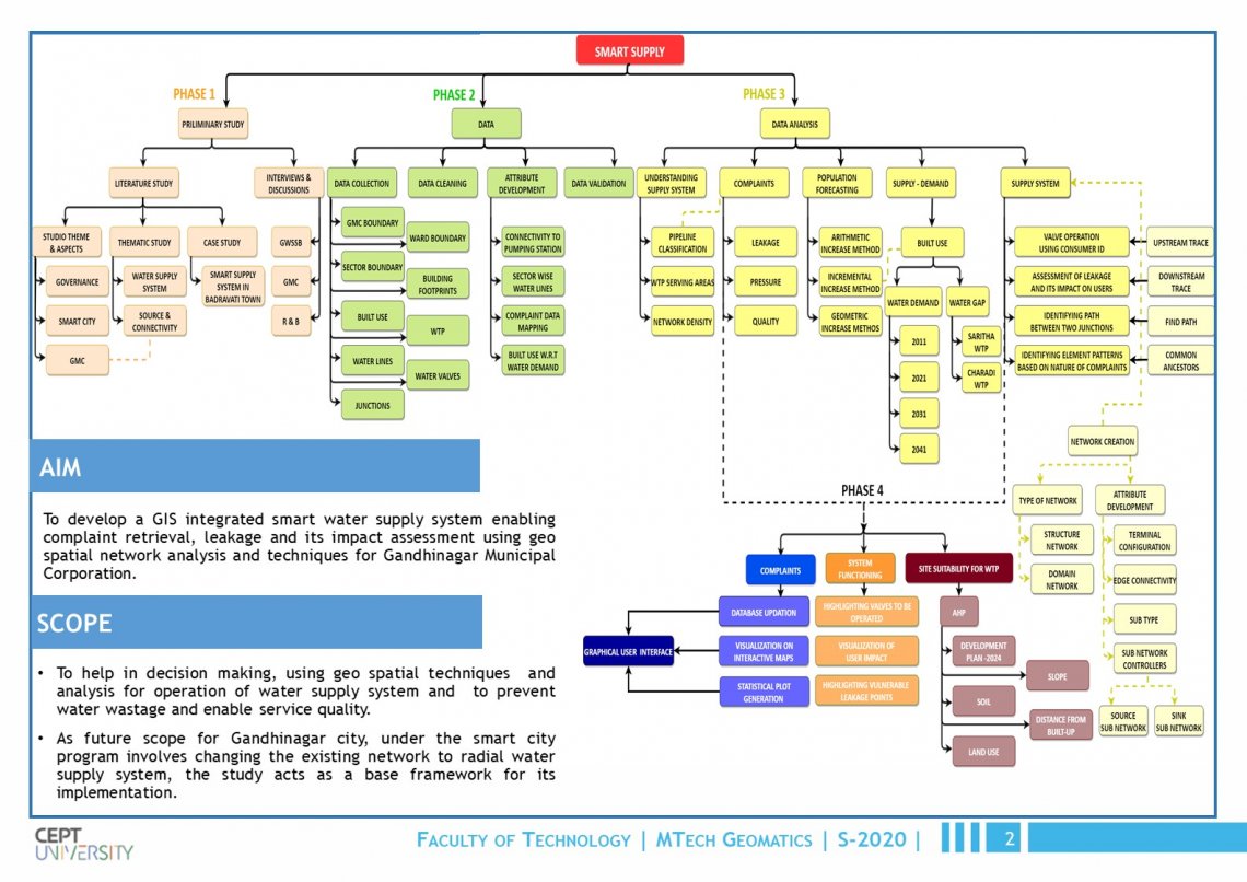
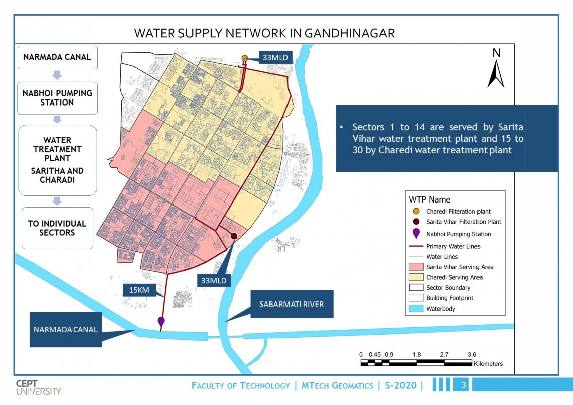
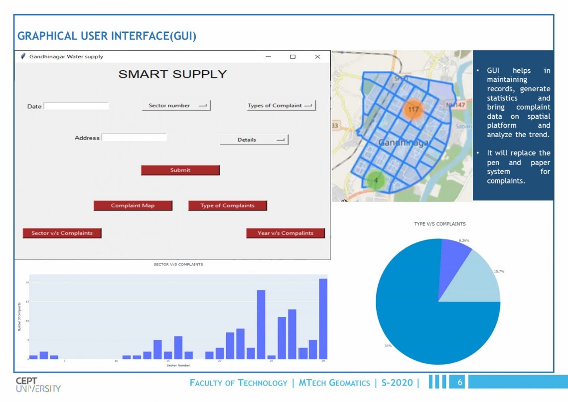
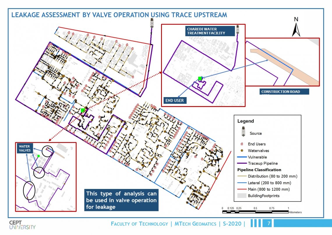
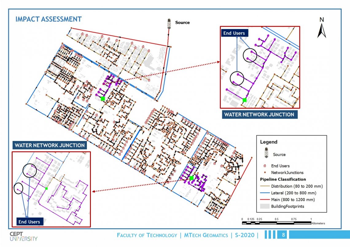
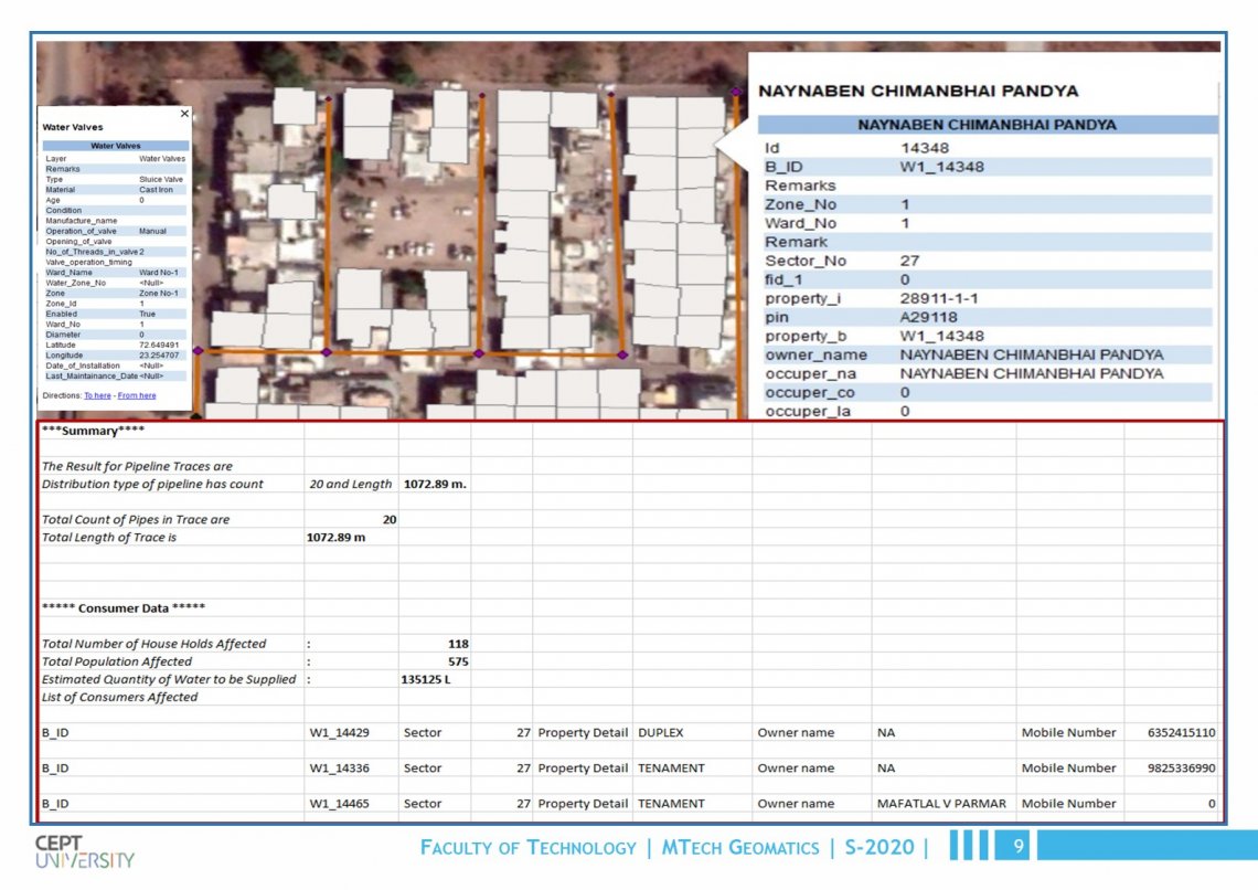
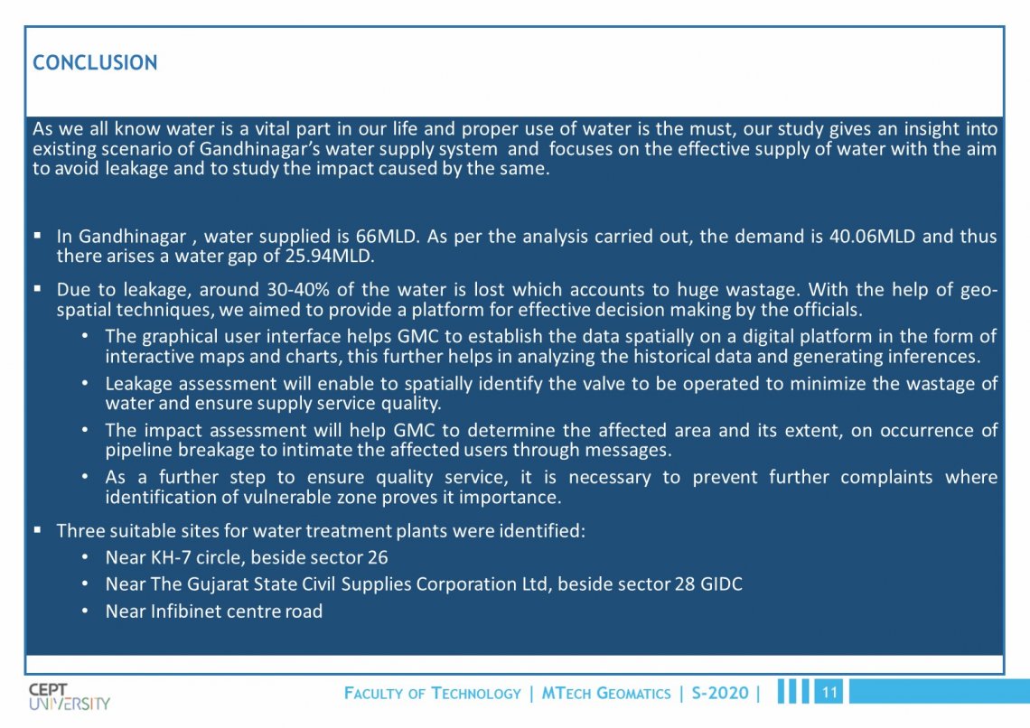
The project helps in decision making, using geo spatial techniques and analysis for operation of supply system and to prevent water wastage and enable service quality. The preliminary study gives an insight into existing scenario of Gandhinagar’s water supply system based on which a graphical user interface for complaints and tools for leakage and impact assessment as well as for identification of vulnerable zones prone to leakage were generated for decision making. The graphical user interface helps GMC to establish the data spatially on a digital platform in the form of interactive maps and charts, this further helps in analysing the historical data and generating inferences. Leakage assessment will enable to spatially identify the valve to be operated to minimize the wastage of water. The impact assessment will help GMC to determine the affected area and its extents on occurrence of pipeline breakage to intimate the affected user. As a further step to ensure quality service, it is important to prevent further complaints where identification of vulnerable zone proves it importance.As future scope for Gandhinagar city, under the smart city program involves changing the existing network to radial water supply system, the study acts as a base framework for its implementation.