Your browser is out-of-date!
For a richer surfing experience on our website, please update your browser. Update my browser now!
For a richer surfing experience on our website, please update your browser. Update my browser now!
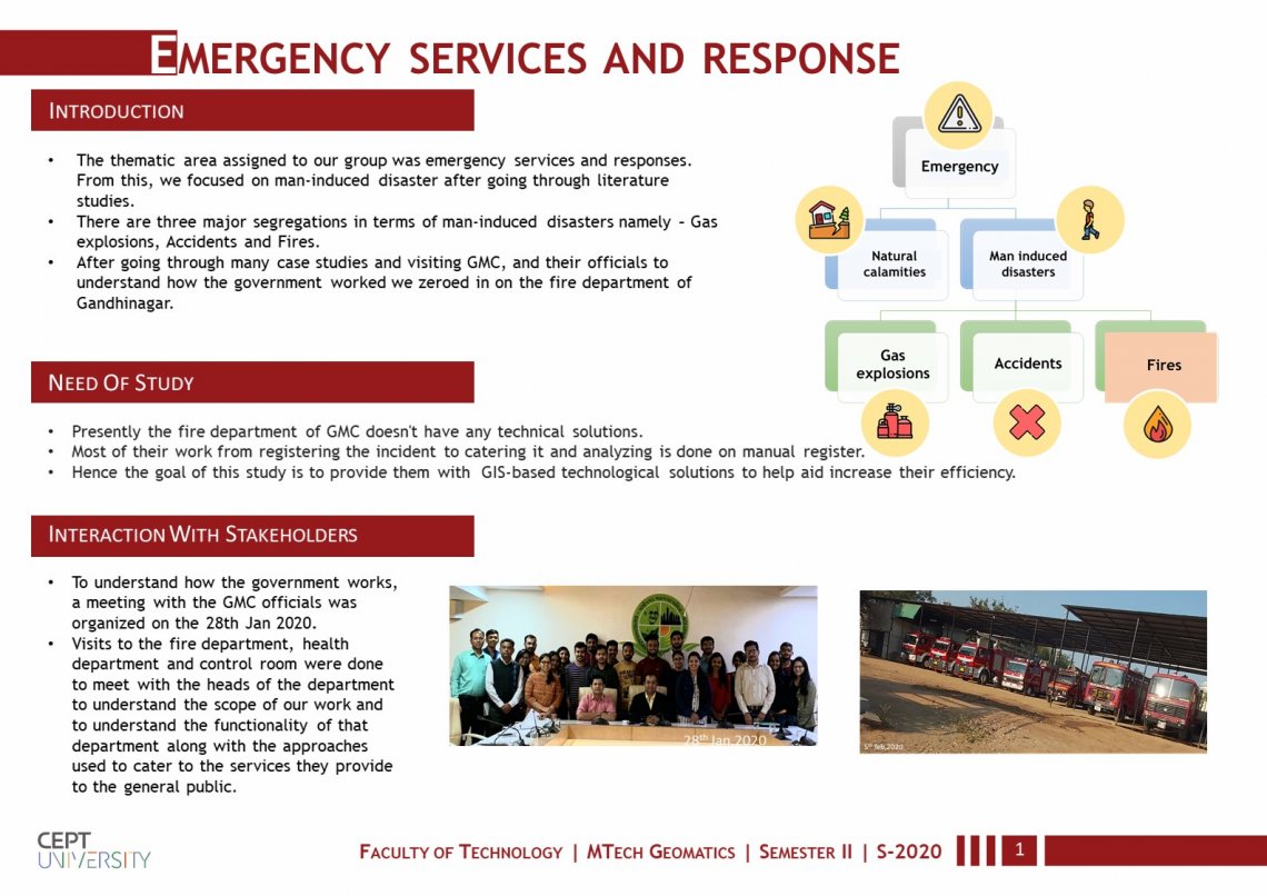
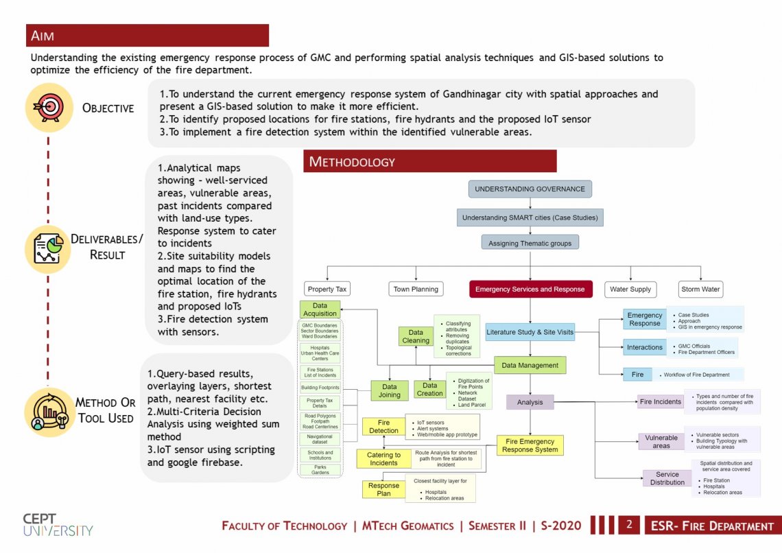
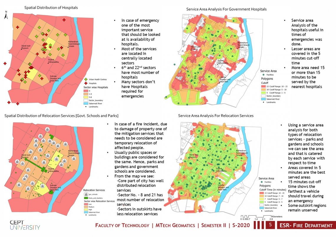
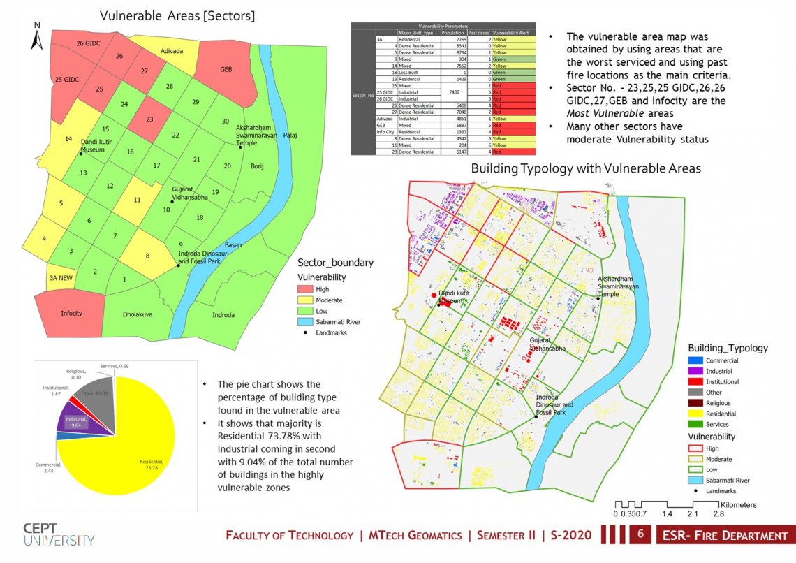
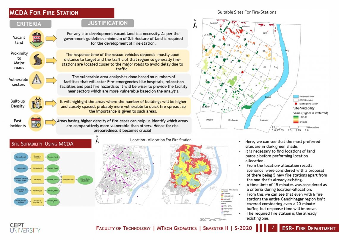
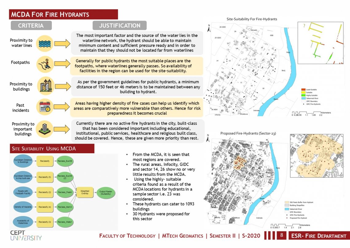
This studio project focuses on designing a GIS-based Decision Support System that aids in emergency services and responses specifically the fire department of Gandhinagar. Some of the major aims focused on in this studio are 1)To understand the current emergency response system of Gandhinagar city with spatial approaches and present a GIS-based solution to make it more efficient. 2)To identify proposed locations for fire stations, fire hydrants and the proposed loT sensor 3)To implement a fire detection system within the identified vulnerable areas.