Your browser is out-of-date!
For a richer surfing experience on our website, please update your browser. Update my browser now!
For a richer surfing experience on our website, please update your browser. Update my browser now!
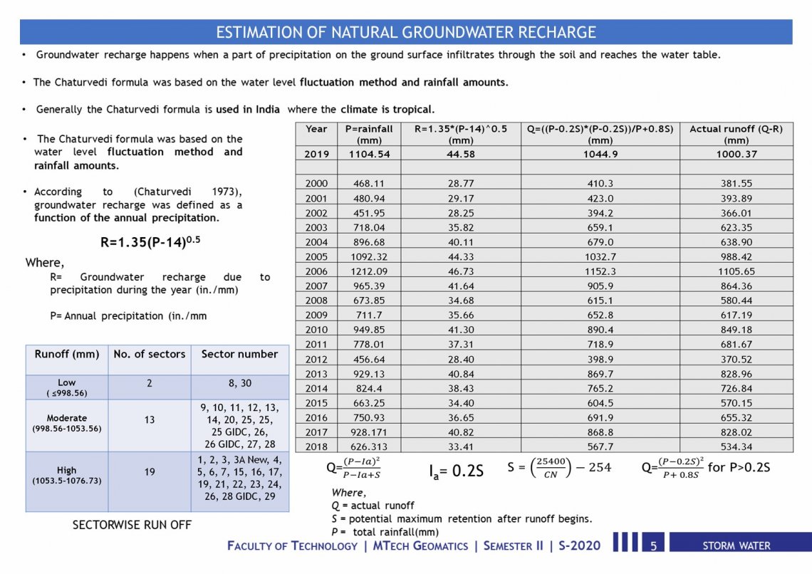
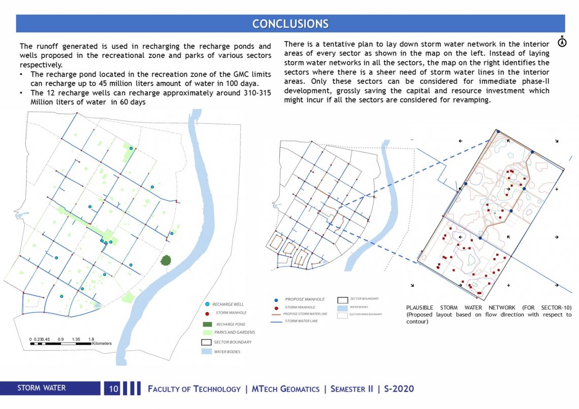
The study area Gandhinagar has a stormwater network in place was studied. It has a discharge capacity of 110 million liters/hours and can withstand a rainfall of 130mm in 24 hours, in the last 20 years rainfall has never crossed this mark, so having a well-laid network in place it can be used to give it back to the city. An attempt is made to recharge groundwater in Gandhinagar also if in case the rainfall escalates the threshold, vulnerable areas are identified to give a heads-up to the government to take suitable measures to prevent water-logging.