Your browser is out-of-date!
For a richer surfing experience on our website, please update your browser. Update my browser now!
For a richer surfing experience on our website, please update your browser. Update my browser now!
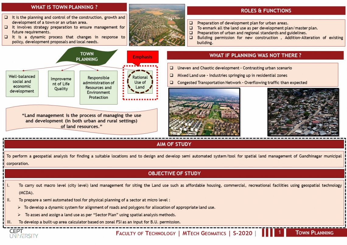
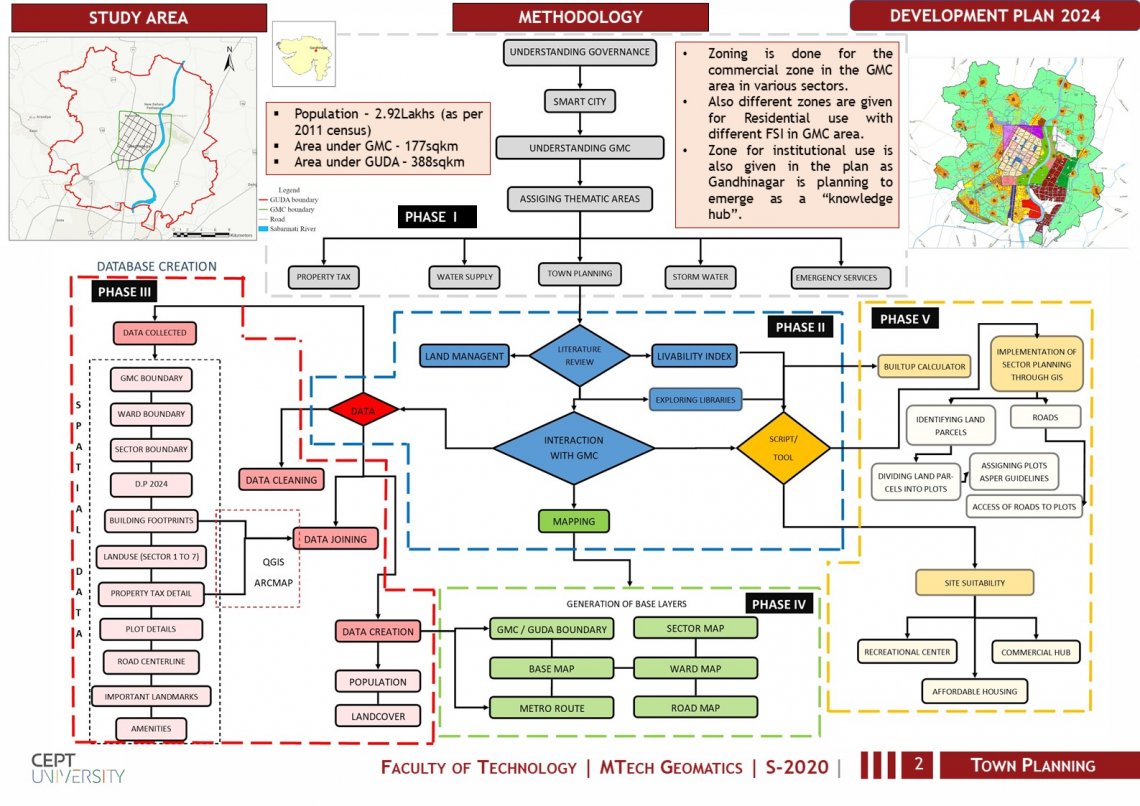
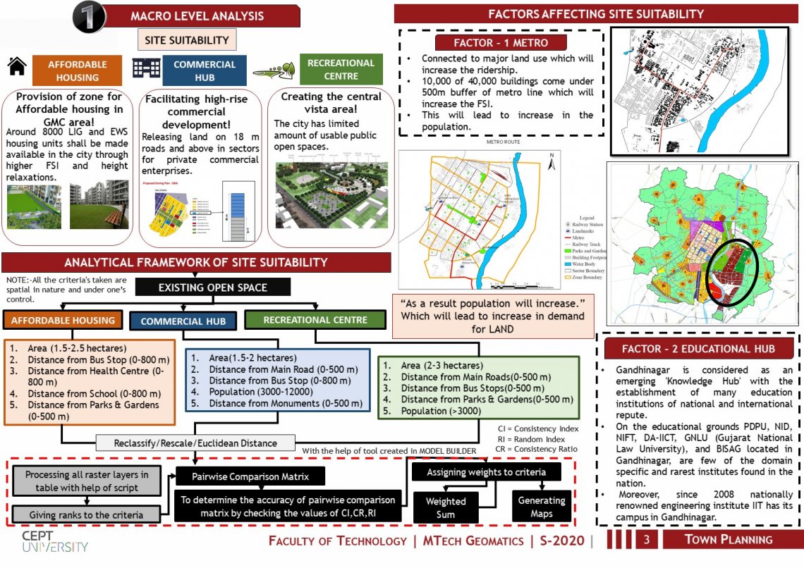
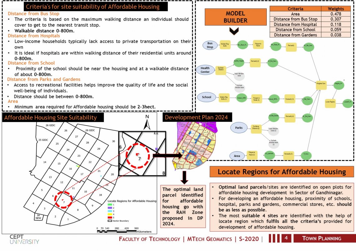
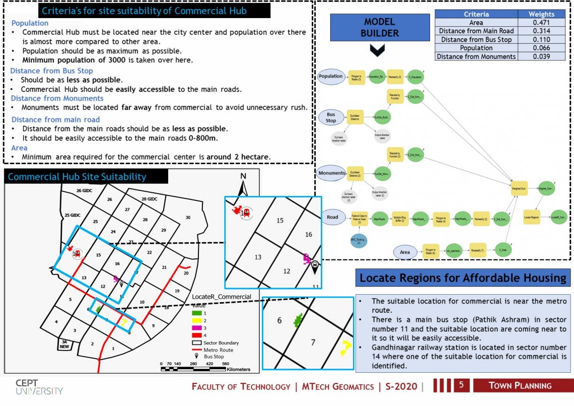
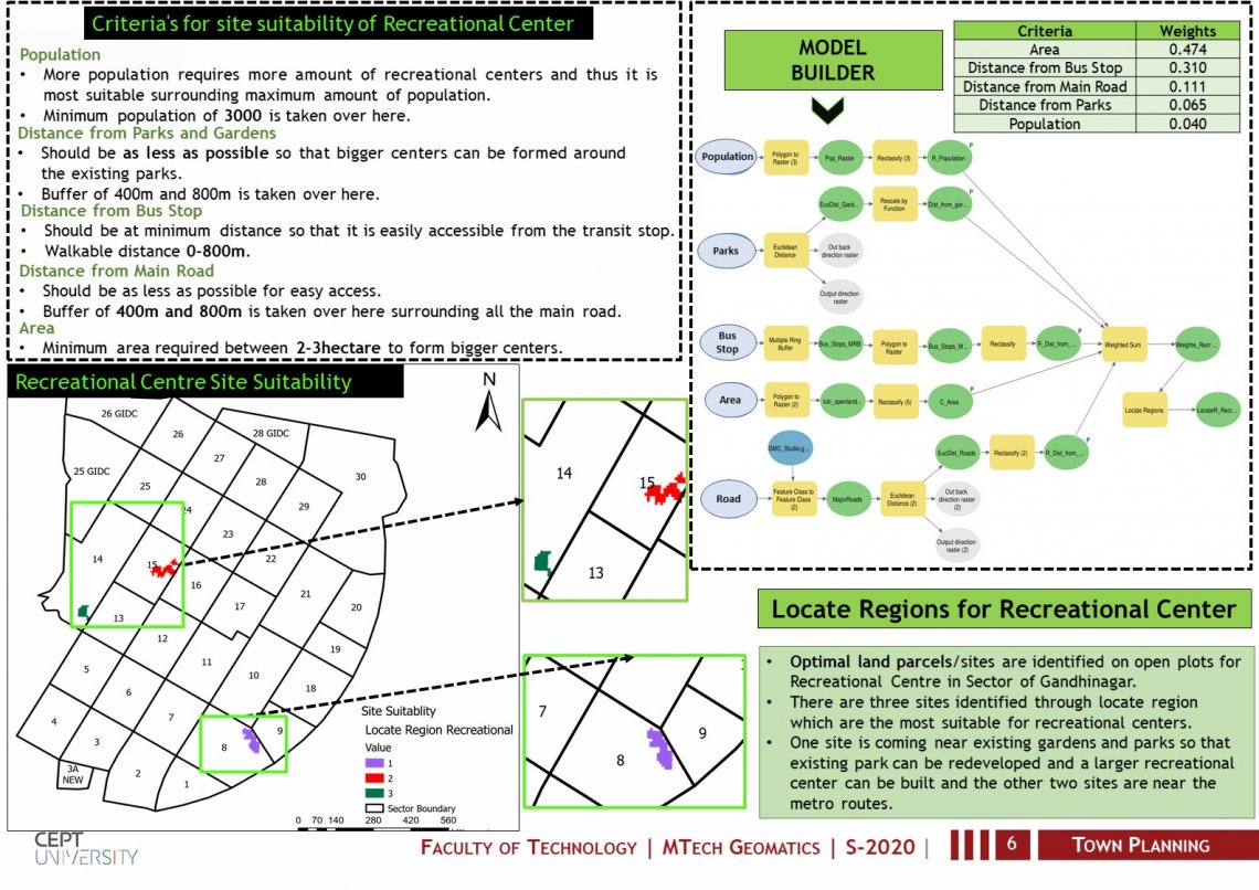
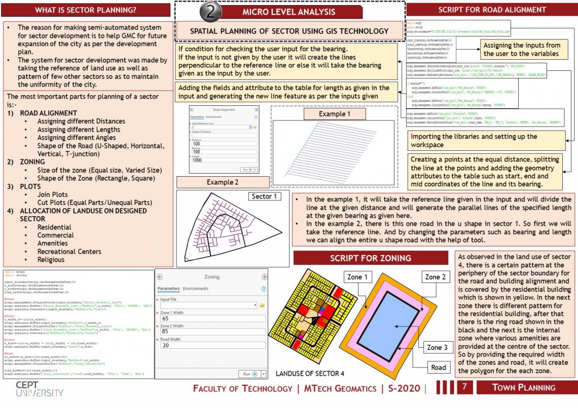
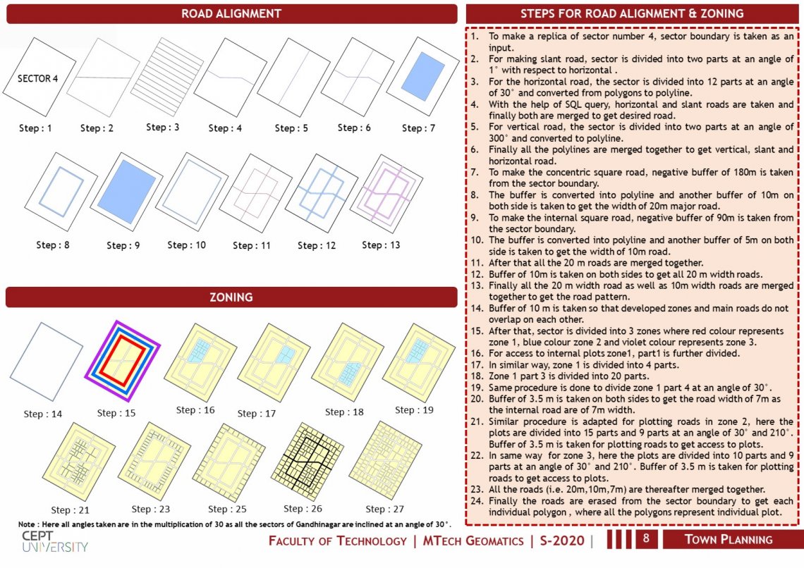
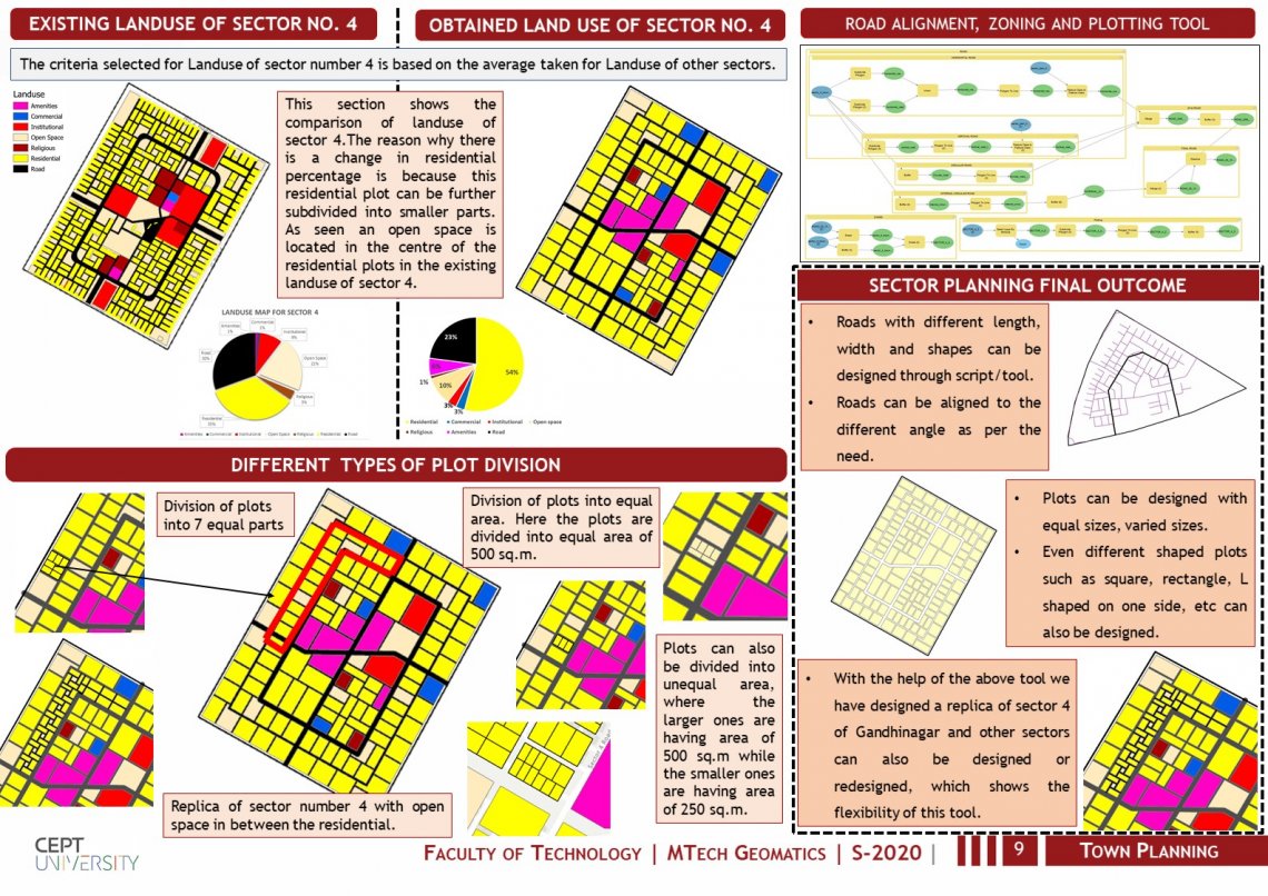
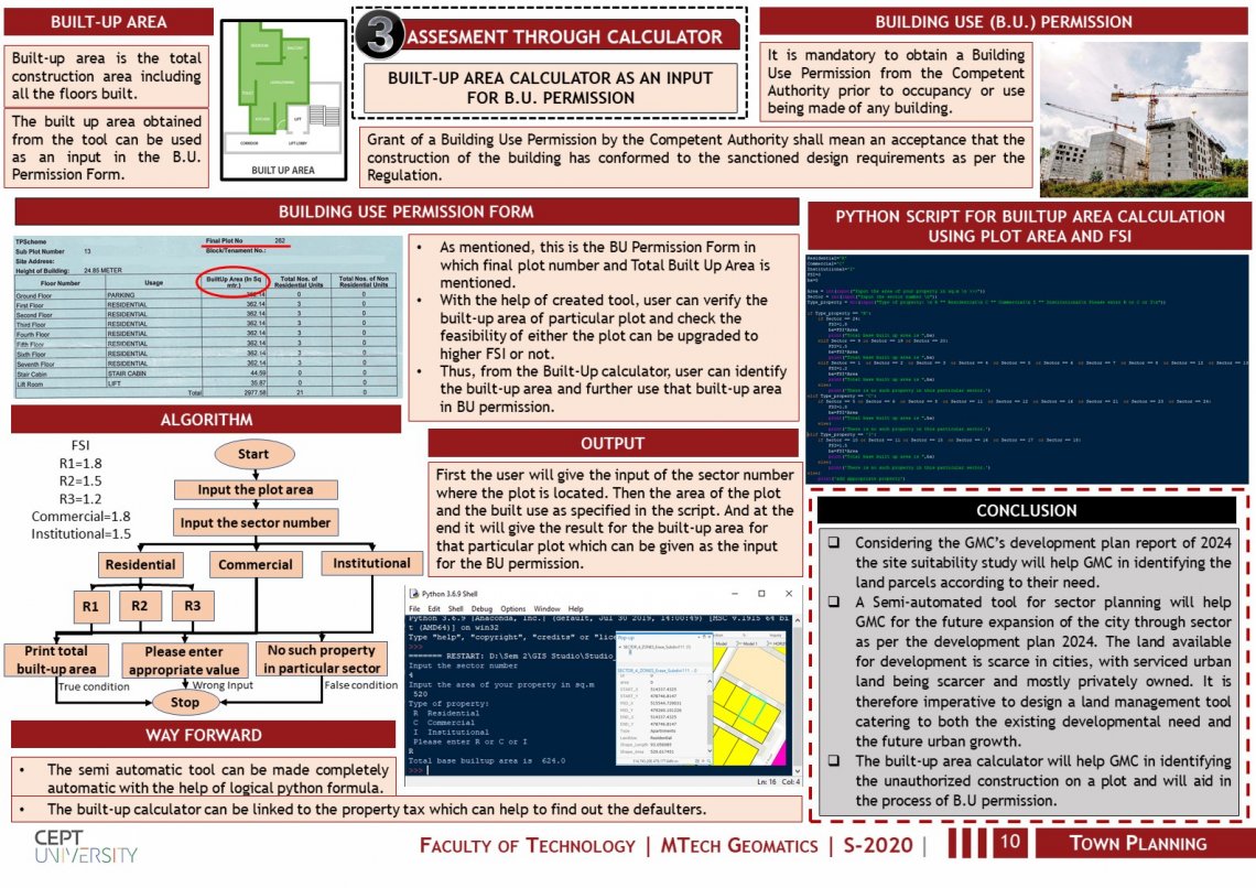
This studio project focuses on performing a geospatial analysis for finding a suitable locations and to design and develop a semi automated system/tool for spatial land management of Gandhinagar municipal corporation. It includes: 1.) Macro level (city level) land management for siting the Landuse such as affordable housing, commercial, recreational facilities using geospatial technology (MCDA). 2.) A semi automated tool for physical planning of a sector at micro level which includes alignment of roads and zones for allocation of appropriate landuse 3.) A built-up area calculator based on zonal FSI as an input for B.U. permission.