Your browser is out-of-date!
For a richer surfing experience on our website, please update your browser. Update my browser now!
For a richer surfing experience on our website, please update your browser. Update my browser now!
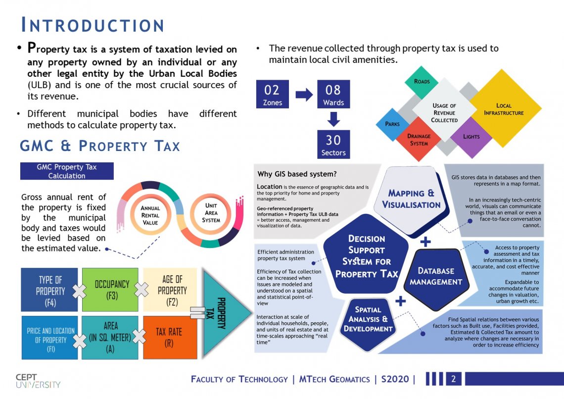
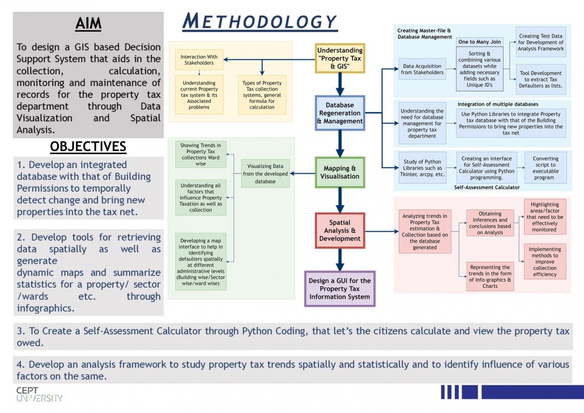
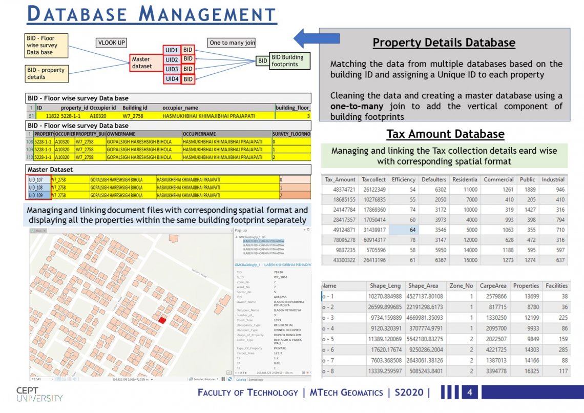
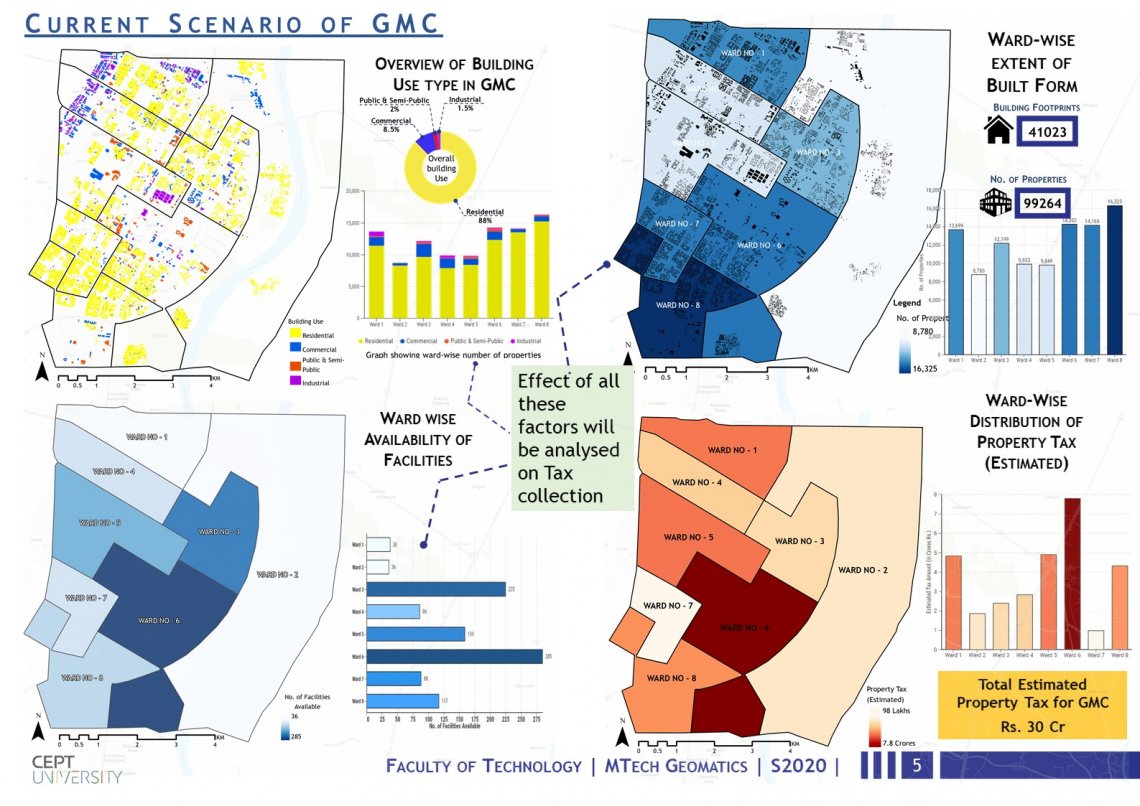
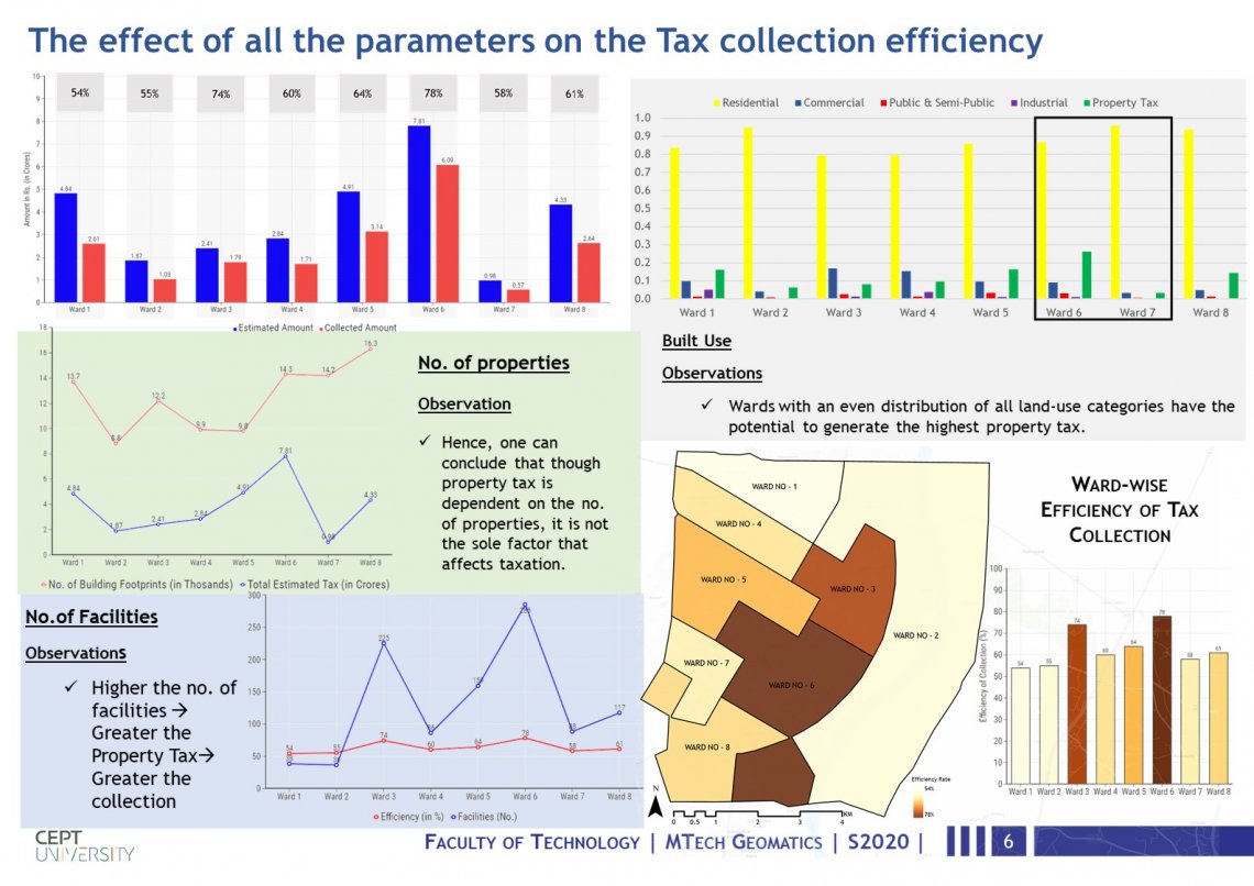
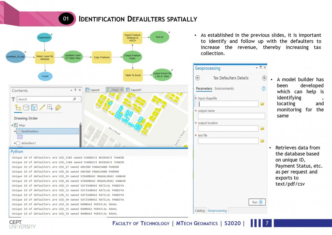
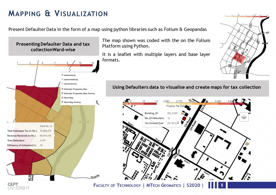
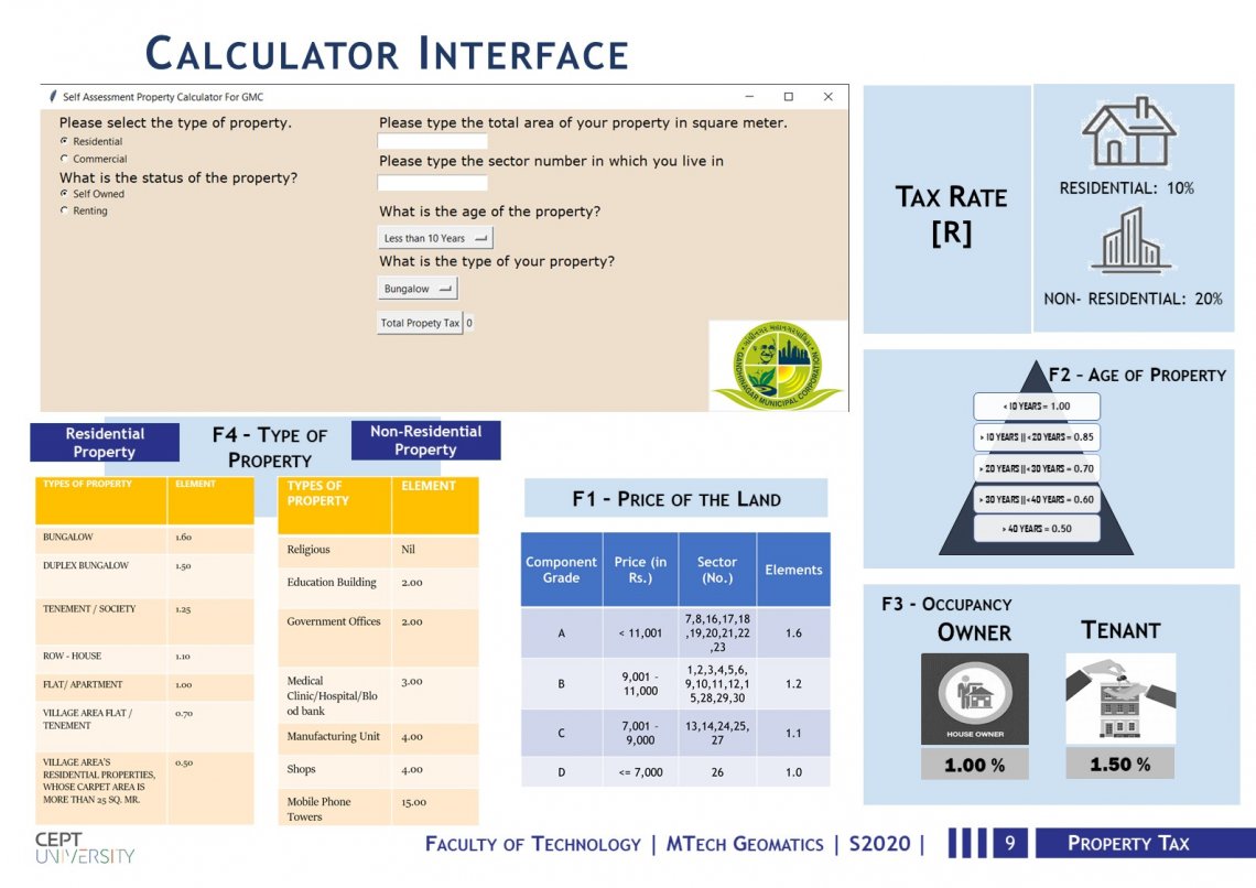
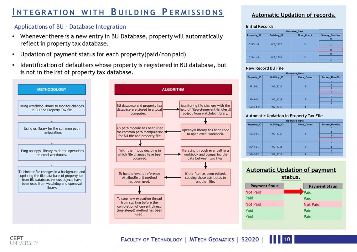
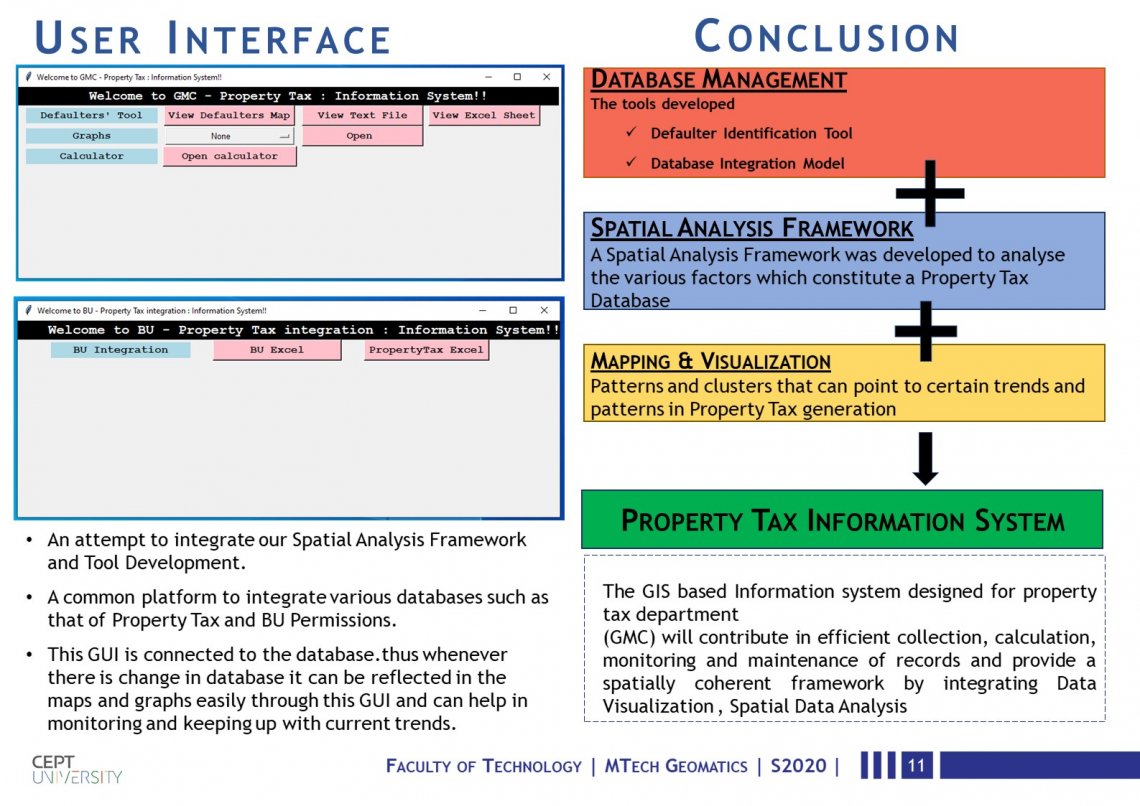
This studio project focuses on designing a GIS based Decision Support System that aids in the collection, calculation, monitoring and maintenance of records for the property tax department through Data Visualization and Spatial Analysis. It includes: 1) A spatial data Analysis framework. 2) Tax defaulter identification tool. 3) Interactive and dynamic maps and graphs to aid with visualization and monitoring. 4) BU permission and property tax integration to bring properties to tax net and increase collection. 5) Self assessment Calculator for Citizen. 6) A GUI combining and bringing all the deliverable to a single platform.