Your browser is out-of-date!
For a richer surfing experience on our website, please update your browser. Update my browser now!
For a richer surfing experience on our website, please update your browser. Update my browser now!
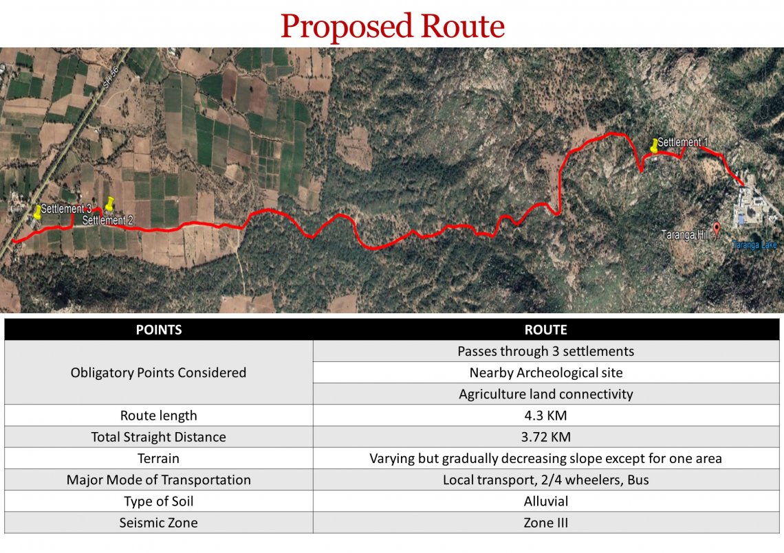
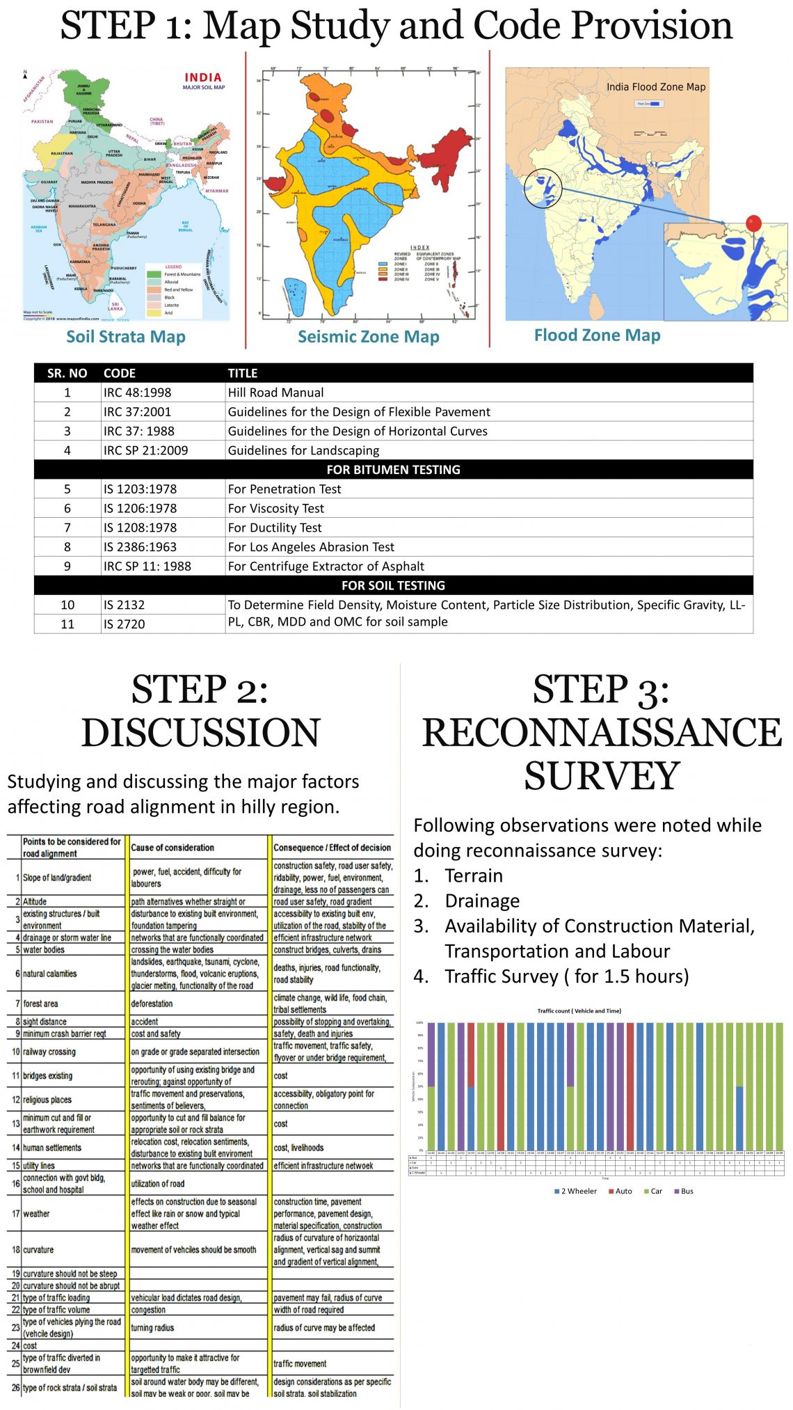
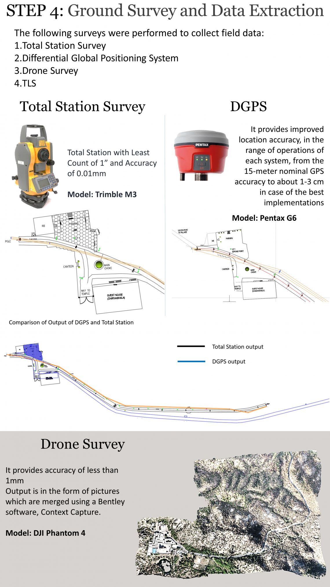
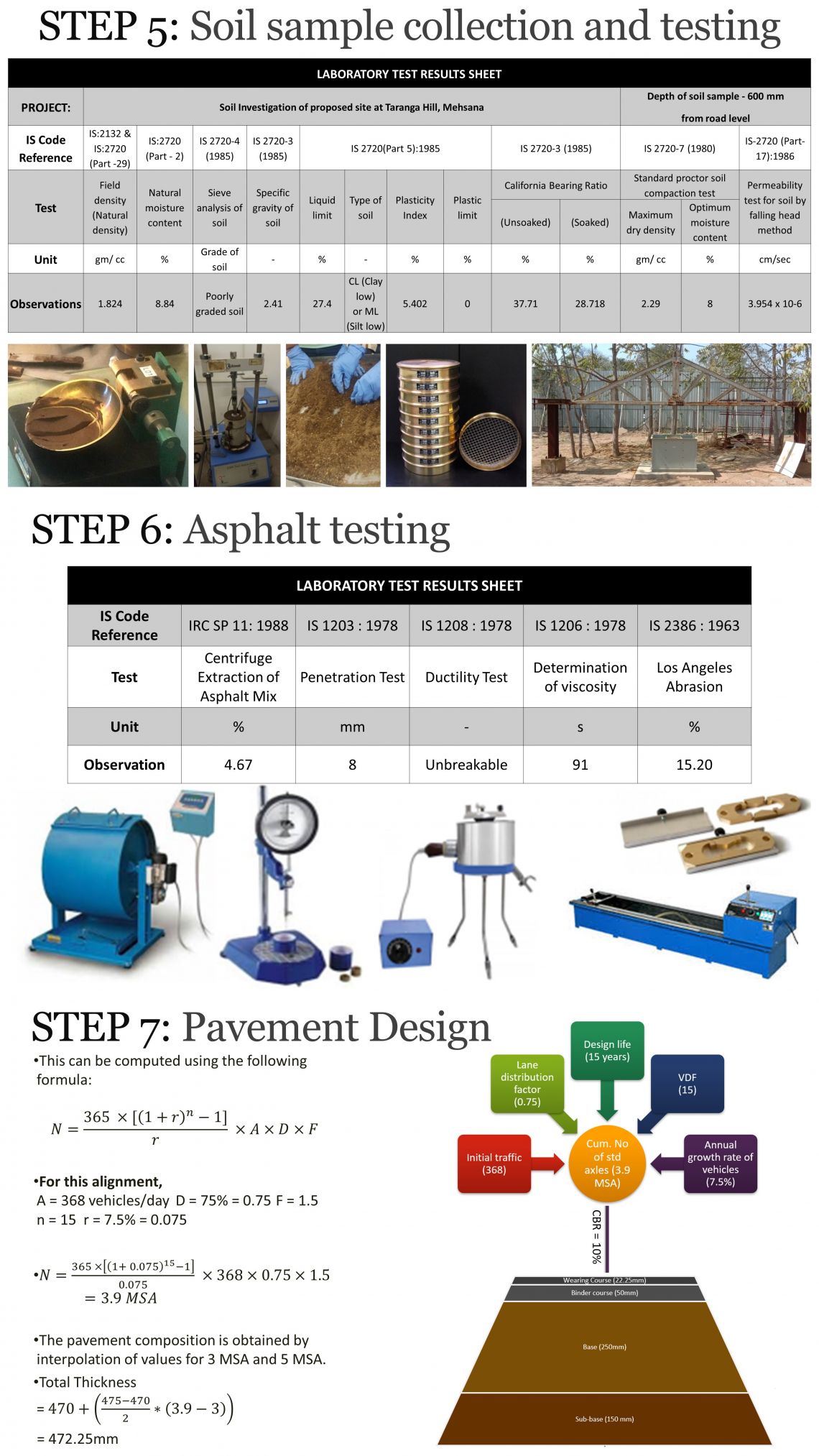
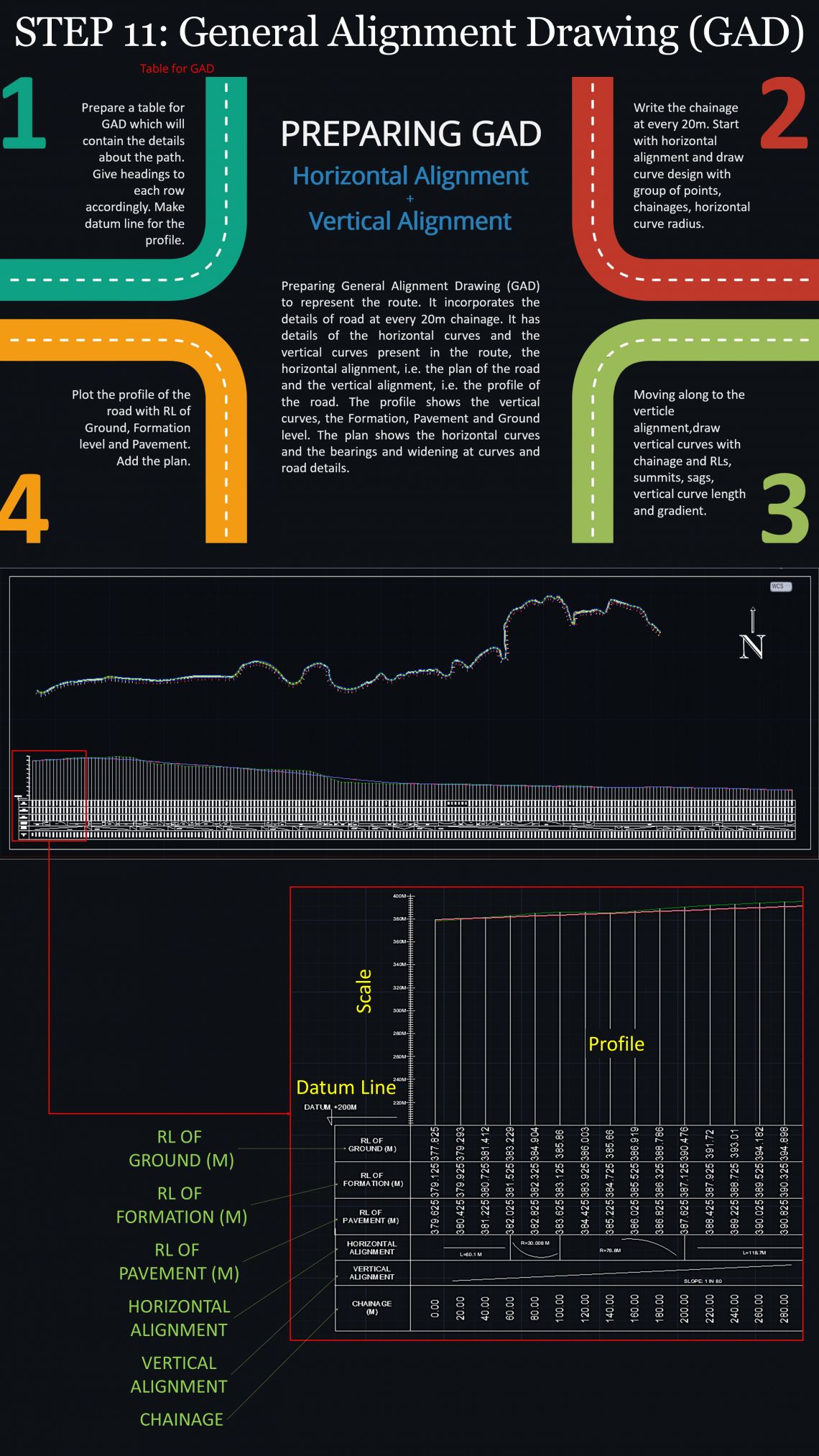
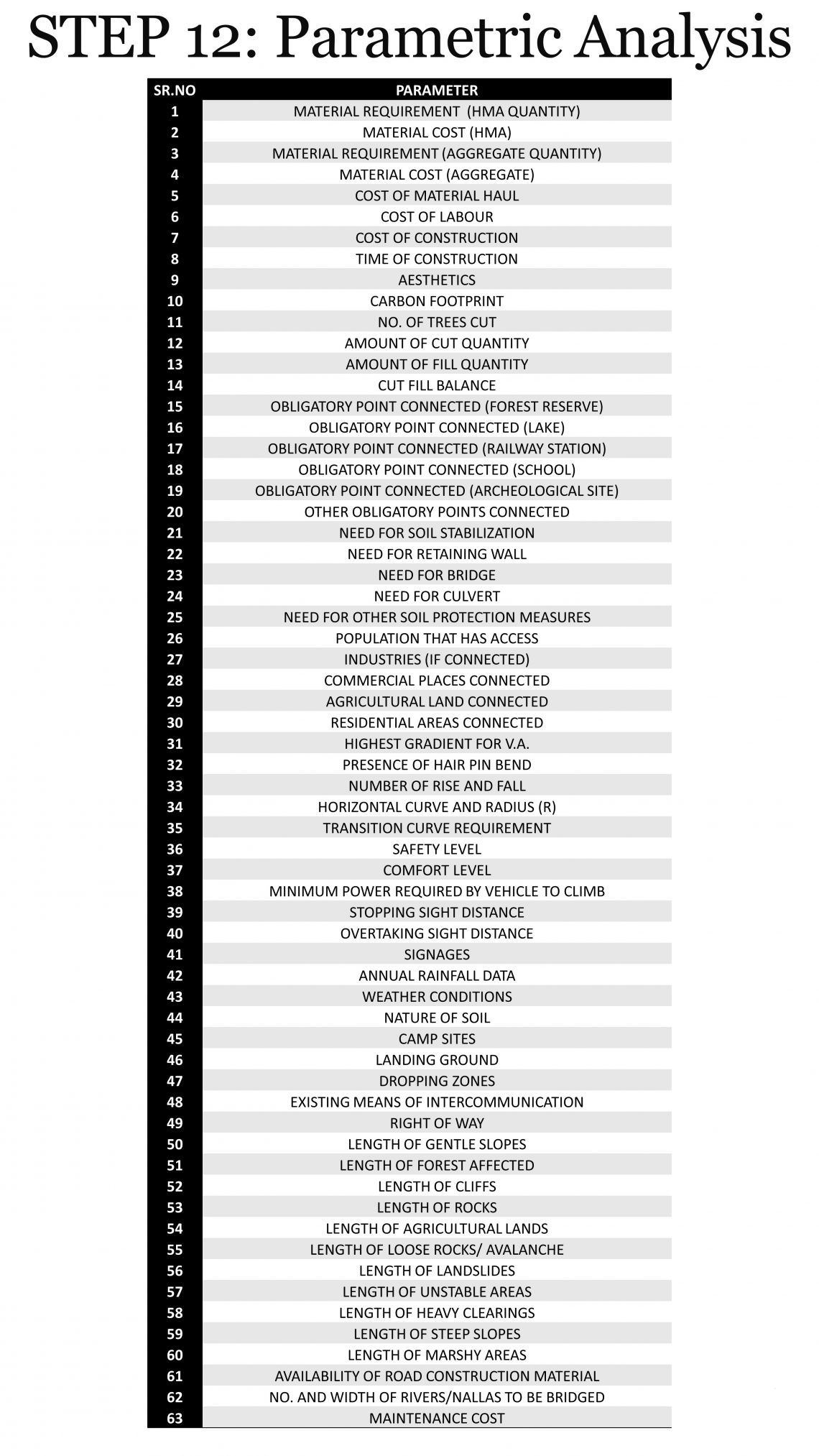
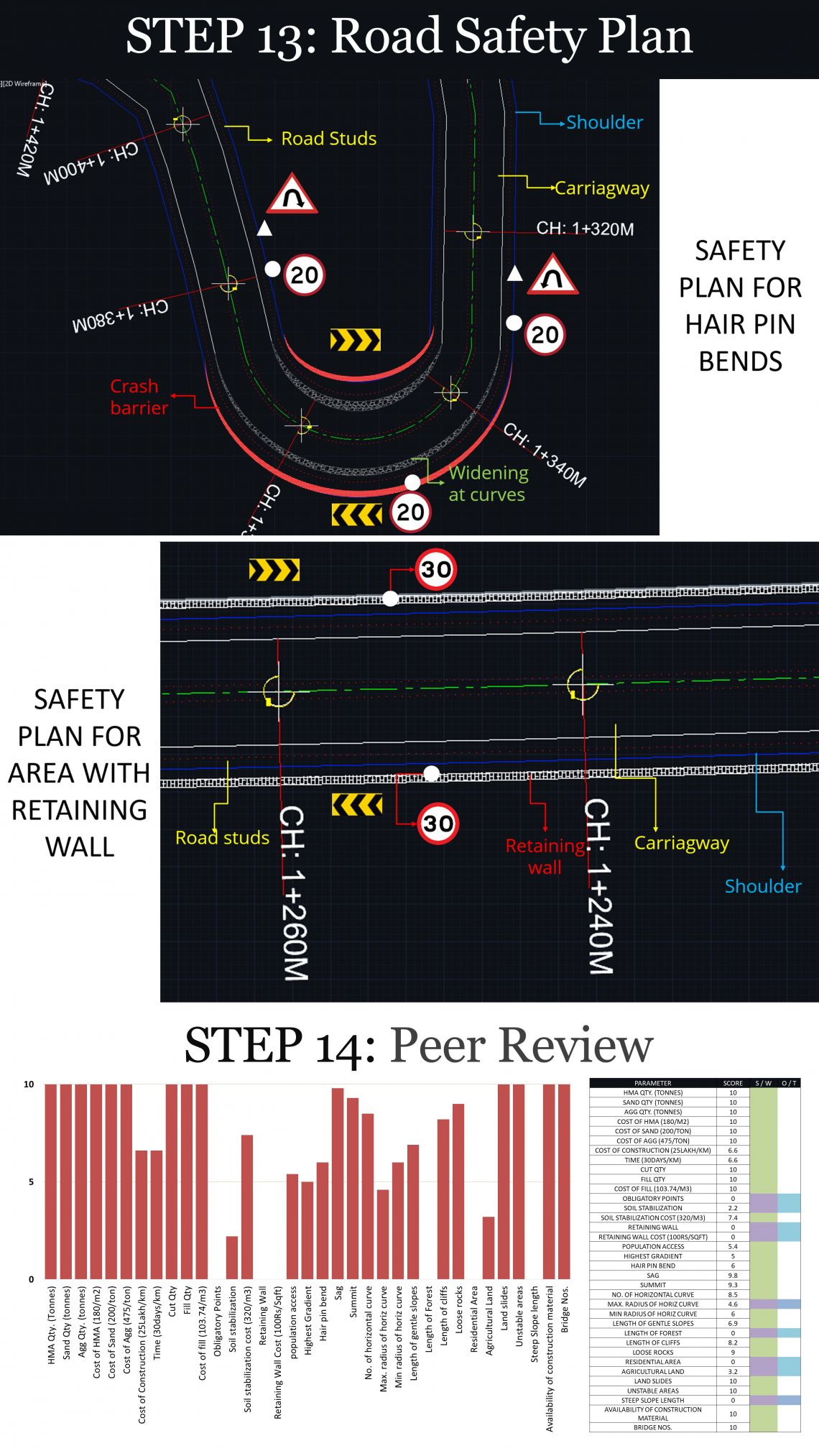
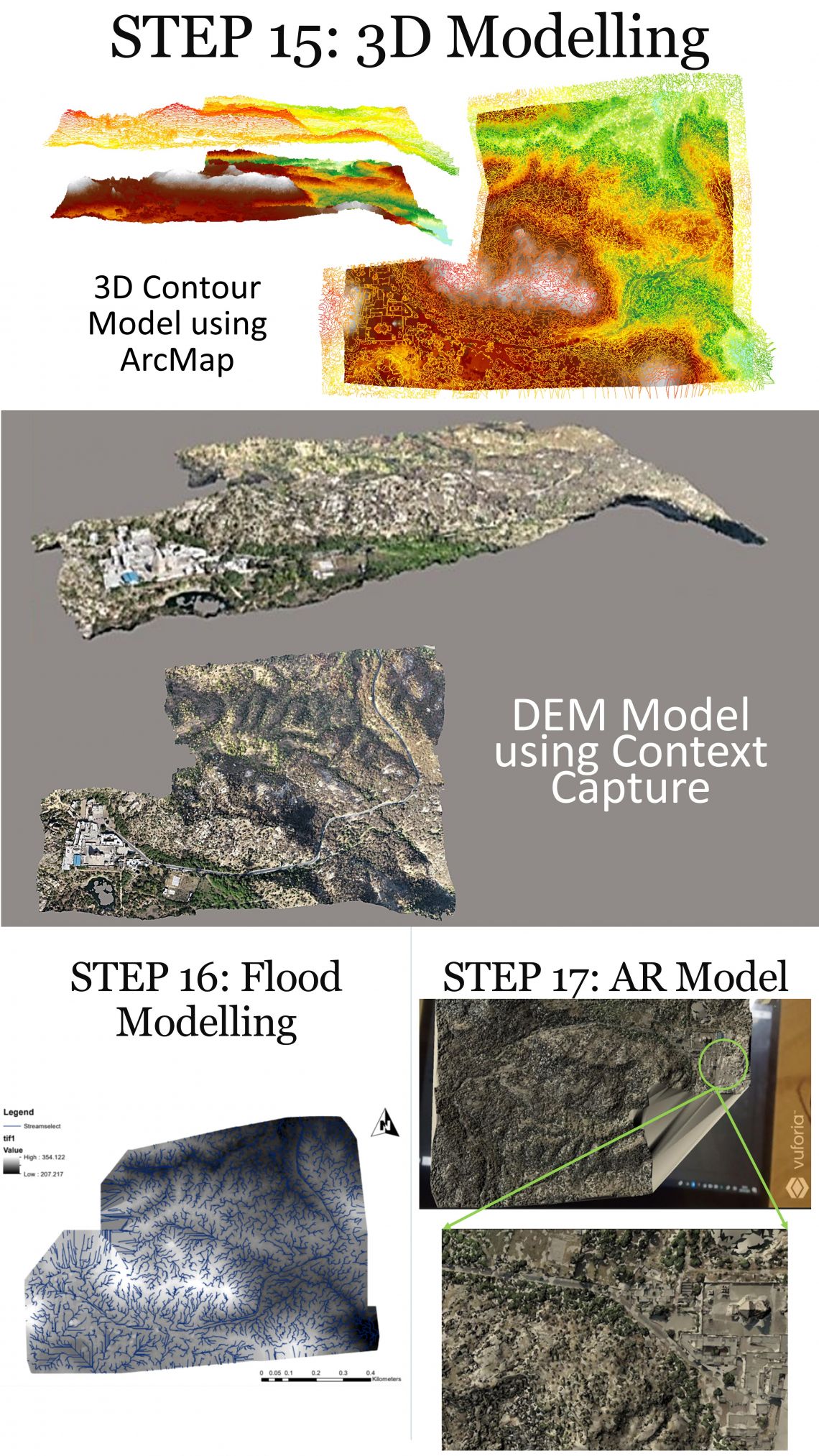
As a part of this course, we did various exercises that helped us gain insight into the actual practices and the method of planning and designing a highway in the hilly region. We began by performing surveys on the existing Taranga Hill Road and understanding the dynamics of DGPS, Drone Survey, and TLS. After that, we conducted tests for analysis of the soil and bitumen to get a better idea about the quality of materials for roads in such areas. For the final exercise, we proposed an individual route that connected the Taranga Temple to SH56.