Your browser is out-of-date!
For a richer surfing experience on our website, please update your browser. Update my browser now!
For a richer surfing experience on our website, please update your browser. Update my browser now!
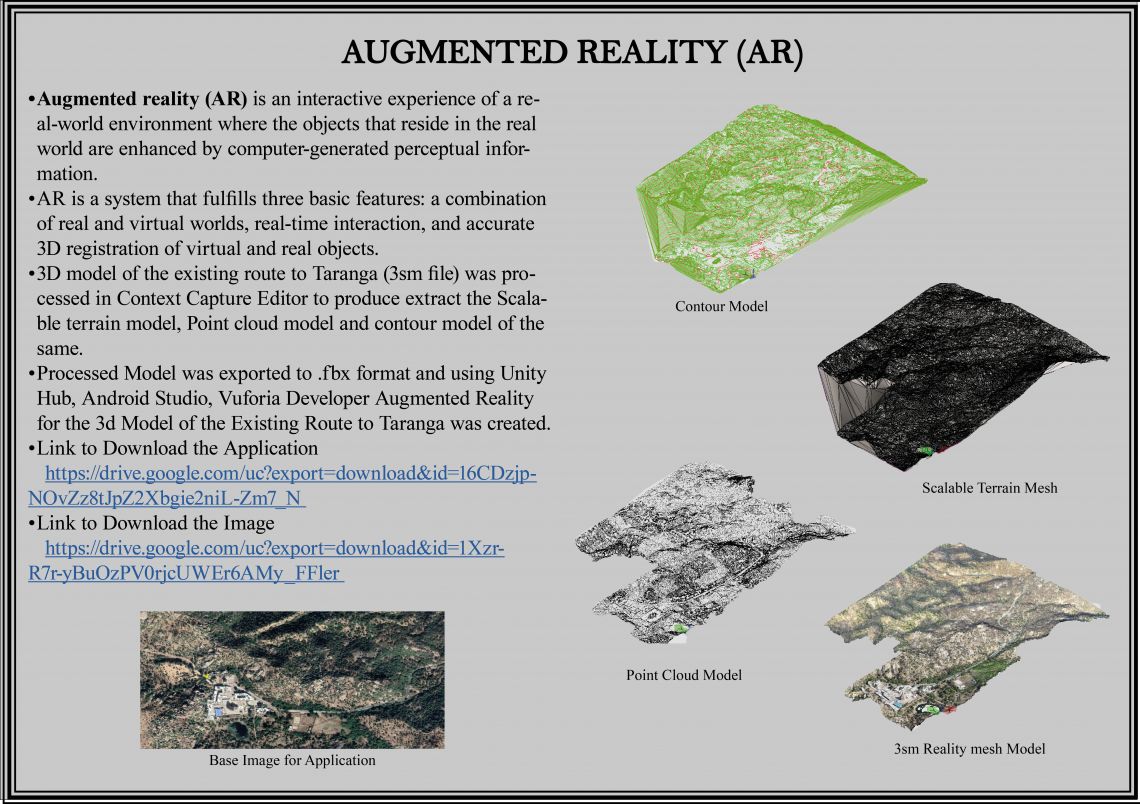
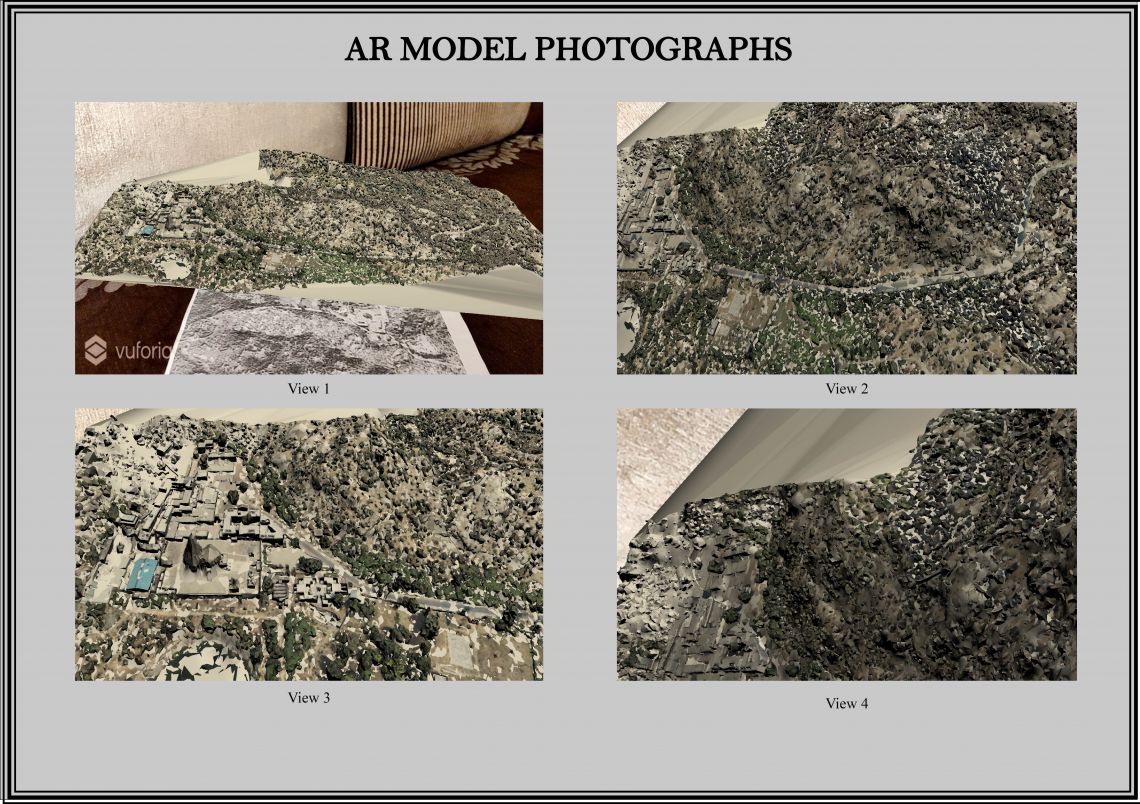
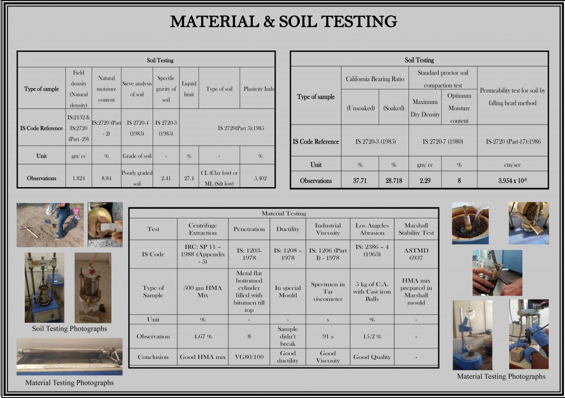
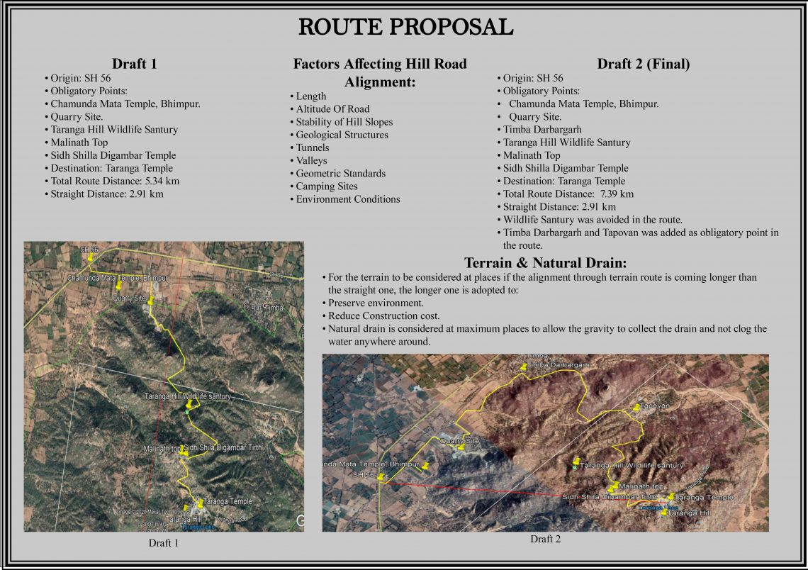
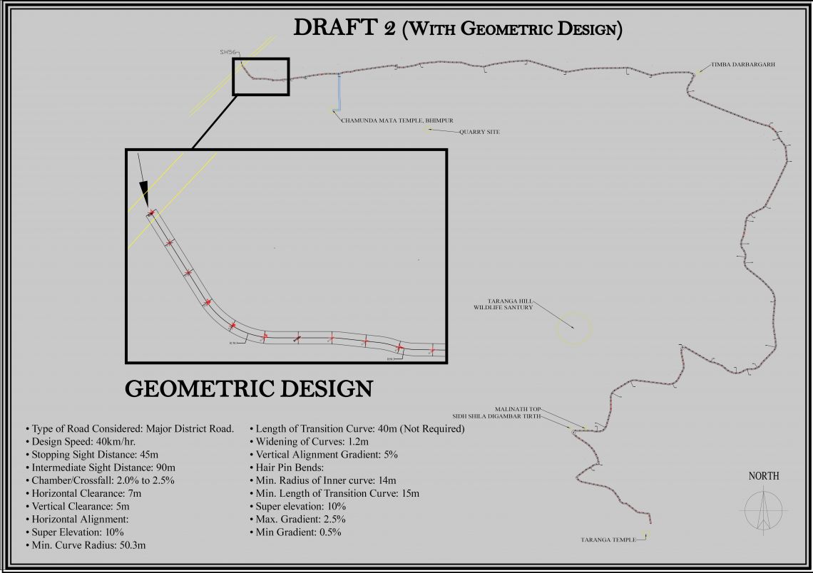
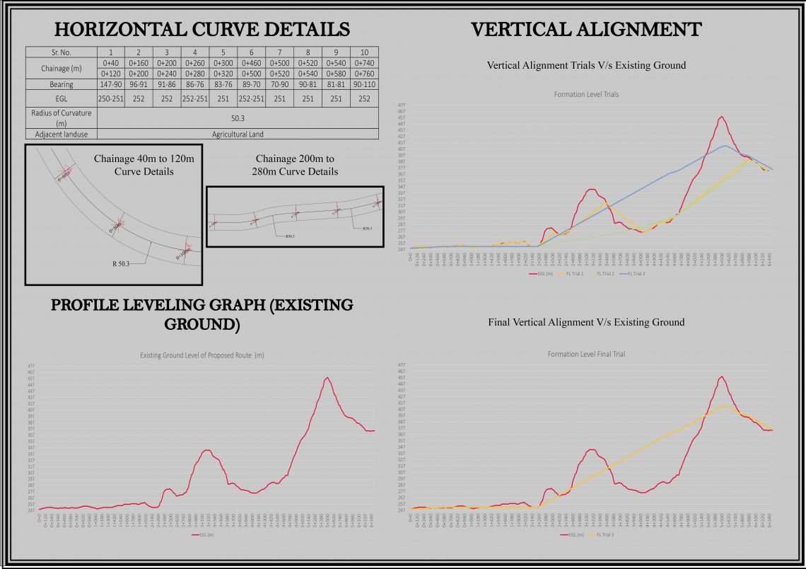
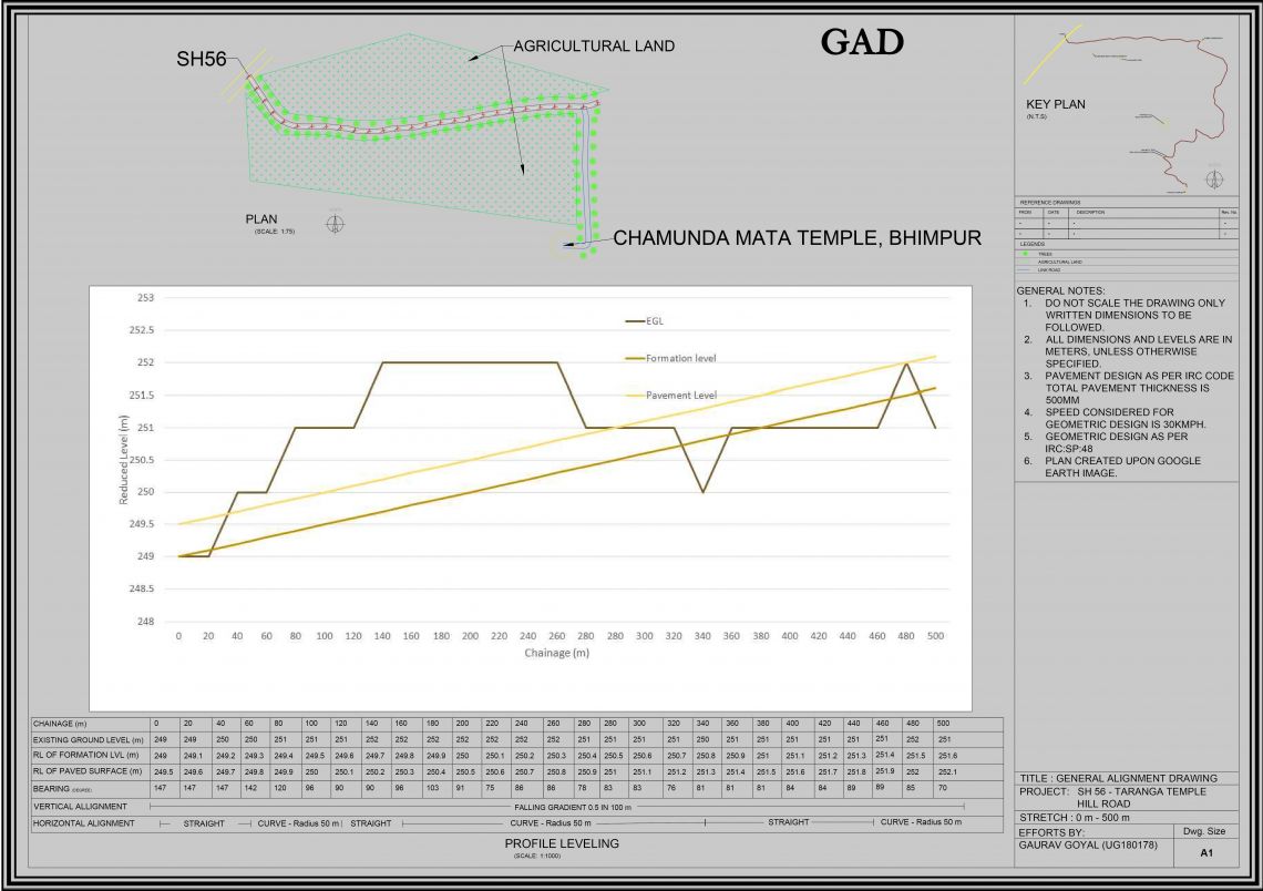
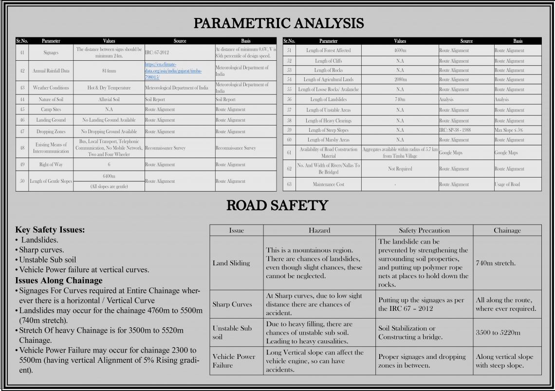
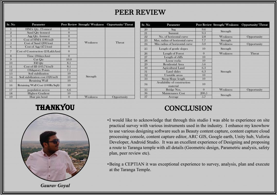
The experience in working in the studio enabled us to explore various type of survey. With this analytical know how we surveyed the existing route to Taranga Temple implying varieties of surveying method. It was a practical approach towards planning and sketch the geometric design of the route to TARANGA Temple with the definite available data. Performing a range of Test to apprehend the actual soil and material. Preparing, Planning and Designing a route with DEM model to Taranga Temple was excellent practical learning process for me.Download:- 1. Entire Portfolio (below attached is only a partofit.)2. Augmented-Reality:- Application,Baseimage