Chanakya Rajani

LA4010

Bridging the Gap

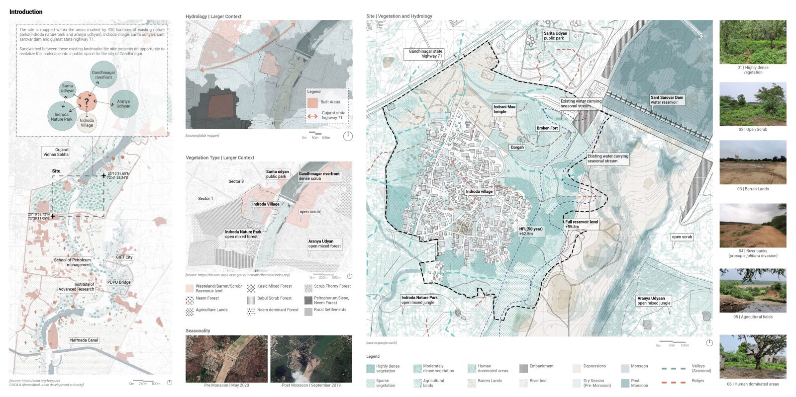
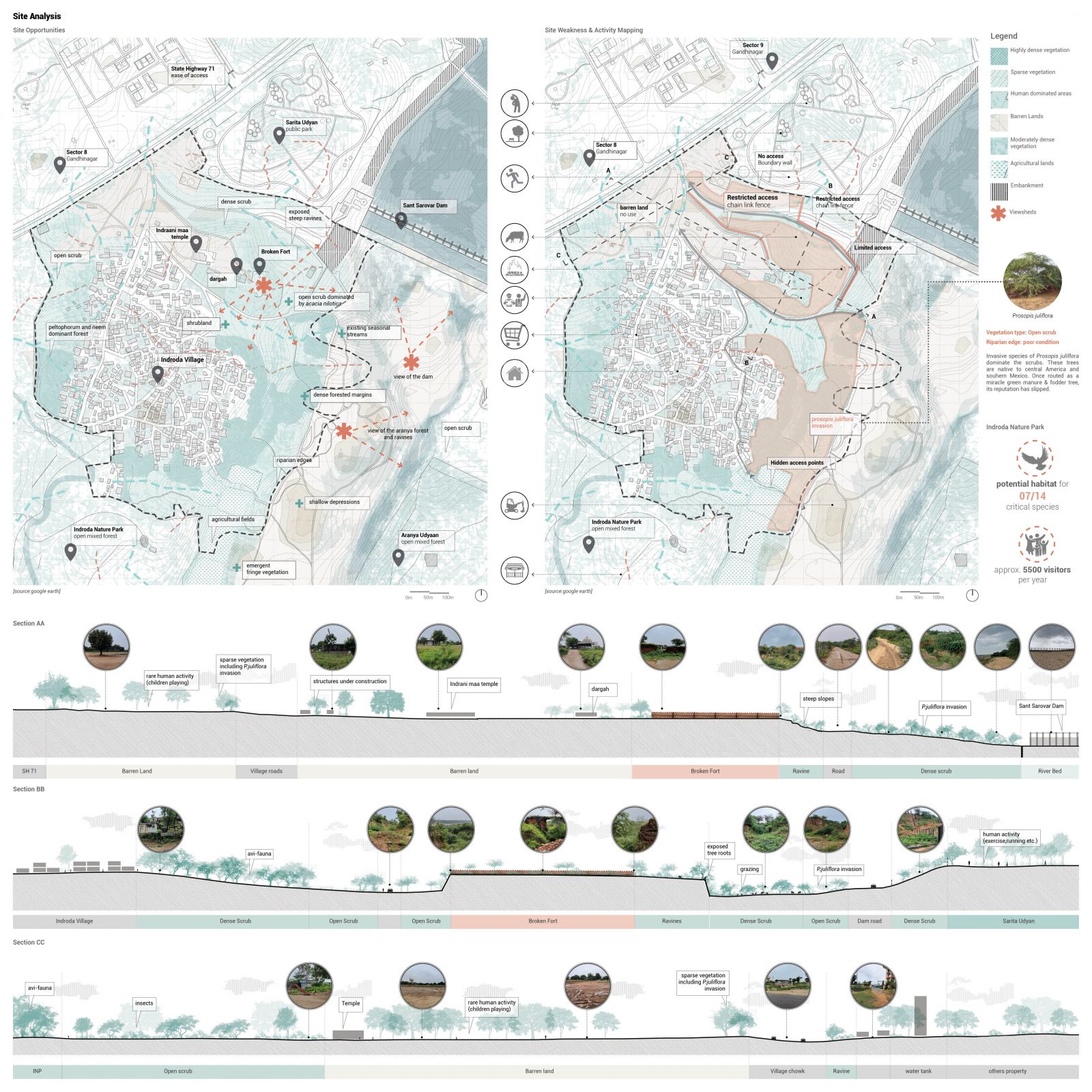
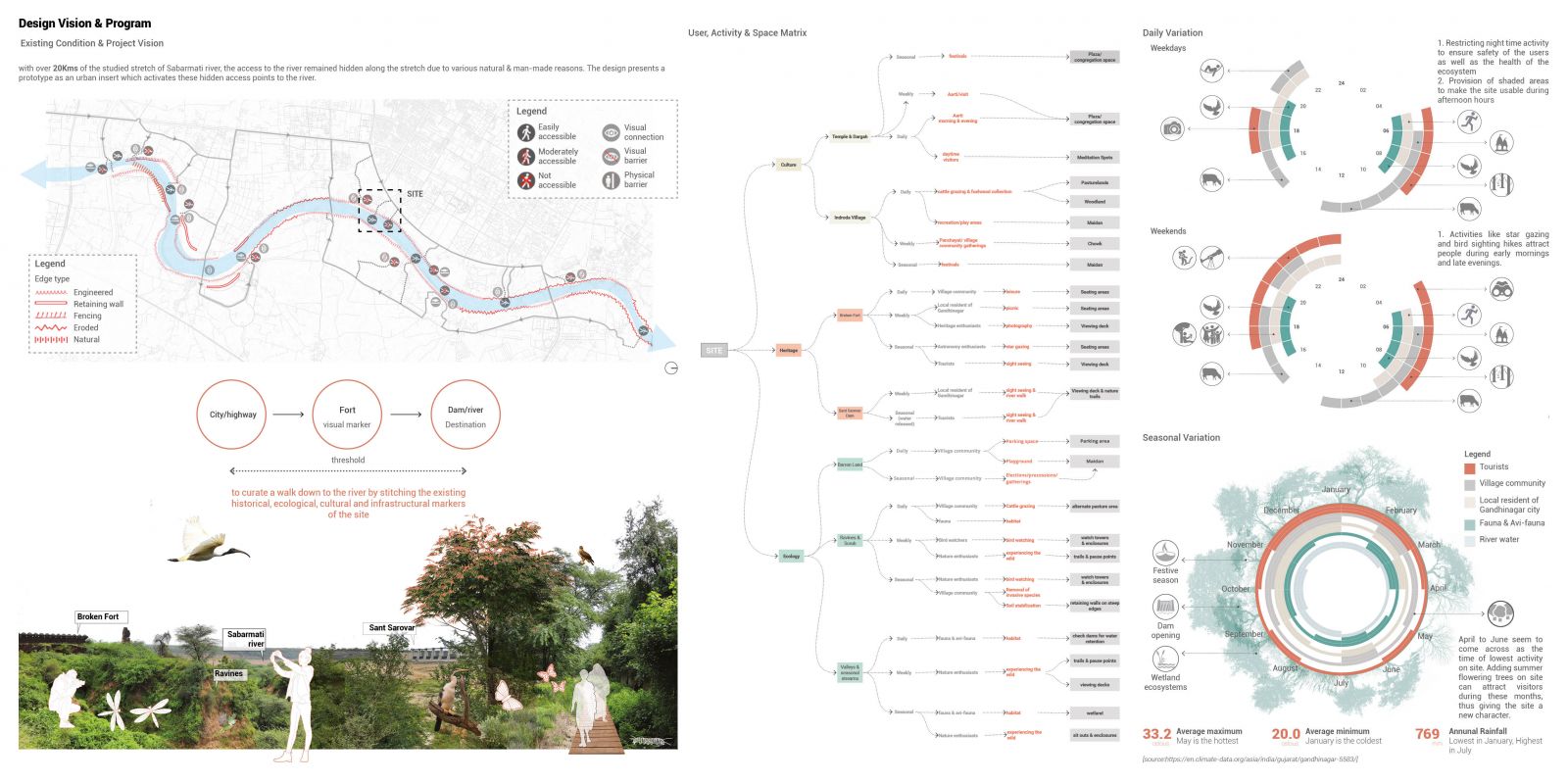
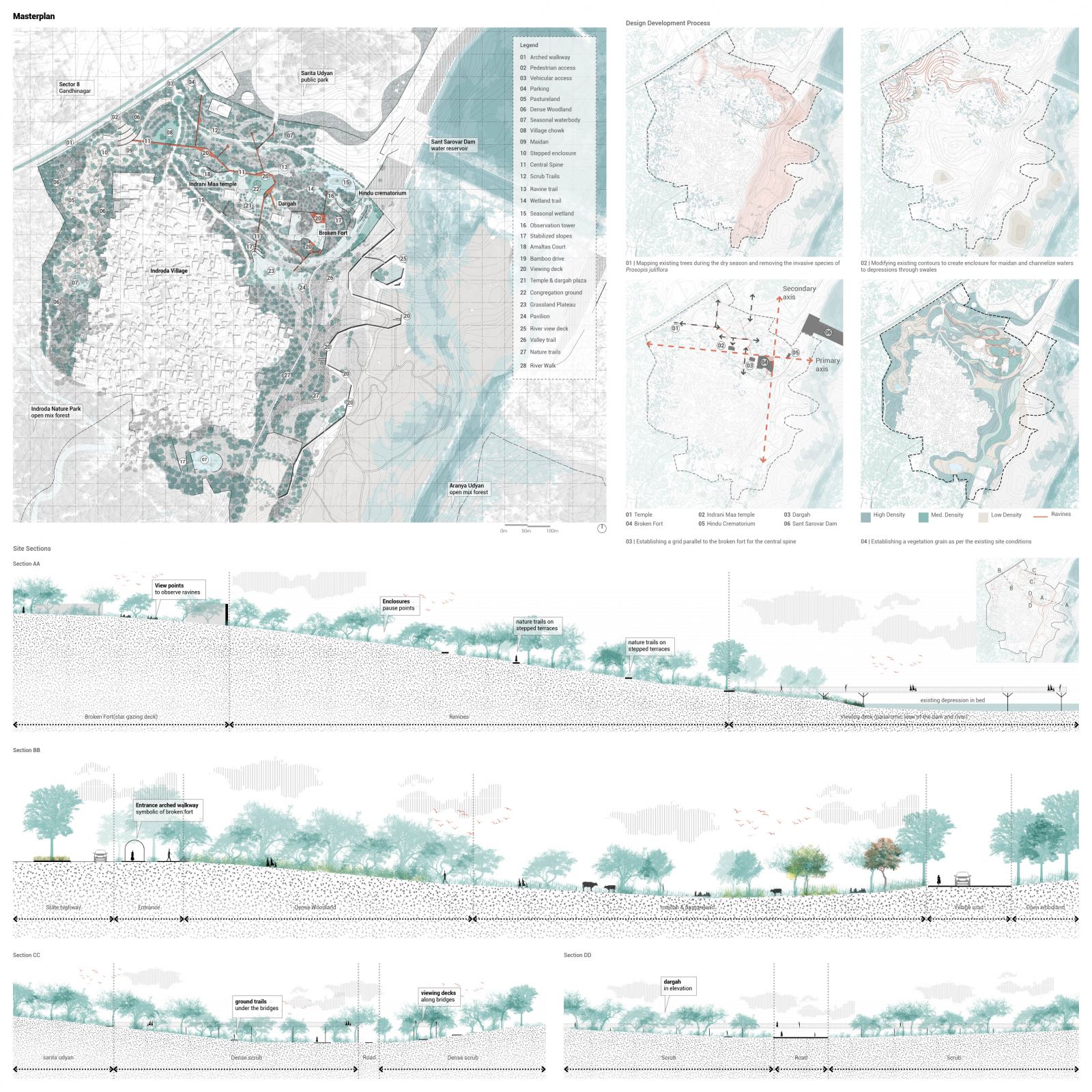
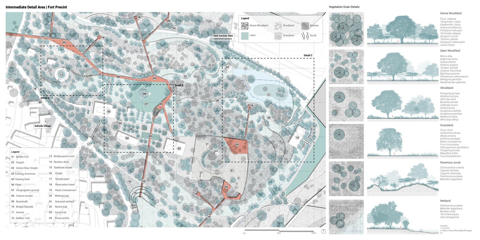
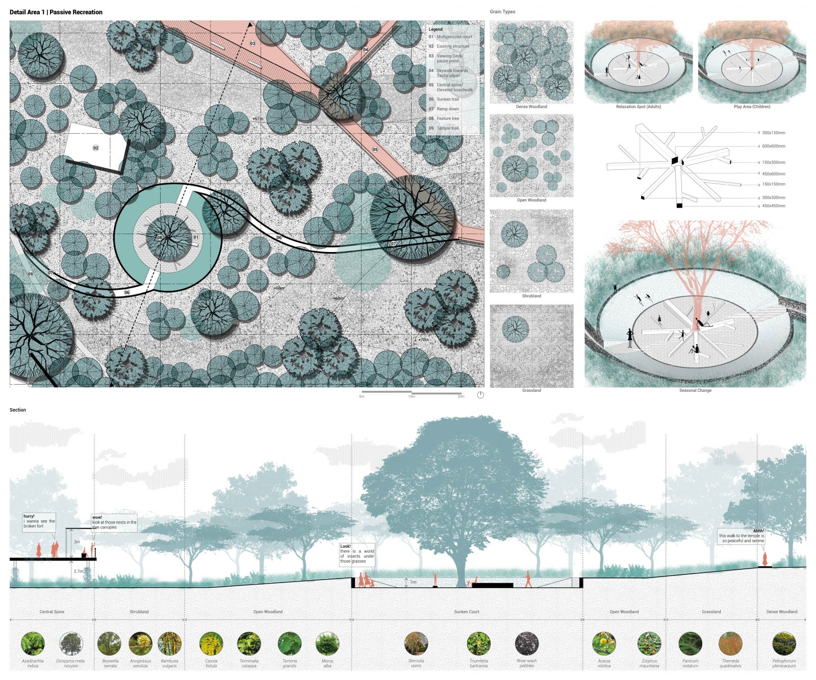
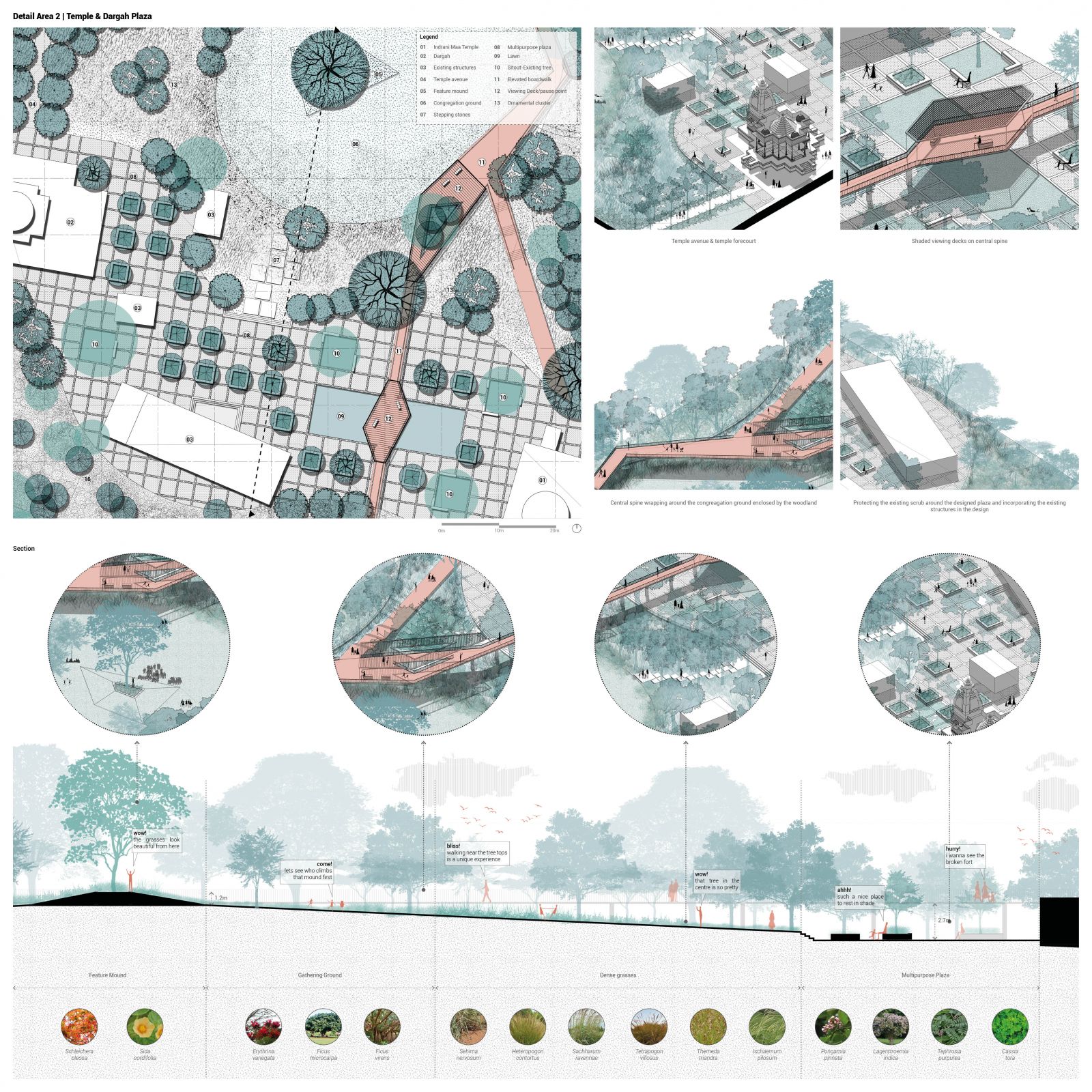
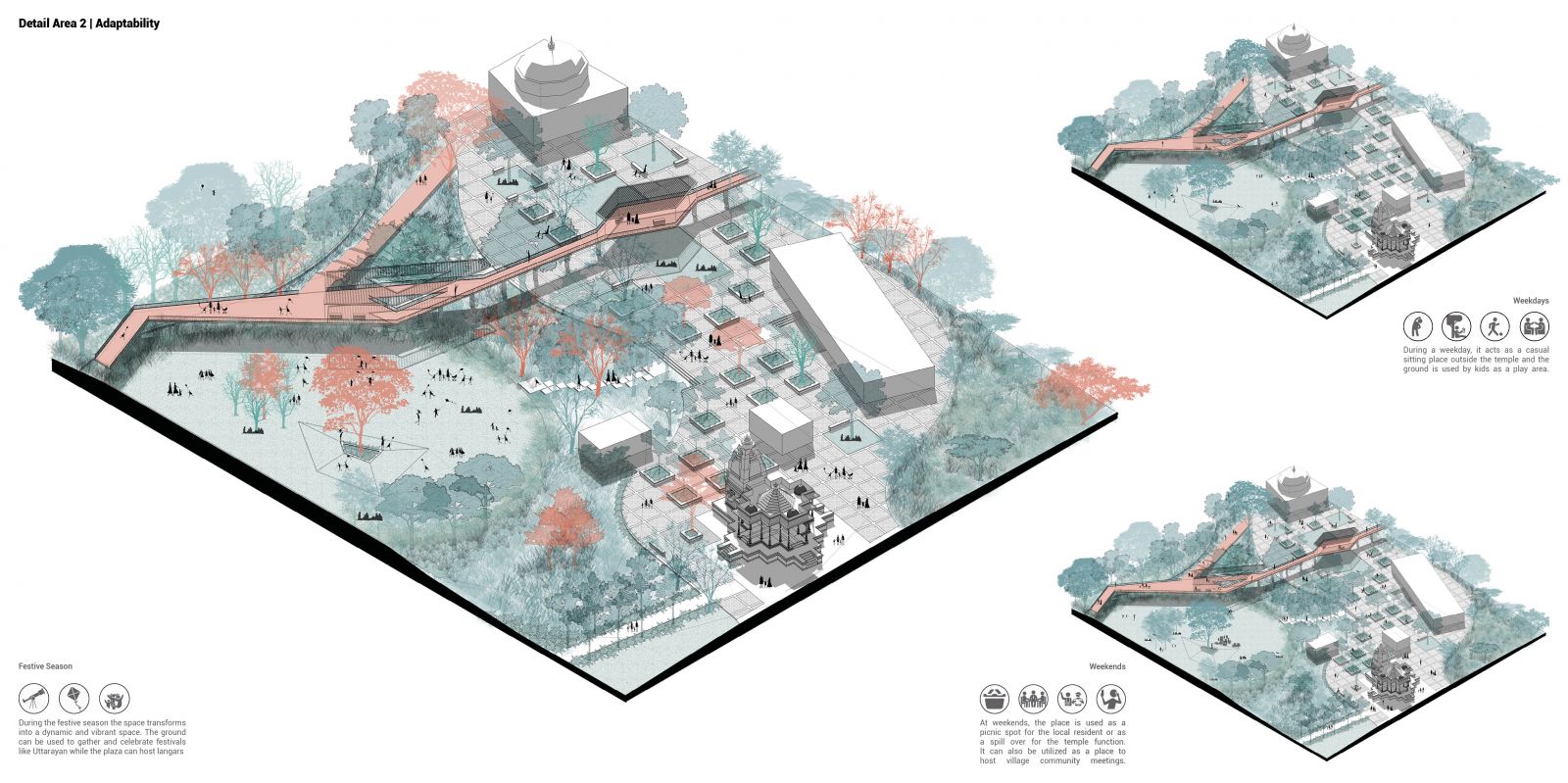
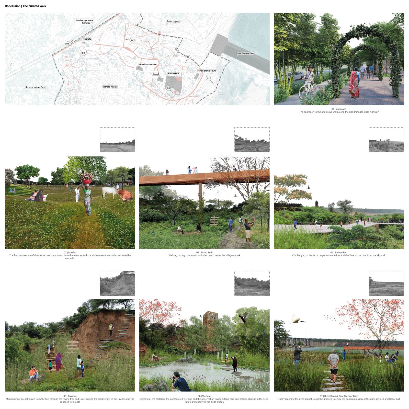
Driving past in numerous privately owned lands and seeing lackluster development along the river, one witnesses that the city of Gandhinagar has turned a blind eye towards the river. With over 20Kms of the studied stretch of Sabarmati River, one’s experience of a walk to the river is curtailed to nearest road or village either due to hidden access points, blocked viewsheds or invasive dense vegetation. The site presents the river at the shortest distance to the urban edge while offering a variety of experiences defined by the existing landmarks of Sant Sarovar Dam and Broken Fort. But the discontinuous nature of the site leads to a fragmented experience. The design is conceptualized as a prototype in form of an urban insert which activates these hidden access points to the river thereby allowing the public to experiencing all the historical, cultural and ecological components the river as a whole 

View Additional Work

Report Content

The site selected for the project was influenced by the first impression. Sandwiched between the existing nature parks, the site is marked by Indroda village, Sant Sarovar dam and Broken fort. The site presents the river in close proximity to the urban edge while offering a variety of experiences. The site displays character of a ravenous scrub surrounded by the open mixed forest character of Indroda Nature Park which was developed as result of ravine reclamation efforts. Indroda village being located in the recreational land use in the current masterplan hasn't witnessed any noticeable growth in the past two decades

The site is defined by the existing landmarks of Sant Sarovar Dam and broken fort. Also, it presents an opportunity to tap on to the existing footfall in the nearby nature parks. But the discontinuous nature of the site, hidden access points and blocked viewsheds lead to a fragmented experience thereby preventing the public from wanting to experience the river. The section shows the changing character of vegetation as one approaches the river bed from the highway. The river beds although densely vegetated have fallen prey to the invasion of P.Juliflora while the barren lands support towards the ridges support rare human activities

Owing to the discontinuous nature of the site, the project seeks to curate a wholesome experience by stitching together the historical, ecological, cultural and infrastructural markers of the site. To enhance the experiences on site, a matrix was formulated for the 4 major identified user groups, namely, Local citizen of Gandhinagar city, Village community, Tourist/history/nature enthusiasts, Fauna & avi-fauna. The inter relation of these user groups with the potential spaces on site was studied and a design program was generated ensuring an all-year-round active site

The masterplan essentially revolves around the elevated central spine around which all the experiences are created connecting the important existing natural & man-made markers of the site. The site along with village is enveloped by a dense woodland that ensures visual continuity from its surroundings. Different trails are created through different vegetation grains and connected in loops to the central spine through the observation towers

The selected detail area contains all historical, cultural and ecological aspects of the site. The masterplan primarily has 6 different vegetation grain types. The vegetation grains have been developed on the basis of the ground condition, slope and the spatial experience of the curated space

The passive recreation area is characterized by 4 vegetation grain types. Key feature of this designed are is a sunken pebble court that sits amidst an open woodland. The hidden enclosure is created as a quite zone for the villagers to relax or children to play. Being an off-shoot of the central spine it acts as interesting point of discovery for the tourist

The design is characterized by a multipurpose plaza that binds the temple and the dargah. The series of planters arranged in 3m x 3m grid are used as casual seating spaces while a congregation ground is created on the ridge top allowing maximum views. The elevated boardwalk wraps the ground and opens up views into the plaza on two viewing decks while it ensures continuity of the grassland on ground. The section highlights that the grasses allow maximum views from the elevated boardwalk and on ground as one approaches the Broken Fort. Also, the feature mound in the centre of the ground acts as a focal point during occasions and gatherings

Adaptability is a key feature of the design. The plaza acts as a multipurpose space at different times of the week and months to keep the space alive

The key feature of this area is a wetland that has been created by tapping on an existing seasonal valley. The ridge has been stabilized by creating terraces which are planted to give privacy to the crematorium. A viewing deck from the Broken Fort extends out into the ravines creating a unique experience for the user to the observe the biodiversity in these ravines from the canopies. The observation tower which ensures continuity between the wetland trail and the elevated central spine is also designed to function as a bird watch tower at multiple levels. Covered with hay and grasses the structure is camouflaged in the landscape presenting good opportunity for bird watching

A walk down to the Sabarmati