Soni Kashvi Sanjay

UR3005

''Quilt'': A landscape Mosaic

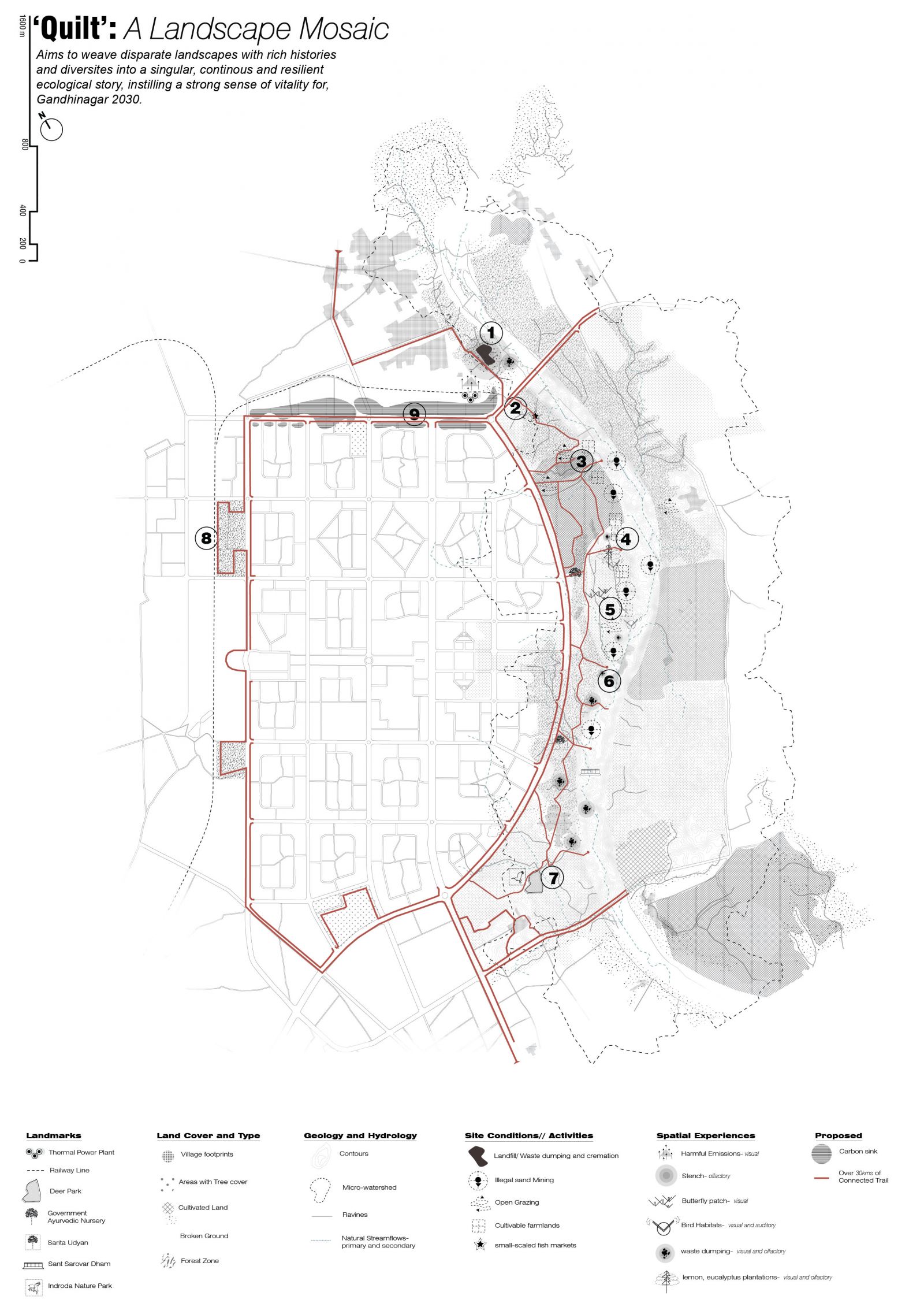
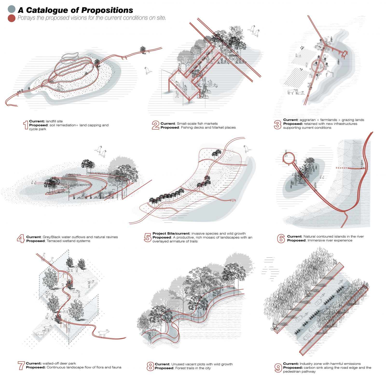
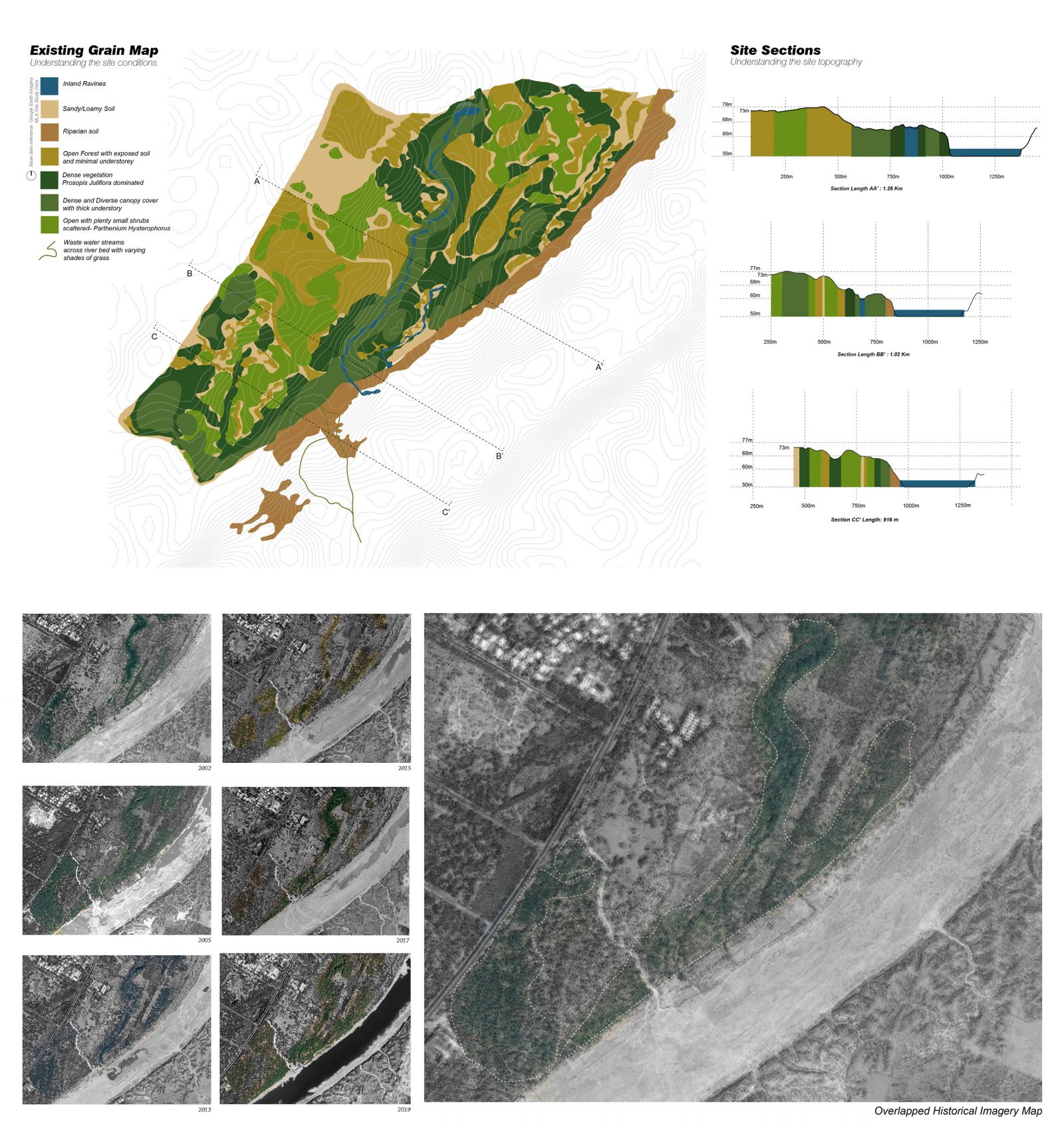
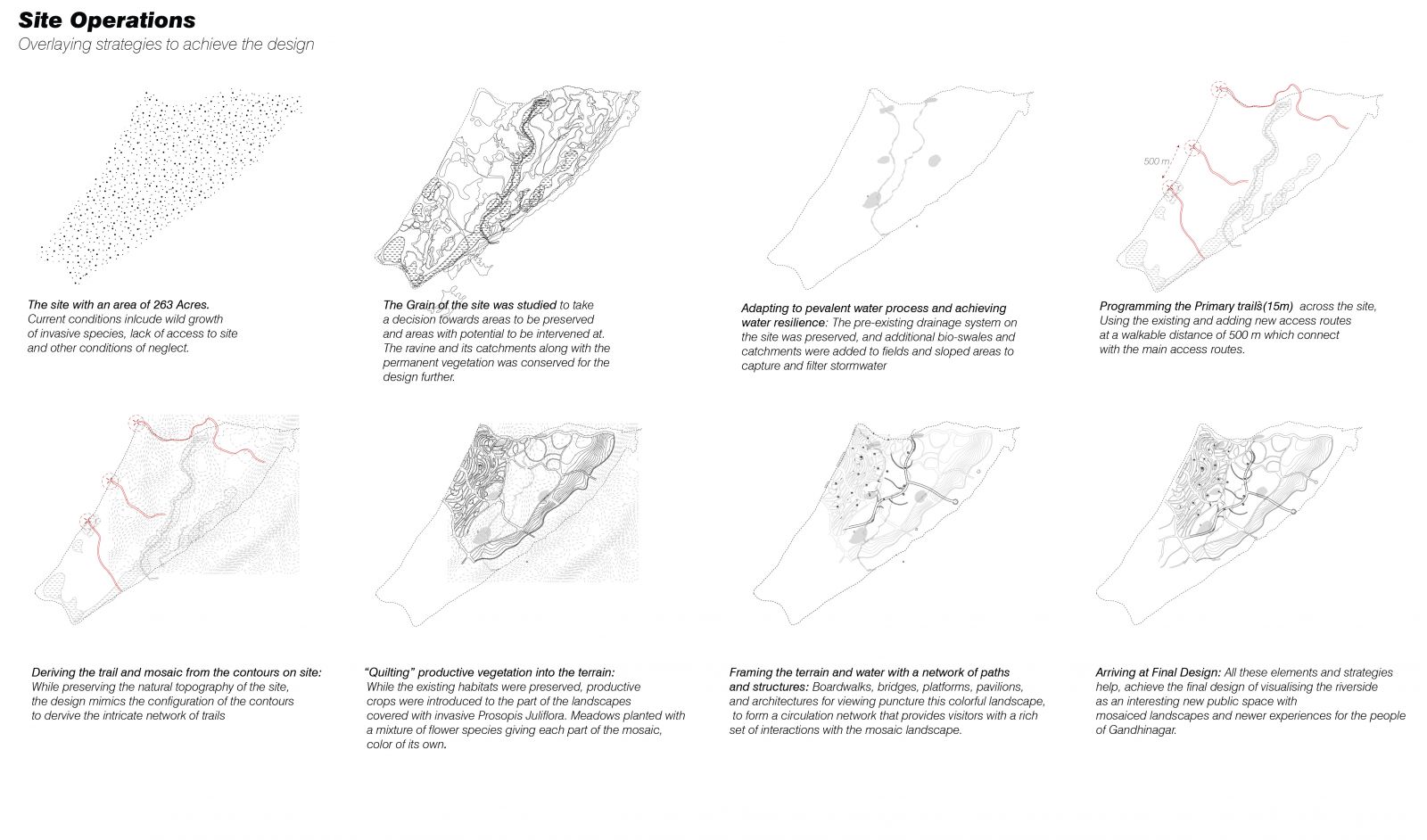
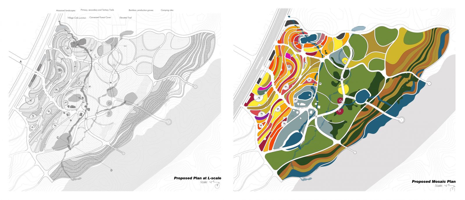
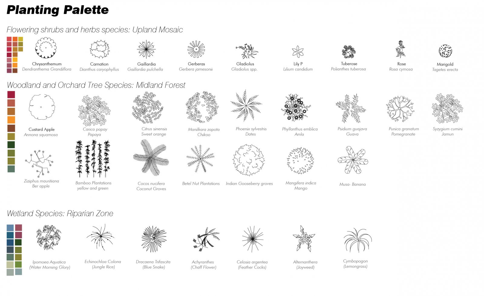
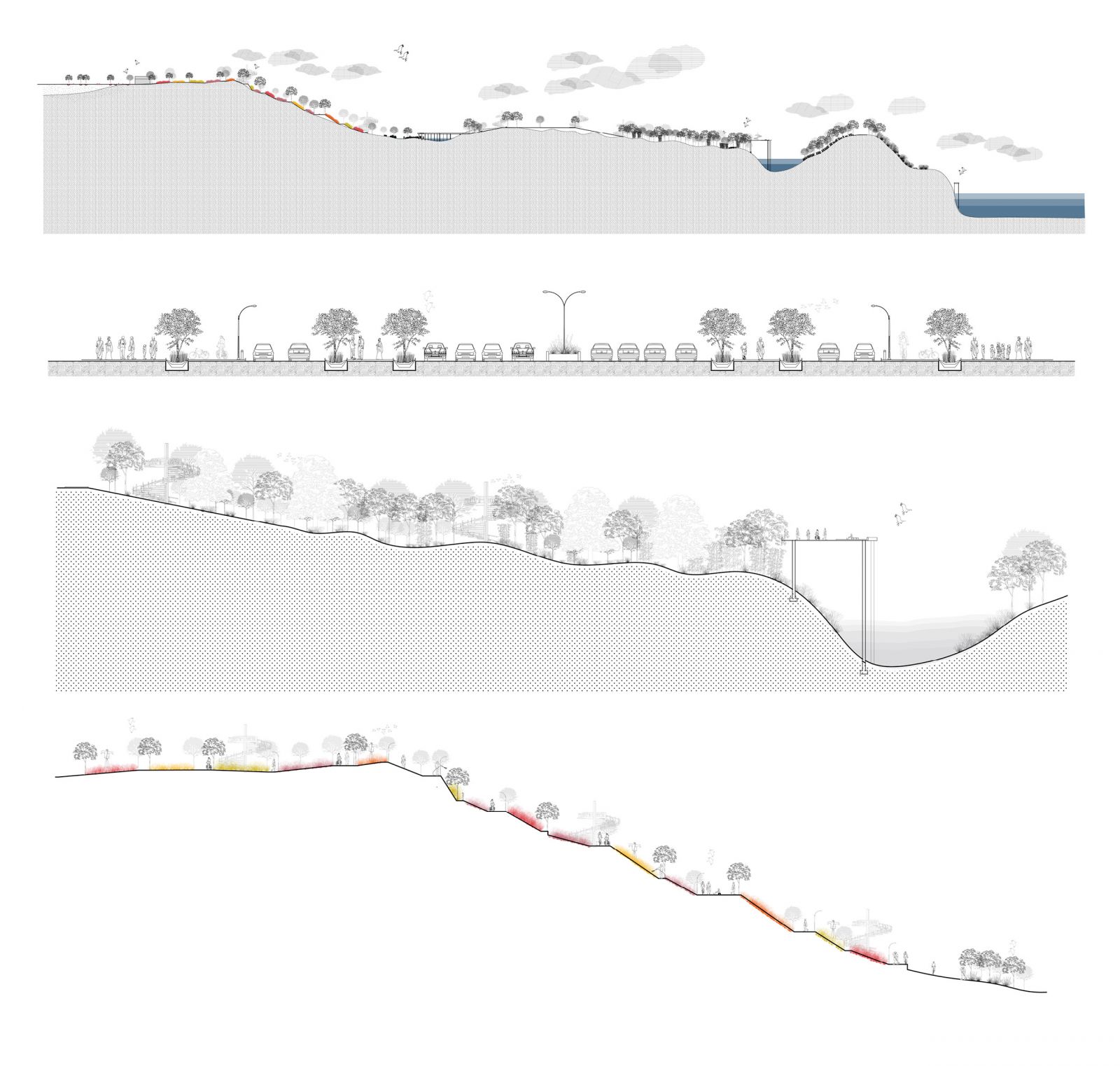
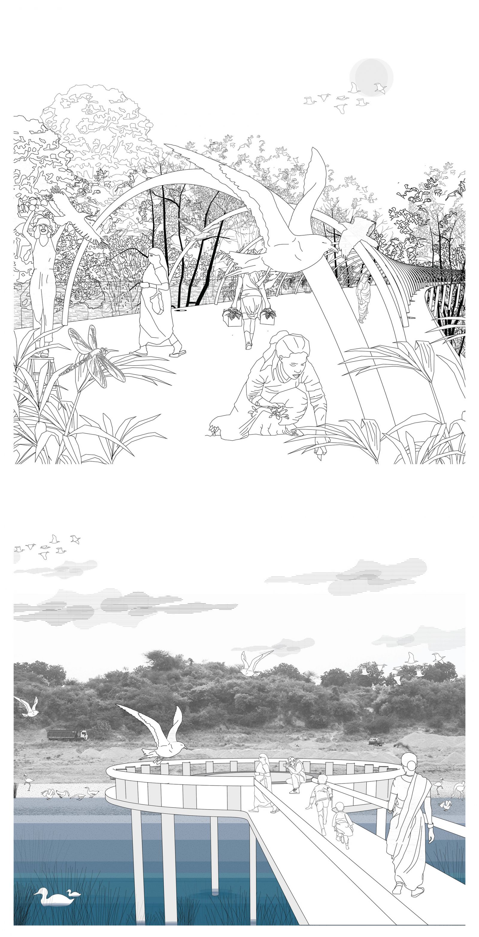
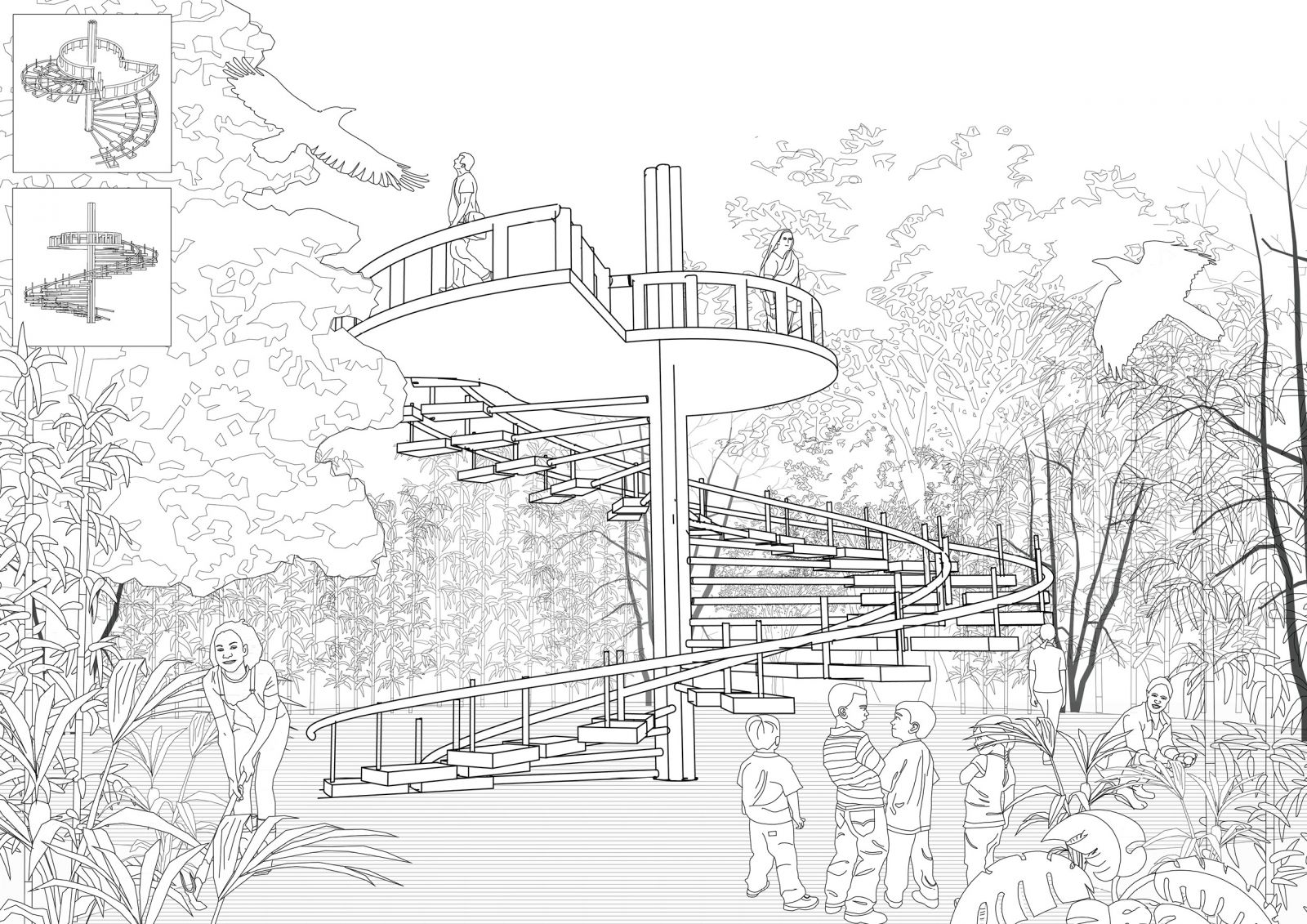
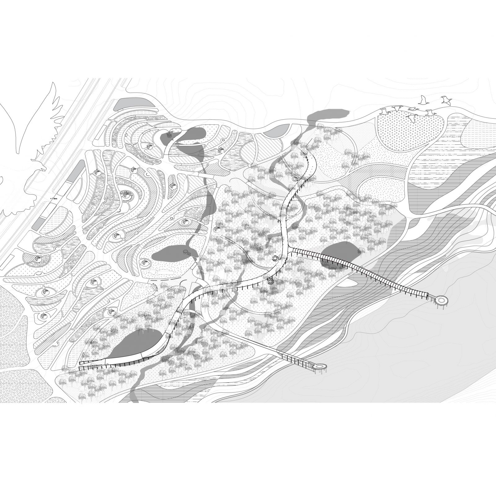
The project 'Quilt' envisions a cohesive and integrated public realm along Gandhinagar's riverside with a continuously connected pedestrian and bicycling network. It transforms one part of the quilt (a wasteland) into a dynamic Urban Forest Park. This design incorporates a variegated mosaic landscape, along with forests that are conserved and crisscrossed by pedestrian trail networks. An elevated trail is also designed with platforms, sitting areas, viewing decks to create visual and multi-sensory experiences. The elevated path passes through diverse zones offering different vantage points to view and also be in the canopy of dense forests. The landscape zones are programmed to give citizens places for foraging or walking through wildflowers, bamboo groves, or harvesting edible plants as well social programs such as camping sites. By integrating disparate elements of the riverside, it can achieve both a productive mosaic landscape and a bio-diverse corridor. The proposal does all this while preserving the natural and cultural patterns and processes of the site, linking it to the larger context of the entire river edge.

View Additional Work

Report Content

The river when seen as a citywide public space offers not only green open spaces but also very valuable natural spaces within the urban core, where ecosystem processes can be highly functional. The idea at the XL scale is to give new programs along the river and to create a network that not only weaves the landscape but is also a cycling and pedestrian network for people to traverse through these different landscapes. The map serves as a cartography of the current site conditions, its hydrology, and various activities happening on the site, along with the proposed programs. The parcels are developed to continuously stitch the place into a network of different kinds of landscapes like forests, villages, composting sites, landfills, parks, etc, while essentially quilting the terrain.

Starting from the landfill site which is proposed as a cycle park, one goes through the trail connecting to existing fish markets and fishing decks, the contoured landscapes then enter the village grain and through while also having a way to the terraced wetland systems. One then passes through the project site, explained further to enjoy the rest of stitched landscapes in a continuous trail. The red line depicted in the catalog portrays the 9 different ways one will traverse through this connected trail.

I started by looking at the existing mosaic of the landscape grain present on site. This grain map and sections depict the different types of these grains already juxtaposed to form a mosaic, but a mosaic which is not enough productive and fine-grained. The historical imagery of the site ranging from over 20 years ago was studied to finally identify the dense vegetation covers to conserve, persistent ravines through the site to preserve and finally the open land, and sparse vegetation covers with scrubs which pose an opportunity for instilling new, richer, denser, mosaic.

The design strategy is primarily quilting the terrain and is implemented by the following four strategies, namely 1.Preservation of the landscape’s assets, 2. “Quilting” productive vegetation into the terrain, 3.Adapting the water processes and water resilience and lastly, Framing the terrain and water with a network of paths and structures

The proposed plan at the L scale brings forth this idea of essentially quilting the existing landscapes with the programmed landscapes to create consumptive, multi-functional, and productive land uses alleviating the rich palette of bio-diversity and enabling a continuous flow of fauna and flora through and beyond the site. Different zones support and cultivate different programs on the site, apart from the weave of trails, and punctures of social spaces, there are zones for camping, recreation, and other larger extents connected to the site that have been envisioned as parts for the future replication of the concept further. The proposed mosaic plan builds on the idea of this mosaic by further detailing the planting palette for the colorful and diverse grain. The species and vegetation are categorized based on the colors and functions applicable to the site and different programs.

The planting palette for the mosaic and other parts, collates and depicts the different types of species for each zone as a part of the design.

The long section(top) cuts through the entire site and its various zones of mosaic, trails and pathways, several catchments and also the elevated trail which traverses across the dense midland forest, and finally to the stepped riparian edge. The second section of J-road, with a ROW OF 100m is re-configured, giving the due street space to pedestrians through wider footpaths, which also serve as access points to the site. The third section, zoom-ins onto the thick forest and its various complexities. The elevated trail, piercing these conserved woodlands, is an experience of its own, serving newer vantage points to celebrate the cultural and natural history of the site. And finally, the last section cuts through the terraced and quilted terrain, showing the trails lined with colorful, flowering species, opening opportunities to seamlessly walk or cycle through the network.

Being on the Elevated Trail Branch which passes through the woodlands and a view from the deck over the river edge, overlooking the other bank

View showing the Architectural Insert, its clearing, and the activities around The architecture, serving as a viewing insert is imagined to be assembled and constructed on-site, using the locally grown Bamboo, thus also generating employment and instilling a deeper sense of association to the forest park.

The design incorporates a variegated mosaic landscape, along with forests that are conserved and crisscrossed by pedestrian trail networks. An elevated trail is also designed with platforms, sitting areas, viewing decks to create visual and multi-sensory experiences. The elevated path passes through diverse zones offering different vantage points to view and also be in the canopy of dense forests. The landscape zones are programmed to give citizens places for foraging or to walk through wildflowers, bamboo groves, or harvest edible plants as well as social programs such as camping sites. By integrating disparate elements of the riverside, it can achieve both a productive mosaic landscape and a bio-diverse corridor. The proposal does all this while preserving the natural and cultural patterns and processes of the site, linking it to the larger context of the entire river edge.