Hariyali Gajera

UR3005

Waterful: Slow, Spread & Sink

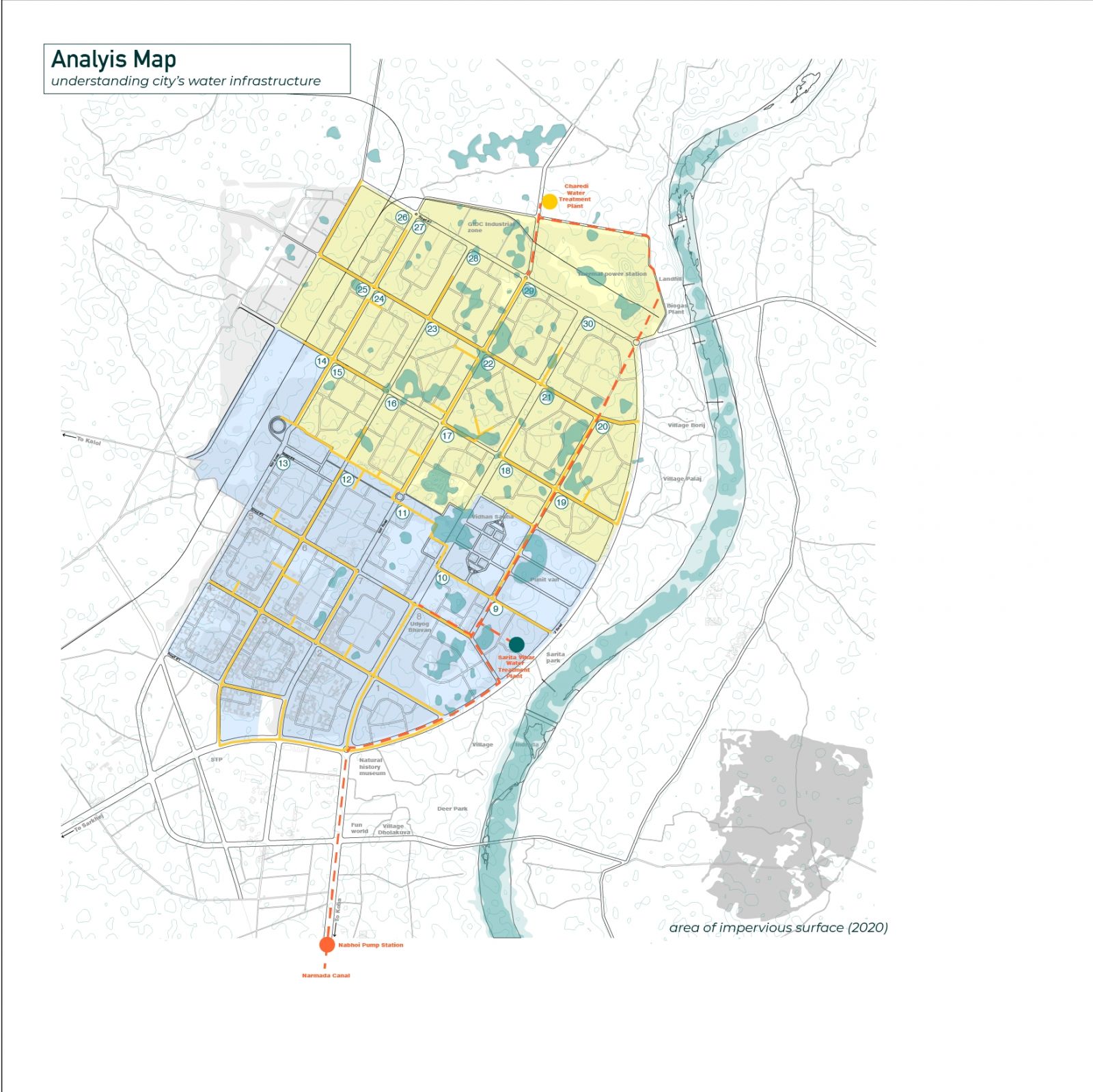
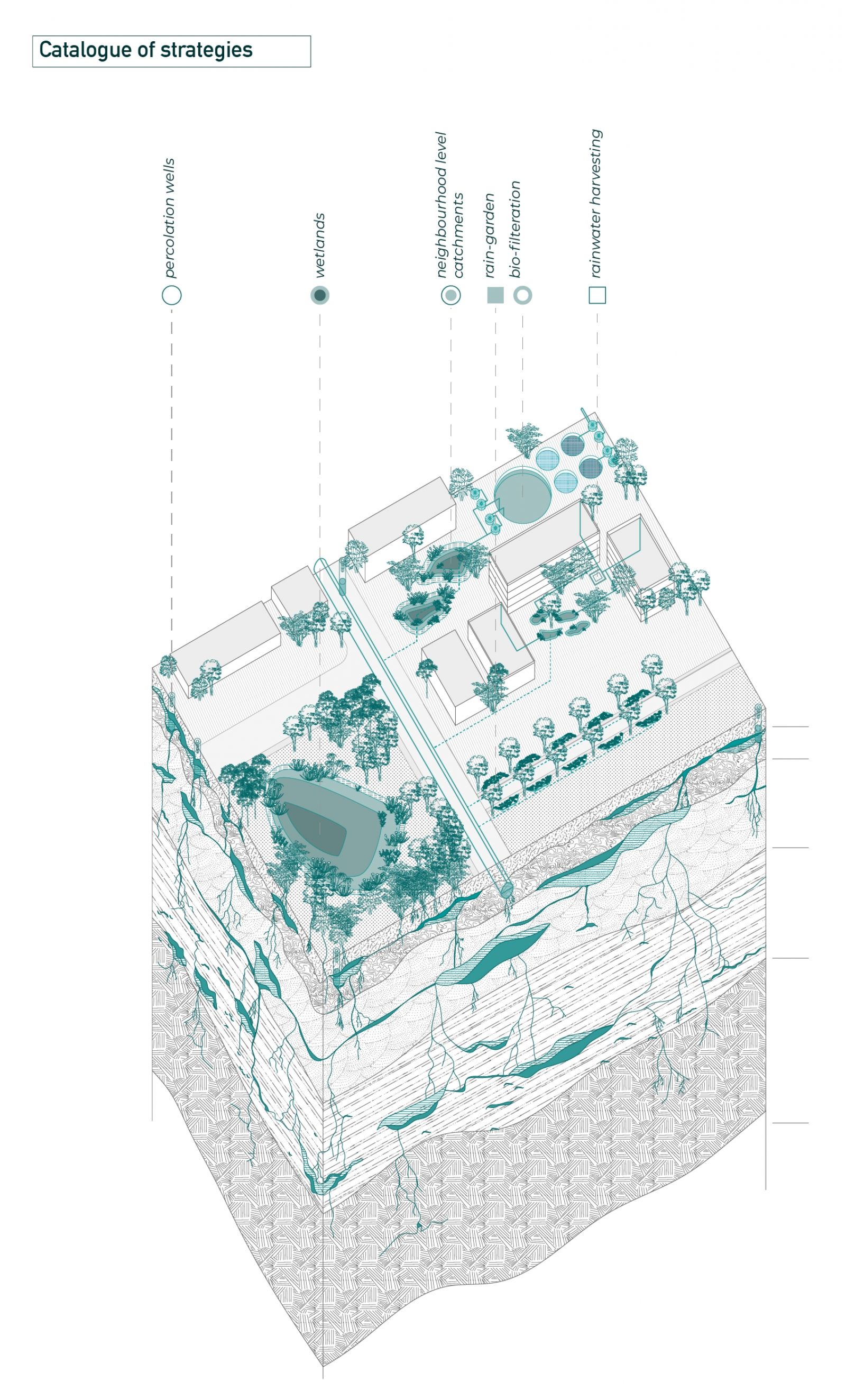
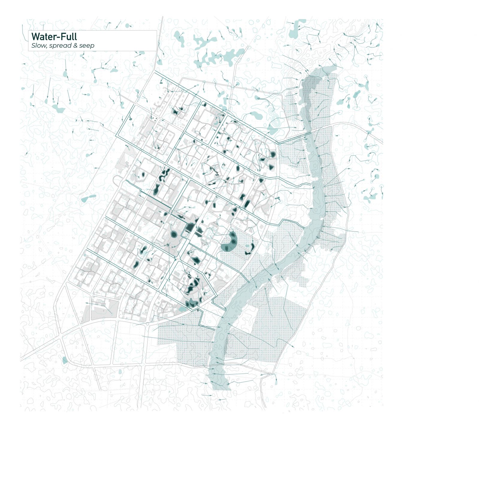
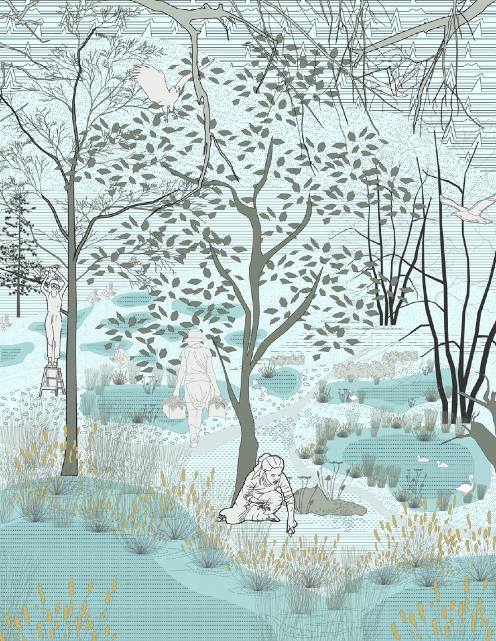
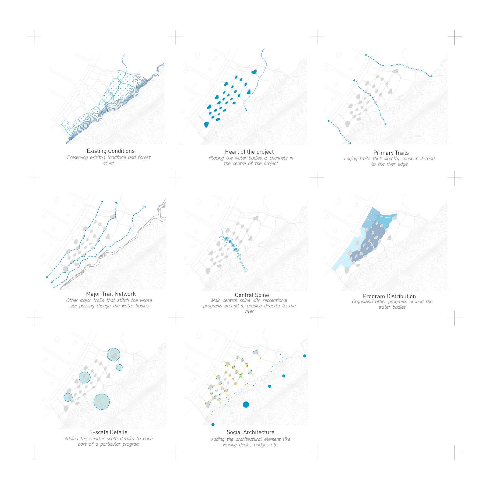
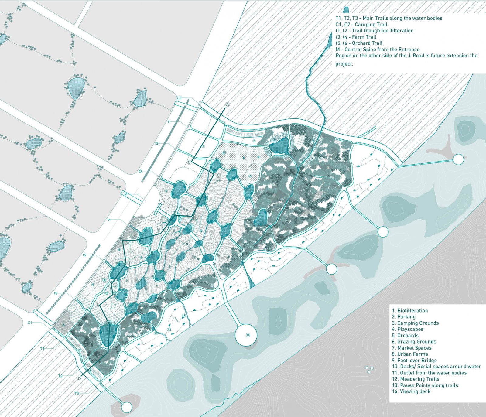
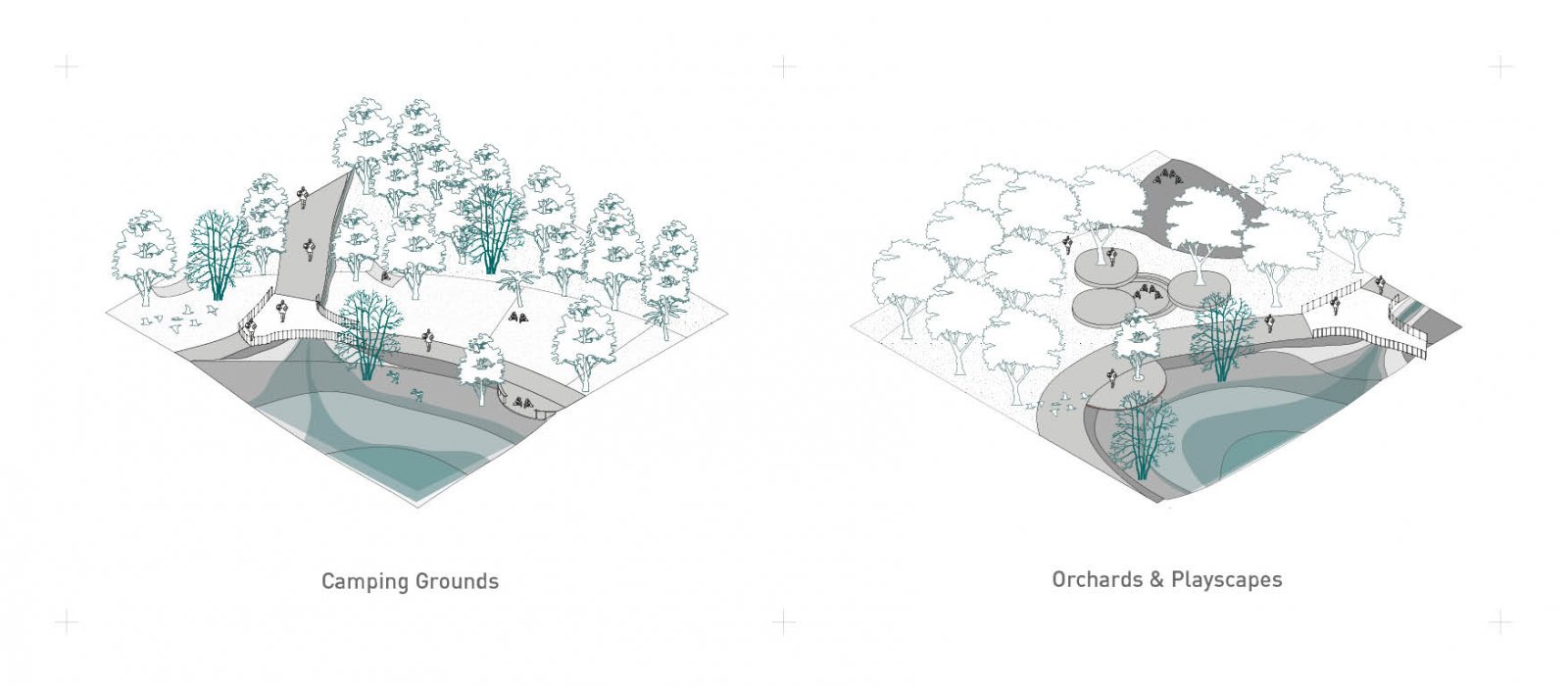
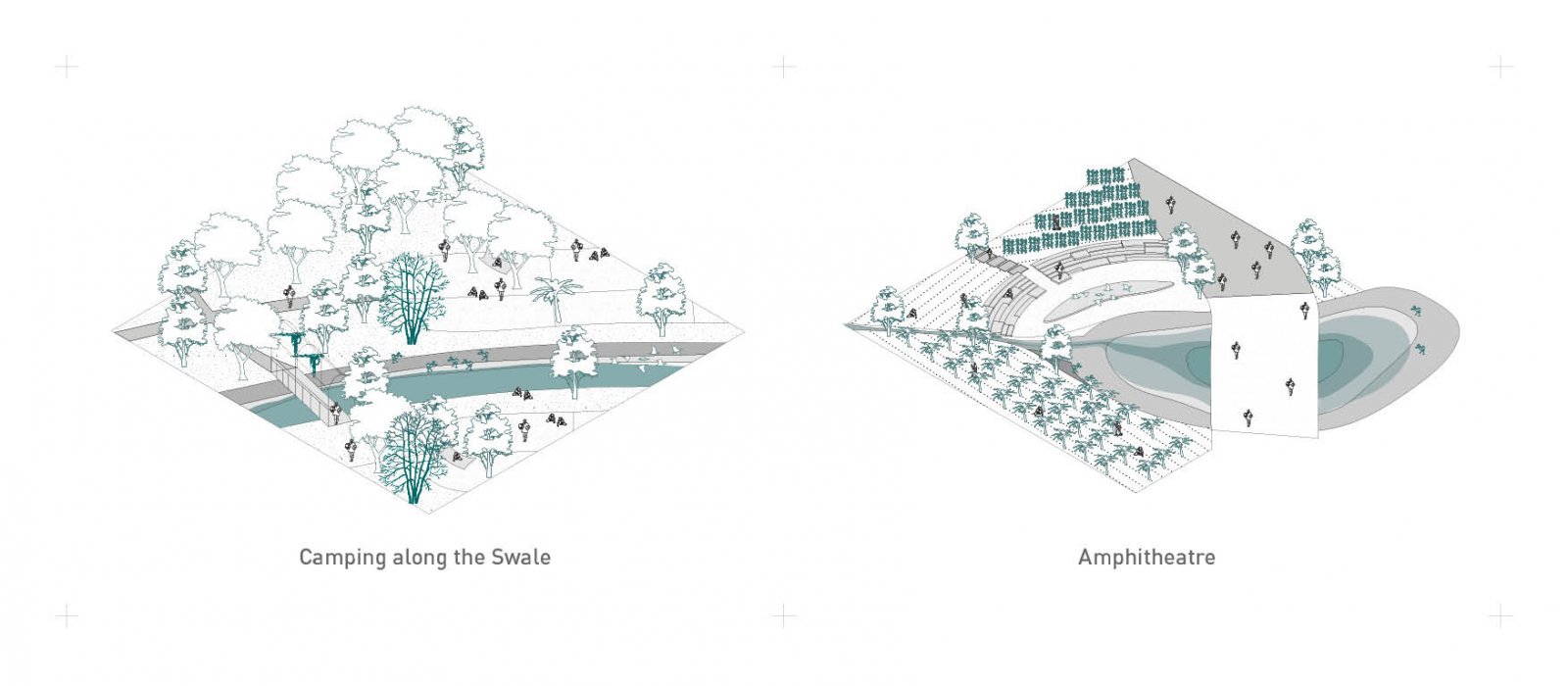
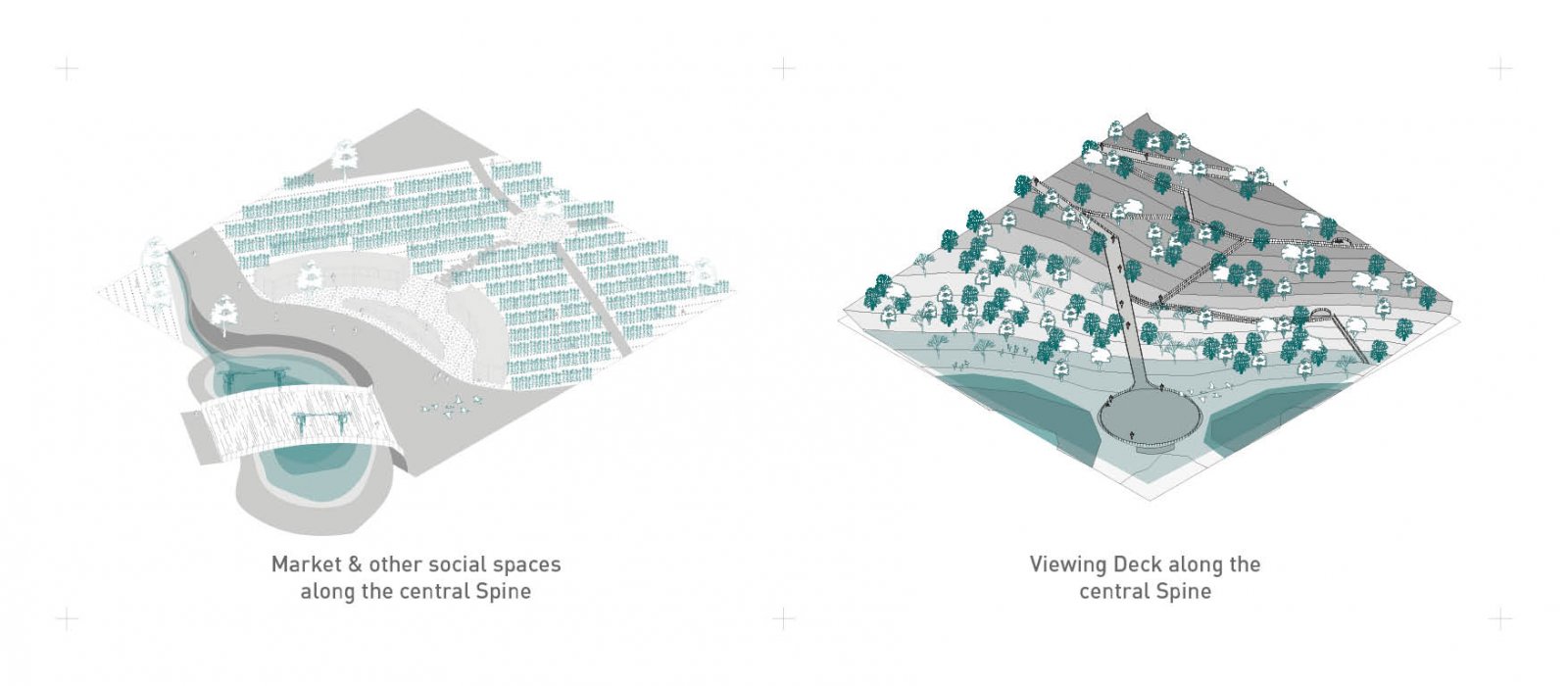
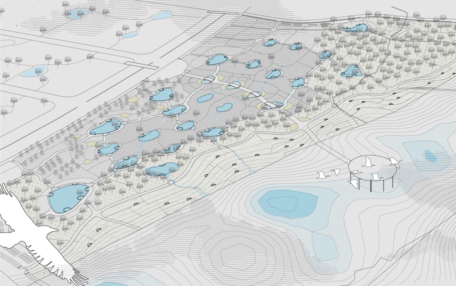
Project "Water-full" at Gandhinagar city, aims to apply various strategies at the city level to maximize the infiltration of water and recharge groundwater basins. The strategies include street re-design with swales, catchments, and percolation wells on larger lots. The series of strategies will allow for water to slow, spread, and sink. The same idea is demonstrated and detailed at the main site along the Sabarmati river. There will be a series of connected wetland systems that will clean the city's greywater and stormwater and allow it to percolate into the ground before it runs off into the river. It will also give Gandhinagar residents a productive public space with programs nestled around water and connected through a network of trails. Alongside, making water visible on the site it will naturally become a habitat for bio-diversity. It is expected that the project will increase the groundwater table and facilitate osmosis so that it can continuously feed into the river.

View Additional Work

Report Content

To begin with, the ground water level of the city is going down by 20m each decade With the Sabarmati river dried up, city has been depending on Narnada Canal for its daily need. Apart from the negligence towards the water as a resource, riverside and river has been ignored by the city over a period of time. As a result of this negligence, the river acts as a back of the city majorly used for dumping religious waste, sand mining, and releasing black / grey water. Apart from being dead in terms activity & human involvement, the flood plain is infested with the wild and invasive prosopis julifora, making the site poor in terms of biodiversity.

Various water retaining strategies like street side sain gardens percolation well, bio-filleration system etc. have been understood and strategically located in the city depending upon the site conditions

After studying the contour map of the city and overlaying it with the layer of open-spaces and and existing built fabric,  naturally forming, catchments have been proposed to be revived and retained. The other low-lying areas where a catchment condition is not feasible is supposed to be equipped with percolation / recharge wells that will fuel up the infilteration of water in the ground.

Concept Sketch illustrating the experience of the project.

Coming to the main site of intervention, the proposal here attempts to create a series of interconnected wetland system that will hold the rainwater and treated stormwater and treated grey water. Grey water & stormwater or brought to the site via city's existing laid network of drains & is treated on site via the process of trio-filteration in a series & a hierarchy of treatment ponds before releasing them into soft ponds  The  soft ponds are all connected, eventually draining its overflow into another pond (channelized by  modified contours), which eventually runs off into an artificially created swale (parallel to a natural and adjcanent swale) which opens up in the river. This wet system of catchments or the wetland park is the heart of  the proposal programmatically as well as  geometrically. Artificial modification of  contour is applied in order to achieve the desired flow of the water the water garden is then complemented by its surrounding alloted programs like a play area

The majority of the assigned programs make up the upland, with the heart of the project i.e, the water garden being the middle land. The lower land offers existing swale a few  natural catchments and a dramatic slope that terminating into the river. Hence the low land majorly is occupied with meandering trouts and pause points for their users to absorb the site experience

Experiences of different programs around the water bodies

Experiences of different programs around the water bodies

Experiences of different programs around the water bodies

Bird's eye view of the proposal