Your browser is out-of-date!
For a richer surfing experience on our website, please update your browser. Update my browser now!
For a richer surfing experience on our website, please update your browser. Update my browser now!
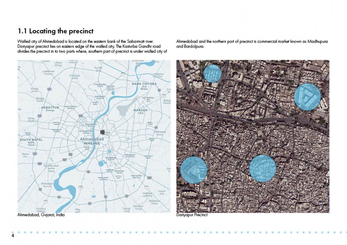
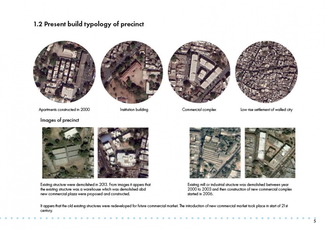
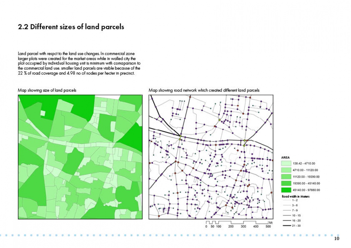
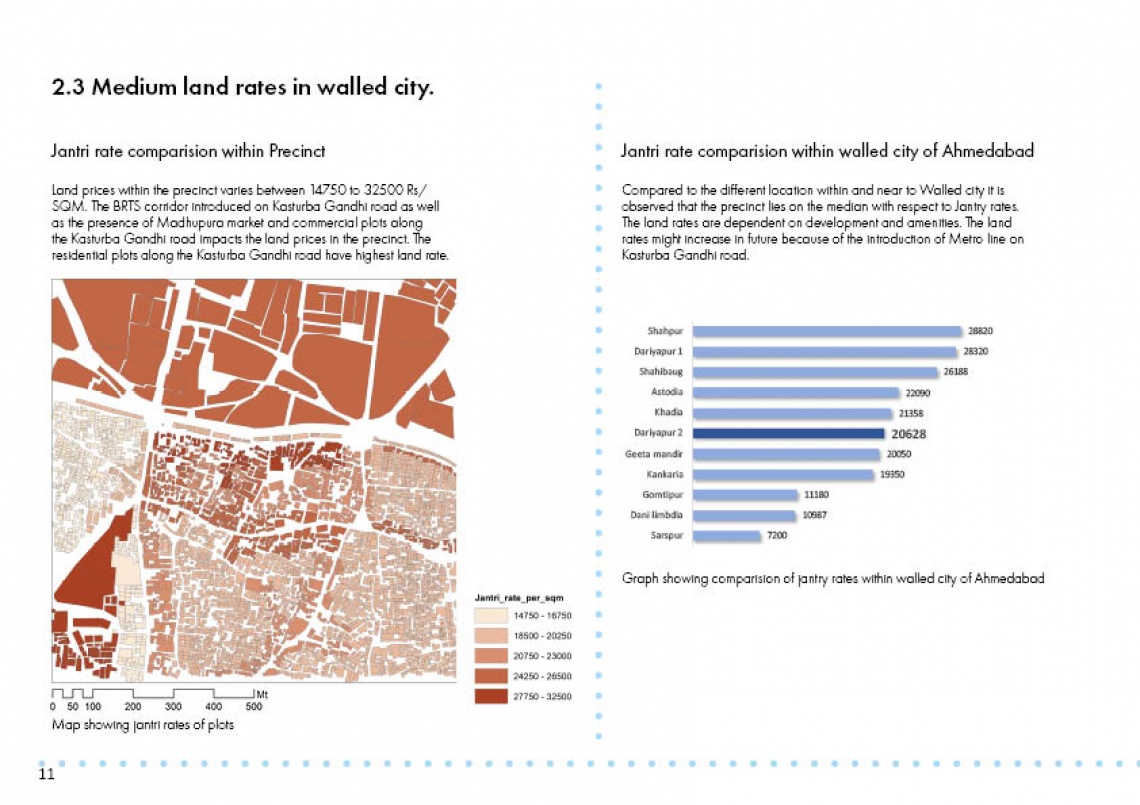
Through the evolution of the Ahmedabad Dariyapur has gone through changing spatial pattern and the changing land and building use. The affordability affects the choices of living. The income of the households is the deciding factor for the housing choices. The size if the housing unit and the housing typology is depended on the spending capacity of the individual person. The living choices of the people is also affected by the location and form of the area. The physical form of the city consists of street pattern, building sizes shape architecture population density and pattern of residential industrial commercial uses. The urban form of the precinct can be understood in terms of internal form of precinct. The internal form refers to the structure of the precinct which can be explained through land use, density, accessibility etc. This internal form can influence the land use of the region. The availability of the different land use may determine the housing rates and the type of the houses like detached units, row houses, apartments and chawls. The Dariyapur ward is fragmented in to two parts by Kasturba Gandhi road. The one fragment of the precinct represents the commercial market and other represent residential mixed with commercial building use. Thus, the attempt is made to establish the link between land use pattern of precinct and living choices of people of Dariyapur.