Your browser is out-of-date!
For a richer surfing experience on our website, please update your browser. Update my browser now!
For a richer surfing experience on our website, please update your browser. Update my browser now!
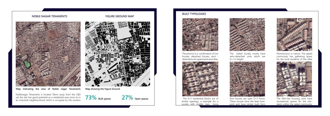
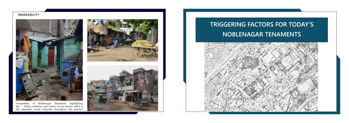
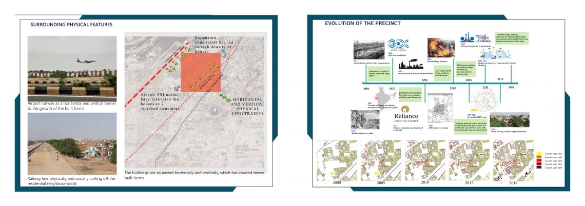
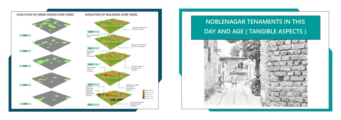
A city is a large fabric of urban forms and infrastructure which functions with extensive systems. The interaction is among the people, business and the ruling body. Based on multiple factors every city varies from each other. On the banks of river Sabarmati lies the city of Ahmedabad, former capital of Gujarat, India. The city is physically divided into two regions by the river. The old city lies on the east and the new city lies on the west, creates a total contrast in the city. To understand the variations, the city is studied at different layers, analyzing various parameters specified by the foundation studio of Faculty of Planning at CEPT University. An area of 1km by 1km is allotted to each student throughout the city of Ahmedabad to do the analytical study for “Understanding the City” studio. This portfolio is a detailed study of the precinct which lies in the neighborhood of Sardar Vallabhai International Airport at Noblenagar Tenaments near Naroda, an urban fringe of the city. The quantitative and qualitative analysis is done by surveying the local communities, mapping through an analytical software - Geographic Information System (GIS), documenting the precinct and literature studies. The studio exercises have helped to analyze the complexity of urban fabric and identify the issues through evidence-based approaches. The precinct so identified is a landlocked residential area between the airport runway and the railway line cutting the precinct is an industrial neighborhood. The evolution of the precinct is strongly influenced by the Gujarat Industrial Development Corporation (GIDC) at Naroda industrial area. Due to the employment potential of the surroundings, the occupants of the row houses in the chawls are the industry workers along with the Pakistanis who settled here post partition. The floor space index (FSI) is restricted and the scope of expansion of the buildings is nil as the precinct has high density of row houses. The chances of expansion of living spaces is unfeasible for the residents which has made them extend their homes to streets. The low-income group residents and the row houses in the precinct bring a strong character to the Noblenagar Tenaments which is the focus of the portfolio.