Your browser is out-of-date!
For a richer surfing experience on our website, please update your browser. Update my browser now!
For a richer surfing experience on our website, please update your browser. Update my browser now!
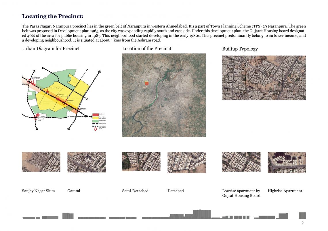
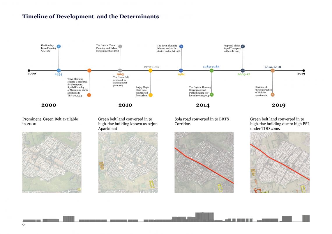
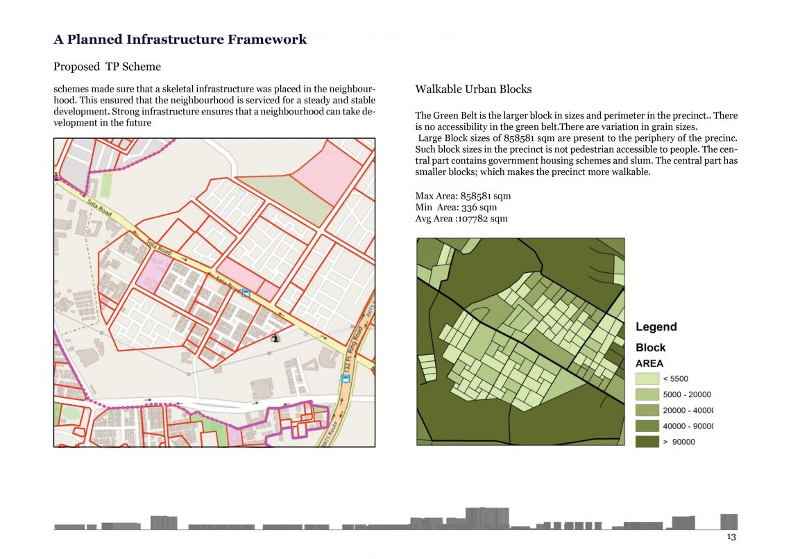
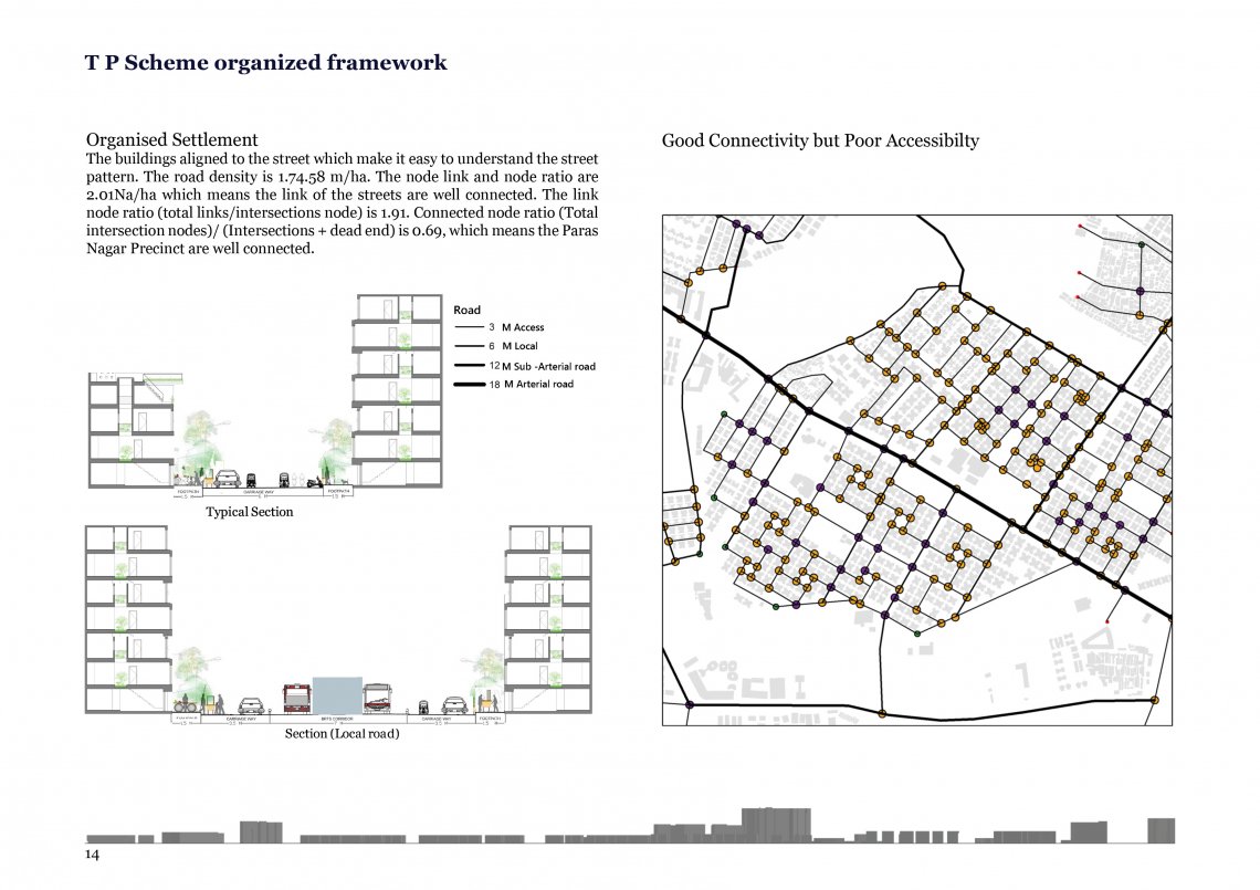
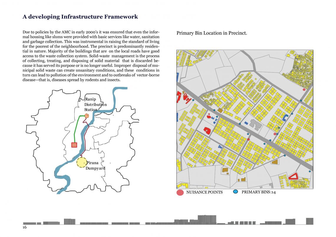
A city can be termed as layers of functional, psychological and agglomeration the 1st semester foundation studio titled ‘Understanding the City’ aims to develop intimate understanding of the city of Ahmadabad. The study was undertaken to gain conceptual, methodological & analytical understanding about how a city function. Ahmadabad has been studied across 156 precincts and a one km square stretch was focused upon to gain perspective. The publication looks at the precinct from the lens of affordability and transformation, two key aspects observed in the neighborhood. It also shows how this affordable precinct is undergoing the change and what may lie ahead for this kind of neighborhood in the city of Ahmadabad. Paras Nagar, which is located in the north-west part of the city, along the 132 ft wide ring road. It is predominantly a residential neighborhood with cooperative housing societies, developed by the Gujarat housing board in the 1980s. It was earlier a Green Belt, which gradually developed into a residential neighborhood, and thus incorporated into the city. The study aims at understanding how various factors at the planning level affect livelihood and lifestyle of the people. To identify critical details in order to understand the implications of the policy decisions at a planning stage, that were taken during development of the neighborhood, and to understand the effect of the growing city on it and vice versa. Paras Nagar has been unchanged for decades since it was built, apartments in low rise structures dominate the neighborhood. These structures have been standing for almost 40 years, and now many are in critical condition. In my perspective, ‘Dull’, ‘Serene’ and ‘Monotonous’ are the three words that represent the neighborhood. Though, this might change soon, as Paras Nagar is on the verge of transformation (sans redevelopment). Paras Nagar had a green belt earlier which was later reassigned for residential development. This empty, vacant belt of land has isolated the neighborhood from the growing city for long. Looking at the map, one can observe that the neighborhood is fragmented, with green belt on one side and the ring road on the other side. It also has the Sola road BRTS corridor which divided the precinct in to two parts. I have tried to study the impact of the above conditions on the residents and their lifestyles.