• Home
  • FP
  • UR2021
  • Re-imagining Public space with Vending areas

Zarna Govind Prajapati

UR2021

Re-imagining Public space with Vending areas

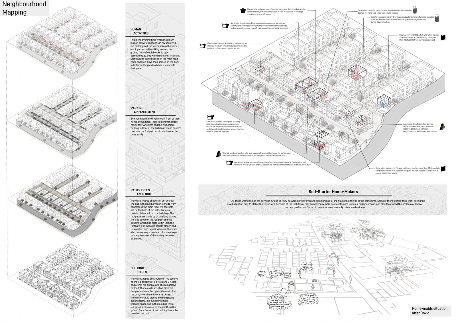
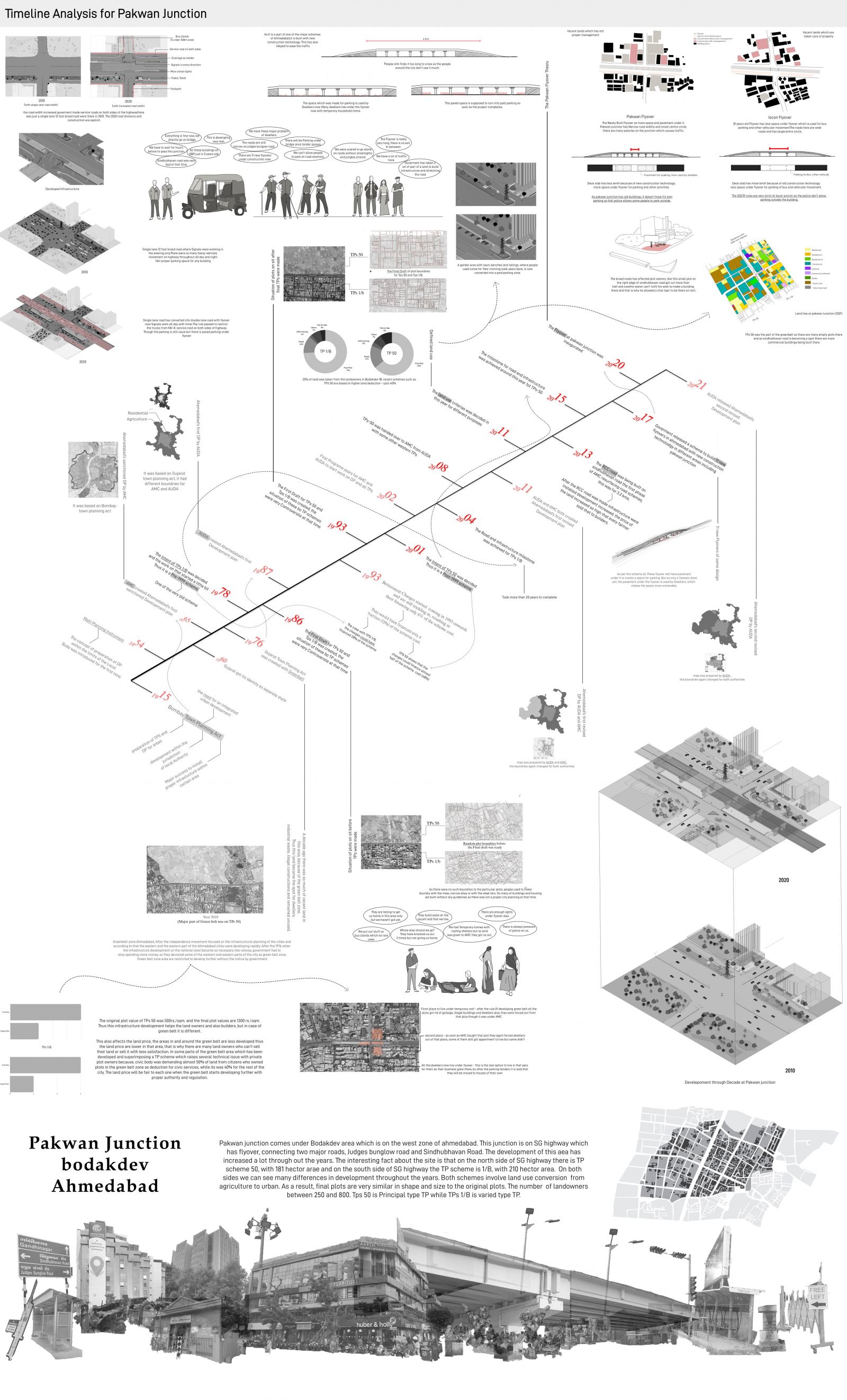
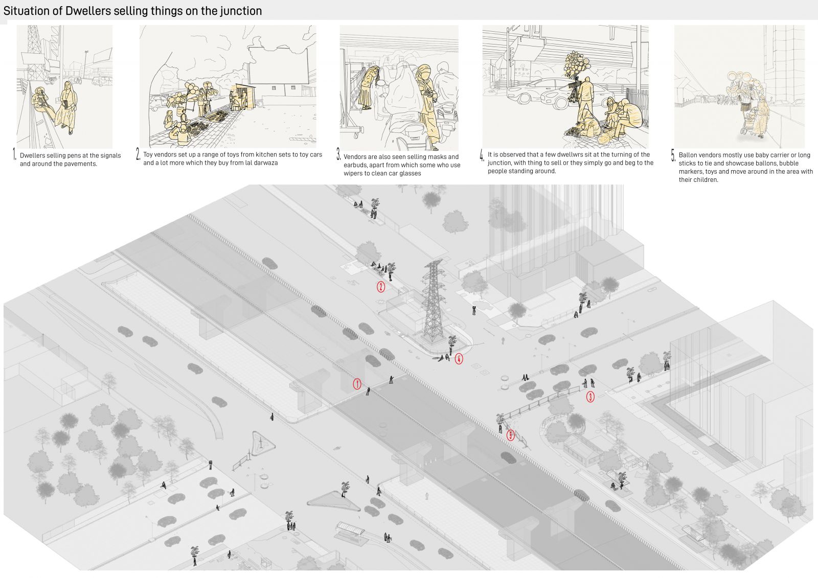
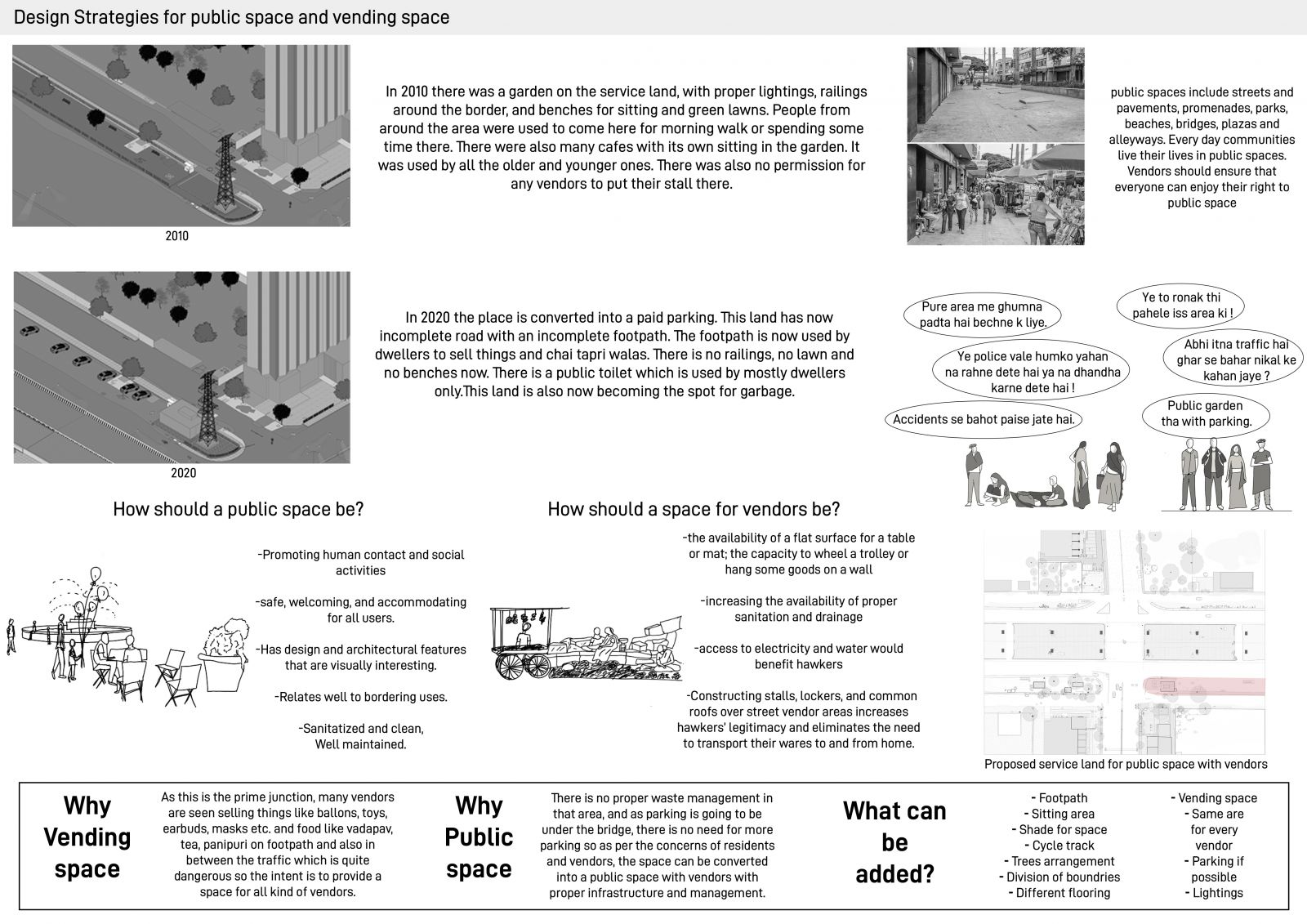
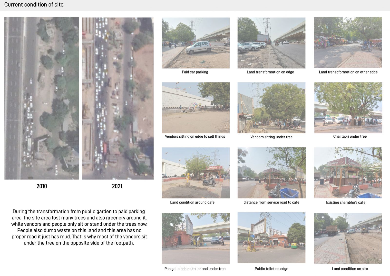
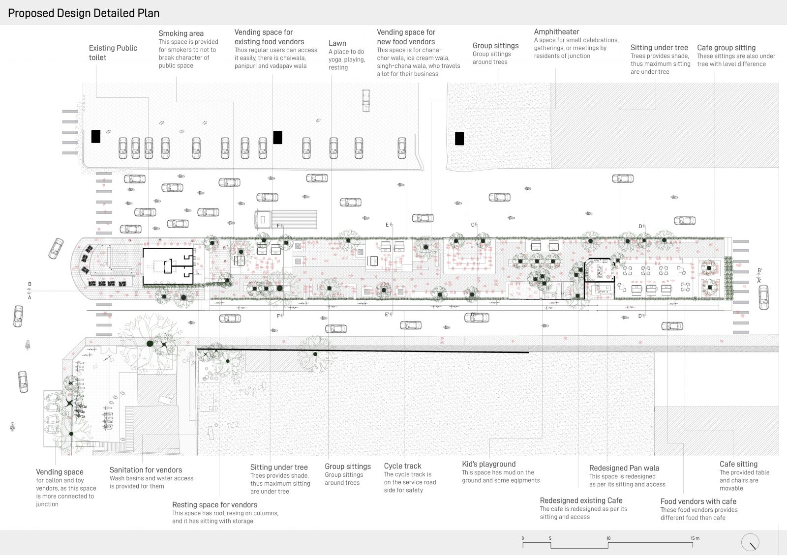
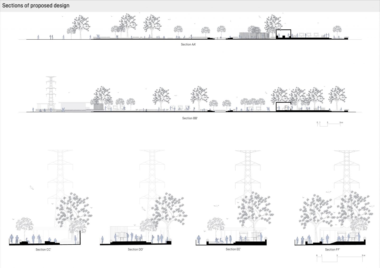
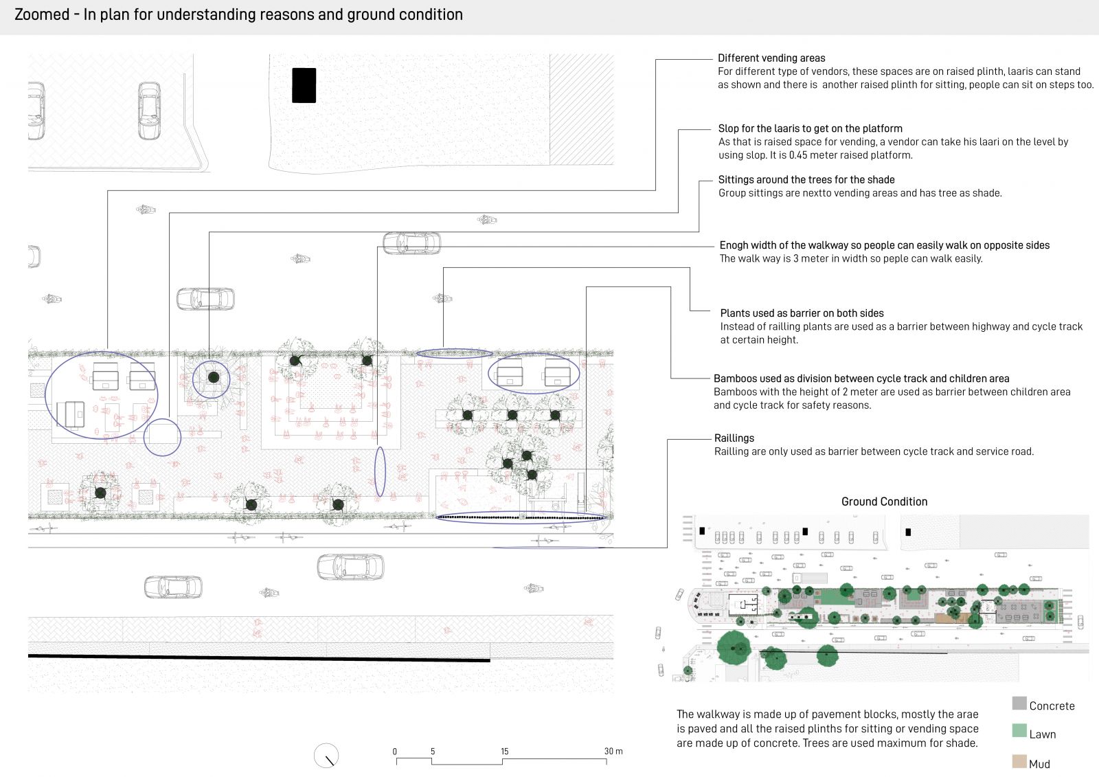
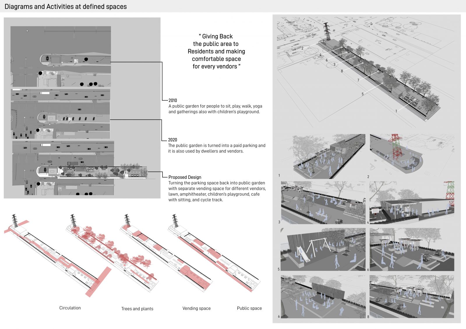
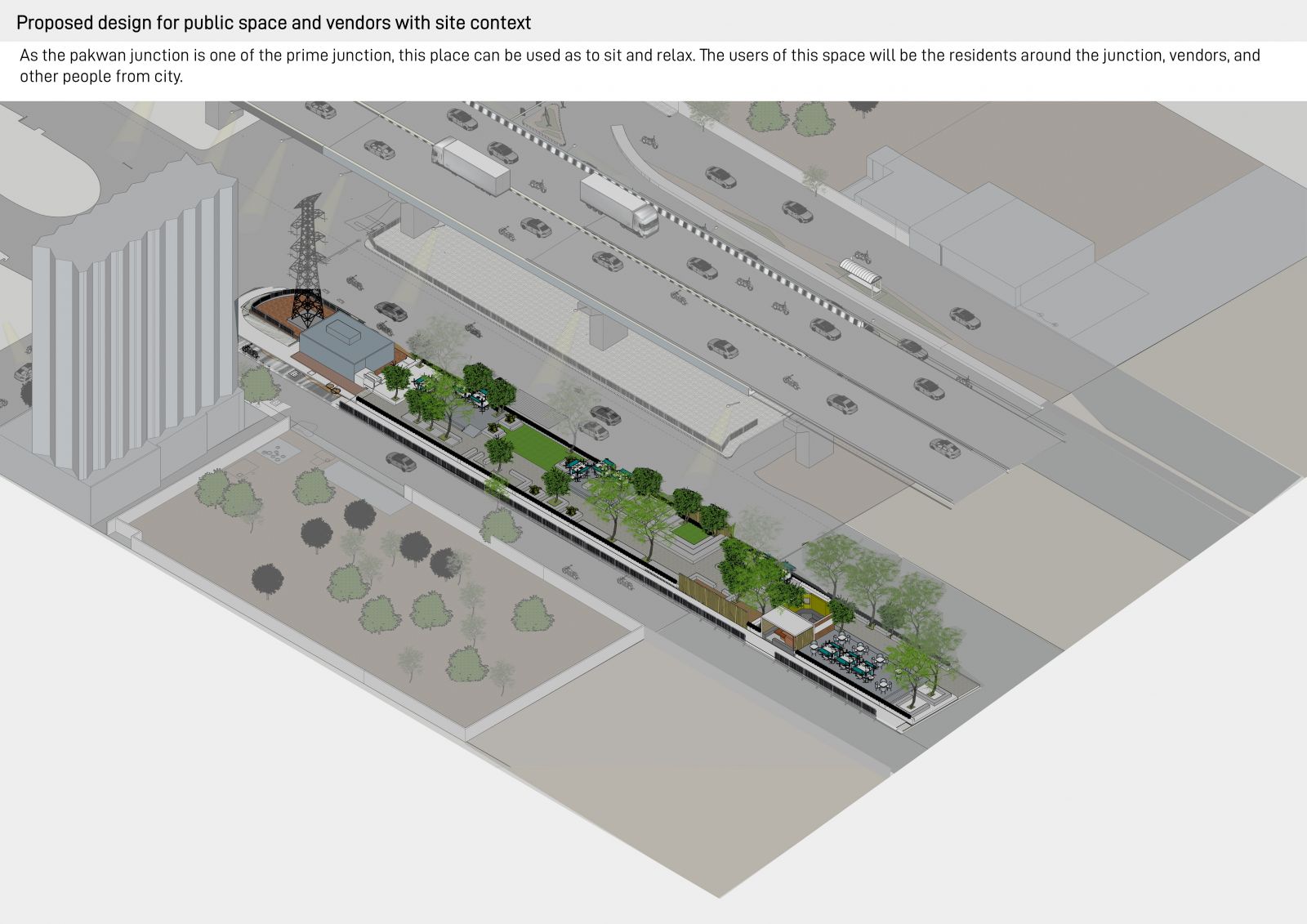
Pakwan junction is one of the prime junctions of Ahmedabad these days, but it has many problems with vehicular and human circulation. According to the analysis about the timeline from the year 1915 to the year 2020, there are so many changes in infrastructure and governance of the junction but the one major thing that changed which brought my focus was the land between the highway and service lane, The land was used as public space before the year 2010, which is now converted into a paid parking with bad condition. Also through the mapping of the site one can see many vendors selling different things across the junction. After interviewing the vendors and residents around the junction design strategies were made and the intent was to bring back public space for residents around the junction and make a safe vending place for different kinds of vendors. The Proposed design has vending space for existing vendors, new vendors for balloons, plastic toys, or food vendors. It also has a lawn, amphitheater, kid’s area, redesigned cafe, and its sitting and more trees for shade.   

View Additional Work

Report Content

This initial exercise was about mapping different aspects of neighborhood, here these maps shows circulation, plantation and physical infrastructure of my society; It also shows situation of women home-makers who are into business from home and home-maids.

This timeline analysis starts from 1915, when the first Town Planning was made to 2020, the current condition. This shows the changes in infrastructure and governance of pakwan junction through a long period of time.

This map shows the different vendors who sell masks, plastic toys, balloons, ear buds, and various things across the junction.

The intent of the design strategies was to bring back public space also with vending areas for local vendors. This was a need of residents around junction and dwellers who sell on the junction.

This shows the current situation and land condition of the land between highway and service road, the image also shows the difference between year 2010 and year 2020 for this land.

This is the detailed map of proposed design for Public space, it has children’s area, redesigned café and panwala, more trees and sittings, a cycle track and most importantly, different vending spots in between for different vendors.

These are the sections of proposed design, it shows possible activities on different places in detail. It also shows the level differences between spaces.

The Proposed plan is zoomed in on one part to understand the basis of certain elements. The small map shows the ground condition.

This shows the zoom-in views of different spaces like children’s area, amphitheater, vending space, sittings with activities; it also shows the diagrams of different aspects of design.

This map shows the proposed design with existing site context.