Your browser is out-of-date!
For a richer surfing experience on our website, please update your browser. Update my browser now!
For a richer surfing experience on our website, please update your browser. Update my browser now!
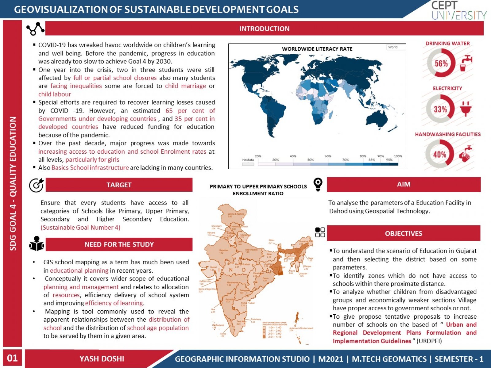
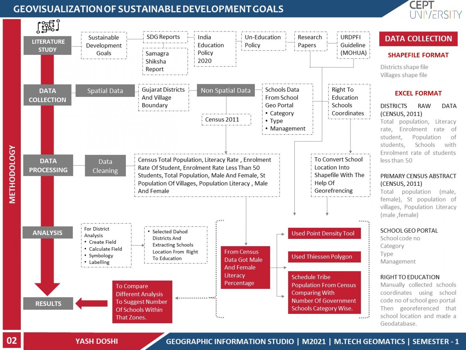
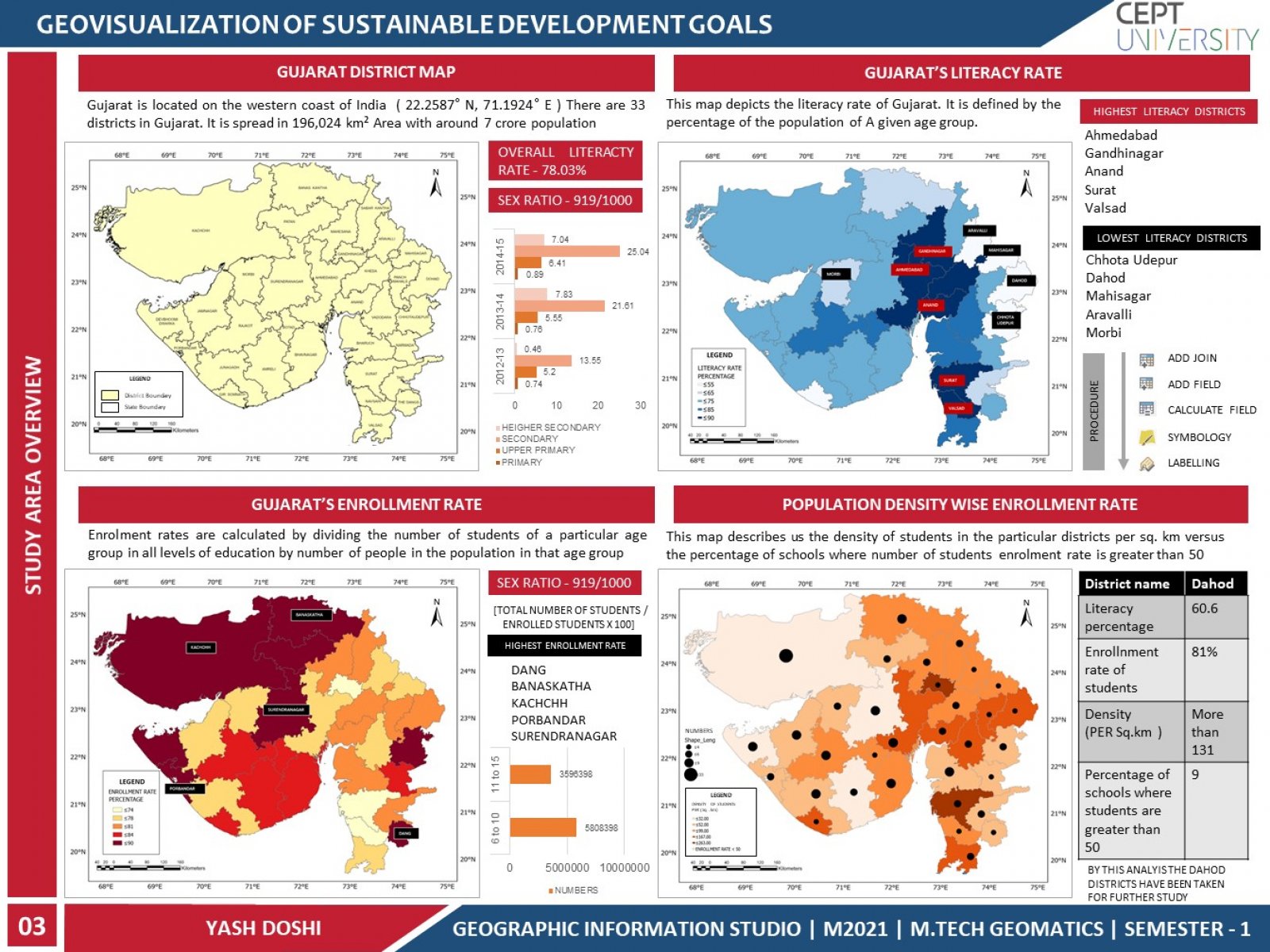
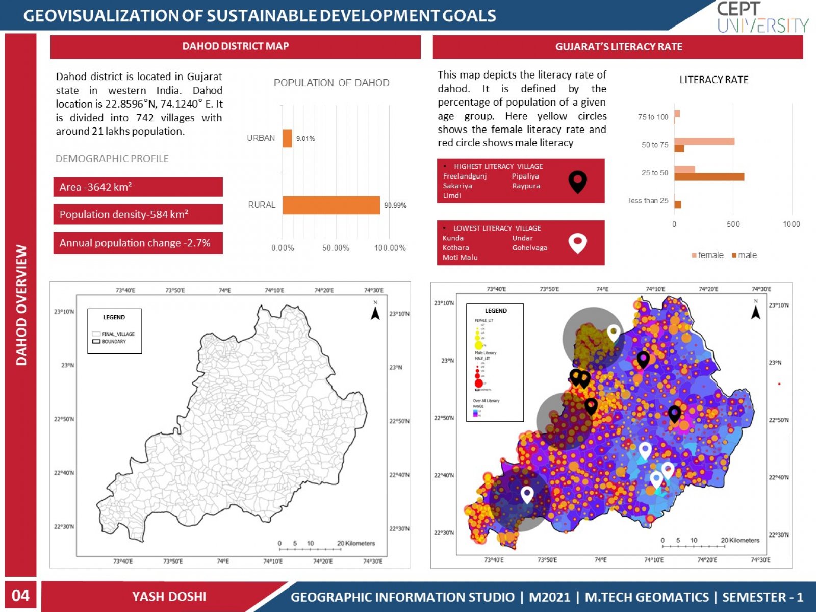
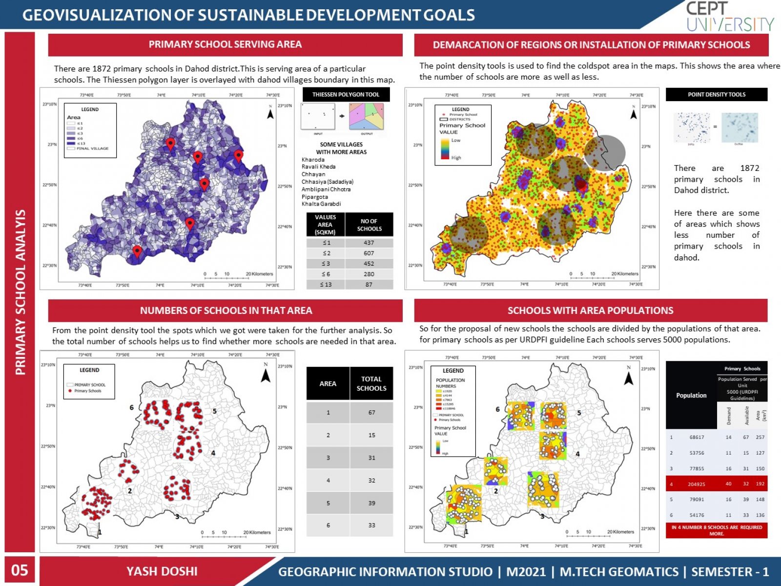
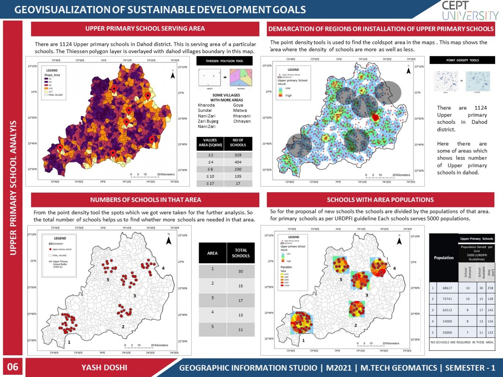
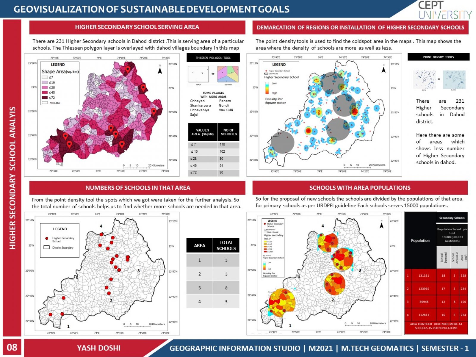
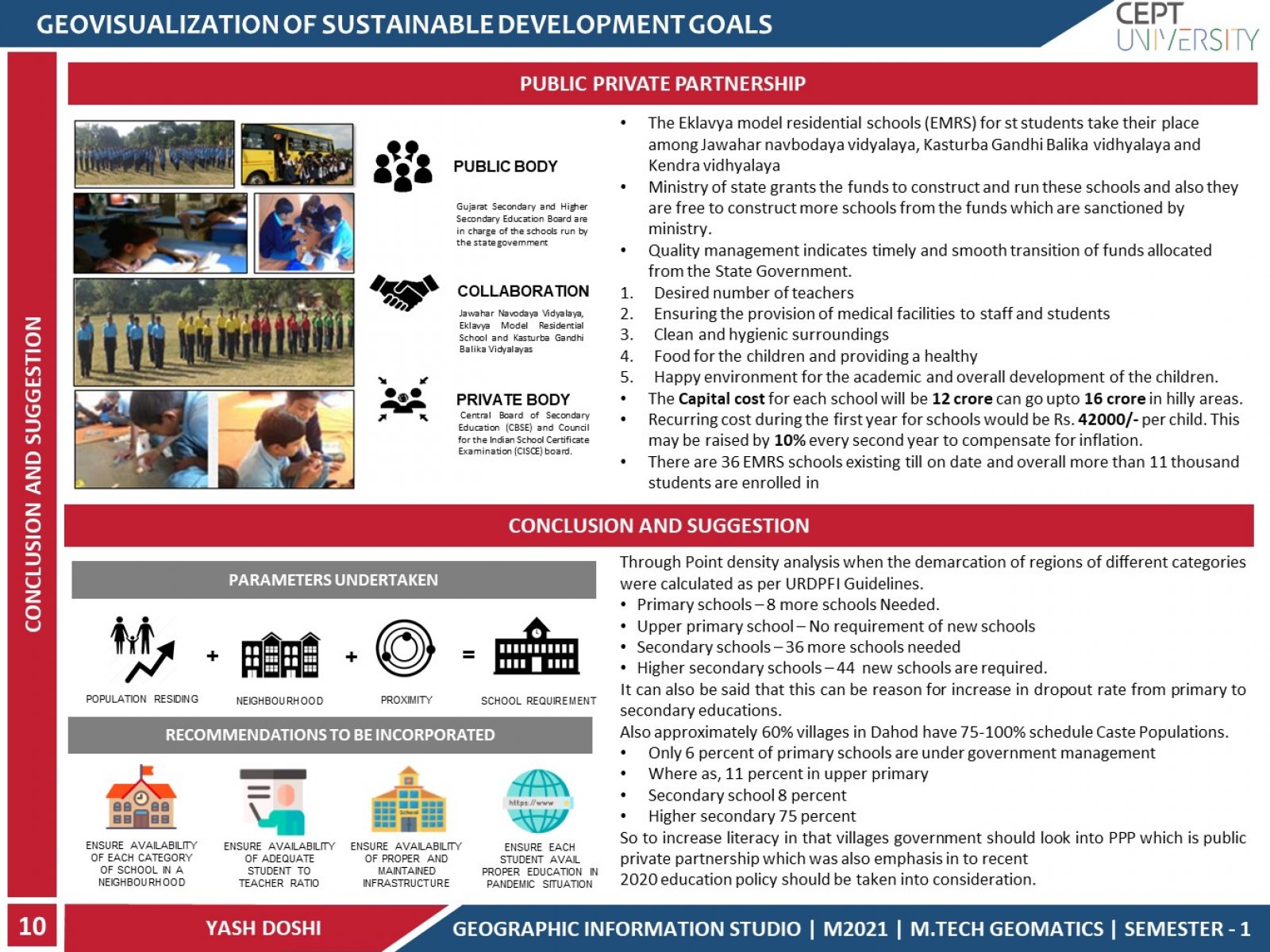
This project is about analyzing the access to educational facilities in Dahod District of Gujarat in a spatial perspective. This project highlights the regions that does not fulfill minimum criteria of different categories of schools. For this various parameters were overlayed to demarcate the regions for installation of schools. To study the catchment served by each school using thiessen polygon and overlaying it with village boundary and population to visualize the need of proposing school location as per URDPFI Guideline.
