Your browser is out-of-date!
For a richer surfing experience on our website, please update your browser. Update my browser now!
For a richer surfing experience on our website, please update your browser. Update my browser now!
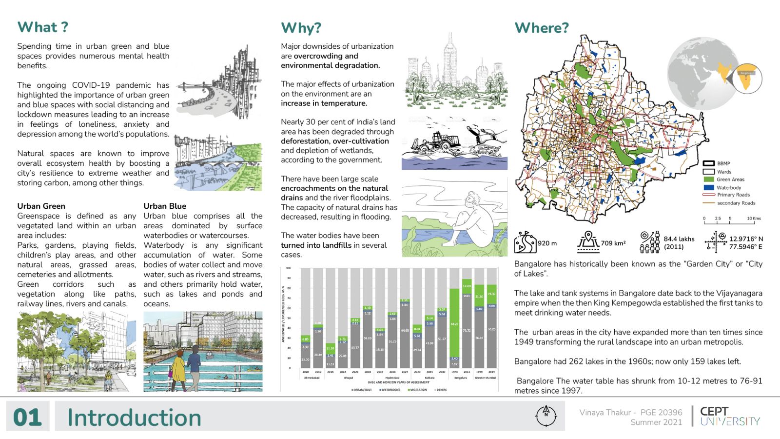
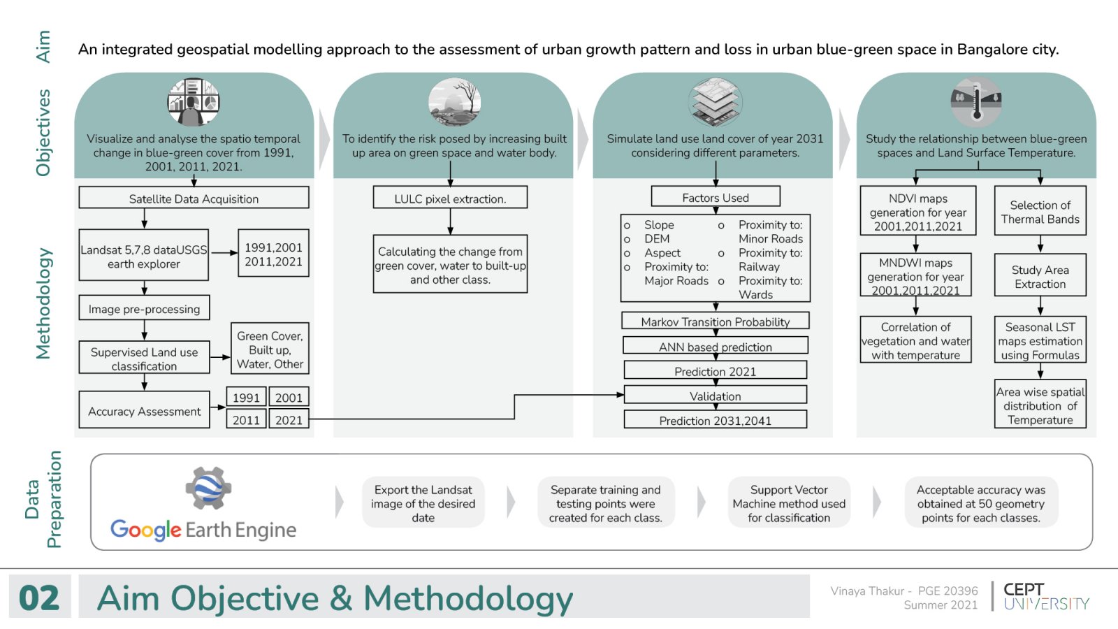
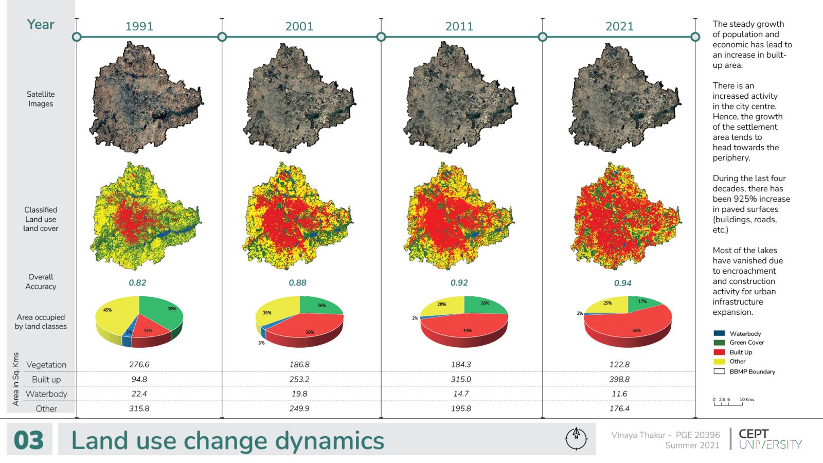
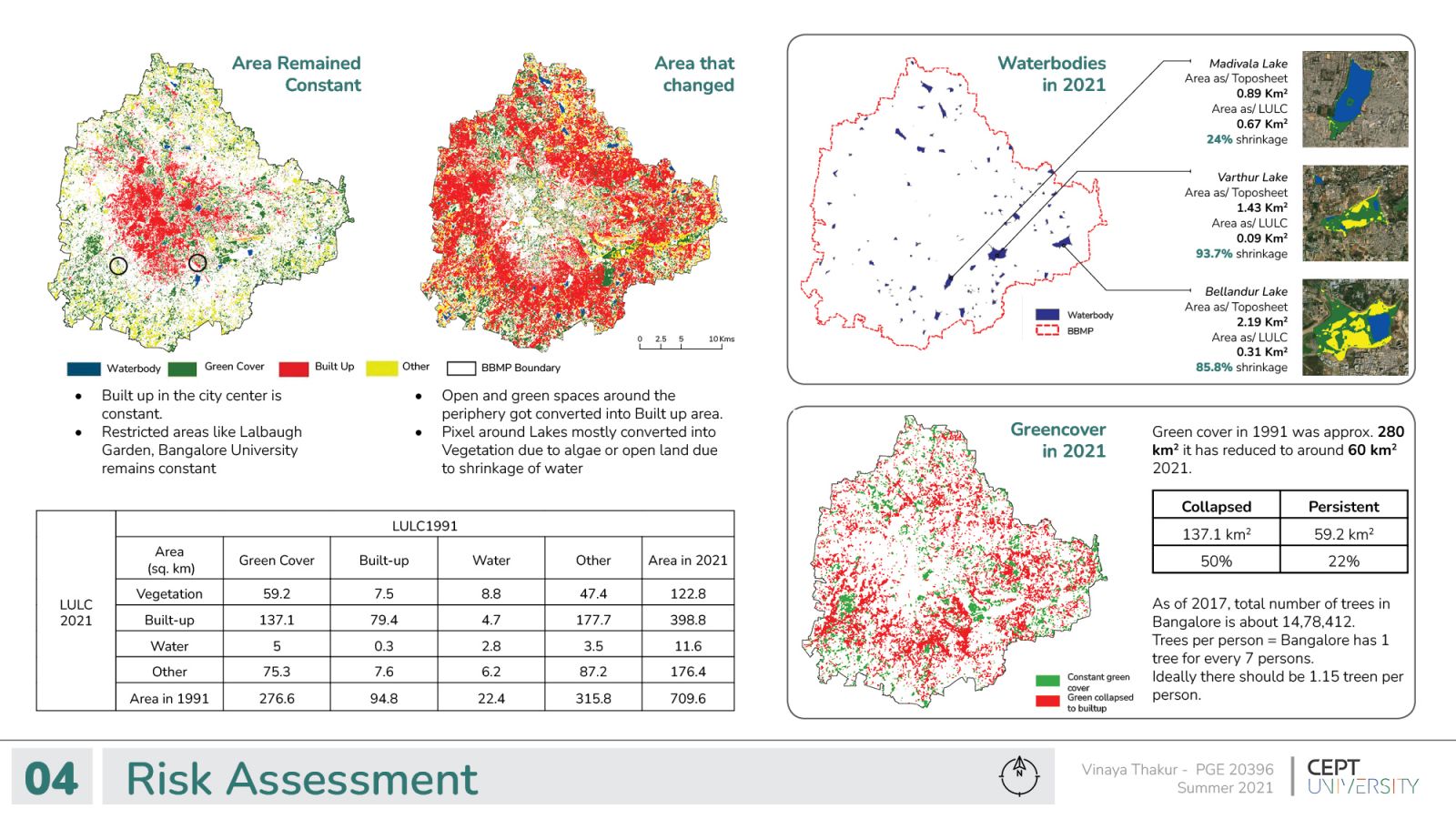
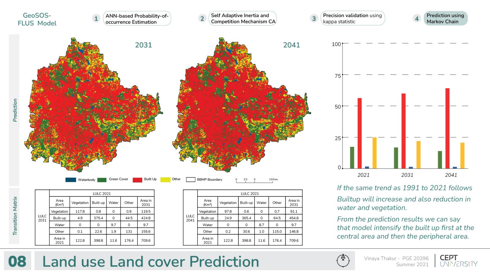
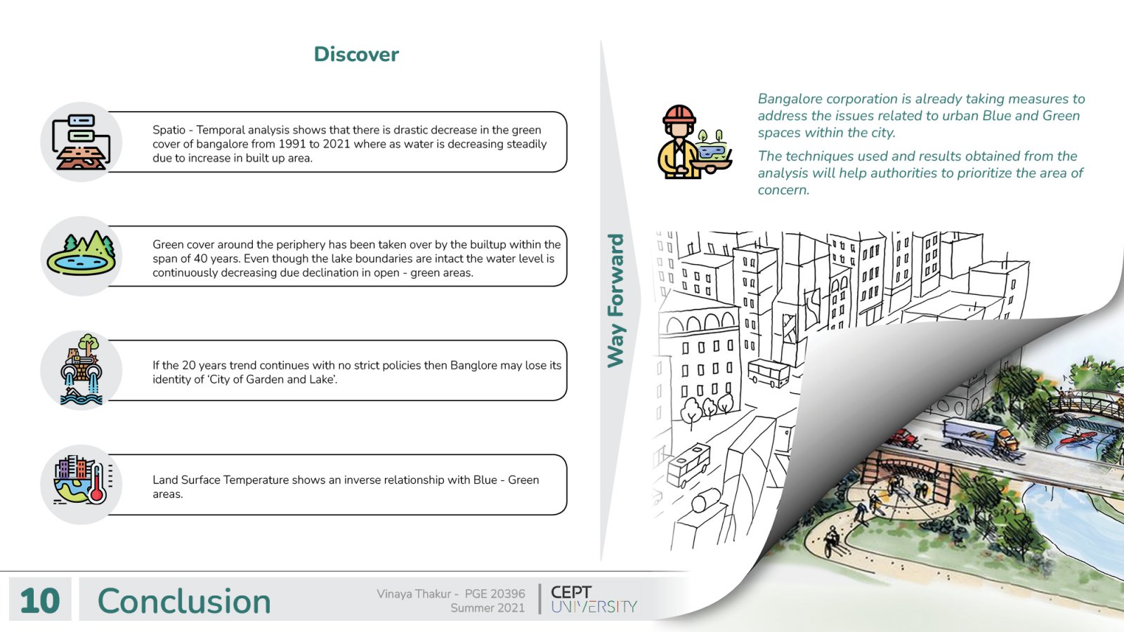
COVID-19 pandemic highlighted the importance of mental health and its relation with the urban blue and green spaces within the neighborhood. Green spaces include any vegetated land within an urban area for example Parks, gardens, and green corridors along the roads, etc. whereas urban blue is any collected surface water converted into lakes and ponds within the city boundary. This study reviews the use of geospatial modeling and remotely sensed data to analyze the dynamics of urban blue-green spaces by understanding the trends of the past, the present, and extrapolating to the future. If the 20 years trend continues with no strict policies then Bangalore may lose its identity as ‘City of Garden and Lake’. The techniques used and results obtained from the analysis will help authorities prioritize the area of concern.