Your browser is out-of-date!
For a richer surfing experience on our website, please update your browser. Update my browser now!
For a richer surfing experience on our website, please update your browser. Update my browser now!
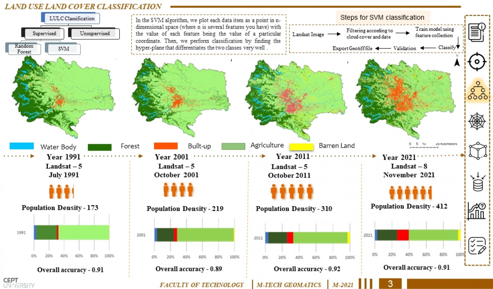
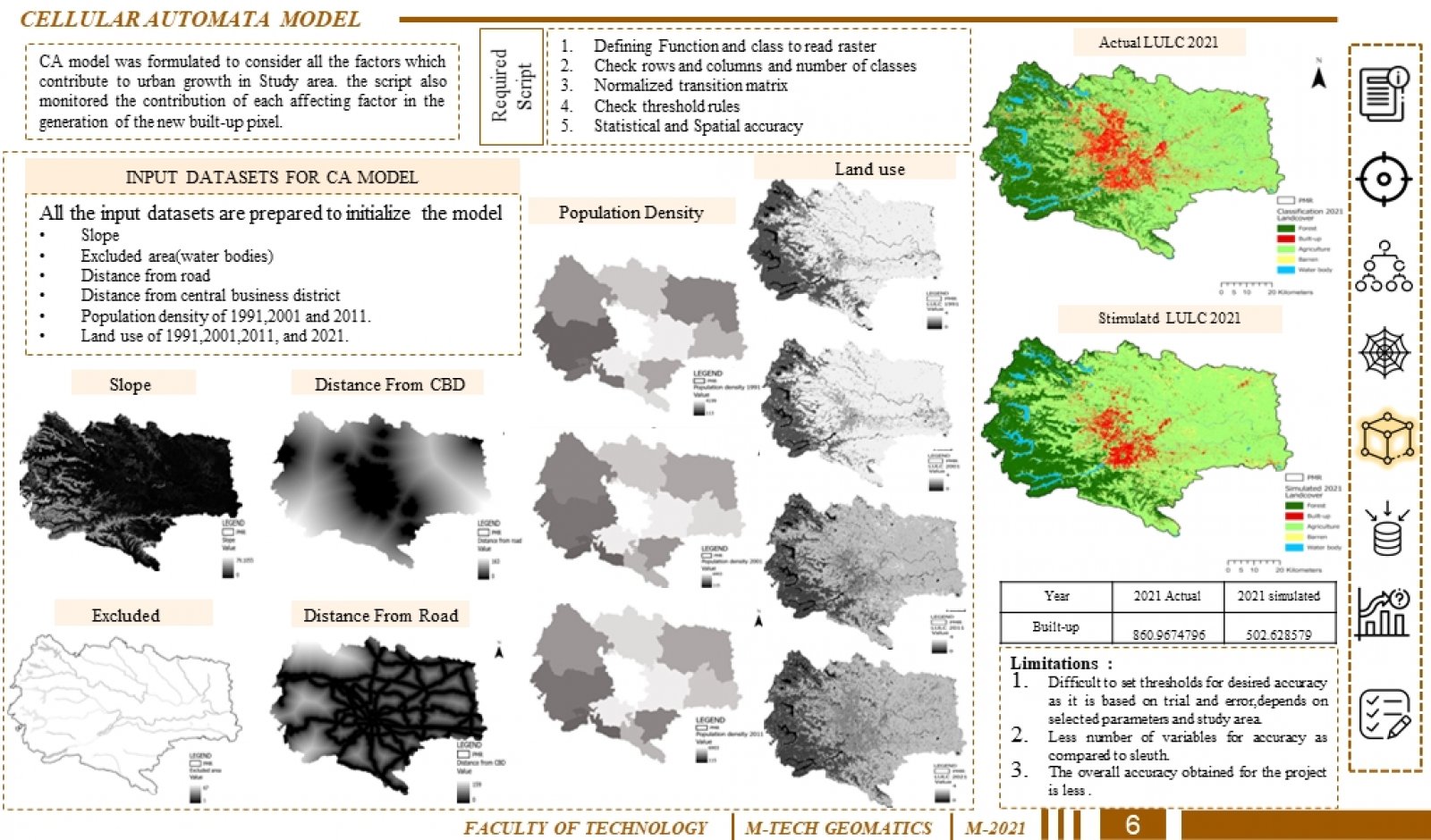
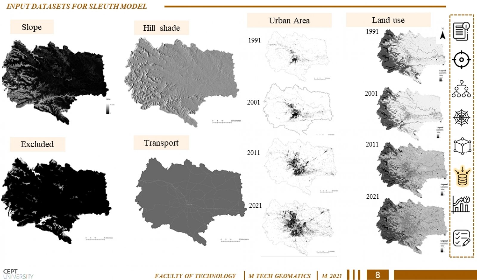
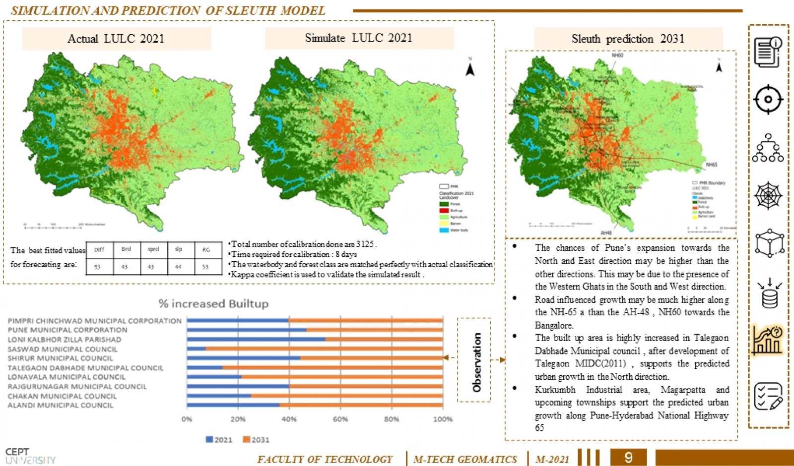
Urban sprawl, also called sprawl or suburban sprawl, the rapid expansion of the geographic extent of cities and towns, often characterized by low-density residential housing, single-use zoning and increased reliance on the private automobile for transportation. This Study deals with performing LULC classification and change detection between temporal datasets (1991/2001/2011/2021) using Geo-spatial tools and predicting the future urban sprawl pattern using SLEUTH for the year 2031 in the region based on certain parameters which contribute to the expansion of the city from that we can get an idea of type of growth patterns that occurs within our study region by knowing value of coefficients and identify various applications that we can used for urban planning.