Your browser is out-of-date!
For a richer surfing experience on our website, please update your browser. Update my browser now!
For a richer surfing experience on our website, please update your browser. Update my browser now!
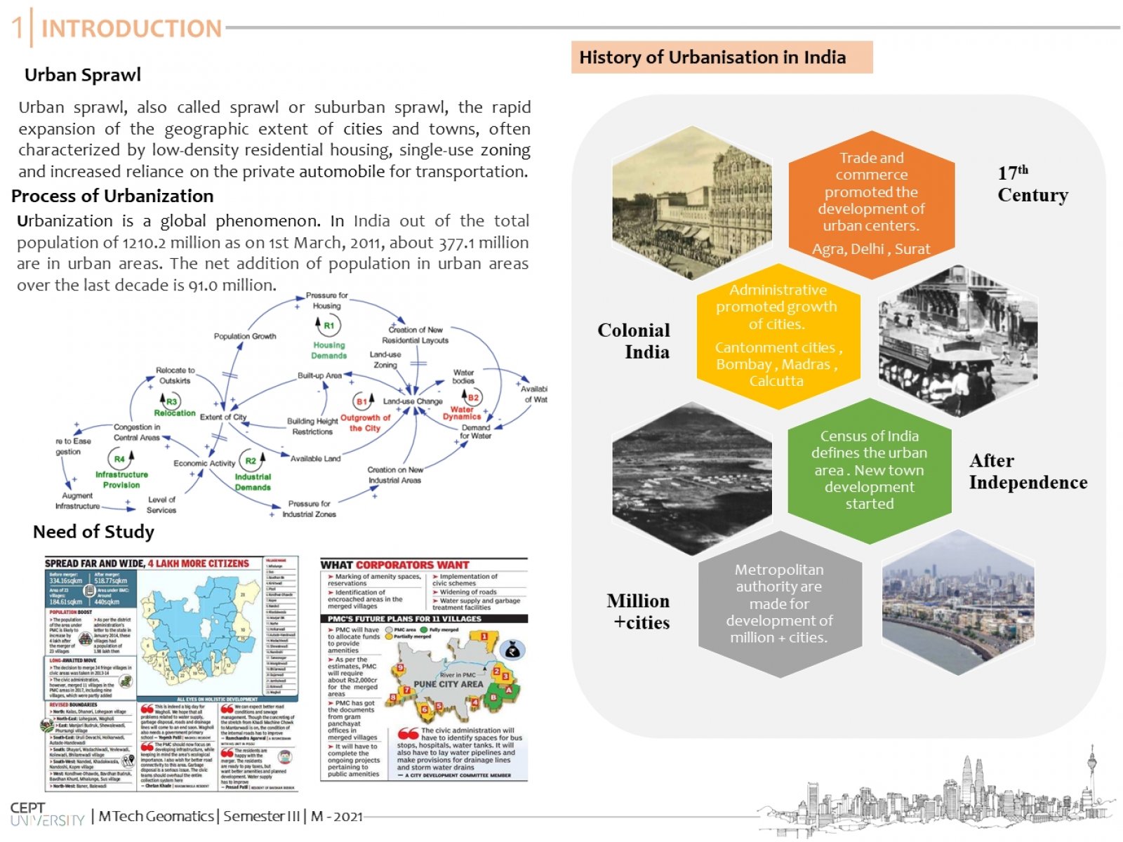
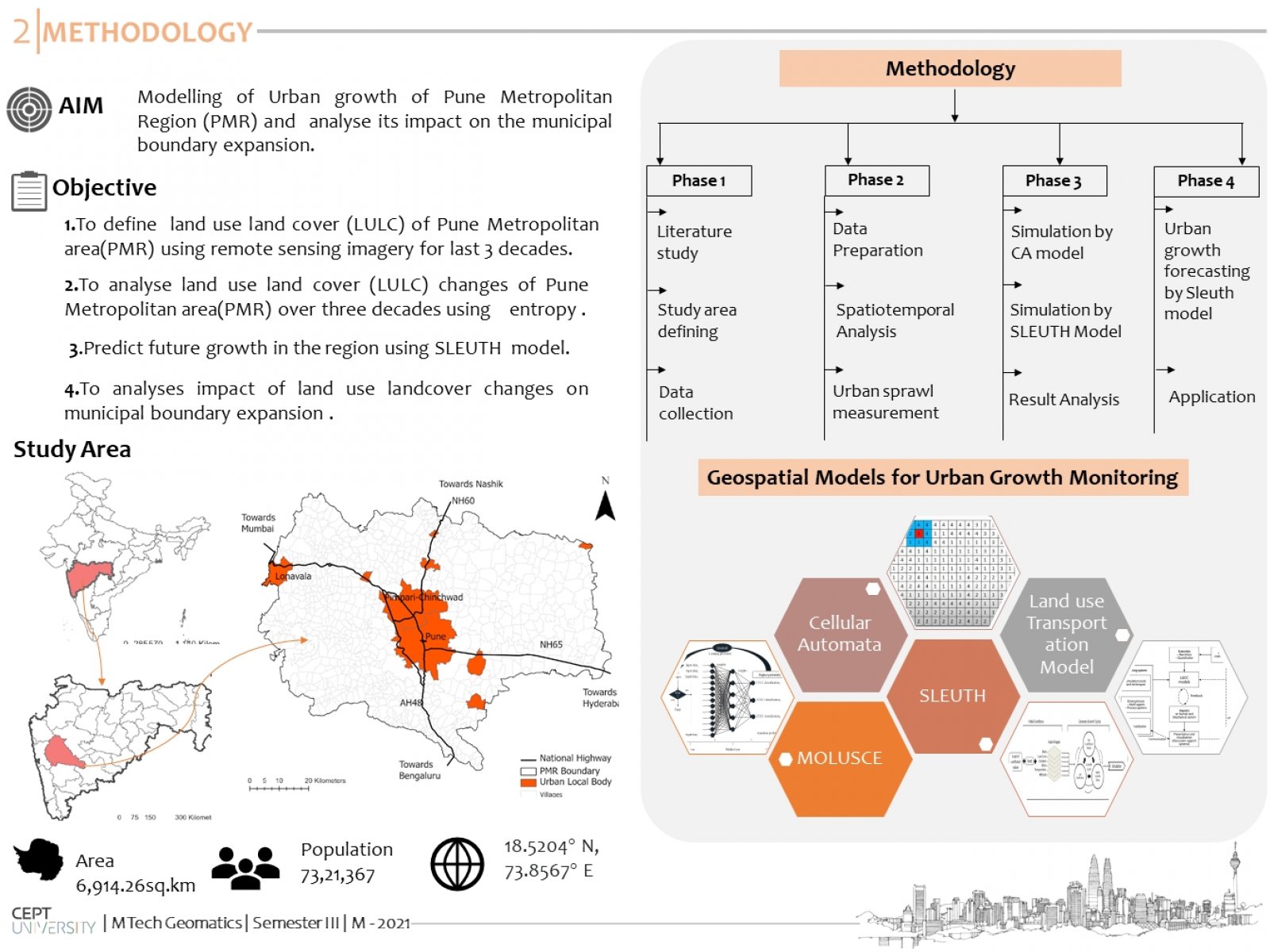
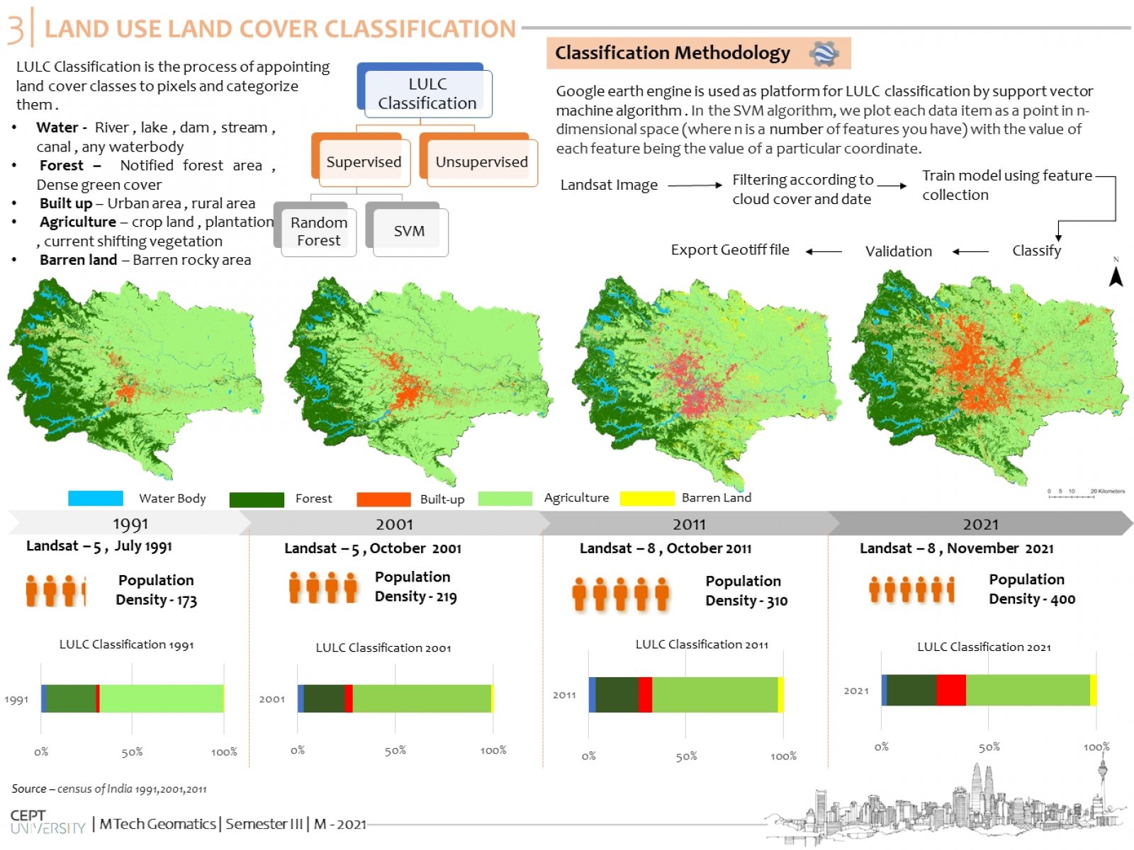
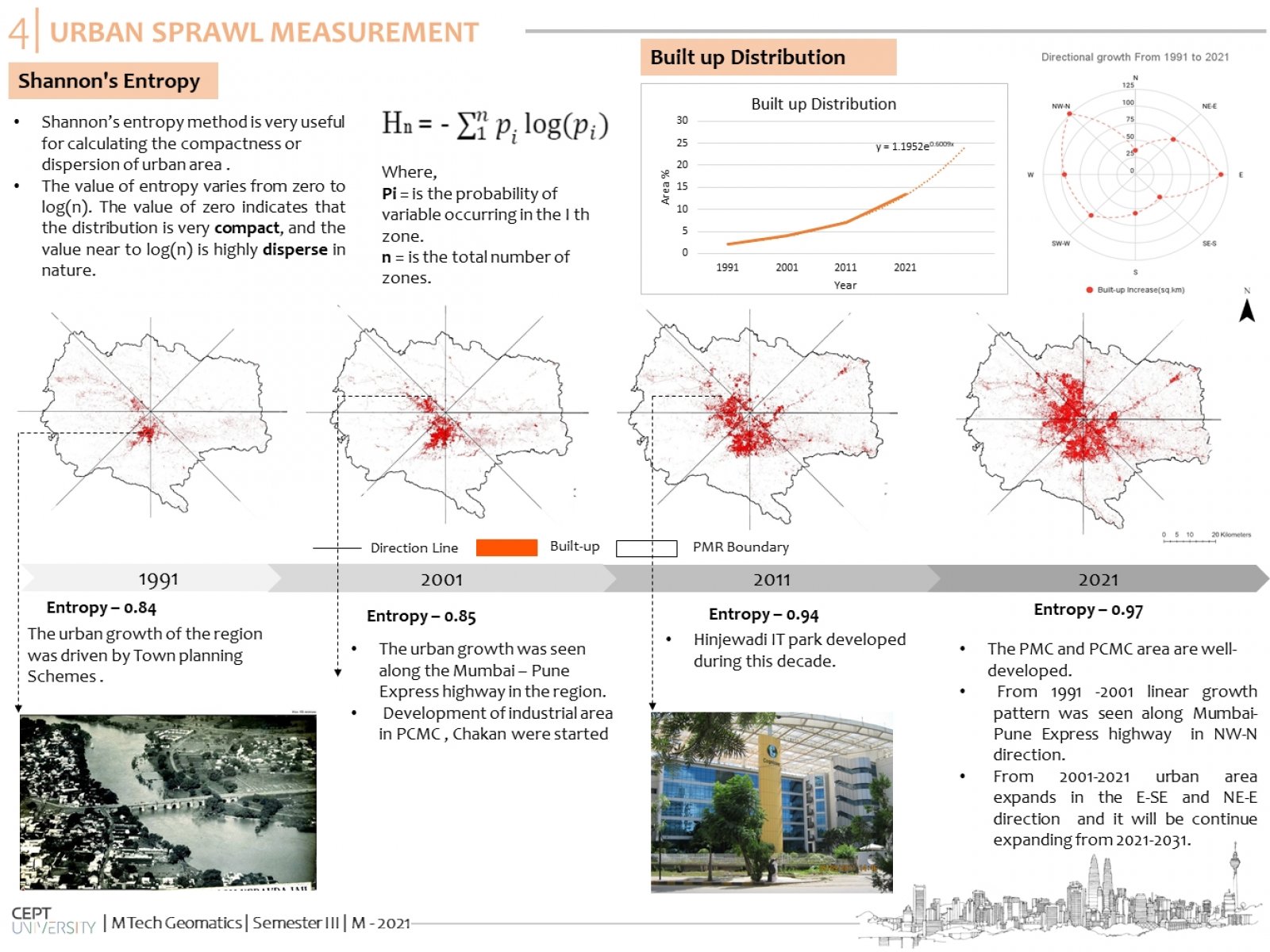
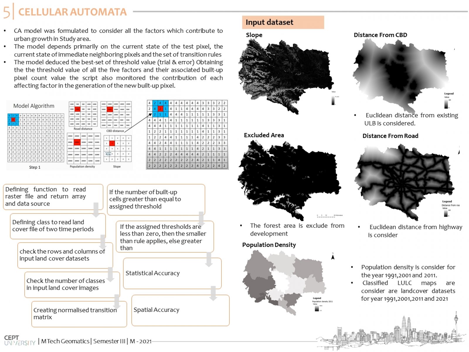
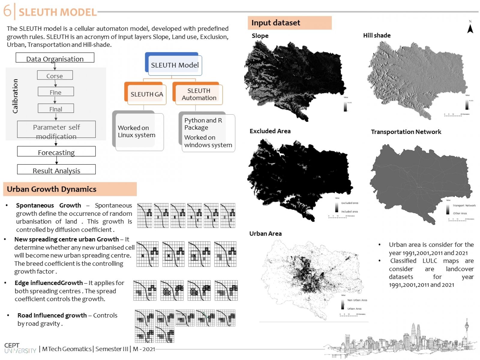
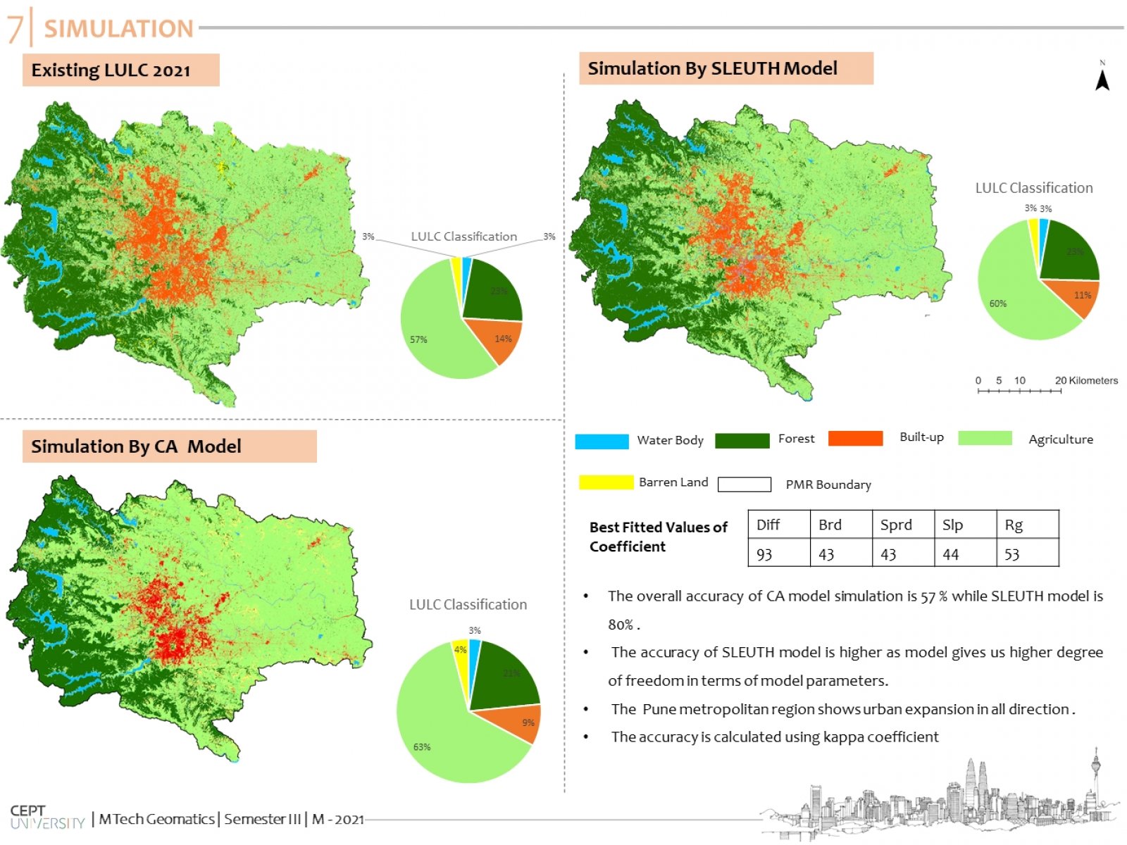
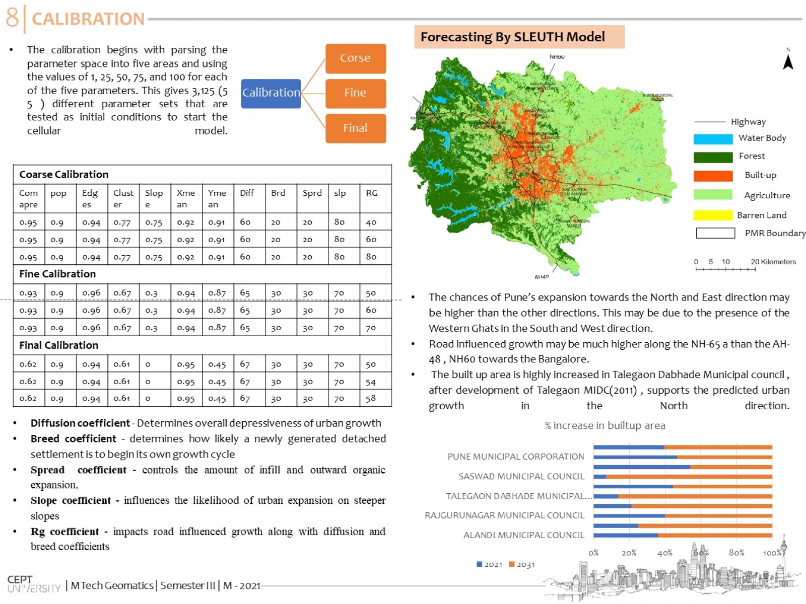
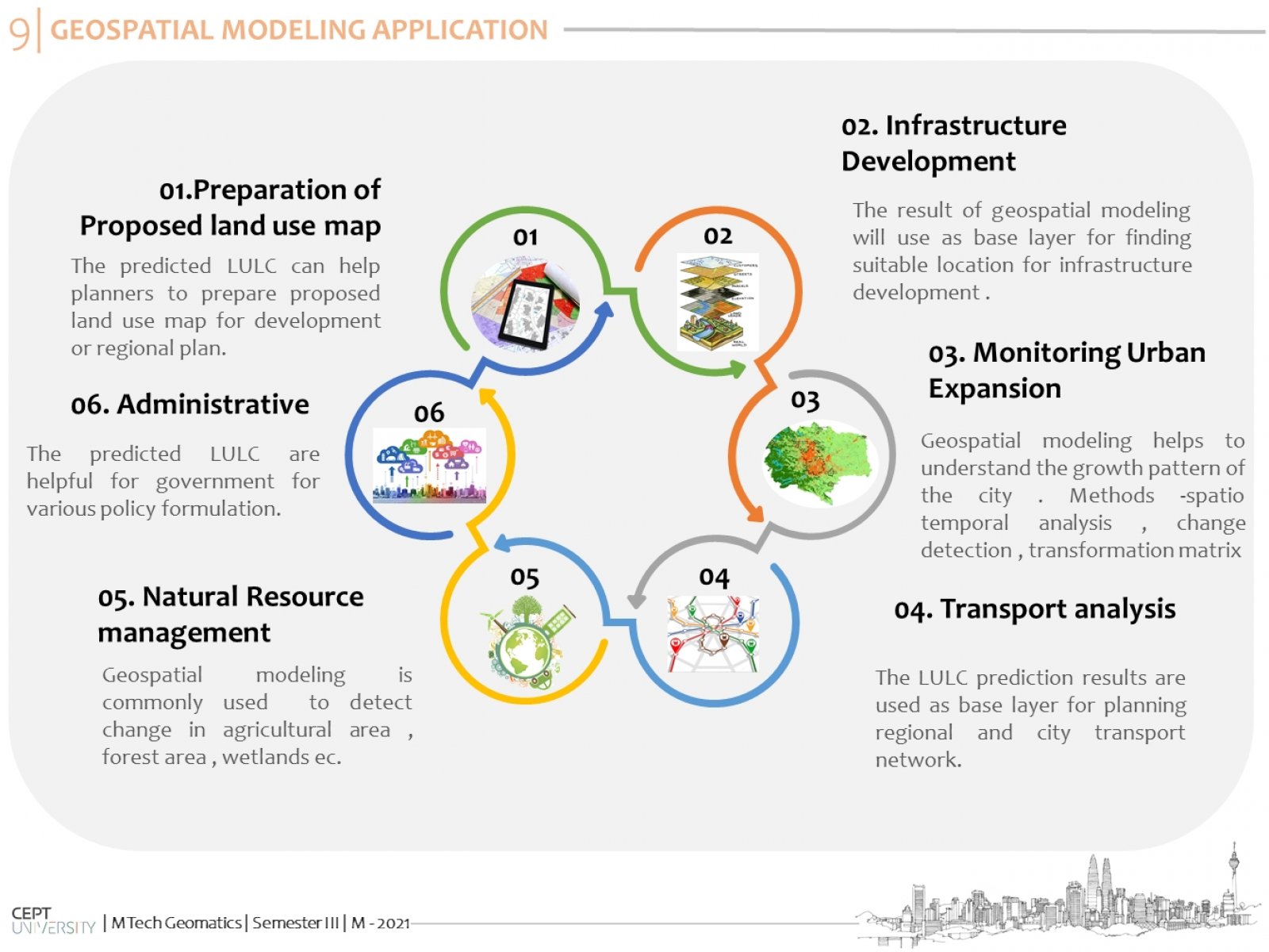
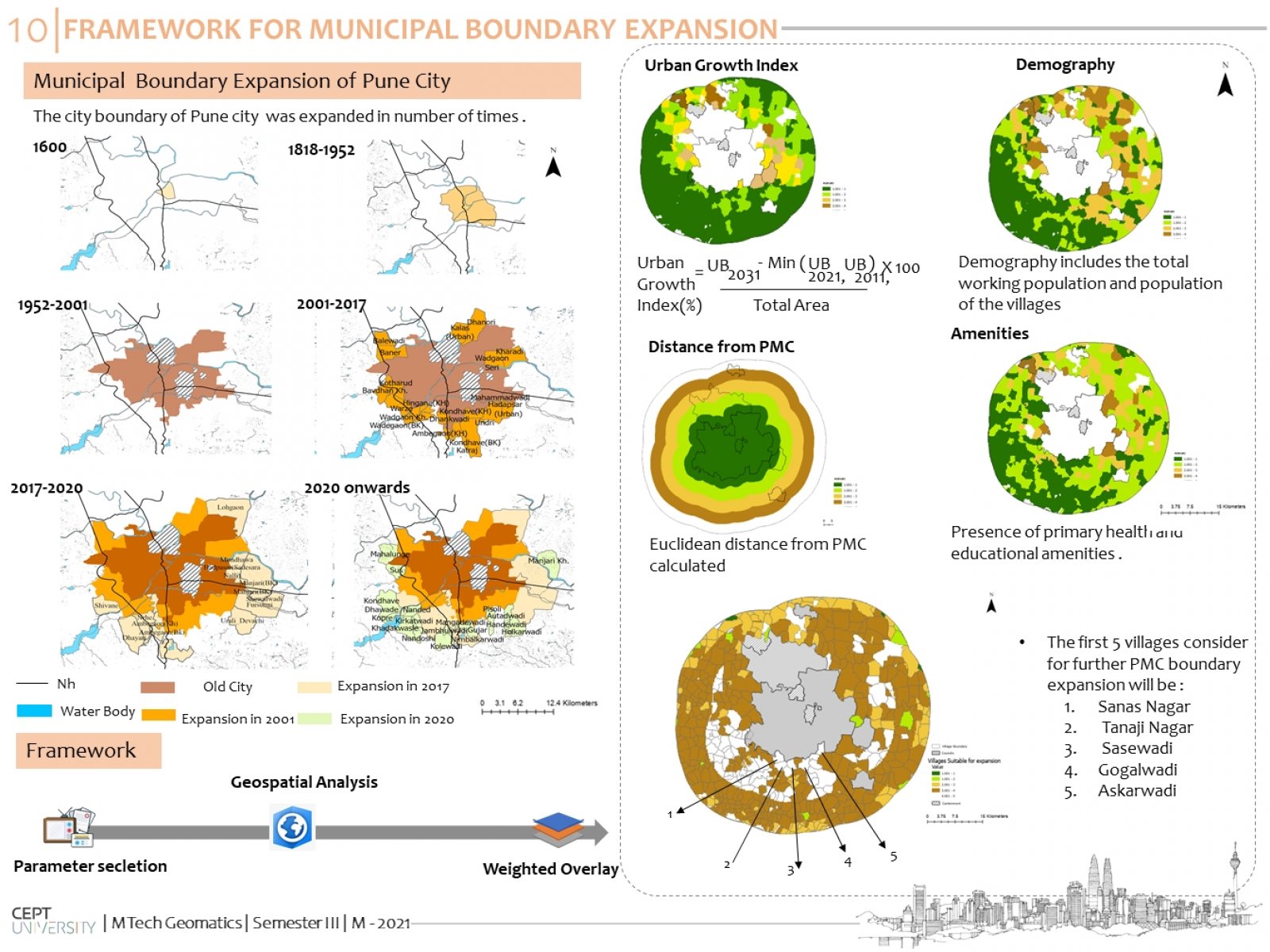
Urban growth is a worldwide phenomenon but the rate of urbanization is very fast in developing countries like India. It is mainly driven by unorganized expansion, increased immigration, rapidly increasing population. In this context, land use and land cover change are considered one of the central components in current strategies for managing natural resources and monitoring environmental changes.The present study aims to analyze LULC change, designate and monitor the spatial expansion of the Pune Metropolitan Region based on geospatial models like SLEUTH and Cellular Automata.
