• Home
  • FT
  • CT2019
  • Planning and Design of Road infrastructure in hilly regi

Ruchit Patel

CT2019

Planning and Design of Road infrastructure in hilly regi

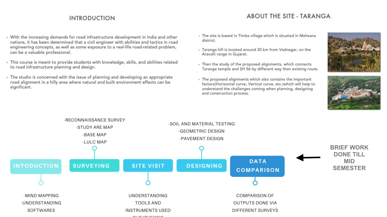
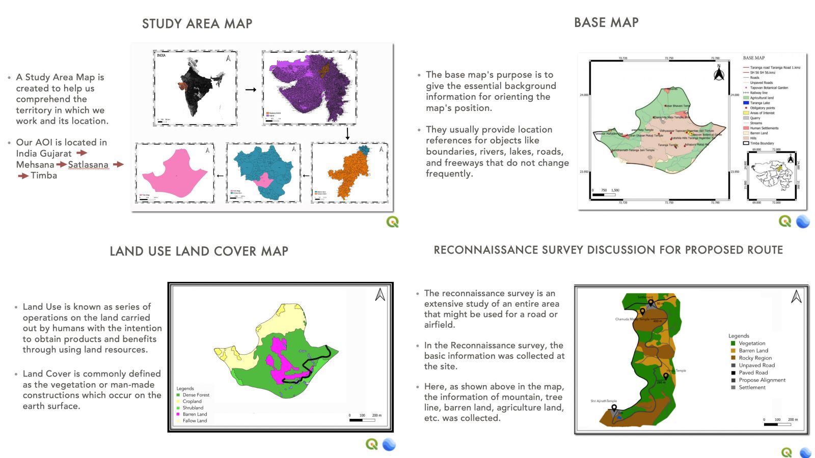
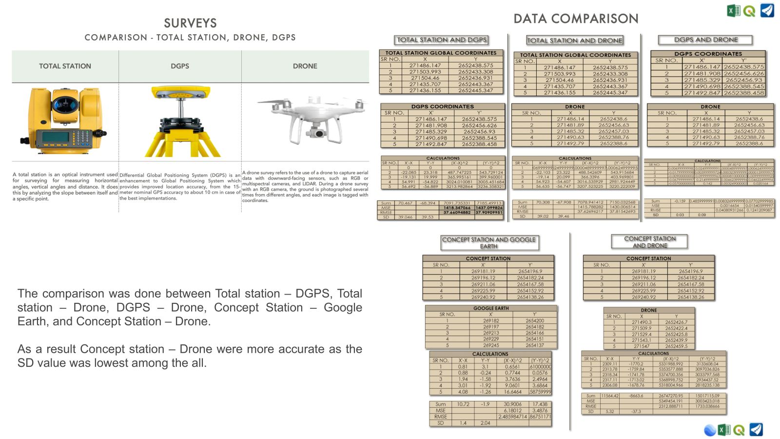
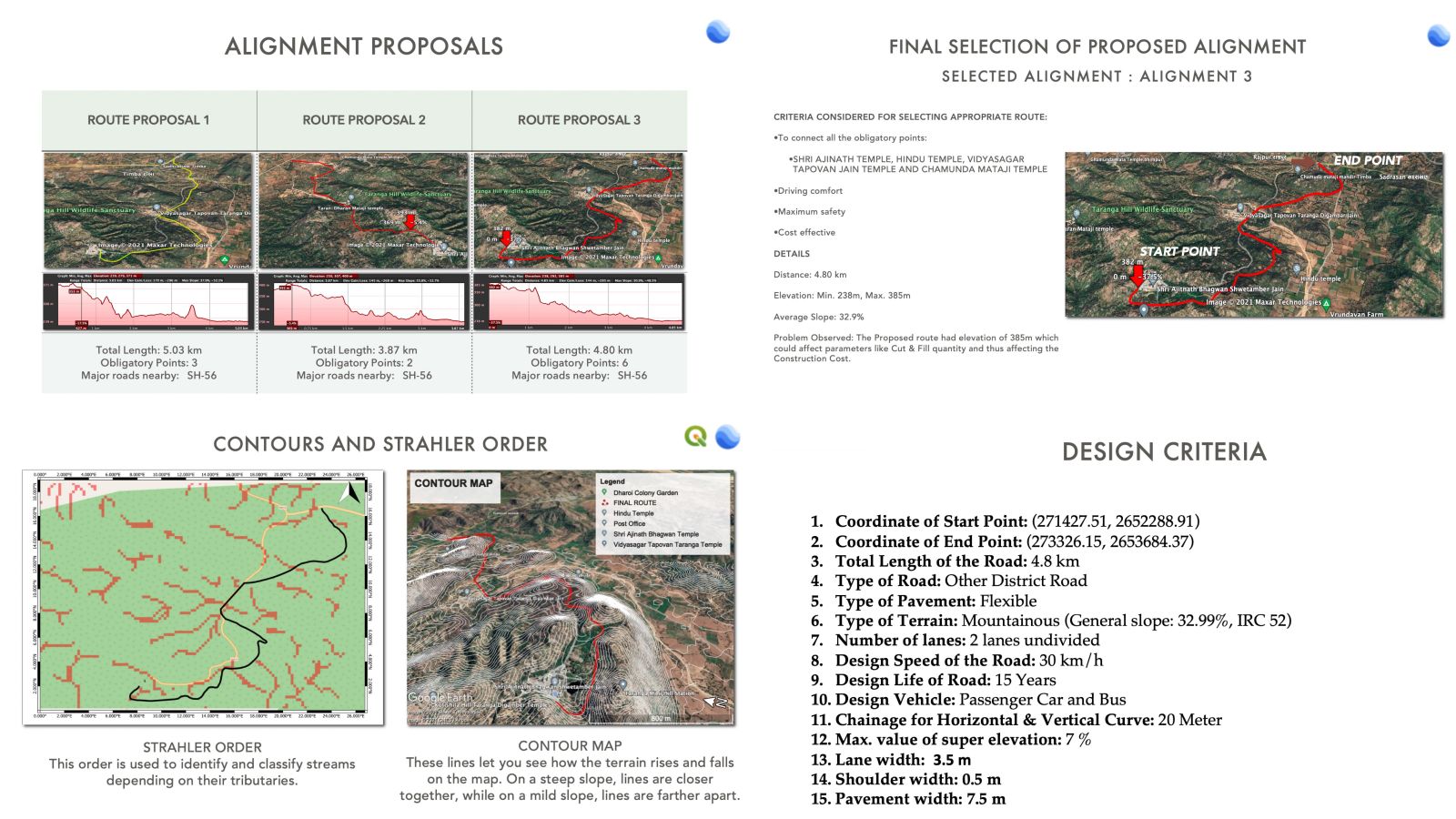
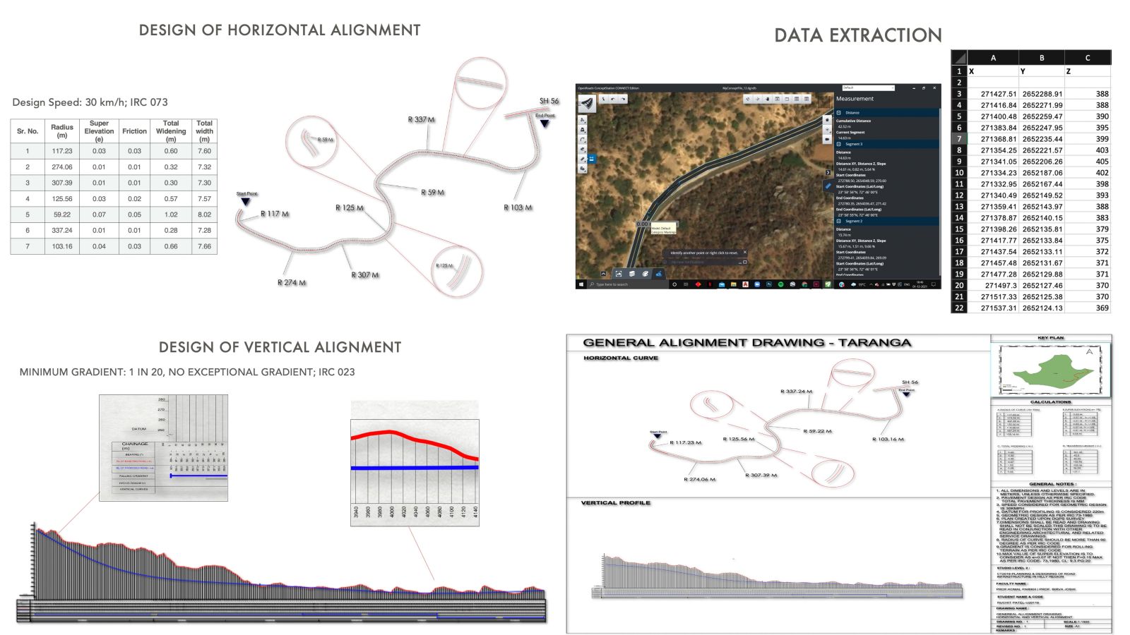
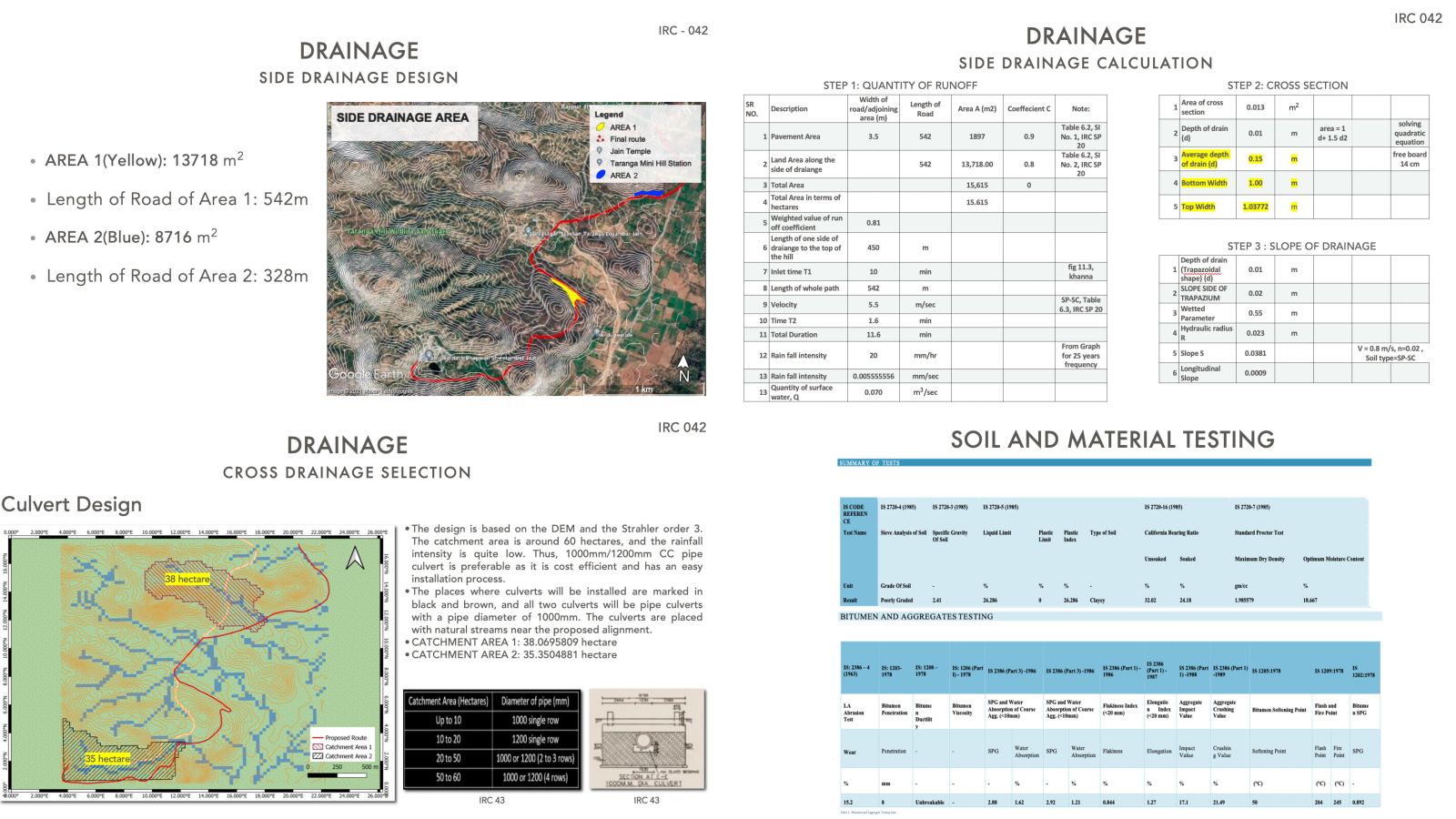
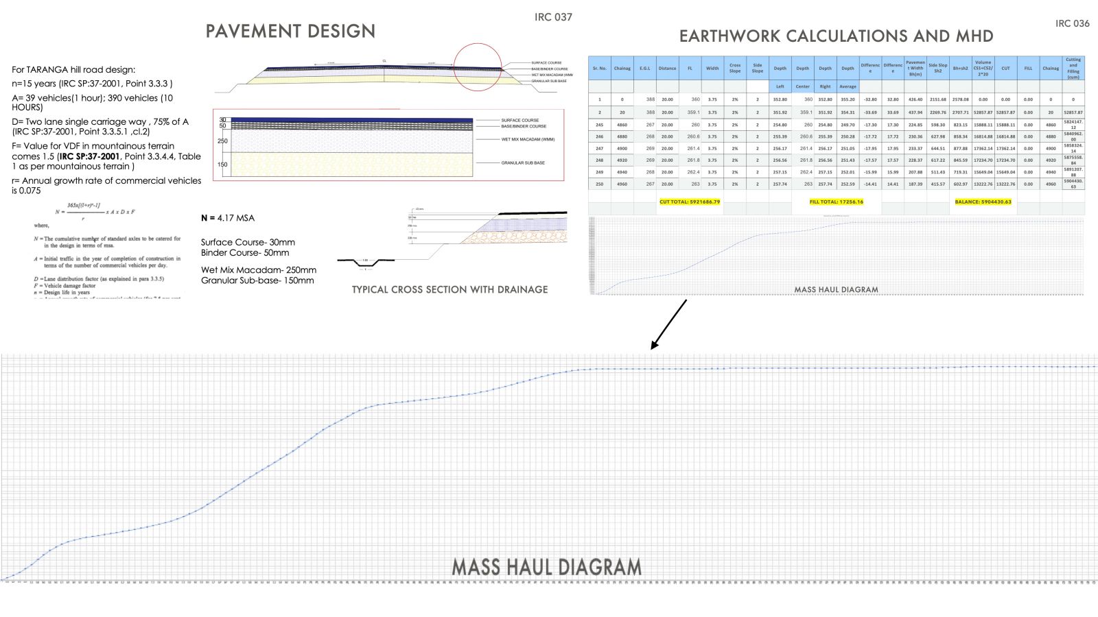
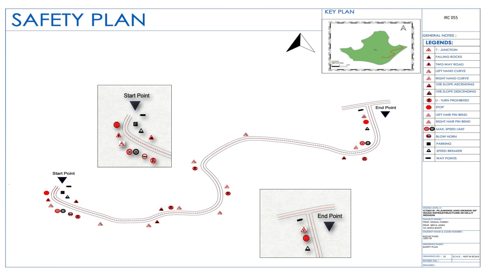
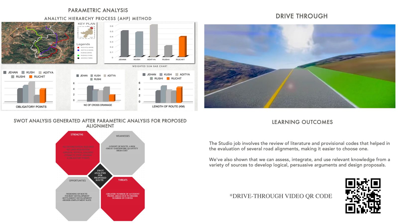
From slow-moving, vulnerable walkers, bikers, and animals to fast-moving automobiles of all types, road design necessitates an awareness of the frequently competing demands of multiple users. It's also important to understand the civil engineering science of road construction, as well as the complexities of regulatory rules. For the role of road planning and design, engineers must master all of this knowledge. This Studio prepares us for these difficult challenges by investigating the design of a road in a steep area. Throughout the course, every aspect of the road design problem will be examined, including user requirements, testing, and route alignment selection based on civil and highway engineering principles, techniques, codes, and technical specifications; design of its elements, quantity calculations; parametric studies, and road safety analysis.


Report Content

In the midterms, the whole batch was divided into the groups of two. Each group was given a stretch of road and then we had to the geometric design of the same. We started with mind mapping and brainstorming of how and why road infrastructure is important. Then we went through a bundle softwares like – QGIS, Google Earth, AutoCad, and ConceptStation. We then did the surveying of our stretch and came up with Reconnaissance survey map, study area map and other maps as output. Later we went to Makhaniyo Hill to understand and know the application of the instruments used in surveying. After all this we went to the designing part which included the soil and material testing, Geometric design which included horizontal, vertical and general alignment drawing (GAD), pavement design and drainage design. At last we came up with the outputs done via different surveys and did the comparison. After midterms, each student was given different sites from the following - Taranga, Makhaniyo Hill and Ida

The following image consists of all the four maps used in the surveying - Study area map, Base map, LULC map and Reconnaissance survey map

The comparison was done between Total station – DGPS, Total station – Drone, DGPS – Drone, Concept Station – Google Earth, and Concept Station – Drone. As a result Concept station – Drone were more accurate as the SD value was lowest among the all.

There were three total alignments options for the particular site. Contour and Strahler order shows the main streams/tributaries and rise and fall of land of the site.

The following image consists of geometric design of the alignment - Horizontal, Vertical and GAD

Drainage Design - Cross Drainage of the pavement.

Pavemennt Design which showcases the individual layers of the pavement.

Safety plan show the three different signs - mandatory, infomatory and guide signs placed on the proposed routes.

The total cost of building road is calculated as followed in the above image.

Parametric analysis, SWOT analysis, and Drive-through video

Project Video