Your browser is out-of-date!
For a richer surfing experience on our website, please update your browser. Update my browser now!
For a richer surfing experience on our website, please update your browser. Update my browser now!
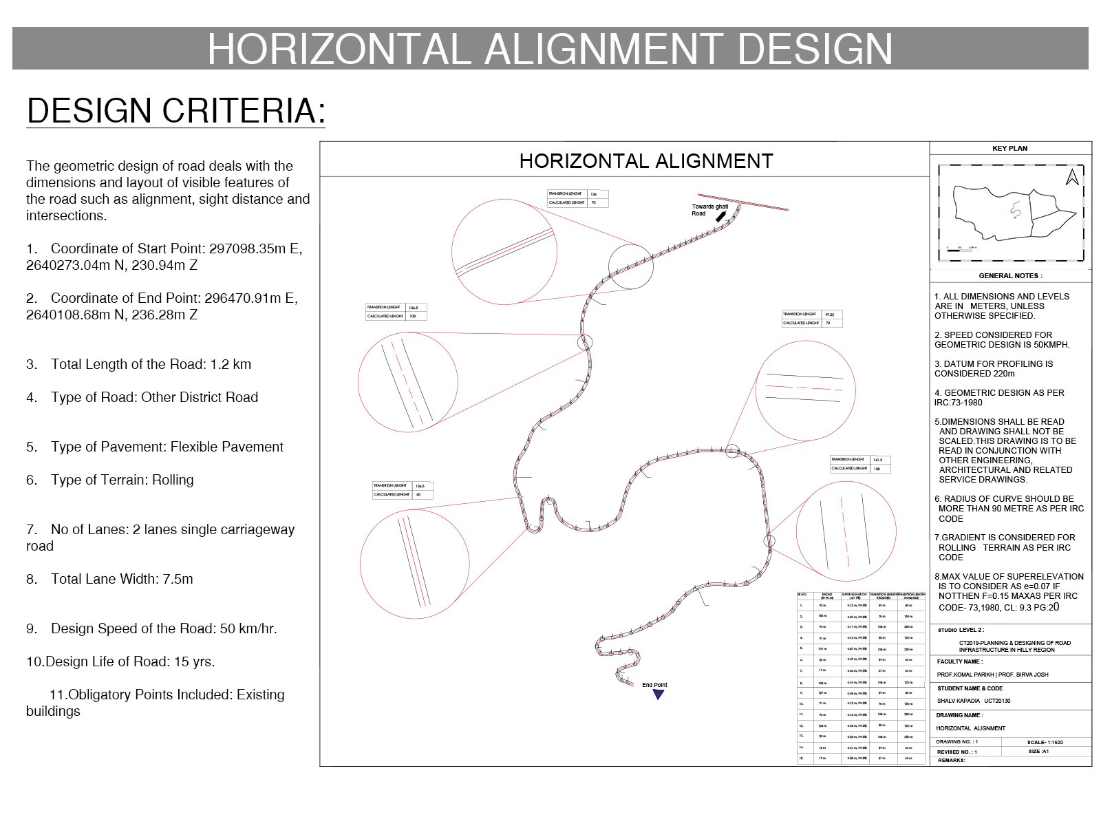
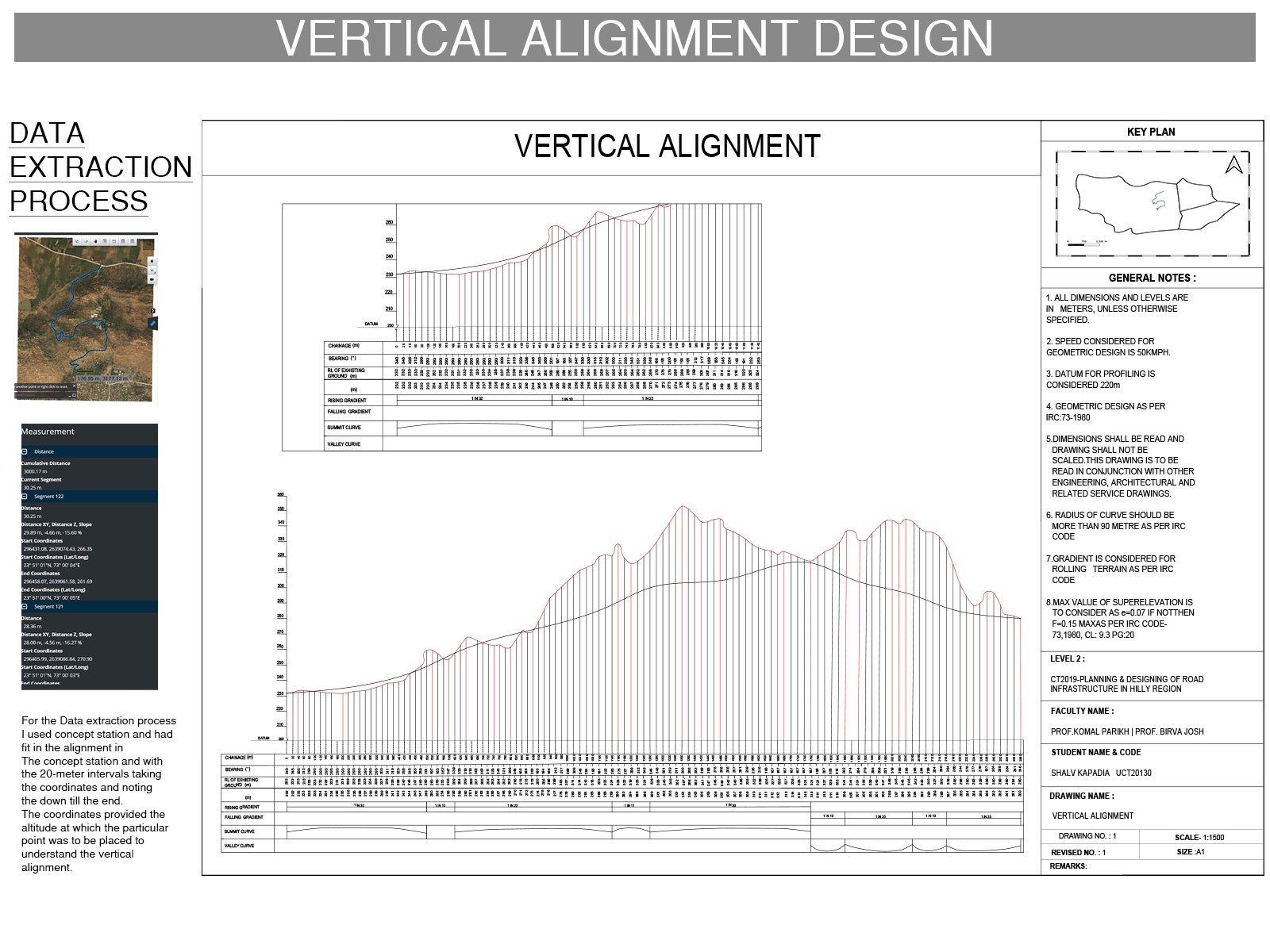
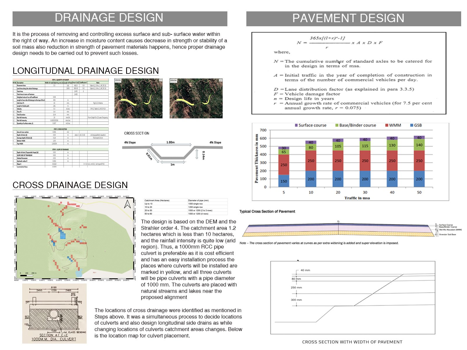
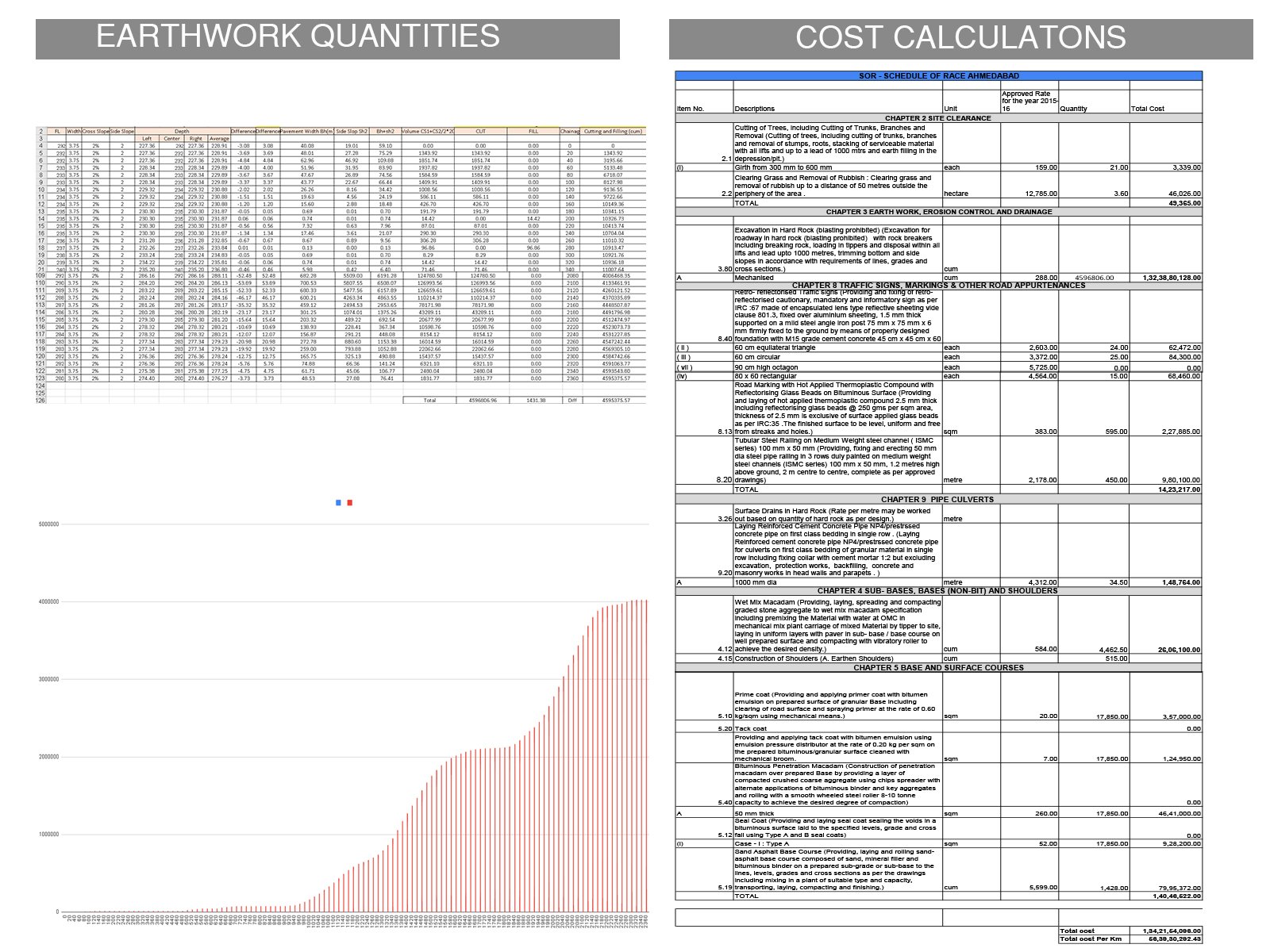
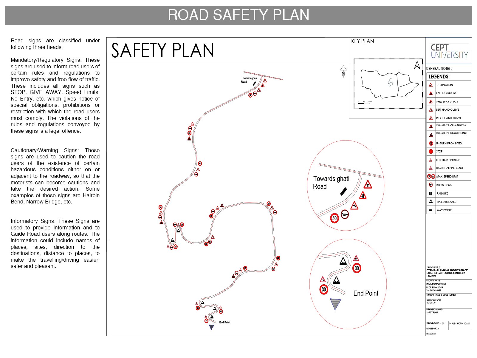
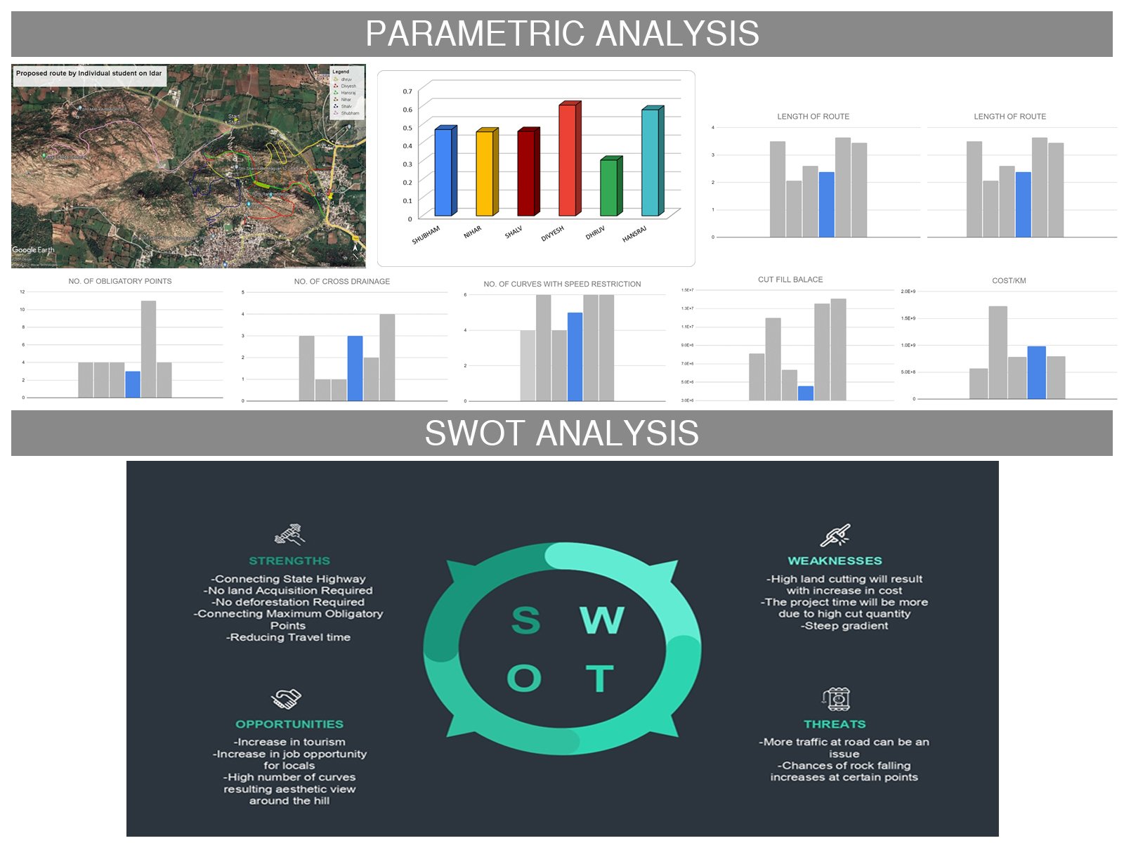
The studio delves into the method of street infrastructure planning and design in a hilly placing. I explored the planning and production of a street in a hilly vicinity via a diffusion of activities and concepts. This studio shared actual-international surveying know-how thru web site visits in Idar. Among other items, we checked out diverse codal provisions, geometric design, drainage layout, and pavement design. Using the Concept Station software program, we build a three-D force via of our proposed path. We learned a way to use QGIS, Concept Capture, and Open Roads Concept Station, among different programmes.
View Additional Work