Your browser is out-of-date!
For a richer surfing experience on our website, please update your browser. Update my browser now!
For a richer surfing experience on our website, please update your browser. Update my browser now!
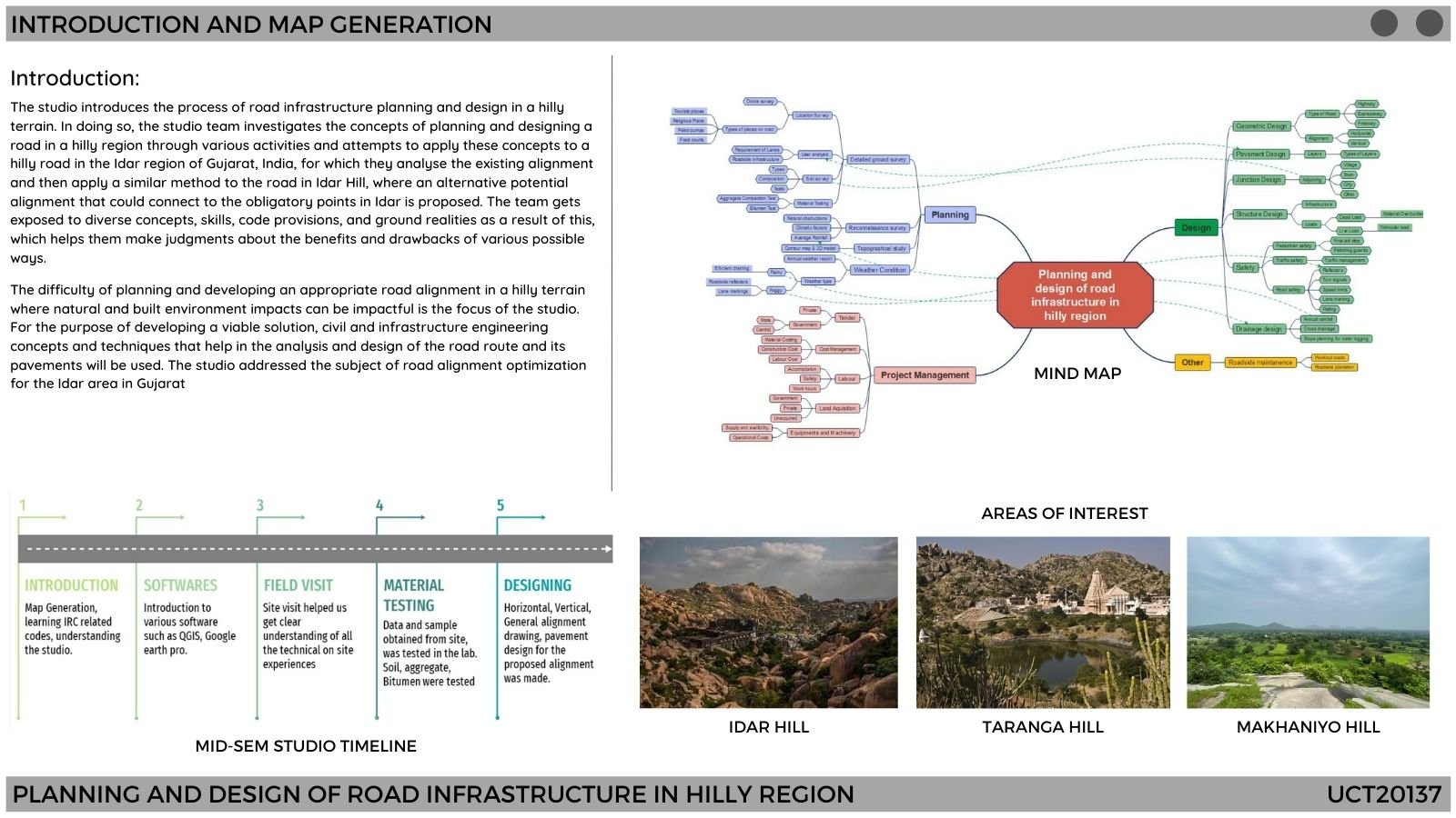
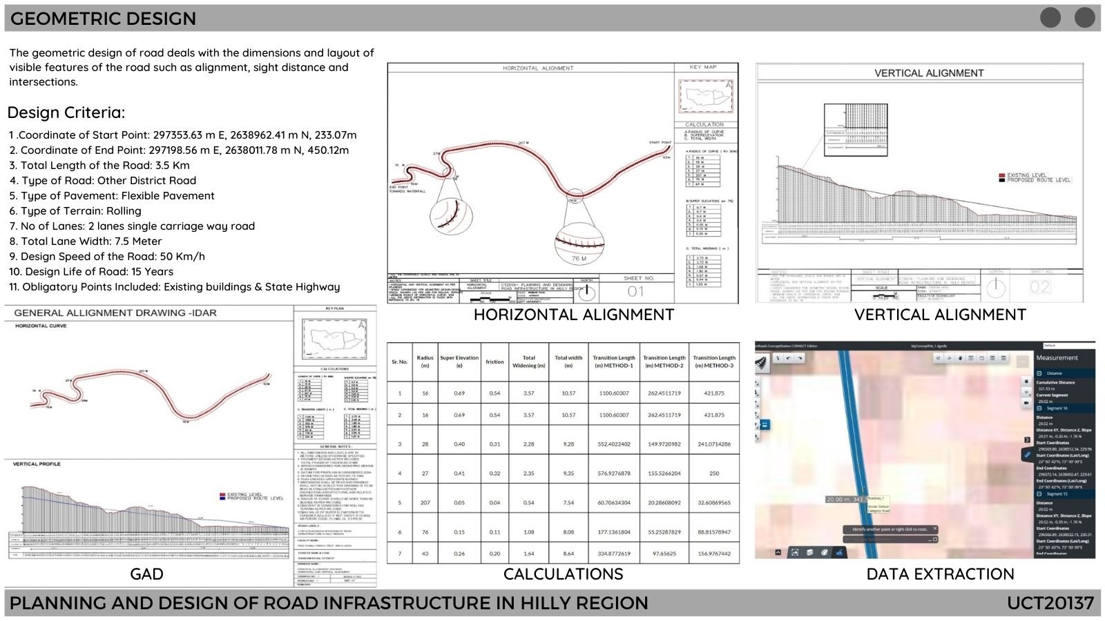
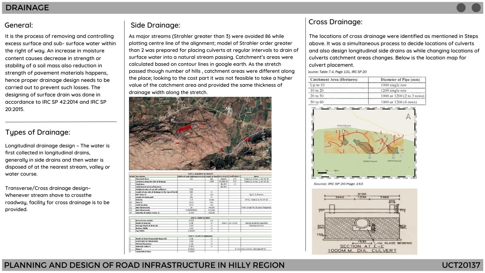
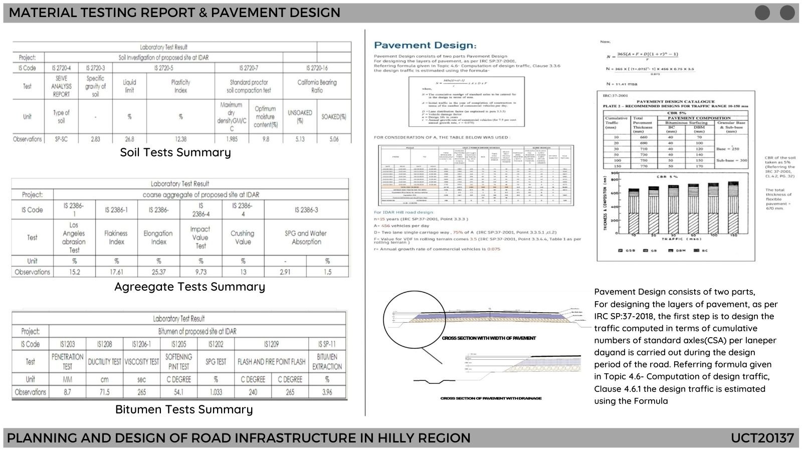
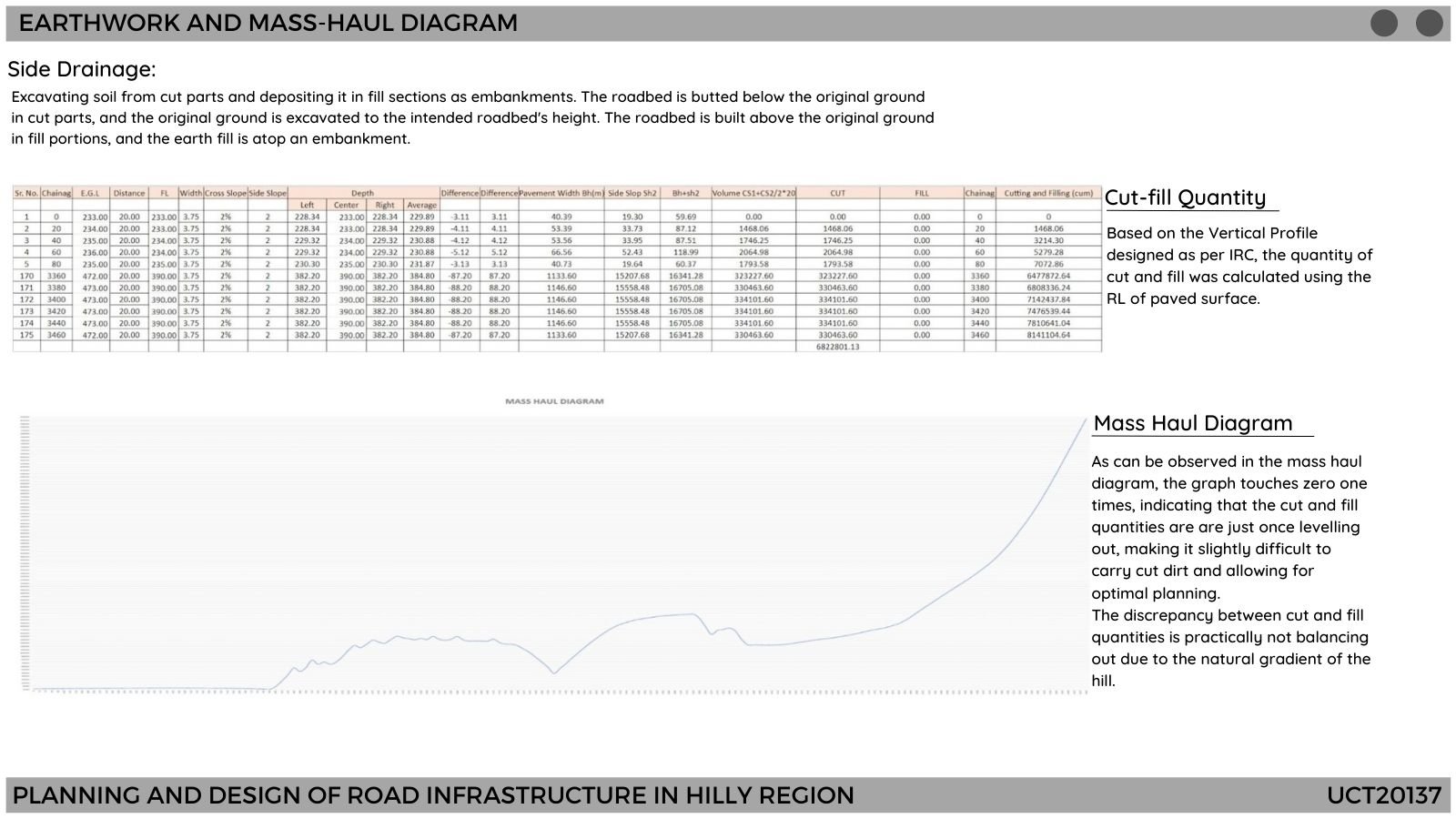
This studio dwells around the problem of planning and designing a suitable road alignment in hilly regions where natural and built environment effects can be influential. Civil and infrastructure engineering principles and techniques that aid in analyzing and design of the road route and its pavements will be applied for generating a suitable solution. It is identified that a civil engineer equipped with the thorough skill of field survey and understanding for soil properties, highway and traffic engineering principles and having a certain exposure to the actual real-life road-related problem can be very useful professionally. Given exercises and discussions for existing roadway and supporting, facilities will enable students to propose their own alignment, design of its elements, quantity calculations, parametric studies and road safety analysis. Skill-building for visualization and analysis of collected data through advanced mapping techniques like 3D Model, DSM and drive-through video will be introduced. To accomplish mentioned tasks, exposure and skill-building will be provided by advanced design tools such as Open-Road, Bentley reality modelling, AutoCAD, Google Earth & Q-GIS.
View Additional Work